Lowry, Denver
Coordinates: 39°43′17″N 104°53′44″W / 39.721448°N 104.895573°W
Lowry is a neighborhood in the City and County of Denver, Colorado. The Lowry neighborhood is located at the site of the former Lowry Air Force Base. The old Lowry Firehouse has been converted into Colorado Free University. The Denver U.S. Post Office (ZIP Code 80230) serves the neighborhood.[1]
References
- ↑ "ZIP Code Lookup" (JavaScript/HTML). United States Postal Service. January 3, 2007. Retrieved January 3, 2007.
External links
Neighborhoods of the City and County of Denver, Colorado | ||
|---|---|---|
| Central | 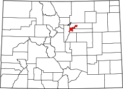 | |
| North |
| |
| Northeast | ||
| Northwest |
| |
| South |
| |
| Southeast |
| |
| East |
| |
| West |
| |
| Other |
| |
| ||
This article is issued from Wikipedia - version of the 10/9/2016. The text is available under the Creative Commons Attribution/Share Alike but additional terms may apply for the media files.