Lovozersky District
| Lovozersky District Ловозерский район (Russian) | |
|---|---|
.svg.png) Location of Lovozersky District in Murmansk Oblast | |
| Coordinates: 67°00′N 38°00′E / 67.000°N 38.000°ECoordinates: 67°00′N 38°00′E / 67.000°N 38.000°E | |
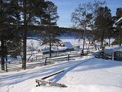 View of the selo of Kanevka in Lovozersky District | |
.png) | |
|
| |
| Location | |
| Country | Russia |
| Federal subject | Murmansk Oblast[1] |
| Administrative structure (as of April 2011) | |
| Administrative center | selo of Lovozero[1] |
| Inhabited localities: | |
| Urban-type settlements[2] | 1 |
| Rural localities | 4 |
| Municipal structure (as of November 2009) | |
| Municipally incorporated as | Lovozersky Municipal District[3] |
| Municipal divisions:[3] | |
| Urban settlements | 1 |
| Rural settlements | 1 |
| Local government: | |
| Head[4] | Dmitry Pisarev[5] |
| Representative body | Council of Deputies[4] |
| Statistics | |
| Area (municipal district) | 53,800 km2 (20,800 sq mi)[6] |
| Population (2010 Census) | 11,820 inhabitants[7] |
| • Urban | 71.2% |
| • Rural | 28.8% |
| Density | 0.22/km2 (0.57/sq mi)[8] |
| Time zone | MSK (UTC+03:00)[9] |
| Established | August 1, 1927[10][11] |
| Official website | |
| Lovozersky District on WikiCommons | |
Lovozersky District (Russian: Лово́зерский райо́н) is an administrative district (raion), one of the six in Murmansk Oblast, Russia.[1] Municipally, it is incorporated as Lovozersky Municipal District.[3] It occupies most of the central and northeastern parts of the Kola Peninsula. The area of the district is 53,800 square kilometers (20,800 sq mi).[6] Its administrative center is the rural locality (a selo) of Lovozero.[1] District's population: 11,820 (2010 Census);[7] 14,311 (2002 Census);[12] 18,263 (1989 Census).[13] The population of Lovozero accounts for 24.3% of the district's total population.[7]
Geography
The territory of the district encompasses almost the entire northern half of the Kola Peninsula, excluding the town of Ostrovnoy. The Ponoy and Yokanga Rivers flow through the district's territory. The Kandalaksha Nature Reserve, a federal-level strict ecological reserve, covers a portion of the Barents Sea coast on the north of Lovozersky District.
History
The district was established on August 1, 1927, when the All-Russian Central Executive Committee (VTsIK) issued two Resolutions: "On the Establishment of Leningrad Oblast" and "On the Borders and Composition of the Okrugs of Leningrad Oblast".[10] According to these resolutions, Murmansk Governorate was transformed into Murmansk Okrug, which was divided into six districts (Lovozersky being one of them) and included into Leningrad Oblast.[10] The administrative center of the district was established in the selo of Lovozero.[10]
On July 31, 1930, the administrative commission of the Leningrad Executive Committee granted the district an ethnic status.[14] The Presidium of the Leningrad Oblast Executive Committee confirmed this decision on January 7, 1931.[14]
In 1934, the Murmansk Okrug Executive Committee developed a redistricting proposal, which was approved by the Resolution of the 4th Plenary Session of the Murmansk Okrug Committee of the VKP(b) on December 28-29, 1934 and by the Resolution of the Presidium of the Murmansk Okrug Executive Committee on February 2, 1935.[15] On February 15, 1935, the VTsIK approved the redistricting of the okrug into seven districts, although it did not specify what territories the new districts were to include.[15] On February 26, 1935, the Presidium of the Leningrad Oblast Executive Committee worked out the details of the new district scheme and issued a resolution, which, among other things, transferred Kildinsky Selsoviet of the former Kolsko-Loparsky District to Lovozersky District.[15] However, Chalmny-Varrsky and Semiostrovsky Selsoviets of Lovozersky District were transferred to Saamsky District.[15] Chalmny-Varrsky Selsoviet, however, did not remain in Saamsky District for long—the VTsIK Resolution of September 10, 1937 transferred it back to Lovozersky District.[15]
When Saamsky District was abolished on January 26, 1963, its selsoviets were transferred to Lovozersky District.[16]
On December 26, 1962, when the Presidium of the Supreme Soviet of the RSFSR decreed to re-organize the Soviets of People's Deputies and the executive committees of the krais, oblasts, and districts into the industrial and agricultural soviets, Murmansk Oblast was not affected and kept one unified Oblast Soviet and the executive committee.[16] Nevertheless, on February 1, 1963, the Decree by the Presidium of the Supreme Soviet of the RSFSR established the new structure of the districts of Murmansk Oblast, which classified Lovozersky District as rural.[16] However, this classification only lasted for less than two years.[16] The November 21, 1964 Decree by the Presidium of the Supreme Soviet of the RSFSR restored the unified Soviets of People's Deputies and the executive committees of the krais and oblasts where the division into the urban and rural districts was introduced in 1962, and the districts of Murmansk Oblast were re-categorized as regular districts again by the January 12, 1965 Presidium of the Supreme Soviet of the RSFSR Decree.[16]
Demographics
Some of the district's population is Sámi.
References
Notes
- 1 2 3 4 Law #96-01-ZMO
- ↑ The count of urban-type settlements may include the work settlements, the resort settlements, the suburban (dacha) settlements, as well as urban-type settlements proper.
- 1 2 3 Law #574-02-ZMO
- 1 2 Charter of Lovozersky District
- ↑ Official website of Lovozersky District. Head of the District (Russian)
- 1 2 Official website of Lovozersky District. District Overview (Russian)
- 1 2 3 Russian Federal State Statistics Service (2011). "Всероссийская перепись населения 2010 года. Том 1" [2010 All-Russian Population Census, vol. 1]. Всероссийская перепись населения 2010 года (2010 All-Russia Population Census) (in Russian). Federal State Statistics Service. Retrieved June 29, 2012.
- ↑ The value of density was calculated automatically by dividing the 2010 Census population by the area specified in the infobox. Please note that this value is only approximate as the area specified in the infobox does not necessarily correspond to the area of the entity proper or is reported for the same year as the population.
- ↑ Правительство Российской Федерации. Федеральный закон №107-ФЗ от 3 июня 2011 г. «Об исчислении времени», в ред. Федерального закона №271-ФЗ от 03 июля 2016 г. «О внесении изменений в Федеральный закон "Об исчислении времени"». Вступил в силу по истечении шестидесяти дней после дня официального опубликования (6 августа 2011 г.). Опубликован: "Российская газета", №120, 6 июня 2011 г. (Government of the Russian Federation. Federal Law #107-FZ of June 31, 2011 On Calculating Time, as amended by the Federal Law #271-FZ of July 03, 2016 On Amending Federal Law "On Calculating Time". Effective as of after sixty days following the day of the official publication.).
- 1 2 3 4 Administrative-Territorial Division of Murmansk Oblast, pp. 34-35
- ↑ Official website of Lovozersky District. History of the district (Russian)
- ↑ Russian Federal State Statistics Service (May 21, 2004). "Численность населения России, субъектов Российской Федерации в составе федеральных округов, районов, городских поселений, сельских населённых пунктов – районных центров и сельских населённых пунктов с населением 3 тысячи и более человек" [Population of Russia, Its Federal Districts, Federal Subjects, Districts, Urban Localities, Rural Localities—Administrative Centers, and Rural Localities with Population of Over 3,000] (XLS). Всероссийская перепись населения 2002 года [All-Russia Population Census of 2002] (in Russian). Retrieved August 9, 2014.
- ↑ Demoscope Weekly (1989). "Всесоюзная перепись населения 1989 г. Численность наличного населения союзных и автономных республик, автономных областей и округов, краёв, областей, районов, городских поселений и сёл-райцентров" [All Union Population Census of 1989: Present Population of Union and Autonomous Republics, Autonomous Oblasts and Okrugs, Krais, Oblasts, Districts, Urban Settlements, and Villages Serving as District Administrative Centers]. Всесоюзная перепись населения 1989 года [All-Union Population Census of 1989] (in Russian). Институт демографии Национального исследовательского университета: Высшая школа экономики [Institute of Demography at the National Research University: Higher School of Economics]. Retrieved August 9, 2014.
- 1 2 Administrative-Territorial Division of Murmansk Oblast, pp. 38–39
- 1 2 3 4 5 Administrative-Territorial Division of Murmansk Oblast, pp. 47–49
- 1 2 3 4 5 Administrative-Territorial Division of Murmansk Oblast, p. 56
Sources
- Мурманская областная Дума. Закон №96-01-ЗМО от 6 января 1998 г. «Об административно-территориальном устройстве Мурманской области», в ред. Закона №1953-01-ЗМО от 24 декабря 2015 г. «О внесении изменений в Закон Мурманской области "Об административно-территориальном устройстве Мурманской области"». Опубликован: "Мурманский Вестник", №10, стр. 3, 16 января 1998 г. (Murmansk Oblast Duma. Law #96-01-ZMO of January 6, 1998 On the Administrative-Territorial Structure of Murmansk Oblast, as amended by the Law #1953-01-ZMO of December 24, 2015 On Amending the Law of Murmansk Oblast "On the Administrative-Territorial Structure of Murmansk Oblast". ).
- Мурманская областная Дума. Закон №574-02-ЗМО от 29 декабря 2004 г. «О статусе, наименованиях и составе территорий муниципального образования Ловозерский район и муниципальных образований, входящих в его состав», в ред. Закона №1156-01-ЗМО от 23 ноября 2009 г «Об упраздении некоторых населённых пунктов Мурманской области и внесении изменений в отдельные законодательные акты Мурманской области». Вступил в силу 1 января 2005 г. Опубликован: "Мурманский Вестник", №249, стр. 5, 30 декабря 2004 г. (Murmansk Oblast Duma. Law #574-02-ZMO of December 29, 2004 On the Status, Names, and Composition of the Territories of the Municipal Formation of Lovozersky District and of the Municipal Formations It Comprises, as amended by the Law #1156-01-ZMO of November 23, 2009 On the Abolition of Several Inhabited Localities of Murmansk Oblast and on Amending Several Legislative Acts of Murmansk Oblast. Effective as of January 1, 2005.).
- Ловозерский районный Совет депутатов. Решение №64 от 24 января 2006 г. «Устав муниципального образования Ловозерский район Мурманской области», в ред. Решения №313 от 29 декабря 2008 г «Об утверждении Устава муниципального образования Ловозерский район Мурманской области с внесёнными изменениями и дополнениями в соответствии с Федеральным законом №131-ФЗ от 06.10.2003 (ред. от 21.07.2007 №187-ФЗ) "Об общих принципах организации местного самоуправления в Российской Федерации"». Вступил в силу после официального опубликования. Опубликован: "Ловозерская Правда", №23, стр. 4–8, 12 мая 2006 г. (Lovozersky District Council of Deputies. Decision #64 of January 24, 2006 Charter of the Municipal Formation of Lovozersky District of Murmansk Oblast, as amended by the Resolution #313 of December 29, 2008 On the Adoption of the Charter of the Municipal Formation of Lovozersky District of Murmansk Oblast, Amended and Supplemented in Accordance with the Federal Law #131-FZ of October 6, 2003 (revision #187-FZ of July 21, 2007) "On the General Principles of Organization of the Local Self-Government in the Russian Federation". Effective as of after the official publication.).
- Архивный отдел Администрации Мурманской области. Государственный Архив Мурманской области. (1995). Административно-территориальное деление Мурманской области (1920-1993 гг.). Справочник. Мурманск: Мурманское издательско-полиграфическое предприятие "Север".
| Cities and towns (all levels) | |||
|---|---|---|---|
| Closed administrative-territorial formations | |||
| Administrative districts | |||