Love River
| Love River (Ai He) | |
| River | |
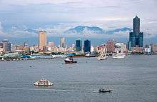
 Love River in Downtown Kaohsiung | |
| Country | Taiwan |
|---|---|
| Tributaries | |
| - left | Houbi Channel |
| - right | Ta Kang Creek |
| City | Kaohsiung |
| Source | |
| - location | Renwu District, Kaohsiung City |
| Mouth | Taiwan Strait |
| - location | Kaohsiung |
| - elevation | 0 ft (0 m) |
| - coordinates | 22°37′25″N 120°17′23″E / 22.62361°N 120.28972°ECoordinates: 22°37′25″N 120°17′23″E / 22.62361°N 120.28972°E |
| Length | 7.46 mi (12 km) |
| Basin | 21.62 sq mi (56 km2) |
The Love River or Ai River or DPP river (simplified Chinese: 爱河; traditional Chinese: 愛河; pinyin: Ài Hé; Pe̍h-ōe-jī: Ài-hô) is a river (canal) in southern Taiwan. It originates in Renwu District, Kaohsiung City, and flows 12 kilometers (7.5 mi) through Kaohsiung to Kaohsiung Harbor. Love River is the spine of Kaohsiung, playing a similar role to the River Thames of London. It is of great cultural significance to the people of Kaohsiung and plays an important role in its economy and tourism. A riverside park, the Love River Park, runs along the riverbank in downtown Kaohsiung City. A night market operates in the park, and there are three outdoor cafés, often with live bands. Boats which hold about fifteen people take tourists up and down the river. The scenery is enhanced by attractive city structures near the river, such as the Holy Rosary Cathedral, Kaohsiung Bridge, and the Kaohsiung District Court. Cultural events such as concerts and the Lantern Festival are often held by the river.
The Love River was once heavily polluted, when raw sewage and industrial waste water flowed untreated into the river. Recent efforts by the city government to divert the waste water to the treatment plant in Cijin District has resulted in significantly improved water quality.

History
Before the urban development of the area, the river flowed in a wide and flat channel, used for irrigation and surrounded by farms. In the Qing Dynasty, it was called the Takao River. In 1895, the Japanese dredged the river and turned it into a canal to transport lumber from Southeast Asia. Embankments (levees) were built on the river and in 1908, Kaohsiung Harbor was constructed at the mouth of the Love River, replacing the mangrove forests. In 1945, Taiwan fell under the control the Republic of China and the riversides became parks. However, as Taiwan’s economy switched from agricultural to industrial, the river began to get increasingly polluted. (The first incident of pollution was halfway through the Japanese occupation of Taiwan when paper mills ejected waste into the river.) The urbanization created more waste, and in 1965, raw sewage began to flow into the river when an export processing zone was created.
Treatment
In 1979, the government started to clean the river. The water was black and had a sewer-like odor. A set of floodgates were built on the river to capture trash and sewage and send it to a treatment plant. Unfortunately, the system only works from October to April because in the rainy season, May to September, the treatment system cannot cope with the increased flow and the floodgates must be opened, sending pollution into the lower stretch of the Love River. (The river here is tidal and so is safe to swim in the dry season.)
Tributaries
- Ta Kang Creek
- Houbi Channel[1]
 Kaohsiung Night view along the Love River.
 Ferry rides are popular along the Love River.
 Hesi Road becomes lively at night.
 View of the River from Jhongjheng Bridge.
 Hesi Road early morning.
 Love River early morning.
 Sailboats on the Love River.
%2C_Kaohsiung%2C_Taiwan.jpg) Night view
Night view
References
External links
| Wikimedia Commons has media related to Love River. |
- Wilma Chou, Kaohsiung City's Love River brought back from the dead, Taiwan Journal, August 23, 2002
.svg.png)