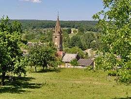
Louvergny
| Louvergny | ||
|---|---|---|
 | ||
| ||
 Louvergny | ||
|
Location within Grand Est region  Louvergny | ||
| Coordinates: 49°33′10″N 4°44′25″E / 49.5529°N 4.7403°ECoordinates: 49°33′10″N 4°44′25″E / 49.5529°N 4.7403°E | ||
| Country | France | |
| Region | Grand Est | |
| Department | Ardennes | |
| Arrondissement | Vouziers | |
| Canton | Le Chesne | |
| Government | ||
| • Mayor (2008–2014) | Jean-Pierre Lelarge | |
| Area1 | 8.95 km2 (3.46 sq mi) | |
| Population (2008)2 | 77 | |
| • Density | 8.6/km2 (22/sq mi) | |
| Time zone | CET (UTC+1) | |
| • Summer (DST) | CEST (UTC+2) | |
| INSEE/Postal code | 08261 / 08390 | |
| Elevation |
172–249 m (564–817 ft) (avg. 220 m or 720 ft) | |
|
1 French Land Register data, which excludes lakes, ponds, glaciers > 1 km² (0.386 sq mi or 247 acres) and river estuaries. 2 Population without double counting: residents of multiple communes (e.g., students and military personnel) only counted once. | ||

Louvergny is a former commune in the Ardennes department in northern France. On 1 January 2016, it was merged into the new commune Bairon-et-ses-Environs.[1]
Geography
Louvergny is mostly situated on the southern bank of the Ruisseau des Prés, which flows into the Lake of Bairon.
Population
| Historical population | ||
|---|---|---|
| Year | Pop. | ±% |
| 1793 | 348 | — |
| 1800 | 394 | +13.2% |
| 1806 | 407 | +3.3% |
| 1821 | 378 | −7.1% |
| 1831 | 415 | +9.8% |
| 1836 | 425 | +2.4% |
| 1841 | 429 | +0.9% |
| 1846 | 458 | +6.8% |
| 1851 | 447 | −2.4% |
| 1866 | 348 | −22.1% |
| 1872 | 332 | −4.6% |
| 1876 | 314 | −5.4% |
| 1881 | 295 | −6.1% |
| 1886 | 282 | −4.4% |
| 1891 | 262 | −7.1% |
| 1896 | 230 | −12.2% |
| 1901 | 204 | −11.3% |
| 1906 | 192 | −5.9% |
| 1911 | 194 | +1.0% |
| 1921 | 172 | −11.3% |
| 1926 | 179 | +4.1% |
| 1931 | 158 | −11.7% |
| 1936 | 138 | −12.7% |
| 1946 | 150 | +8.7% |
| 1954 | 134 | −10.7% |
| 1962 | 140 | +4.5% |
| 1968 | 111 | −20.7% |
| 1975 | 93 | −16.2% |
| 1982 | 95 | +2.2% |
| 1990 | 90 | −5.3% |
| 1999 | 75 | −16.7% |
| 2008 | 77 | +2.7% |
The inhabitants are called Marinettes.
See also
References
- ↑ Arrêté préfectoral 30 November 2015 (French)
| Wikimedia Commons has media related to Louvergny. |
This article is issued from Wikipedia - version of the 1/28/2016. The text is available under the Creative Commons Attribution/Share Alike but additional terms may apply for the media files.