Louisa County, Iowa
| Louisa County, Iowa | |
|---|---|
|
Louisa County Courthouse in Wapello | |
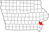 Location in the U.S. state of Iowa | |
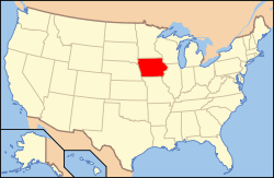 Iowa's location in the U.S. | |
| Founded | 1836 |
| Seat | Wapello |
| Largest city | Wapello |
| Area | |
| • Total | 418 sq mi (1,083 km2) |
| • Land | 402 sq mi (1,041 km2) |
| • Water | 16 sq mi (41 km2), 3.8% |
| Population | |
| • (2010) | 11,387 |
| • Density | 28/sq mi (11/km²) |
| Congressional district | 2nd |
| Time zone | Central: UTC-6/-5 |
| Website |
www |

Louisa County (loo-WEYE-zə) is a county located in the U.S. state of Iowa. As of the 2010 census, the population was 11,387.[1] The county seat is Wapello.[2]
Louisa County is part of the Muscatine Micropolitan Statistical Area.
History
Louisa County was formed on December 7, 1836 as a part of Wisconsin Territory.[3] Two theories have been offered for the origins of its name: one is that it was named after Louisa Massey,[4] who was very well known in the area at the time because she avenged the murder of her brother when she shot the party responsible; the other is that it was named after Louisa County, Virginia.[5] Louisa County became a part of Iowa Territory upon its formation on July 4, 1838.[3]
The first courthouse was a simple wood-framed building. In 1840, a second courthouse, measuring 40' x 20' (about 12 x 6 m), was constructed of stone. In 1854, a third structure was built. The courthouse used today was erected in 1928.[6]
Geography
According to the U.S. Census Bureau, the county has a total area of 418 square miles (1,080 km2), of which 402 square miles (1,040 km2) is land and 16 square miles (41 km2) (3.8%) is water.[7] Its eastern border is adjacent to the Mississippi River.
Major highways
Adjacent counties
- Johnson County (northwest)
- Muscatine County (north)
- Rock Island County, Illinois (northeast)
- Mercer County, Illinois (east)
- Des Moines County (south)
- Henry County (southwest)
- Washington County (west)
National protected area
Demographics
| Historical population | |||
|---|---|---|---|
| Census | Pop. | %± | |
| 1850 | 4,939 | — | |
| 1860 | 10,370 | 110.0% | |
| 1870 | 12,877 | 24.2% | |
| 1880 | 13,142 | 2.1% | |
| 1890 | 11,873 | −9.7% | |
| 1900 | 13,516 | 13.8% | |
| 1910 | 12,855 | −4.9% | |
| 1920 | 12,179 | −5.3% | |
| 1930 | 11,575 | −5.0% | |
| 1940 | 11,384 | −1.7% | |
| 1950 | 11,101 | −2.5% | |
| 1960 | 10,290 | −7.3% | |
| 1970 | 10,682 | 3.8% | |
| 1980 | 12,055 | 12.9% | |
| 1990 | 11,592 | −3.8% | |
| 2000 | 12,183 | 5.1% | |
| 2010 | 11,387 | −6.5% | |
| Est. 2015 | 11,185 | [8] | −1.8% |
| U.S. Decennial Census[9] 1790-1960[10] 1900-1990[11] 1990-2000[12] 2010-2013[1] | |||
2010 census
The 2010 census recorded a population of 11,387 in the county, with a population density of 28.3315/sq mi (10.9389/km2). There were 5,002 housing units, of which 4,346 were occupied.[13]
2000 census

As of the census[14] of 2000, there were 12,183 people, 4,519 households, and 3,316 families residing in the county. The population density was 30 people per square mile (12/km²). There were 5,133 housing units at an average density of 13 per square mile (5/km²). The racial makeup of the county was 93.91% White, 0.25% Black or African American, 0.18% Native American, 0.20% Asian, 0.02% Pacific Islander, 4.56% from other races, and 0.88% from two or more races. 12.62% of the population were Hispanic or Latino of any race.
There were 4,519 households out of which 35.00% had children under the age of 18 living with them, 61.30% were married couples living together, 8.20% had a female householder with no husband present, and 26.60% were non-families. 22.50% of all households were made up of individuals and 10.40% had someone living alone who was 65 years of age or older. The average household size was 2.66 and the average family size was 3.11.
In the county the population was spread out with 27.70% under the age of 18, 7.90% from 18 to 24, 28.70% from 25 to 44, 21.70% from 45 to 64, and 14.10% who were 65 years of age or older. The median age was 36 years. For every 100 females there were 98.90 males. For every 100 females age 18 and over, there were 96.00 males.
The median income for a household in the county was $39,086, and the median income for a family was $43,972. Males had a median income of $31,293 versus $22,085 for females. The per capita income for the county was $17,644. About 7.00% of families and 9.30% of the population were below the poverty line, including 12.40% of those under age 18 and 7.90% of those age 65 or over.
Communities
Cities
Unincorporated community
Townships
Population ranking
The population ranking of the following table is based on the 2010 census of Louisa County.[15]
† county seat
| Rank | City/Town/etc. | Municipal type | Population (2010 Census)
|
|---|---|---|---|
| 1 | † Wapello | City | 2,067 |
| 2 | Columbus Junction | City | 1,899 |
| 3 | Morning Sun | City | 836 |
| 4 | Grandview | City | 556 |
| 5 | Columbus City | City | 391 |
| 6 | Letts | City | 384 |
| 7 | Fredonia | City | 244 |
| 8 | Oakville | City | 173 |
| 9 | Cotter | City | 48 |
See also
References
- 1 2 "State & County QuickFacts". United States Census Bureau. Retrieved July 18, 2014.
- ↑ "Find a County". National Association of Counties. Retrieved 2011-06-07.
- 1 2 "WI: Individual County Chronologies". publications.newberry.org. Retrieved 2016-09-28.
- ↑ Gannett, Henry (1905). The Origin of Certain Place Names in the United States. U.S. Government Printing Office. p. 191.
- ↑ Savage, Tom A Dictionary of Iowa Place Names, University of Iowa Press, 2007, p. 11 ISBN 1587297590
- ↑ Louisa County, Iowa
- ↑ "US Gazetteer files: 2010, 2000, and 1990". United States Census Bureau. 2011-02-12. Retrieved 2011-04-23.
- ↑ "County Totals Dataset: Population, Population Change and Estimated Components of Population Change: April 1, 2010 to July 1, 2015". Retrieved July 2, 2016.
- ↑ "U.S. Decennial Census". United States Census Bureau. Retrieved July 18, 2014.
- ↑ "Historical Census Browser". University of Virginia Library. Retrieved July 18, 2014.
- ↑ "Population of Counties by Decennial Census: 1900 to 1990". United States Census Bureau. Retrieved July 18, 2014.
- ↑ "Census 2000 PHC-T-4. Ranking Tables for Counties: 1990 and 2000" (PDF). United States Census Bureau. Retrieved July 18, 2014.
- ↑ "Population & Housing Occupancy Status 2010". United States Census Bureau American FactFinder. Retrieved May 20, 2011.
- ↑ "American FactFinder". United States Census Bureau. Retrieved 2008-01-31.
- ↑ http://www.census.gov/2010census/
External links
| Wikimedia Commons has media related to Louisa County, Iowa. |
 |
Johnson County | Muscatine County | Rock Island County, Illinois | |
| Washington County | |
Mercer County, Illinois | ||
| ||||
| | ||||
| Henry County | Des Moines County |
Municipalities and communities of Louisa County, Iowa, United States | ||
|---|---|---|
| Cities | ||
| Townships | ||
| Unincorporated community | ||

Coordinates: 41°13′05″N 91°15′36″W / 41.21806°N 91.26000°W