Lough Gur
| Lough Gur Loch Gair | |
|---|---|
 | |
| Location | County Limerick |
| Coordinates | 52°30′58.97″N 8°31′59.80″W / 52.5163806°N 8.5332778°WCoordinates: 52°30′58.97″N 8°31′59.80″W / 52.5163806°N 8.5332778°W |
| Basin countries | Ireland |
| Surface area | 0.78 km2 |
| Average depth | 1.5 m |
| Max. depth | 3.8 m |
| Water volume | 1.2 hm3 |
| Residence time | 0.21 years[1] |
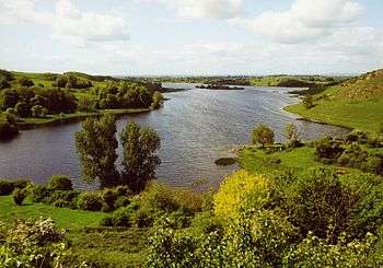
Lough Gur (Irish: Loch Gair) is a lake in County Limerick, Ireland between the towns of Herbertstown and Bruff. The lake forms a horseshoe shape at the base of Knockadoon Hill and some rugged elevated countryside. It is one of Ireland's most important archaeological sites. Humans have lived near Lough Gur since about 3000 BC and there are numerous megalithic remains there.[2]
Grange stone circle (the largest stone circle in Ireland) and a dolmen are located near the lake.[2] The remains of at least three crannogs are present, and remains of Stone Age houses have been unearthed (the house outlines are known as "The Spectacles"). A number of ring forts are found in the area, with one hill fort overlooking the lake. Some are Irish national monuments.[2]
A visitors' centre is open beside Lough Gur, along with a car park and picnic area. A gradual shore-line is present at the visitor area, with a shallow section of lake reaching up to the maintained lawn. As a result, the area is often used for water sports, though motorised craft are banned on the lake.[2]
There is a castle, or tower house (closed to visitors) near the entrance to the carpark. Named Bourchier's Castle after Sir George Bourchier, the son of the second Earl of Bath,[2] it lies at the neck of the peninsula around which the lake washes. There is some other architecture dating from more recent times, with the ruins of an early Christian church by the road leading down to the lake. At the far end of the lake are the ruins of a Norman castle, Black Castle,[2] which is reached by a hill-side walk along the east side of the lake. This is one of the keeps used during the Desmond Rebellions, and is probably the place where the Earl of Desmond secured his authority in 1573 after casting off his English apparel and donning Irish garments on his return to Munster from London.

See also
References
- ↑ De Eyto E, Irvine K (2007). "Assessing the status of shallow lakes using an additive model of biomass size spectra". Aquatic Conservation: Marine and Freshwater Ecosystems. 17: 724–736. doi:10.1002/aqc.801.
- 1 2 3 4 5 6 7 Illustrated Guide to Lough Gur, O'Kelly, M. J. and O'Kelly, C. 1981. Published by Houston, Cork.
External links
- Lough Gur - official visitor centre site at Shannon Heritage
- Lough Gur Neolithic Settlement and Stone Age Centre
- Lough Gur Development site.
- Google Earth Community KMZ file indicating the location of several important Lough Gur sites.