Louangnamtha Airport
| Louangnamtha Airport ສະຫນາມບິນຫຼວງ້ໍາທາ | |||||||||||
|---|---|---|---|---|---|---|---|---|---|---|---|
 | |||||||||||
| IATA: LXG – ICAO: VLLN | |||||||||||
| Summary | |||||||||||
| Airport type | Public/Civil Aviation Authority | ||||||||||
| Operator | Laos Civil Aviation Authority | ||||||||||
| Elevation AMSL | 600 m / 1,968 ft | ||||||||||
| Coordinates | 20°57′38″N 101°24′09″E / 20.96056°N 101.40250°ECoordinates: 20°57′38″N 101°24′09″E / 20.96056°N 101.40250°E | ||||||||||
| Map | |||||||||||
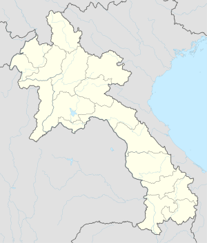 LXG Location of airport in Laos | |||||||||||
| Runways | |||||||||||
| |||||||||||
Louangnamtha Airport (IATA: LXG, ICAO: VLLN) is an airport in Laos, 6 km south of the city of Luang Namtha.
The airport was closed between 2006 and 2008 for a renovation that extended the runway from 1,200 to 1,600 metres, allowing larger aircraft such as the ATR 72 to use the airport, and built a new 700 m2 passenger terminal.[1][2]
Airlines and destinations
| Airlines | Destinations |
|---|---|
| Lao Airlines | Vientiane Seasonal Charter: Sayaboury |
References
- ↑ "Mekong Tourism Resettlement Project", Lao National Tourism Authority, page 4: The existing airport runway is only 1,200 m, which is 300 m short of the 1,500 m runway standard. In addition, the runway is in poor condition, full of patches, encroached with vegetation and lacks a drainage system. Thus, it is considered unsafe especially during the rainy season. At present, the airport is unable to receive ATR72 (70 seats) and only receives Chinese built YN7 (50 seat) and YN12 (12 seats). This subproject aims to improve and extend the runway, construct a drainage system, passenger terminal and small control tower, and provide emergency and fire service equipment and air navigation services.
- ↑ "Renovation of Luang Namtha airport delayed", Lao News Agency, 11 Nov 2007. The project will upgrade the runway, 1,600-metres long and 30 metres wide, build a one storey passenger terminal of 700 square metres, and a control tower, and install other safety facilities at the airport.
External links
![]() Media related to Louangnamtha Airport at Wikimedia Commons
Media related to Louangnamtha Airport at Wikimedia Commons
- Airport information for VLLN at World Aero Data. Data current as of October 2006.
- Airport information at Great Circle Mapper
This article is issued from Wikipedia - version of the 11/27/2016. The text is available under the Creative Commons Attribution/Share Alike but additional terms may apply for the media files.