Los Palacios
Not to be confused with Los Palacios (La Rioja) or Los Palacios y Villafranca.
| Los Palacios | |
|---|---|
| Municipality | |
.png) Los Palacios municipality (red) within Pinar del Río Province (yellow) and Cuba | |
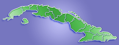 Location of Los Palacios in Cuba | |
| Coordinates: 22°34′56″N 83°14′56″W / 22.58222°N 83.24889°WCoordinates: 22°34′56″N 83°14′56″W / 22.58222°N 83.24889°W | |
| Country |
|
| Province | Pinar del Río |
| Founded | 1760[1] |
| Established | 1879 |
| Area[2] | |
| • Total | 786 km2 (303 sq mi) |
| Elevation | 45 m (148 ft) |
| Population (2005)[3] | |
| • Total | 38,950 |
| • Density | 1,879/km2 (4,870/sq mi) |
| Time zone | EST (UTC-5) |
| Area code(s) | +53-82 |
Los Palacios (Spanish pronunciation: [los paˈlasjos]) is a municipality and town in the Pinar del Río Province of Cuba. It was founded in 1760.[1]
Geography
The municipality is divided into the barrios of Limones, Macurijes, Paso Real, Santa Mónica, Santo Domingo, Sierra and Urbano.[1]
Los Palacios Municipal Museum is located in the 21st street.
Demographics
In 2004, the municipality of Los Palacios had a population of 38,950.[3] With a total area of 786 km2 (303 sq mi),[2] it has a population density of 49.6/km2 (128/sq mi).
See also
References
- 1 2 3 Guije.com. "Los Palacios" (in Spanish). Retrieved 2007-10-07.
- 1 2 Statoids (July 2003). "Municipios of Cuba". Retrieved 2007-10-07.
- 1 2 Atenas.cu (2004). "2004 Population trends, by Province and Municipality" (in Spanish). Archived from the original on 2007-09-27. Retrieved 2007-10-07.
External links
![]() Media related to Los Palacios at Wikimedia Commons
Media related to Los Palacios at Wikimedia Commons
This article is issued from Wikipedia - version of the 2/2/2016. The text is available under the Creative Commons Attribution/Share Alike but additional terms may apply for the media files.