Los Alamos, New Mexico
| Los Alamos, New Mexico | |
|---|---|
| CDP | |
|
View from Camp May Trail | |
 Location of Los Alamos, New Mexico | |
| Coordinates: 35°53′28″N 106°17′52″W / 35.89111°N 106.29778°WCoordinates: 35°53′28″N 106°17′52″W / 35.89111°N 106.29778°W | |
| Country | United States |
| State | New Mexico |
| County | Los Alamos |
| Area | |
| • Total | 10.9 sq mi (28.1 km2) |
| • Land | 10.9 sq mi (28.1 km2) |
| • Water | 0.0 sq mi (0.0 km2) |
| Elevation | 7,320 ft (2,231 m) |
| Population (2010) | |
| • Total | 12,019 |
| • Density | 1,102/sq mi (427.7/km2) |
| Time zone | Mountain (MST) (UTC-7) |
| • Summer (DST) | MDT (UTC-6) |
| ZIP codes | 87544-87545 |
| Area code(s) | 505 |
| FIPS code | 35-42320 |
| GNIS feature ID | 0901357 |


Los Alamos (Spanish: Los Álamos, meaning "The Cottonwoods") is a census-designated place (CDP) in and the county seat of Los Alamos County, New Mexico, United States, built on the Pajarito Plateau's four mesas and the adjoining White Rock Canyon. The CDP population was 12,019 at the 2010 Census.
Los Alamos is home to the Los Alamos National Laboratory, established in 1943 for the Manhattan Project. Previously, the site was occupied by the Los Alamos Ranch School.
Los Alamos is the fifth-fastest-growing city in New Mexico, after Albuquerque, Rio Rancho, Las Cruces, and Ruidoso. Los Alamos has the highest millionaire concentration of any US city with 12.4 percent of households having at least $1 million in assets.[1]
History
Los Alamos is built on the Pajarito Plateau between White Rock Canyon and the Valles Caldera. The first settlers on the plateau are thought to be Keres speaking Native Americans around the 10th century. Around 1300, Tewa settlers immigrated from the Four Corners Region and built large cities but were driven out within 50 years by Navajo and Apache raids and by drought. Both the Keres and Tewa towns can be seen today in the ruins of Bandelier National Monument and Tsankawi.
The land of the plateau was then divided up for homesteading. Most residents of the plateau built simple log cabins that they only lived in during warm weather to feed livestock, with the homesteaders moving down to the warmer Rio Grande Valley. Homesteader Harold H. Brook sold part of his land and buildings to Detroit businessman Ashley Pond II in 1917 which began the Los Alamos Ranch School, named after the aspen trees that blossomed in the spring.
In 1942, during World War II, the Department of War began looking for a remote location for the Manhattan Project. The school was closed when the government used its power of eminent domain to take over the Ranch School and all the remaining homestead that same year. The Ranch School was paid $225 per acre; the homesteaders were paid between $7 and $15 per acre. All information about the town was highly classified until the bombing of Hiroshima.
All incoming truckloads were labeled as common items to conceal the true nature of their contents, and any outbound correspondence by those working and living in Los Alamos was censored by military officials. At the time, it was referred to as "The Hill" by many in Santa Fe, and as "Site Y" by military personnel. The mailing address for all of Los Alamos was PO Box 1663, Santa Fe, NM. After the Manhattan Project was completed, White Rock was abandoned until 1963 when people began to re-inhabit and rebuild new homes and buildings.
Los Alamos National Laboratory was established as a research government facility under the Department of Energy.
In 2000, a 48,000 acre wildfire, Cerro Grande Fire, tore through the townsite after the Park Service lit a prescribed fire in a high wind situation. The town was evacuated for eight days while firefighters from all over the country battled the blaze. Over 400 homes were lost. The Federal Emergency Management Agency (FEMA) built temporary housing on North Mesa near the Middle School for those who were displaced by the fire. It was nicknamed FEMA-ville. After the fires, there was widespread flooding because of the removal of the groundcover by the fire.
On Monday, June 27, 2011, the Las Conchas Fire broke out in the mountains southwest of the town, prompting a mandatory evacuation from the town and temporary closure of LANL until Sunday. Although Las Conchas was larger than that of the Cerro Grande Fire, no buildings or structures in Los Alamos County were damaged.[2]
On November 10, 2015, the National Park Service and the U.S. Department of Energy announced the establishment of Manhattan Project National Historical Park in Los Alamos, along with units in Hanford, Washington and Oak Ridge, Tennessee.
Geography and climate
Los Alamos is located at 35°53′28″N 106°17′52″W / 35.89111°N 106.29778°W (35.891086, −106.297727),[3] approximately 35 mi (56 km) to the northwest of Santa Fe. Elevation is 7,320 feet (2,230 m).
According to the United States Census Bureau, the CDP has a total area of 10.9 square miles (28 km2), all of it land.
The town of Los Alamos is divided up across four mesas—Barranca Mesa, North Mesa, Los Alamos Mesa and South Mesa—along with the connecting communities at the base of the mountain. The Lab also occupies half of South Mesa, Two Mile Mesa, Frijoles Mesa, Mesita de Buey and several nearby areas in the region (in the valleys and at the base of the mountain). White Rock lies at the top of White Rock Canyon. There are three access roads between White Rock and Los Alamos—Main Hill Road, Jemez Road and Pajarito Road. Since 9-11, Pajarito Road has been restricted to LANL badge holders for security reasons.
Los Alamos has a humid continental climate (Köppen Dfb) with cold though not severe winters and summers with very warm days, cool nights, and frequent monsoonal thunderstorms. Its high altitude moderates summer heat and makes precipitation relatively high (twice as much as Albuquerque) but makes for a short frost-free season, with the last frost usually in May. Snowfall is quite heavy, but very little of it lies on the ground for long, with the median cover in January being 4 inches (0.10 m) and the highest monthly mean 14 inches (0.36 m) in February 1993, whilst temperatures below 0 °F (−17.8 °C) are very rare, occurring on an average of two nights annually.
| Climate data for Los Alamos, New Mexico (1981–2010 normals) | |||||||||||||
|---|---|---|---|---|---|---|---|---|---|---|---|---|---|
| Month | Jan | Feb | Mar | Apr | May | Jun | Jul | Aug | Sep | Oct | Nov | Dec | Year |
| Record high °F (°C) | 65 (18) |
69 (21) |
73 (23) |
80 (27) |
93 (34) |
95 (35) |
95 (35) |
92 (33) |
94 (34) |
84 (29) |
72 (22) |
69 (21) |
95 (35) |
| Average high °F (°C) | 39.9 (4.4) |
43.7 (6.5) |
51.3 (10.7) |
59.8 (15.4) |
69.2 (20.7) |
78.8 (26) |
81.3 (27.4) |
78.0 (25.6) |
72.3 (22.4) |
61.4 (16.3) |
49.1 (9.5) |
39.7 (4.3) |
60.38 (15.77) |
| Average low °F (°C) | 18.9 (−7.3) |
22.1 (−5.5) |
27.5 (−2.5) |
33.8 (1) |
42.7 (5.9) |
51.4 (10.8) |
55.1 (12.8) |
53.5 (11.9) |
47.3 (8.5) |
36.9 (2.7) |
26.7 (−2.9) |
19.1 (−7.2) |
36.25 (2.35) |
| Record low °F (°C) | −18 (−28) |
−17 (−27) |
−3 (−19) |
5 (−15) |
24 (−4) |
28 (−2) |
37 (3) |
31 (−1) |
23 (−5) |
6 (−14) |
−14 (−26) |
−13 (−25) |
−18 (−28) |
| Average precipitation inches (mm) | 0.98 (24.9) |
0.86 (21.8) |
1.20 (30.5) |
1.05 (26.7) |
1.39 (35.3) |
1.52 (38.6) |
2.82 (71.6) |
3.60 (91.4) |
2.01 (51.1) |
1.55 (39.4) |
0.98 (24.9) |
1.01 (25.7) |
18.99 (482.3) |
| Average snowfall inches (cm) | 13.7 (34.8) |
10.9 (27.7) |
9.4 (23.9) |
3.5 (8.9) |
0.3 (0.8) |
0 (0) |
0 (0) |
0 (0) |
0 (0) |
2.2 (5.6) |
4.8 (12.2) |
11.9 (30.2) |
56.7 (144) |
| Average precipitation days | 5.4 | 6.1 | 7.2 | 5.9 | 7.6 | 8.0 | 13.3 | 15.5 | 9.4 | 7.0 | 5.6 | 6.2 | 97.2 |
| Average snowy days | 4.5 | 4.6 | 4.0 | 1.7 | 0.3 | 0 | 0 | 0 | 0 | 0.8 | 2.7 | 4.9 | 23.4 |
| Source: NOAA [4] | |||||||||||||
Demographics
2015
| Race | |
|---|---|
| White alone | 88.5% |
| Black or African American alone | 0.8% |
| American Indian and Alaska Native alone | 1.5% |
| Asian alone | 6.7% |
| Native Hawaiian and Other Pacific Islander alone | 0.1% |
| Two or More Races | 2.5% |
| Hispanic or Latino | 17.1% |
| White alone, not Hispanic or Latino | 72.8% |
2000
As of the census[6] of 2000, there were 11,909 people, 5,110 households, and 3,372 families residing in the CDP. The population density was 1,096.2 inhabitants per square mile (423.2/km2). There were 5,463 housing units at an average density of 502.8 per square mile (194.1/km2). The racial makeup of the CDP was 89.13% White, 0.44% African American, 0.56% Native American, 4.47% Asian, 0.04% Pacific Islander, 3.01% from other races, and 2.35% from two or more races. Hispanic or Latino of any race were 12.21% of the population.

There were 5,110 households out of which 31.4% had children under the age of 18 living with them, 56.4% were married couples living together, 6.5% had a female householder with no husband present, and 34.0% were non-families. 29.8% of all households were made up of individuals and 7.6% had someone living alone who was 65 years of age or older. The average household size was 2.31 and the average family size was 2.89.
In the CDP the population was spread out with 24.8% under the age of 18, 4.8% from 18 to 24, 29.2% from 25 to 44, 28.2% from 45 to 64, and 12.9% who were 65 years of age or older. The median age was 40 years. For every 100 females there were 101.3 males. For every 100 females age 18 and over, there were 100.1 males.
The median income for a household in the CDP was $71,536, and the median income for a family was $86,876. Males had a median income of $65,638 versus $39,352 for females. The per capita income for the CDP was $34,240. About 2.4% of families and 3.6% of the population were below the poverty line, including 2.6% of those under age 18 and 5.3% of those age 65 or over.
VLBA node
The radio telescope located in Los Alamos is one of ten dishes composing the Very Long Baseline Array (VLBA).
City and regional partnerships
Sister City
Los Alamos maintains sister city status with the following international location:
| City | Country | Sister City since |
|---|---|---|
| Sarov | 1993 |
Coworking
In June 2016 a collaboration was initiated between the County of Los Alamos, the Los Alamos Commerce & Development Corporation and the Los Alamos National Laboratory's Feynman Center for Innovation and Community Relations and Partnerships Office, to open a private, non-profit coworking space called ProjectY cowork Los Alamos.[7]
Wildfires

- 1954 Water Canyon Fire
- 1977 La Mesa Fire
- 1996 Dome Fire
- 1998 Oso Complex Fire
- 2000 Cerro Grande Fire
- 2011 Las Conchas Fire
See also
- Bandelier National Monument, National Park Service unit
- Bradbury Science Museum
- Casa Mesita
- Ed Grothus
- Manhattan Project National Historical Park, National Park Service and Department of Energy unit
References
- ↑ "Where Millionaires Live in America". Kiplinger. June 2014.
- ↑ "Las Conchas Wildfire". Incident Information System. Retrieved 6 July 2011.
- ↑ "US Gazetteer files: 2010, 2000, and 1990". United States Census Bureau. 2011-02-12. Retrieved 2011-04-23.
- ↑ "NowData – NOAA Online Weather Data". National Oceanic and Atmospheric Administration. Retrieved 2012-02-02.
- ↑ "Population estimates, July 1, 2015, (V2015)". www.census.gov. Retrieved 2016-09-29.
- ↑ "American FactFinder". United States Census Bureau. Retrieved 2008-01-31.
- ↑ Writer, T. S. Last | Journal Staff. "Updated: Coworking spaces blooming in Los Alamos, elsewhere". www.abqjournal.com. Retrieved 2016-10-14.
External links
| Wikimedia Commons has media related to Los Alamos, New Mexico. |
| Wikivoyage has a travel guide for Los Alamos. |
- Los Alamos County website
- Los Alamos Chamber of Commerce
- Los Alamos Historical Society
- Bandelier National Monument
- h2g2 article on Los Alamos, New Mexico
- Los Alamos-Sarov Sister Cities website
- Los Alamos, NM at DMOZ
Municipalities and communities of Los Alamos County, New Mexico, United States | ||
|---|---|---|
| CDPs | 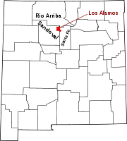 | |
Santa Fe (capital) | |
| Topics |
|
| Society | |
| Regions | |
| Cities | |
| Counties | |