Loon Lake (Oregon)
| Loon Lake | |
|---|---|
 | |
| Location | Douglas County, Oregon |
| Coordinates | 43°35′13″N 123°50′14″W / 43.58694°N 123.83722°WCoordinates: 43°35′13″N 123°50′14″W / 43.58694°N 123.83722°W |
| Type | Landslide-dammed lake, oligotrophic |
| Primary inflows | Lake Creek |
| Primary outflows | Mill Creek |
| Catchment area | 89 sq mi (231 km2)[1] |
| Basin countries | United States |
| Max. length | 2 mi (3 km) |
| Max. width | 0.4 mi (0.6 km) |
| Surface area | 294 acres (119 ha)[1] |
| Average depth | 53 ft (16 m)[1] |
| Max. depth | 105 ft (32 m)[1] |
| Water volume | 15,700 acre·ft (19,400,000 m3)[1] |
| Residence time | 1 month[1] |
| Shore length1 | 6.1 mi (9.8 km)[1] |
| Surface elevation | 392 ft (119 m)[2][3] |
| 1 Shore length is not a well-defined measure. | |
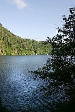
Loon Lake is a 294-acre (119 ha)[1] lake in Douglas County in the Oregon Coast Range of the United States, 15 miles (24 km) east-southeast of Reedsport, Oregon, at an elevation of 392 feet (119 m).[2] The lake is about 2 miles (3 km) long with a maximum width of about 0.4 miles (0.6 km), and is over 100 feet (30 m) deep in some places.
The lake is "a classic example of a landslide lake",[1] dammed by a slide of sandstone blocks which fell into the Lake Creek valley about 1,400 years ago. The lake was discovered in 1852 and named for the loons found on its waters.
See also
References
- 1 2 3 4 5 6 7 8 9 Johnson, Daniel M.; et al. (1985). Atlas of Oregon Lakes. Oregon State University Press. p. 224. ISBN 0-87071-343-4. This lists the elevation as 420 ft.
- 1 2 "USGS Topographic Map". This shows an elevation of 392 ft.
- ↑ U.S. Geological Survey Geographic Names Information System: Loon Lake (Oregon) This lists the elevation as 397 ft.
External links
This article is issued from Wikipedia - version of the 4/7/2016. The text is available under the Creative Commons Attribution/Share Alike but additional terms may apply for the media files.