Longva
| Longva | |
|---|---|
| Village | |
|
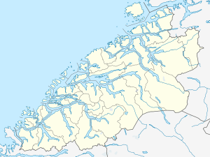
Longva is on the center-left side of the island on the right | |
 Longva  Longva Location in Møre og Romsdal | |
| Coordinates: 62°39′49″N 06°16′44″E / 62.66361°N 6.27889°ECoordinates: 62°39′49″N 06°16′44″E / 62.66361°N 6.27889°E | |
| Country | Norway |
| Region | Western Norway |
| County | Møre og Romsdal |
| District | Sunnmøre |
| Municipality | Haram Municipality |
| Elevation[1] | 7 m (23 ft) |
| Time zone | CET (UTC+01:00) |
| • Summer (DST) | CEST (UTC+02:00) |
| Post Code | 6293 Longva |
Longva is a village in Haram Municipality in Møre og Romsdal county, Norway. The village is located on the southwest side of the island of Skuløya, along the Longvafjorden. It is about 12 kilometres (7.5 mi) northeast of the village of Austnes on Haramsøya via the Ullasund Bridge. The population (2003) was 637, but since 2004, Longva has not been considered an urban settlement by Statistics Norway, and its data is therefore not registered.[2][3]
References
- ↑ "Longva" (in Norwegian). yr.no. Retrieved 2010-10-20.
- ↑ Statistisk sentralbyrå (1 January 2003). "Urban settlements. Population and area, by municipality".
- ↑ Statistisk sentralbyrå (1 January 2004). "New and omitted urban settlements".
This article is issued from Wikipedia - version of the 9/16/2016. The text is available under the Creative Commons Attribution/Share Alike but additional terms may apply for the media files.
