Longtan District, Taoyuan
| Longtan 龍潭區 | |
|---|---|
| District | |
| Longtan District | |
|
Longtan Lake | |
 | |
| Coordinates: 24°50′40″N 121°12′19″E / 24.84444°N 121.20528°E | |
| Country | Taiwan |
| Municipality | Taoyuan |
| Government | |
| • Mayor | Yu-tsai, Deng |
| Area | |
| • Total | 75.2341 km2 (29.0480 sq mi) |
| Population (January 2016) | |
| • Total | 118,648 |
| • Density | 1,600/km2 (4,100/sq mi) |
| Website | http://www.longtan.gov.tw/ |


Longtan District (Chinese: 龍潭區; pinyin: Lóngtán Qū) is a rural district in southern Taoyuan City, Taiwan. Longtan is home to the headquarters of the Republic of China Army.
The township is known for the Buddhist temple in the center of Longtan Lake and the large Bainien community project. The area is surrounded by high-tech industries and mountains.
Longtan is home to a number of military bases, and a few research installations. National Chung-Shan Institute of Science and Technology and Institute of Nuclear Energy Research[1] are two of the more well known ones.
History
Longtan used to be a rural township of the former Taoyuan County. On 25 December 2014, it was upgraded into a district of Taoyuan City.
Geography
- Area: 75.23 km²
- Population: 118,648 people (January 2016)
Administrative divisions
Huangtang, Yongxing, Zhongshan, Wushulin, Wulin, Bonian, Lingyun, Longxiang, Bade, Shengde, Shanglin, Longtan, Longxing, Zhongzheng, Shanghua, Jiulong, Wuhan, Tungxing, Zhongxing, Beixing, Jiaan, Sankeng, Daping, Sanlin, Jianlin, Fulin, Gaoping, Gaoyuan, Sanhe and Sanshui Village.
Government institutes
Education
Tourist attractions
Transportation
Longtan is served by National Highway No. 3.
See also
References
- ↑ Institute of Nuclear Energy Research (INER) (Chinese). (English).
External links
| Wikimedia Commons has media related to Longtan, Taoyuan. |
 Longtan travel guide from Wikivoyage
- Longtan Township Government website
- Facebook fanpage(I Love Longtan)
Districts of Taoyuan | ||
|---|---|---|
City seat: Taoyuan District | ||
| Districts | 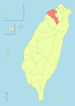 | |
| Mountain indigenous district | ||
Coordinates: 24°50′40″N 121°12′19″E / 24.84444°N 121.20528°E