Longboat Key, Florida
| Longboat Key, Florida | |
|---|---|
| Town | |
 Location in Manatee County and the state of Florida | |
| Coordinates: 27°23′49″N 82°38′41″W / 27.39694°N 82.64472°WCoordinates: 27°23′49″N 82°38′41″W / 27.39694°N 82.64472°W | |
| Country | United States |
| State | Florida |
| Counties | Sarasota, Manatee |
| Government | |
| • Town commissioner | 7 Total |
| Area | |
| • Total | 16.0 sq mi (41.4 km2) |
| • Land | 4.1 sq mi (10.7 km2) |
| • Water | 11.9 sq mi (30.7 km2) |
| Elevation | 3 ft (1 m) |
| Population (2010) | |
| • Total | 6,888 |
| • Density | 1,668/sq mi (643.9/km2) |
| Time zone | Eastern (EST) (UTC-5) |
| • Summer (DST) | EDT (UTC-4) |
| ZIP code | 34228 |
| Area code(s) | 941 |
| FIPS code | 12-41150[1] |
| GNIS feature ID | 0286084[2] |
| Website |
www |
Longboat Key is a town in Manatee and Sarasota counties along the central west coast of the U.S. state of Florida, located on and coterminous with the barrier island of the same name. Longboat Key is south of Anna Maria Island, between Sarasota Bay and the Gulf of Mexico. It is almost equally divided between Manatee and Sarasota counties. The town of Longboat Key was incorporated in 1955 and is part of the Bradenton–Sarasota–Venice Metropolitan Statistical Area.
The town's population was 6,888 at the 2010 census,[3] down from 7,603 at the 2000 census.
History
Early History
Longboat Key was originally inhabited by Native Americans. The area Longboat Key was scouted by Juan Anasco who was the first white man to explore the key and Hernando De Soto's scout which his Longboat went through the Longboat Pass on the north end of the Key. According to local legend he believed the Indians were hostile and when they reached land on the island and fled leaving their Longboat in a bayou. Pirate Jean Lafitte was said to have been shipwrecked near or on Longboat Key.[4] For over 300 years Longboat Key was vastly ignored.
Settlement
In the late 1800s, Longboat Key was opened up for settlement. Longboat Key was first settled by Thomas Mann and his sons in 1884 receiving 144 acres (58 ha) on the key in which he moved to in 1888 with his family and his house was located in the north end of the key.[5] A year after buying the land the town was given a name and was known as Longbeach. With a passage being dug in 1895 from Sarasota Bay to Tampa Bay steamships and Paddle boats could access the island. Soon, a mail service was established that brought residents mail that sent mail from Cortez. The land was sold in 1905 for $500 for commercial development. In the early 1900s Longboat Key was a farming community until 1921. Longboat Key was very popular mostly for growing fruits and tomatoes with Bryon Corey owning a farm which was on the New Pass on the southernmost point of the key. In 1912 The Sarasota Times said on its headline: "From a lonely Key, it is now a center of trucking and fruit growing."
The key lost most of its agriculture during a hurricane in 1921 when also most of the key's buildings were destroyed by a hurricane. There were no roads that lead here until 1929 when a bridge lead to St. Armands, so most transportation was done with a ferry dock on the north end of the key.[6] That same year, the island was split in two counties, Sarasota and Manatee. In 1925 at the south end, John Ringling, a developer, built the Ritz Carlton Hotel which began in March 1926 which was never completed and eventually torn down. In 1936 for the first time, telephone service was brought to the South End of the island and by 1939 or 1940 it was brought to the North End. In World War II Longboat Key had a bombing range.
Incorporation
On November 13, 1955, the town was incorporated in a 186–13 vote. At the time only about a third of Longboat Key was developed and about 215 people lived there. The town when it was incorporated changed its name from Longbeach to Longboat Key.[5]
Development
In the 1960s and 1970s the Arvida corporation bought the south end of Longboat key and developed it for $13.5 million.[5] President Bush had arrived on Longboat on September 10, 2001 the day before the September 11 Attacks to read to second graders in a campaign called at the Emma T. Booker School in Sarasota.[7] On November 14, 2015 the town of Longboat Key celebrated a 60- year anniversary.[8]
Government
The town of Longboat Key has a commission-manager form of government.
The United States Postal Service operates a post office on Longboat Key, with the entire island having the ZIP code of 34228. The post office was established on October 10, 1907, as "Longbeach" and was located in the community of that name on the north end of the key. On February 1, 1958, the name of the Longbeach post office was changed to Longboat Key. There was also a post office named "Longboat" established on March 27, 1914, in the Sarasota County portion of the key, but it was discontinued on January 14, 1922, and its functions were assumed by the Sarasota post office.[9]
The quasi-governmental form of the Condominium Association exists in one of its most complex forms in and on Longboat Key, comprising the "Federation of Longboat Key Condominiums". In addition to the Longboat Key Chamber of Commerce, and in concert with the Town of Longboat Key, these entities have made Longboat Key an exemplar of local government and citizen cooperation in participation and management for communities of its type.
Longboat Key is served by two newspapers published year-round, the Longboat Observer and the Longboat Key News[10]
In recent years, "federalizing" the Key by having the U.S. Congress create the "Longboat Key National Seashore" has been suggested. Currently Longboat Key is located within two Florida counties, Manatee County in the north and Sarasota County in the south, but there have been calls for the Florida Legislature to pursue an initiative to create a 68th county, "Longboat Key County," to simplify governance of the island. Neither of these initiatives is likely to be passed, however.
Geography
Longboat Key is located north of St. Armands Key, with its circle of shopping and dining, and Lido Key, and south of Bradenton Beach, Holmes Beach, and Anna Maria, which are located on adjacent Anna Maria Island. The nearby cities of Sarasota and Bradenton and the Sarasota–Bradenton International Airport round out Longboat Key's varied list of geographic amenities. State Road 789 (Gulf of Mexico Drive) runs the length of the island, with ancillary boulevards branching off to residential neighborhoods. From some locations one can see both Sarasota Bay and the Gulf of Mexico. At other points the island widens and accommodates various homes owned both singly and in condominiums, hotels, and sports clubs.
According to the United States Census Bureau, the town has a total area of 16.0 square miles (41.4 km2), of which 4.1 square miles (10.7 km2) is land and 11.9 square miles (30.7 km2), or 74.19%, is water.[3]
Some Longboat Key residents are "snowbirds", who vacation on or own second homes on Longboat Key, and are present only during the winter months. Others are homesteaders, utilizing the various homestead exemptions provided to Florida citizens who own and occupy their principal residences within the state, as set forth under the Florida Constitution.
There are numerous restaurants on Longboat Key, Mar Vista, The Lazy Lobster, The Dry Dock, Pattigeorge's Restaurant, Chart House, the Longboat Key Club Restaurant, Euphemia Haye, Maison Blanche, Bayou Tavern, and Harry's. There are also full-service grocery stores, including Publix, and pharmacies, located centrally.
Most of the Gulf side of Longboat Key comprises beaches.
The southern most area of the key is mostly part of the Longboat Key Club.
 Boardwalk to beach
 Beach on Gulf side of key
 Beach expanse
Real estate
Much of the land area of Longboat Key is occupied by either single-family homes or condominium apartments. Most of the condominium associations co-own common elements which comprise pools, tennis courts, sites with water views and access to beaches.
Almost the entire land area of Longboat Key is now occupied. The remaining older, singly owned houses are as much as 45 years old, annexed to comparatively small parcels, again an outgrowth of the ½ acre limitation on homestead property area within municipalities as set forth in the Florida Constitution. In the last few years, these properties have been purchased by new owners who sought to and did demolish them in order build small, ornate homes worth much more, many being valued to amounts on the order of as much as a few million dollars, a peculiar outgrowth of the unlimited-in-value homestead exemption for principal residences from forced sale provided to homesteaders under the Florida Constitution. This diverse mix of homes owned both singly and in condominium line the many cul-de-sacs and boulevards branching off main roads towards both the bay and the gulf, with the length of the island served by Gulf of Mexico Drive.
Water
A perennial problem for Longboaters was water quantity and quality. Salinity and sedimentary factors threatened the availability of potable water to island residents, visitors, and businesses. This problem was alleviated sufficiently when the Governing Board of the Southwest Florida Water Management District approved a connection to Sarasota County's water supply, augmenting the existing connection to that of Manatee County.[11]
Demographics
| Historical population | |||
|---|---|---|---|
| Census | Pop. | %± | |
| 1960 | 1,000 | — | |
| 1970 | 2,850 | 185.0% | |
| 1980 | 4,843 | 69.9% | |
| 1990 | 5,937 | 22.6% | |
| 2000 | 7,603 | 28.1% | |
| 2010 | 6,888 | −9.4% | |
| Est. 2015 | 7,266 | [12] | 5.5% |
As of the census[1] of 2000, there were 7,603 people, 4,280 households, and 2,846 families residing in the town. The population density was 1,546.4 people per square mile (596.7/km²). There were 8,834 housing units at an average density of 1,796.8 per square mile (693.3/km²). The racial makeup of the town was 99.24% White, 0.07% African American, 0.08% Native American, 0.43% Asian, 0.01% Pacific Islander, 0.01% from other races, and 0.16% from two or more races. Hispanic or Latino of any race were 0.67% of the population.
There were 4,280 households out of which 3.0% had children under the age of 18 living with them, 64.3% were married couples living together, 1.4% had a female householder with no husband present, and 33.5% were non-families. 30.2% of all households were made up of individuals and 21.6% had someone living alone who was 65 years of age or older. The average household size was 1.78 and the average family size was 2.11.
In the town the population was spread out with 2.6% under the age of 18, 0.9% from 18 to 24, 5.7% from 25 to 44, 32.4% from 45 to 64, and 58.3% who were 65 years of age or older. The median age was 68 years. For every 100 females there were 86.8 males. For every 100 females age 18 and over, there were 86.7 males.
The median income for a household in the town was $290,251, and the median income for a family was $307,983. Males had a median income of $261,157 versus $230,104 for females. The per capita income for the town was $280,963. About 0.4% of families and 0.9% of the population were below the poverty line, including 0.9% of those under age 18 and 1.0% of those age 65 or over.
Notable people
Notable current and former residents of Longboat Key include:
- Al Arbour, four-time Stanley Cup-winning former coach of the New York Islanders[14]
- Lou Bender, pioneer player with the Columbia Lions and in early pro basketball, who was later a successful trial attorney[15]
- Nick Bollettieri, founded Bradenton's Nick Bollettieri Tennis Academy in 1978 and groomed such champions as Andre Agassi and Monica Seles[16]
- Vern Buchanan, automobile dealer and member of the United States House of Representatives for Florida's 16th congressional district, which includes Longboat Key[17]
- Marcella Hazan, Italian cooking instructor and cookbook author
- Nathan J. Kaplan, Illinois jurist and politician
- Charlie Maxwell, former Major League Baseball player for the Detroit Tigers, Boston Red Sox, Baltimore Orioles and Chicago White Sox
- Ed Miracle, artist[18]
- Frank Mockler, 47th Governor of American Samoa
- Joe Perry, lead guitarist for the rock band Aerosmith[19]
- Ronna Romney, former Michigan Republican politician and former sister-in-law to Governor Mitt Romney[20]
See also
References
- 1 2 "American FactFinder". United States Census Bureau. Retrieved 2008-01-31.
- ↑ "US Board on Geographic Names". United States Geological Survey. 2007-10-25. Retrieved 2008-01-31.
- 1 2 "Geographic Identifiers: 2010 Demographic Profile Data (G001): Longboat Key town, Florida". U.S. Census Bureau, American Factfinder. Retrieved April 2, 2013.
- ↑ "Longboat Key - History and Place to Visit". Longboat Key Chamber. Retrieved 2015-12-14.
- 1 2 3 "Longboat Key - History and Place to Visit". Longboat Key Chamber. Retrieved 2016-01-07.
- ↑ "Farming on Longboat till 1921". longboat key history.com. Retrieved 2016-02-24.
- ↑ "9-11 Research: George W. Bush". 911research.wtc7.net. Retrieved 2016-01-07.
- ↑ "Longboat Key celebrates 60th anniversary". Your Observer. Retrieved 2016-01-07.
- ↑ Bradbury, Alford G., and Hallock, E. Story, A Chronology of Florida Post Offices, 1962, reprinted 1993, Port Salerno, Florida: Florida Classics Library, p. 49. ISBN 0-9630788-1-X
- ↑ http://www.lbknews.com/
- ↑ http://www.swfwmd.state.fl.us/news/viewarticle.php?id=221 swfwmd.state.fl.us
- ↑ "Annual Estimates of the Resident Population for Incorporated Places: April 1, 2010 to July 1, 2015". Retrieved July 2, 2016.
- ↑ "Census of Population and Housing". Census.gov. Retrieved June 4, 2015.
- ↑ Vecsey, George (November 3, 2007). "Al Arbour: The Man Behind the Glass". The New York Times. Retrieved August 28, 2015.
- ↑ Mallozzii, Vincent M. "Lou Bender, Columbia Star Who Helped Popularize Basketball in New York, Dies at 99", The New York Times, September 12, 2009. Accessed September 13, 2009.
- ↑ ABBY WEINGARTEN Correspondent. "Who lives here?". HeraldTribune.com. Retrieved 2012-12-18.
- ↑ https://web.archive.org/web/20160625041937/http://www.heraldtribune.com/article/20110423/ARCHIVES/104231021
- ↑ http://www.yourobserver.com/realestate/1114201223036/Miracle-statue-en-route-to-Dubai
- ↑ "Joe Perry's Condo". Virtual Globetrotting. 2011-01-10. Retrieved 2012-12-18.
- ↑ https://web.archive.org/web/20160625042438/http://www.yourobserver.com/article/coreys-landing-home-sells-355-million
External links
- Town of Longboat Key official website
- Longboat Key Center for the Arts
- Longboat Key Historical Society
- Longboat Key Chamber of Commerce
Municipalities and communities of Sarasota County, Florida, United States | ||
|---|---|---|
| Cities | 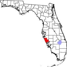 | |
| Town | ||
| CDPs | ||
| Unincorporated community | ||
| Footnotes | ‡This populated place also has portions in an adjacent county or counties | |
Municipalities and communities of Manatee County, Florida, United States | ||
|---|---|---|
| Cities | 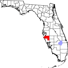 | |
| Town | ||
| CDPs | ||
| Unincorporated communities | ||
| Ghost town | ||
| Footnotes | ‡This populated place also has portions in an adjacent county or counties | |