Long Glacier

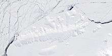
Long Glacier (72°30′S 96°43′W / 72.500°S 96.717°WCoordinates: 72°30′S 96°43′W / 72.500°S 96.717°W) is a glacier about 8 nautical miles (15 km) long in the southeastern part of Thurston Island, Antarctica. It flows south to the Abbot Ice Shelf, 14 nautical miles (26 km) west of Harrison Nunatak. The glacier was mapped by the United States Geological Survey from surveys and U.S. Navy air photos, 1960–66, and was named by the Advisory Committee on Antarctic Names for Fred A. Long, Jr., an aviation machinist of U.S. Navy Squadron VX-6, who wintered at Little America V in 1957 and was in Antarctica in the 1960–61 and 1962–63 seasons.[1]
Maps
- Thurston Island – Jones Mountains. 1:500000 Antarctica Sketch Map. US Geological Survey, 1967.
- Antarctic Digital Database (ADD). Scale 1:250000 topographic map of Antarctica. Scientific Committee on Antarctic Research (SCAR), 1993–2016.
References
- ↑ "Long Glacier". Geographic Names Information System. United States Geological Survey. Retrieved 2013-06-30.
![]() This article incorporates public domain material from the United States Geological Survey document "Long Glacier" (content from the Geographic Names Information System).
This article incorporates public domain material from the United States Geological Survey document "Long Glacier" (content from the Geographic Names Information System).