Lone Mountain (California)
| Lone Mountain | |
|---|---|
 | |
| Highest point | |
| Elevation | 421 ft (128 m) NAVD 88[1] |
| Coordinates | 37°46′45″N 122°27′07″W / 37.7790963°N 122.4519159°WCoordinates: 37°46′45″N 122°27′07″W / 37.7790963°N 122.4519159°W [2] |
| Geography | |
 Lone Mountain
| |
| Location | San Francisco, California |
| Topo map | USGS San Francisco North |
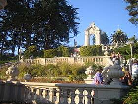
Lone Mountain is a historic hill in west-central San Francisco, California and the site of the private University of San Francisco (USF) – Lone Mountain Campus, which in turn was previously the San Francisco Lone Mountain College for Women. It was once the location of Lone Mountain Cemetery, a complex encompassing the Laurel Hill, Calvary, Masonic, and Odd Fellows Cemeteries.[3]
Lone Mountain is one of California's historic hills. The hill is near to the former location of the Odd Fellows Cemetery, Masonic Cemetery, and Greek Orthodox Cemetery. The graves in these cemeteries, along with most graves in San Francisco, were moved to Colma by the 1940s. Lone Mountain is also home to the Angelo J. Rossi Playground and Rossi Pool at Arguello Boulevard and Anza Street.
Lone Mountain is also known as "University Terrace" because of the terraces that connect the two USF campuses.
Cemetery

The Lone Mountain Cemetery was opened on May 30, 1854.[4]
In 1867, the cemetery was renamed Laurel Hill Cemetery, after the Laurel Hill garden cemetery in Philadelphia.[4][5]
In the early 20th century, San Francisco voted most of its cemeteries out of existence, ostensibly for public health reasons; after decades of further dispute the transfer of Lone Mountain's forty-seven thousand inhabitants began, primarily to Cypress Lawn Memorial Park in the city of Colma, immediately south of San Francisco. In what writer Harold Gilliam has described as "an act of civic vandalism," thousands of crypts and mausoleums were unearthed, the granite and marble dumped along the Pacific shoreline to reinforce seawalls.[6]
The Spanish name for Lone Mountain was El Divisadero, from the Spanish divisadero, which means a point from which one can look far.[7]


See also
References
- ↑ "Lone Mountain, California". Peakbagger.com. Retrieved 2014-03-04.
- ↑ "Lone Mountain". Geographic Names Information System. United States Geological Survey. Retrieved 2010-05-17.
- ↑ Kastler, Deanna L. "Cemeteries". Encyclopedia of San Francisco. San Francisco Museum & Historical Society. Retrieved 2010-05-22.
- 1 2 Unmaking Historic Spaces: Urban Progress and the San Francisco Cemetery Debate, 1895-1937, by Tamara Venit Shelton, California History, volume 85 number 3 2008
- ↑ "Laurel Hill Cemetery". Daily Alta California. April 12, 1867.
- ↑ Thompson, Walter J. "In The Shadow of Lone Mountain". San Francisco History. SFgenealogy. Retrieved 2010-05-22.
- ↑ "Appendix B: Streets of San Francisco". San Francisco History. San Francisco Genealogy. Retrieved 2014-03-04.
External links
- Proctor, William A. (1950). "Location, regulation, and removal of cemeteries in the City and County of San Francisco". Department of City Planning, City and County of San Francisco.

- "Photo from Tank Hill towards North showing USF". Flickr. Retrieved 2009-08-20.
- Proctor, William A. (1950), Location, regulation, and removal of cemeteries in the City and County of San Francisco, Department of City Planning, City and County of San Francisco
- San Francisco Cemeteries
- Encyclopedia of San Francisco Article on cemeteries
- San Francisco Columbarium
- San Francisco Parks
- Photo from Tank Hill towards North showing USF
| Downtown | .svg.png) | |
|---|---|---|
| North of Downtown | ||
| Outside Lands | ||
| Western Addition | ||
| Southern | ||
| ||