London-Corbin Airport
| London-Corbin Airport Magee Field | |||||||||||
|---|---|---|---|---|---|---|---|---|---|---|---|
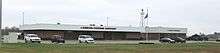 Terminal and restaurant | |||||||||||
| IATA: LOZ – ICAO: KLOZ – FAA LID: LOZ | |||||||||||
| Summary | |||||||||||
| Airport type | Public | ||||||||||
| Owner | Cities of London & Corbin | ||||||||||
| Serves | London, Kentucky | ||||||||||
| Elevation AMSL | 1,212 ft / 369 m | ||||||||||
| Coordinates | 37°05′13″N 084°04′39″W / 37.08694°N 84.07750°W | ||||||||||
| Website | london-corbinairport.com | ||||||||||
| Runways | |||||||||||
| |||||||||||
| Statistics (2006) | |||||||||||
| |||||||||||
London-Corbin Airport (IATA: LOZ, ICAO: KLOZ, FAA LID: LOZ), also known as Magee Field, is a general aviation airport located in Laurel County, Kentucky, three nautical miles (6 km) south of the central business district of London[1] and about 12 miles north of Corbin. The airport is operated by both cities.[1] It is not currently served by scheduled airline service, though service was once available on US Airways Express dba Air Kentucky and Tennessee Airways. Prior to the passage of the Airline Deregulation Act, the airport was served by Piedmont Airlines (1948-1989) turboprops, including the Fairchild Hiller FH-227 and the NAMC YS-11.
Facilities and aircraft
London-Corbin Airport covers an area of 186 acres (75 ha) at an elevation of 1,212 feet (369 m) above mean sea level. It has one asphalt paved runway designated 6/24 which measures 5,750 by 150 feet (1,753 x 46 m).[1]

For the 12-month period ending January 10, 2006, the airport had 13,063 aircraft operations, an average of 35 per day: 53% general aviation, 31% military and 17% air taxi. At that time there were 73 aircraft based at this airport: 78% single-engine, 7% multi-engine, 3% jet, 10% helicopter, 1% glider, 1% ultralight.[1]
The London Composite Squadron of the Kentucky Wing Civil Air Patrol is based here. It is one of the oldest Civil Air Patrol Units in the United States.
The Kentucky National Guard constructed a readiness facility on the field in 2009 and was dedicated by Adjutant General Don Storm at opening.
References
External links
- London-Corbin Airport, official site
- Aerial photo as of 11 March 1997 from USGS The National Map
- FAA Terminal Procedures for LOZ, effective December 8, 2016
- Resources for this airport:
- FAA airport information for LOZ
- AirNav airport information for KLOZ
- ASN accident history for LOZ
- FlightAware airport information and live flight tracker
- NOAA/NWS latest weather observations
- SkyVector aeronautical chart, Terminal Procedures