Loliondo Airstrip
| Loliondo Airstrip Uwanja mdogo wa Ndege wa Loliondo | |||||||||||
|---|---|---|---|---|---|---|---|---|---|---|---|
 | |||||||||||
| IATA: none – ICAO: HTLD | |||||||||||
| Summary | |||||||||||
| Airport type | Public | ||||||||||
| Owner | Government of Tanzania | ||||||||||
| Operator | Tanzania Airports Authority | ||||||||||
| Location | Loliondo | ||||||||||
| Elevation AMSL | 6,620 ft / 2,018 m | ||||||||||
| Coordinates | 2°04′13″S 35°32′25″E / 2.07028°S 35.54028°ECoordinates: 2°04′13″S 35°32′25″E / 2.07028°S 35.54028°E | ||||||||||
| Map | |||||||||||
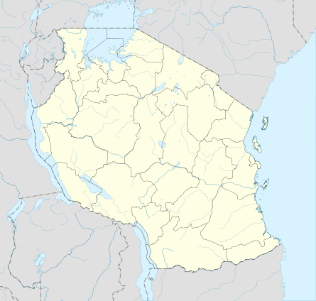 HTLD Location of airstrip in Tanzania | |||||||||||
| Runways | |||||||||||
| |||||||||||
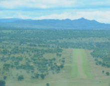
Loliondo Airstrip (ICAO: HTLD) is an airstrip serving the village of Loliondo, in the Arusha Region of Tanzania.
See also
 Tanzania portal
 Aviation portal
- List of airports in Tanzania
- Transport in Tanzania
References
- ↑ "List of Aerodromes in Tanzania" (PDF). Tanzania Civil Aviation Authority. Retrieved 4 April 2013.
- ↑ Airport information for HTLD at Great Circle Mapper.
- ↑ Google Maps - Loliondo
External links
- Tanzania Airports Authority
- OurAirports - Loliondo
- OpenStreetMap - Loliondo
- Loliondo Airstrip on YouTube
This article is issued from Wikipedia - version of the 12/5/2016. The text is available under the Creative Commons Attribution/Share Alike but additional terms may apply for the media files.