Lokrume
| Lokrume | |
|---|---|
|
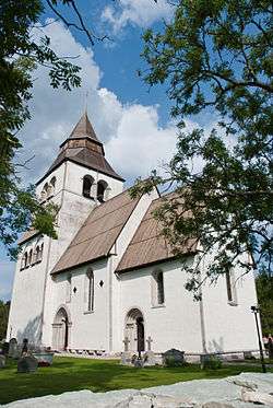
Lokrume Church | |
 Lokrume | |
| Coordinates: 57°41′0″N 18°32′0″E / 57.68333°N 18.53333°ECoordinates: 57°41′0″N 18°32′0″E / 57.68333°N 18.53333°E | |
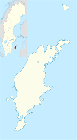
| Country | Sweden |
| Province | Gotland |
| County | Gotland County |
| Municipality | Gotland Municipality |
| Area[1] | |
| • Total | 34.91 km2 (13.48 sq mi) |
| Population (2014)[2] | |
| • Total | 272 |
| Time zone | CET (UTC+1) |
| • Summer (DST) | CEST (UTC+2) |
| Website | http://www.lokrume.se/ |
Lokrume, is a small settlement in the north part of the island of Gotland, Sweden. Formerly a socken,[3] on 1 January 2016, it was reconstituted into the administrative area Lokrume District.[4]
Geography
Lokrume is the name of the socken, now district. It is also the name of the small village surrounding the medieval Lokrume Church,[5] sometimes referred to as Lokrume kyrkby. It is situated in the central northern part of Gotland,[6] with farmed land to the north and forests in the south.[1]
One of the asteroids in the Asteroid belt, 9267 Lokrume, is named after this place.[7]
History
The name Lokrume is from the 14th century name Lokarum and consists of the lok or lauk being the name of a farm, Lauks, and rum meaning "open place". This sums up to "The open place belonging to the Lauks people".[8] Gervid Lauk was a 14th century county judge living in Lokrume, one of the medieval houses belonging to his estate still remains at the Lauks farm.[9]
There are several minor Viking age grave fields and stone ships,[10] as well as larger stones with Iron age grinding grooves.[11] Four silver treasures has been found at Lokrume.[12]
References
- 1 2 "Lokrume, socken". www.svenskuppslagsbok.se (in Swedish). Svensk uppslagsbok. Retrieved 25 January 2015.
- ↑ "Gotland i siffror 2015" [Gotland in numbers 2015]. www.gotland.se. Gotland Municipality. Retrieved 25 May 2016.
- ↑ The exact extent of the socken, now district, can be obtained by clicking on Kartinställningar and check the Socken box in the menu of this map from the Swedish National Heritage Board database.
- ↑ "Förordning om district" [Regulation of districts] (PDF). Ministry of Finance. 17 June 2015. Retrieved 24 May 2016.
- ↑ Lagerlöf, Erland; Svahnström, Gunnar (1973). Gotlands kyrkor [Gotland's Churces] (in Swedish). Stockholm: Rabén & Sjögren. pp. 201–204. ISBN 91-29-41035-5. LIBRIS 7232718.
- ↑ "Lokrume". www.ne.se. Nationalencyklopedin. Retrieved 30 May 2016.
- ↑ "9267 Lokrume (1978 RL10)". www.nasa.goc. NASA. Retrieved 25 January 2015.
- ↑ Svenskt ortnamnslexikon [Swedish location name dictionary] (in Swedish). Uppsala: Språk- och folkminnesinstitutet (SOFI). 2003. ISBN 91-7229-020-X. Retrieved 25 January 2015.
- ↑ Enderborg, Bernt. "Lauks i Lokrume" [Lauks in Lokrume]. www.guteinfo.com (in Swedish). Guteinfo.com. Retrieved 26 January 2015.
- ↑ "Lokrume". www.fmis.raa.se (in Swedish). Swedish National Heritage Board. Retrieved 25 January 2015.
- ↑ "List of Gotland grinding grooves KL". www.stavgard.com. Sören_Gannholm. Retrieved 25 January 2015.
- ↑ "Lokrume socken". www.historiska.se (in Swedish). Swedish History Museum. Retrieved 25 January 2015.
External links
| Wikimedia Commons has media related to Lokrume. |
