Loharu
| Loharu | |
|---|---|
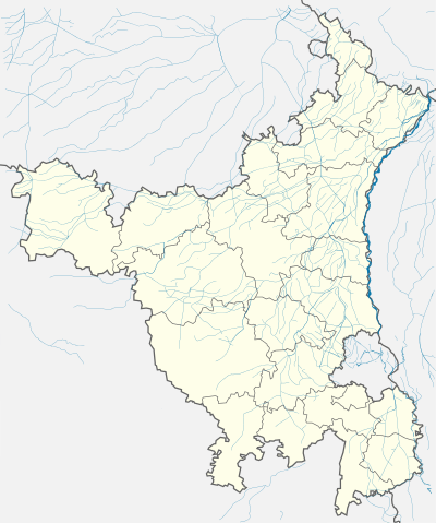  Location in Haryana, India | |
| Coordinates: 28°24′12″N 75°59′08″E / 28.4032°N 75.9856°ECoordinates: 28°24′12″N 75°59′08″E / 28.4032°N 75.9856°E | |
| Country |
|
| State | Haryana |
| District | Bhiwani |
| Elevation | 262 m (860 ft) |
| Population (2001) | |
| • Total | 11,421 |
| Languages | |
| • Official | Hindi |
| Time zone | IST (UTC+5:30) |
| Vehicle registration | HR |
| Website |
haryana |
Loharu (also known as Luharu) is a city, municipal committee and assemblly constituency in the Bhiwani district of the Indian state of Haryana. It is the administrative headquarters of one of the four administrative sub-divisions of the district and covers 119 villages.[1][2] It is also a railway junction station.
It was the seat of the eponymous princely state during the British Raj, established in 1803; and an important reminiscence of that is the Loharu Fort, now a key tourist destination.
Etymology

The town gets its name from the Lohars or blacksmiths of the town who were employed in the minting of coins for the erstwhile Jaipur state.[3]
History
The princely state of Loharu was founded by Ahmad Baksh Khan in 1803 when he received the town of Loharu from the British East India Company as a reward for his services against the Jat rulers of Bharatpur (along with the pargana of 'Firozepur Jirka', now in Gurgaon district, from Lord Lake).[4][5][6]
After the Independence of India in 1947, the state acceded unto the Union of India. Many of the ruling family and the city's Muslim inhabitants re-settled in Lahore, Pakistan. However, the Nawab and his direct descendants stayed on, in India (except for Mahbano Begum, the eldest daughter of Nawab Aminuddin Ahmed, who lives in Islamabad).
Loharu Fort
Loharu Fort was the residential and administrative center of Loharu State. Zaildar Jaglan Jat of Bidhwan was the largest landlord.
Higher and Technical Education
There are a number of institutions of higher education located in the Loharu area. The Keystone Group of Institutions, an AICTE approved institution offering B.Tech and MBA courses from Rajasthan Technical University, is 5 kilometres (3.1 mi) from the Loharu station. Loharu is 30 kilometres (19 mi). from Birla Institute Of Technology and Science, one of the best engineering institute in the country. It is also home to Rani Jhansi Laxmi Bai Govt Polytechnic, located on the Loharu-Bhiwani road and the government P.G College on Bhiwani road, which offers undergraduate and postgraduate courses and is affiliated to M.D.U, Rohtak.
Transport
Loharu is a railway station junction on Rewari-Mahendragarh-Sadulpur railway route. It was a metre gauge track that was converted to 1,676 mm (5 ft 6 in) broad gauge in 2009. Th metre gauge railway line from Loharu junction to Sikar junction, Ringas junction and Jaipur is being converted to broad gauge.
Villages
References
- ↑ Bhiwani district Haryana Official website.
- ↑ Introduction Bhiwani district Official website.
- ↑ Loharu Town The Imperial Gazetteer of India, 1909, v. 16, p. 170.
- ↑ Loharu State The Imperial Gazetteer of India, 1909, v. 16, p. 169.
- ↑ Chapter 5: My Loharu Connection The Battle Within, by Brigadier Mirza Hamid Hussain, Pakistan Army 33. 1970. ISBN 969-407-286-7 -.(ebook)
- ↑ The State of Loharu Indian States: A Biographical, Historical, and Administrative Survey, by Somerset Playne, R. V. Solomon, J. W. Bond, Arnold Wright. Asian Educational Services, 2006. ISBN 81-206-1965-X.Page 691.
Further reading
- Khandan-e-Loharu Ke Shura (Loharu Family Biography), by Hamid Sultan Ahmad. New Delhi, Ghalib Institute, 1981. (Ghalib Institute Catalogue)
- Murder of Mr. Fraser, and Execution of the Nawab Shams-ud-din - Page 86 Rambles and Recollections of an Indian Official, by W.H. Sleeman, Vincent A. Smith, Published by Asian Educational Services, 1996. ISBN 81-206-1013-X. (ebook)
- Chapter 5: My Loharu Connection The Battle Within, by Brigadier Mirza Hamid Hussain, Pakistan Army 33. 1970. ISBN 969-407-286-7 -.(ebook)
- The Yusufi Dynasty at RoyalArk.net
Bhiwani district topics | ||
|---|---|---|
| Cities and towns |  | |
| Sports | ||
| Transport | ||
| Lok Sabha constituencies | ||
| Vidhan Sabha constituencies | ||