Loess Plateau
| Loess Plateau | |||||||
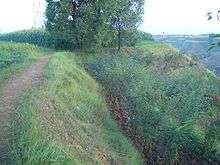
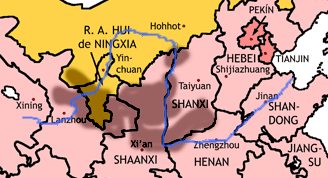 The Loess Plateau (shaded) | |||||||
| Traditional Chinese | 黃土高原 | ||||||
|---|---|---|---|---|---|---|---|
| Simplified Chinese | 黄土高原 | ||||||
| Literal meaning | The Yellow Earth Plateau | ||||||
| |||||||
The Loess Plateau, also known as the Huangtu Plateau, is a 640,000 km² plateau located around the Wei River valley and the southern half of the Ordos Loop of the Yellow River in central China. It covers almost all of the provinces of Shaanxi and Shanxi and extends into parts of Gansu, Ningxia, and Inner Mongolia. It was enormously important to Chinese history, as it formed the cradle of Chinese civilization and its eroded silt is responsible for the great fertility of the North China Plain, along with the repeated and massively destructive floods of the Yellow River. Its soil has been called "most highly erodible... on earth"[1] and conservation efforts and land management are a major focus of modern Chinese agriculture.
Name
The area is named for its most distinctive feature, the highly friable "loess" (German for "loose"; Chinese: 黃土, huángtǔ, "yellow earth") soil that has been deposited by wind storms over the ages.
History
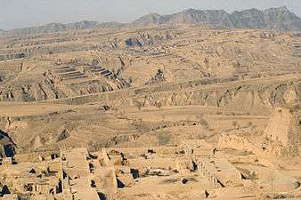
Historically the Loess Plateau has provided simple yet insulated shelter from the cold winter and hot summer in the region, as homes called yaodong (窰洞) were often carved into the loess soil; in medieval times people stayed here to grow rice; some families still live in this kind of shelter in modern times. During the 1556 Shaanxi earthquake, 830,000 people were killed as a result of collapsing loess caves. The yaodongs that are best known to the world are perhaps those in Yan'an where the Communist Party led by Mao Zedong headquartered in 1930s. When Edgar Snow, the author of Red Star Over China, visited Mao and his party, he lived in a yaodong. In ancient times, this region was also an important center of the Silk Road.[2] Goods moving by caravan to the west included gold, rubies, jade, textiles, coral, ivory, and art works. In the opposite direction moved bronze weapons, furs, ceramics, and cinnamon bark.[3]
Climate
The plateau generally has a semi-arid climate (Köppen BSn), with extensive monsoonal influence. Winters are cold and dry, while summers are very warm and in many places hot. Rainfall tends to be heavily concentrated in summer, and the area receives extensive amounts of sunshine.
Agriculture and environment
The Loess Plateau was highly fertile and easy to farm in ancient times, which contributed to the development of early Chinese civilization around the Loess Plateau.
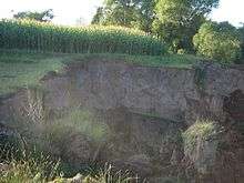
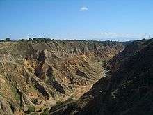
Centuries of deforestation and over-grazing, exacerbated by China's population increase, have resulted in degenerated ecosystems, desertification, and poor local economies.
In 1994 an effort known as the Loess Plateau Watershed Rehabilitation Project was launched to mitigate desertification; limited success has resulted for a portion of the Loess Plateau, where now trees and grass have turned green. A major focus of the Project was to try to guide the people living in the Plateau to use more sustainable ways of living such as keeping goats in pens not being allowed to roam free and erode the soft silty soil found in the plateau. Many trees were planted and nature is now reclaiming a portion of the Loess Plateau. Results have reduced the massive silt loads to the Yellow River by about one percent.[4]
The Loess Plateau was formed over long geologic times, and scientists have derived valuable information about global climate change from samples taken from the deep layer of its silty soil.
See also
- Yunnan-Guizhou Plateau
- Loess Hills of Western Iowa
- Palouse Loess of Eastern Washington
References
- ↑ John M. Laflen, Soil Erosion and Dryland Farming, 2000, CRC Press, 736 pages ISBN 0-8493-2349-5
- ↑ Susan Whitfield, Life Along the Silk Road, 2001, University of California Press, 253 pages ISBN 0-520-23214-3
- ↑ C.Michael Hogan,Silk Road, North China, The Megalithic Portal, ed. A. Burnham
- ↑ World Bank, Reengaging in Agricultural Water Management: Challenges and Options, 2006, 218 pages ISBN 0-8213-6498-7
External links
- People's Daily Online: Loess Plateau Rehabilitation Project
- Soils and Sustainability: Tales from the Loess Plateau
- WorldBank: Restoring China's Loess Plateau
- Hope in a Changing Climate - Documentary featuring the restoration of the Loess Plateau
Coordinates: 36°53′N 108°43′E / 36.883°N 108.717°E