Loch Eriboll
Coordinates: 58°30′18″N 4°40′12″W / 58.505°N 4.670°W
| Loch Eriboll | |
|---|---|
 | |
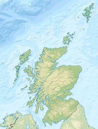 Loch Eriboll | |
| OS grid reference | NC445605 |
 Loch Eriboll Lighthouse on the East side of Loch Eriboll. | |
|
Scotland | |
| Location |
Loch Eriboll Highland Scotland United Kingdom |
|---|---|
| Coordinates | 58°31′00″N 4°38′54″W / 58.516804°N 4.648422°W |
| Year first constructed | 1894 (first) |
| Year first lit | 2003 (current) |
| Automated | 2003 |
| Construction | skeletal tower |
| Tower shape | square parallelepiped clad tower with white panels as daymark and light |
| Markings / pattern | white tower |
| Height | 5 metres (16 ft) |
| Focal height | 19 metres (62 ft) |
| Characteristic | Fl WR 10s. |
| Admiralty number | A3874 |
| NGA number | 3580 |
| ARLHS number | SCO-126 |
| Managing agent | Northern Lighthouse Board[1] |
Loch Eriboll (Scottish Gaelic: "Loch Euraboil") is a 16 km (9.9 mi) long sea loch on the north coast of Scotland, which has been used for centuries as a deep water anchorage as it is safe from the often stormy seas of Cape Wrath and the Pentland Firth. It is named after the village of Eriboll on its eastern shore.
Bronze Age remains can be found in the area, including a souterrain and a very well preserved wheelhouse on the hillside above the west shore. A small scale lime industry developed here in the 19th century.

Around the shores of the loch are the crofting townships of Eriboll, Laid, Heilam, Portnancon and Rispond.
Eilean Hoan is located at the northern, seaward end of the loch and there are various small islets in the vicinity including A' Ghoil-sgeir, An Cruachan, An Dubh-sgeir, Eilean Clùimhrig, and Pocan Smoo.[2] Today it is a largely unspoilt wilderness, in a region of high rainfall and with the lowest population density in the UK.
Naval use
The Royal Navy have been frequent visitors to the loch, particularly during World War II. Portnancon, on the western shore of Loch Eriboll, was where the company of the HMS Hood spent their last shore leave prior to the Battle of the Denmark Strait, and there are stones arranged by sailors into the names of their warships (including Hood and Amethyst) on the hillside above the hamlet of Laid. It was nicknamed "Lock ’orrible" by the British servicemen stationed here during the war because of the often inclement weather. The largest island in the loch, Eilean Choraidh, was used as a representation of the German battleship Tirpitz for aerial bombing practice by the Fleet Air Arm prior to the successful Operation Tungsten in April 1944.[3] The surviving 33 German U-boats, for example U-532 and U-295, formally surrendered here in 1945, ending the Battle of the Atlantic.[4]
A leased area of the shore and loch is classified as a Minor training area by the Defence Training Estate,[5] generally being used for amphibious and specialist training for three fortnights per year.[6]
In 2011 the loch was used as part of Exercise Joint Warrior, the largest war games staged in the UK, involving the navy's new flagship, the assault ship HMS Bulwark.[7]
The studio of renowned ceramic artist Lotte Glob is situated on the west shore of the loch
See also
References
- ↑ Loch Eriboll (Whiten Head) The Lighthouse Directory. University of North Carolina at Chapel Hill. Retrieved 17 May 2016
- ↑ "Get-a-Map". Ordnance Survey. Retrieved 28 November 2009.
- ↑ Haswell-Smith (2004) p. 203
- ↑ Wade, Mike (10 May 2010). "How Hitler's Grey Wolves were brought to heel in a Scottish loch". London: The Times. Retrieved 10 May 2010.
- ↑ "Defence Training Estate Training Areas and Ranges (map)" (PDF). Defence Training Estate. Ministry of Defence. July 2009. Retrieved 15 November 2011.
- ↑ "Loch Eriboll Aquaculture Framework Plan" (PDF). The Planning and Development Service, The Highland Council. The Scottish Government. August 2000. Retrieved 15 November 2011.
- ↑ "Bulwark takes over as UK flagship". Defence News. Ministry of Defence. 18 October 2011. Retrieved 14 November 2011.
Notes
Haswell-Smith, Hamish (2004). The Scottish Islands. Edinburgh: Canongate. ISBN 978-1-84195-454-7.
External links
- "Loch Eriboll Aquaculture Framework Plan" (PDF). The Planning and Development Service, The Highland Council. The Scottish Government. August 2000.
- Panorama of Loch Eriboll (QuickTime required)
- Northern Lighthouse Board
| Wikimedia Commons has media related to Loch Eriboll. |