Llívia
| Llívia | ||
|---|---|---|
| Municipality | ||
 | ||
| ||
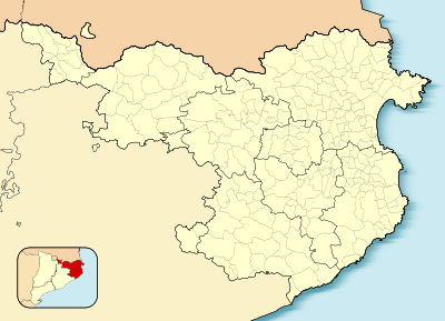
 Location of Llívia in the province of Girona | ||
 Llívia  Llívia Location in Catalonia | ||
| Coordinates: 42°27′52″N 1°58′51″E / 42.46444°N 1.98083°ECoordinates: 42°27′52″N 1°58′51″E / 42.46444°N 1.98083°E | ||
| Country |
| |
| Autonomous community |
| |
| Province | Girona | |
| Comarca | Cerdanya | |
| Judicial district | Puigcerdà | |
| Government | ||
| • Mayor | Elies Nova Inglés (2015)[1] | |
| Area[2] | ||
| • Total | 12.9 km2 (5.0 sq mi) | |
| Elevation | 1,224 m (4,016 ft) | |
| Population (2014)[1] | ||
| • Total | 1,536 | |
| • Density | 120/km2 (310/sq mi) | |
| Demonym(s) | Llivienses | |
| Time zone | CET (UTC+1) | |
| • Summer (DST) | CEST (UTC+2) | |
| Postal code | 17527 | |
| Website |
www | |

Llívia (Catalan pronunciation: [ˈʎiβiə]) is a town in the comarca of Cerdanya, province of Girona, Catalonia, Spain. It is a Spanish exclave within the French département of Pyrénées-Orientales. In 2009, the municipality of Llívia had a total population of 1,589.[3] It is separated from the rest of Spain by a corridor about 1.6 km (1.0 mile) wide, which includes the French communes of Ur and Bourg-Madame.
The Esteve Pharmacy, which is now located in Llívia's recently revamped municipal museum, is a complete 18th-century pharmacy donated to the town by the family who owned it, on condition the contents remain in the town. There are records of pharmacists practising in Llívia since medieval times. The pharmacy has a large display of albarelli, a type of ceramic jar used in pharmacies, as well as antique drugs, and one of the most important collections of prescription books in Europe.[4]
History

Llívia was the site of an Iberian oppidum which commanded the region and was named Julia Lybica[5] by the Romans. It was the ancient capital of Cerdanya in antiquity, before being replaced by Hix (commune of Bourg-Madame, France) in the Middle Ages. During the Visigothic period, its citadel, the castrum Libiae, was held by the rebel Paul of Narbonne against King Wamba in 672. As the "town (or 'city') of Cerdanya," 8th century Llívia may also have been the scene of the siege by which governor Abdul Rahman Al Ghafiqi of Muslim Spain rid himself of the Moorish (Berber) rebel Uthman ibn Naissa ("Munnuza"), who had allied himself with Duke Eudo of Aquitaine to improve the chances of his rebellion,[6] ahead of the Battle of Tours (732 or 733), also known as the Battle of Poitiers.
In 1659, the Treaty of the Pyrenees ceded the comarques of Roussillon, Conflent, Capcir, Vallespir, and northern Cerdanya ("Cerdagne") to the French crown. Llívia did not become part of the French kingdom as the treaty stipulated that only villages were to be ceded to France, and Llívia was considered a city and not a village because of its status as the ancient capital of Cerdanya.[7]
In 1939, at the end of the Spanish Civil War, there was some discussion of Llívia remaining a free territory of the defeated Republican government, but this was never carried out.[8]
References
- 1 2 "Ajuntament de Llívia". Generalitat of Catalonia. Retrieved 2015-11-13.
- ↑ "El municipi en xifres: Llívia". Statistical Institute of Catalonia. Retrieved 2015-11-23.
- ↑ Idescat. Fitxes municipals. Llívia
- ↑ Panareda Clopés, Josep Maria; Rios Calvet, Jaume; Rabella Vives, Josep Maria (1989). Guia de Catalunya, Barcelona: Caixa de Catalunya. ISBN 84-87135-01-3 (Spanish). ISBN 84-87135-02-1 (Catalan).
- ↑ Merino, Antolin; de la Canal, José (1819). "De la santa iglesia de Gerona" (in Catalan). Google Books. Retrieved 9 June 2015.
- ↑ Monumenta Germaniae Historica, Auctores Antiquissimi, p. 361, and Roger Collins, The Arab Conquest of Spain, 710-797, Malden, Massachusetts: Blackwell Publishers, 1989, p. 89
- ↑ Capdevila i Subirana, Joan: Historia del deslinde de la frontera Hispano-Francesa. Del tratado de los Pirineos (1659) a los tratados de Bayona (1856–1868), Ed. Ministerio de Fomento, Centro Nacional de Información Geográfica, Madrid, 2009, pp. 146–149. ISBN 978-84-416-1480-2 (Spanish)
- ↑ Robinson GWS (1959). Exclaves. Annals of the Association of American Geographers 49 (3), 283–295 doi:10.1111/j.1467-8306.1959.tb01614.x
External links
-
 Media related to Llívia at Wikimedia Commons
 |
Angoustrine-Villeneuve-des-Escaldes (France) | Targassonne (France) | | |
| Ur (France) | |
Estavar (France) | ||
| ||||
| | ||||
| Bourg-Madame (France) | Sainte-Léocadie (France) | Saillagouse (France) |