Llandaff
| Llandaff | |
| Welsh: Llandaf | |
 Llandaff electoral ward of Cardiff |
|
| Population | 8,997 (2011)[1] |
|---|---|
| Principal area | Cardiff |
| Ceremonial county | South Glamorgan |
| Country | Wales |
| Sovereign state | United Kingdom |
| Post town | CARDIFF |
| Postcode district | CF5 |
| Dialling code | 029 |
| Police | South Wales |
| Fire | South Wales |
| Ambulance | Welsh |
| EU Parliament | Wales |
| UK Parliament | Cardiff West |

Llandaff (/hlænˈdæf/; Welsh: Llandaf [ɬanˈdɑːv]; from llan "church" and Taf) is a district and community in the north of Cardiff, capital of Wales, having been incorporated into the city in 1922. It is the seat of the Bishop of Llandaff, whose diocese within the Church in Wales covers the most populous area of South Wales.
History

Most of the history of Llandaff centres on its role as a religious site. Before the creation of Llandaff Cathedral it became established as a Christian place of worship in the 6th century AD, probably because of its location as the first firm ground north of the point where the river Taff met the Bristol Channel, and because of its pre-Christian location as a river crossing on a north-south trade route. Evidence of Romano-British ritual burials have been found under the present cathedral. The date of the moving of the cathedral to Llandaff is disputed, but elements of the fabric date from the 12th century, such as the impressive Romanesque Urban Arch, named after the 12th century Bishop, Urban. It has had a history of continual destruction and restoration, as a result of warfare, neglect, and natural disaster. Llandaff has been a focal point of devastating attacks by Owain Glyndŵr and Oliver Cromwell. It was the second most damaged Cathedral in the UK (after Coventry Cathedral) following Luftwaffe bombing during World War II, and subsequently restored by the architect George Pace. One of its main modern points of interest is the aluminium figure of Christ in Majesty (1954–5), by Jacob Epstein, which is suspended above the nave. In 2007 a lightning strike to its spire sent a surge through the building which destroyed its organ. Its replacement, the largest to be built in the UK for over 40 years, was inaugurated in 2010.
A bishop's palace, now in ruins, lies to the south of the Cathedral. It is believed it was constructed at a similar date to Caerphilly Castle, in the late 13th century. It is also believed it was abandoned after being attacked and damaged by Glyndŵr in the 15th century.[2] The gatehouse of the Palace survives and the courtyard is now a public garden.[2]

Llandaff never developed into a chartered borough, and by the 19th century was described as "reduced to a mere village... It consists of little more than two short streets of cottages, not lighted or paved, terminating in a square, into which the great gateway of the old palace formerly opened, and where are still several genteel houses."[3]

Historically Llandaff was informally known as a "city" because of its status as the seat of the Bishop of Llandaff. This status was never officially recognised, largely because the community did not possess a charter of incorporation.[4] The ancient parish of Llandaff included a wide area. Apart from Llandaff itself, it included the townships of Canton, Ely, Fairwater, and Gabalfa.
During the development of the South Wales coalfield and Cardiff Docks, the parish was gradually absorbed into the Borough of Cardiff during the 19th and 20th centuries. Seen as a clean and green up-market countrified village location close to the fast developing city, many of the better-off coal merchants and business people chose to live in Llandaff, including the Insole family. The house now known as Insole Court dates originally from 1856. Llandaff itself became a civil parish and from 1894 to 1922 was part of the Llandaff and Dinas Powis Rural District. On 9 November 1922 the county borough of Cardiff was extended to include the area.[5]
Demography
At the United Kingdom Census 2011 the population of the Llandaff was 8,997, of whom 4,309 were male and 4,688 female.[1] 91.6% were recorded as being of various white ethnicities.[6] Approximately 65% of the population were returned as Christian, with about 1.5% each being Hindu or Muslim, and 30% having no religion or no stated religion.[7]
Welsh language
In the 2011 census 15.3% of the population over 3 years old in Llandaff were recorded as speaking Welsh, or 1337 people. This was a small drop compared to the 2001 census figure, which was 15.4%.[8][9]
The headquarters of BBC Cymru Wales is in Llandaff.
Research by Owen John Thomas shows the historical strength of the Welsh language in Llandaff. According to his book 'Yr Iaith Gymraeg yng Nghaerdydd c. 1800–1914’ (The Welsh language in Cardiff .c1800-1914), the nonconformist church in Cardiff Road was a Welsh-language church in 1813. His work also shows that Welsh was the main language of the street in Llandaff in the 17th century.
Governance

Llandaff is both an electoral ward and a community of the County and City of Cardiff. There is no community council for the area. The electoral ward of Llandaff is bounded by Radyr & Morganstown to the north west; Llandaff North to the north; Riverside to the west; Canton to the south; and Fairwater to the west. The ward is represented by two councillors, Kirsty Davies and Gareth Aubrey, both members of the Liberal Democrats. In 2012, they were re-elected with an increased majority.[10]
In the UK Parliament, Llandaff is part of the constituency of Cardiff West. Its most prominent MPs were former Speaker of the House of Commons George Thomas and former First Minister of Wales and Welsh Labour Party leader Rhodri Morgan. The current MP is Labour's Kevin Brennan, elected in 2001. The current Mayor of Llandaff is long term resident and former contestant on the Great British Bake Off Kathryn Smith.
In the Welsh Assembly, Llandaff is part of the constituency of Cardiff West, whose current AM since 2011 is Mark Drakeford of Labour, he succeeded Rhodri Morgan upon the latter's retirement. The constituency falls within the electoral region of South Wales Central, whose four current AMs are Conservatives Andrew R. T. Davies and David Melding, Plaid Cymru's Leanne Wood and Liberal Democrat Eluned Parrott.
Education
Higher education
- Cardiff Metropolitan University, Llandaff campus
- St. Michael's College, Anglican theological college
State secondary schools
- Bishop of Llandaff Church in Wales High School, comprehensive, English medium.
Welsh medium education is provided by Ysgol Gyfun Gymraeg Glantaf in neighbouring Llandaff North.
State primary schools
- Danescourt Primary School, English medium.[11]
- Llandaff City Church in Wales Primary School, English medium.[12]
- Ysgol Pencae, Welsh medium.[13]
Independent schools
- The Cathedral School, ages 3–18 co-educational, English medium.
- Howell's School, ages 3–18 girls, with co-educational sixth form, English medium.
Transport
Llandaff is served by railway stations at Danescourt, Fairwater and Waun-Gron Park, each is about a mile from the cathedral. There is a half-hourly service to and from Cardiff on the Cardiff City Line. Llandaf railway station is located in Llandaff North.
Cardiff Bus services 1/2 (City Circle), 24/25 (Whitchurch), 62/63 (Radyr/Morganstown), 64/65 (Heath Hospital/Llanrumney), 66 (Danescourt) and Stagecoach service 122 (Tonypandy) operate through the area to/from Cardiff central bus station or city centre.
Western Avenue (A48) runs through the south of the area heading eastbound to Gabalfa & M4 J30 and westbound to Ely, Culverhouse Cross and M4 J33. Cardiff Road leads south towards the city centre.
Economy
The major employment sectors in the area are:
- Public administration, education and health (35.26%)
- Banking, finance and insurance (19.44%)
- Distribution, hotels and restaurants (16.46%)
- Other services (9.13%)
- Manufacturing (8.81%)
- Transport and communication (4.82%)
- Construction (4.43%)
The headquarters of BBC Cymru Wales is in Llandaff. In 2013 the BBC announced that this would move to a new building in central Cardiff in 2018.[14][15]
Doctor Who
Since its revival in 2005, the long-running television series Doctor Who has been produced by BBC Cymru Wales in Llandaff. The location scenes of three episodes were filmed in Llandaff:[16]
- Human Nature (2007)
- The Family of Blood (2007)
- The Eleventh Hour (2010)
The television scriptwriter Terry Nation, who was born in Llandaff, wrote seventy Doctor Who episodes and created the Daleks.[17]
Notable people

- Sir David Mathew (Dafydd ap Mathew) (1400–1484), Grand Standard Bearer of England to Edward IV, fought in the Battle of Towton and is credited for saving King Edward IV's life. His tomb is in Llandaff Cathedral.
- Francis Lewis (1713–1802), one of the signatories of the United States Declaration of Independence[19]
- Sir Ivor Atkins (1869–1953), choirmaster and organist, was born in Llandaff.[20]
- Ivor Williams (1908–1982), artist, lived and painted in Llandaff.
- Roald Dahl (1916–1990), author, was born in Llandaff and attended the Cathedral School.[21]
- Cheryl Gillan (born 1952), Secretary of State for Wales (2010–2012), was born in Llandaff
- Charlotte Church (born 1986), singer and television presenter, was born in Llandaff and attended Howell's School.
References
| Wikimedia Commons has media related to Llandaff. |
- 1 2 "Area: Llandaff (Ward); Sex, 2011 (QS104EW)". Office for National Statistics. Retrieved 3 December 2015.
- 1 2 Pettifer, Adrian (2000). Welsh Castles: A Guide by Counties. The Boydell Press. p. 97. ISBN 0-85115-778-5.
- ↑ "Llanberis – Llandaff". A Topographical Dictionary of Wales. 1849. Retrieved 2008-03-16.
- ↑ J V Beckett, City Status in the British Isles, 1830–2002, Aldershot, 2005
- ↑ Great Britain Historical GIS / University of Portsmouth, Llandaff CP/AP. Retrieved on 2008-03-16.
- ↑ "Area: Llandaff (Ward); Ethnic Group, 2011 QS201EW)". Office for National Statistics. Retrieved 3 December 2015.
- ↑ "Area: Llandaff (Ward); Religion, 2011 (QS208EW)". Office for National Statistics. Retrieved 3 December 2015.
- ↑ Welsh Language Commissioner: 2011 Census: results by community; gwelwyd 24 Ionawr 2015. Archived October 22, 2013, at the Wayback Machine.
- ↑ "Area: Llandaff (Ward); Welsh Language Skills, 2011 (QS206WA)". Office for National Statistics. Retrieved 3 December 2015.
- ↑ Cardiff council elections: The story in each ward, YourCardiff (Wales Online), 3 May 2012. Retrieved 3 December 2012.
- ↑ "Danescourt Primary School". Retrieved 4 December 2015.
- ↑ "Llandaff City Primary School". Retrieved 4 December 2015.
- ↑ "Ysgol Pencae" (in Welsh). Retrieved 4 December 2015.
- ↑ "BBC's Cardiff headquarters to relocate". Ariel. BBC. 1 August 2013. Retrieved 11 June 2014.
- ↑ "BBC Wales HQ to move to Cardiff city centre". Ariel. BBC. 10 June 2014. Retrieved 11 June 2014.
- ↑ "Doctor Who in Wales; Llandaff Village, Cardiff;". BBC. Retrieved 3 December 2015.
- ↑ "Doctor Who: Daleks' creator Terry Nation has blue plaque at Cardiff home". BBC. 20 November 2013. Retrieved 3 December 2015.
- ↑ "Blue plaque marks Dahl sweet shop". BBC. Retrieved 24 December 2014
- ↑ Williams, David. "LEWIS , FRANCIS ( 1713-1802 )". Dictionary of Welsh Biography. Retrieved 18 January 2016.
- ↑ Jerrold Northrop Moore, Atkins, Sir Ivor Algernon (1869–1953), Oxford Dictionary of National Biography, Oxford University Press, 2004 , accessed 16 March 2008
- ↑ Philip Howard, Dahl, Roald (1916–1990), Oxford Dictionary of National Biography, Oxford University Press, 2004; online edition, May 2006, accessed 16 March 2008
External links
| About Cardiff | 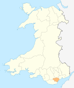 | |
|---|---|---|
| Cardiff templates |
| |
| Neighbourhoods |
| |
Principal areas of Wales | ||
Coordinates: 51°29′36″N 3°12′48″W / 51.49333°N 3.21333°W