Littlemoor
Coordinates: 50°38′30″N 2°26′47″W / 50.6417°N 2.4463°W
- This article refers to Littlemoor in Weymouth, Dorset. For Littlemoor near Chesterfield see Littlemoor, Derbyshire.
Littlemoor is a suburb of Weymouth in Dorset, England.[1] Littlemoor is about 2 miles (3 km) to the north of the town centre. The nearest railway station is Upwey 0.5 miles (0.8 km) to the west.
During World War I, the Littlemoor area was used as an Australian army camp. For this reason many of the roads in the area today are named after towns and cities in Australia.
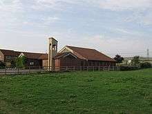
Littlemoor has a skatepark, youth centre and a small shopping centre. Opposite the shopping centre there is a Library; next to which is a small green, and the local Church of England church - St. Francis of Assisi.
Littlemoor is partially surrounded by fields. It has a woodland area (which has been named Teddy Bear woods, referencing to the famous nursery rhyme) managed by Dorset Wildlife Trust, part of their Lorton Meadows nature reserve.

References
External links
![]() Media related to Littlemoor at Wikimedia Commons
Media related to Littlemoor at Wikimedia Commons