Little River, Victoria
| Little River Victoria | |||||||||||||
|---|---|---|---|---|---|---|---|---|---|---|---|---|---|
 Little River | |||||||||||||
| Coordinates | 37°55′59″S 144°30′00″E / 37.933°S 144.500°ECoordinates: 37°55′59″S 144°30′00″E / 37.933°S 144.500°E | ||||||||||||
| Population | 1,393 (2011 census)[1] | ||||||||||||
| Established | 1840 | ||||||||||||
| Postcode(s) | 3211 | ||||||||||||
| Elevation | 22 m (72 ft) | ||||||||||||
| Location | |||||||||||||
| LGA(s) | |||||||||||||
| State electorate(s) | |||||||||||||
| Federal Division(s) | |||||||||||||
| |||||||||||||
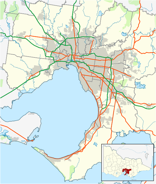
Little River is a town in Victoria, Australia, that is located about 51 kilometres (32 mi) south-west of the Melbourne central business district. It is within the Cities of Greater Geelong and Wyndham local government areas. At the 2011 census, Little River had a population of 1,393.
History
The Little River has headwaters in the nearby Brisbane Ranges. It was also known as the Cocoroc Rivulet, Cocoroc being a locality near the area. Where the road from Melbourne to Geelong crossed Little River, the Travellers Rest Inn was opened there in about 1839.[2]
It had been one of the Port Phillip Association's pastoral runs (the first occupier being James Simpson), and later a large part of the district was included in the Chirnside Estate centred on Werribee. Early on small farmers had the benefit of an 80 km² common for grazing.
The Post Office opened on 1 February 1858.[3]
The railway line though the town was opened in 1876,[4] as part of the line to Geelong. The local railway station is served by V/Line passenger services on the Geelong line.
Aboriginal history
In the vicinity of Mount Rothwell, near Little River, a semi-circular arrangement of rocks now known as Wurdi Youang was discovered and in 2011 described by an astrophysicist from the CSIRO as indicating the setting sun at the solstices and equinox. Although the age is unknown, it could range from 200 to 30,000 years.[5]
Heritage sites
Little River contains a number of heritage listed sites, including:
- 19-27 River Street, Little River railway station [6]
- 985-995 Little River-Ripley Road, Mount Rothwell Homestead [7]
- Old Melbourne Road, Rothwell Bridge [8]
Today
The township has a petrol station and post office, a primary school, a kindergarten, a pub, a bed and breakfast, a park, two playgrounds, a train station, a cricket ground and several churches. Visitors from Melbourne pass through the town on the way to the You Yangs Regional Park and the Mount Rothwell Biodiversity Interpretation Centre.
Australian rock band Little River Band is named after Little River after seeing the name on a road sign on their way to a gig in Geelong.[9] Some scenes for the Australian television series We Can Be Heroes: Finding The Australian of the Year and Angry Boys were filmed at Little River, although it was referred to as the fictional town of 'Dunt'. Little River also featured in the movie Mad Max, with Little River Road being used as the movie's infamous "Highway 9".
Some parts of Little River and surrounding areas were filmed in the Australian television drama series, Blue Heelers. Also, in the nearby You Yangs, the 2003 film, Ned Kelly was shot.
Census populations
| Year | Population | Source(s) |
|---|---|---|
| 1861 | 4 | |
| 1871 | 121 | |
| 1911 | 294 | |
| 1954 | 358 | |
| 1966 | 191 | |
| 2001 | 353 | [10] |
| 2006 | 1,744 | [11] |
| 2011 | 1,393 | [1] |
See also
- Shire of Corio - the former local government area of which Little River was a part
References
- 1 2 Australian Bureau of Statistics (31 October 2012). "Little River (State Suburb)". 2011 Census QuickStats. Retrieved 2012-06-28.
- ↑ Little River Historical Society: A Brief History of Little River
- ↑ Premier Postal History. "Post Office List". Retrieved 2008-04-11.
- ↑ Sid Brown (March 1990). "Tracks Across the State". Newsrail. Australian Railway Historical Society (Victorian Division). pp. 71–76.
- ↑ Wurdi Youang rocks could prove Aborigines were first astronomers, Andrew Carswell and Robert Cockburn, Daily Telegraph (Australia), 5 February 2011
- ↑ "Little River Railway Station and Goods Yard (H1572)". Victorian Heritage Register. Heritage Victoria. Retrieved 4 July 2014.
- ↑ "Mount Rothwell Homestead (H1107)". Victorian Heritage Register. Heritage Victoria. Retrieved 4 July 2014.
- ↑ "Rothwell Bridge (H1454)". Victorian Heritage Register. Heritage Victoria. Retrieved 4 July 2014.
- ↑ Little River Band
- ↑ Australian Bureau of Statistics (9 March 2006). "Little River (Urban Centres and Localities)". 2001 Census QuickStats. Retrieved 4 January 2014.
- ↑ Australian Bureau of Statistics (25 October 2007). "Little River (State Suburb)". 2006 Census QuickStats. Retrieved 4 January 2014.