List of tunnels of the Faroe Islands
%2C_entrance_to_Hvannasundstunnilin.jpg)
Entrance of the Hvannasundstunnilin (Hvannasund Tunnel) close to Norðdepil on the island of Borðoy.
Tunnels and bridges are an important part of the Faroese transportation network.[1]
Tunnels
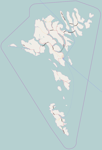
Locations of the tunnels
This list shows the Faroese tunnels, listed by age:[1][2]
| Tunnel | Year | Length m | ft | Connects | Island | Comments | |
|---|---|---|---|---|---|---|
| Hvalbiartunnilin | 1963 | 1,450 | 4,760 | Hvalba and Trongisvágur | Suðuroy | It has only a single lane. There's one priority direction, with a series of passing places on the other side. Starting in 2017, a modern 2,050 m tunnel will be built to replace this current one, which causes many delays and is unfit for modern truck trailers.[3] |
| Árnafjarðartunnilin | 1965 | 1,680 | 5,510 | Ánir, Klaksvík and Árnafjørður | Borðoy | One of the pair of Borðoyartunlarnir that connect Klaksvík with Norddepil on the eastern side of Borðoy where there is a bridge to the Viðoy island. Single lane, no lights. |
| Hvannasundstunnilin | 1967 | 2,120 | 6,960 | Árnafjørður and Hvannasund/Norðdepil | Borðoy | One of the pair of Borðoyartunlarnir. It has only a single lane and no lights. There's one priority direction, with a series of passing places on the other side. |
| Sandvíkartunnilin | 1969 | 1,500 | 4,900 | Sandvík and Hvalba | Suðuroy | It has only a single lane and no lights. There's one priority direction, with a series of passing places on the other side. |
| Norðskálatunnilin | 1976 | 2,520 | 8,270 | Norðskáli and the valley Millum Fjarða | Eysturoy | |
| Leynartunnilin | 1977 | 760 | 2,490 | Leynar and the valley Kollfjarðardalur | Streymoy | |
| Villingardalstunnilin | 1979 | 1,193 | 3,914 | The villages Trøllanes, Mikladalur, Húsar and the uninhabited valley Djúpidalur | Kalsoy | One of the five Kalsoyartunlarnir |
| Ritudalstunnilin | 1980 | 683 | 2,241 | The villages Trøllanes, Mikladalur, Húsar and the uninhabited valley Djúpidalur | Kalsoy | One of the five Kalsoyartunlarnir |
| Mikladalstunnilin | 1980 | 1,082 | 3,550 | The villages Trøllanes, Mikladalur, Húsar and the uninhabited valley Djúpidalur | Kalsoy | One of the five Kalsoyartunlarnir |
| Trøllanestunnilin | 1985 | 2,248 | 7,375 | The villages Trøllanes, Mikladalur, Húsar and the uninhabited valley Djúpidalur | Kalsoy | One of the five Kalsoyartunlarnir |
| Teymur í Djúpadal | 1979–85 | 220 | 720 | The villages Trøllanes, Mikladalur, Húsar and the uninhabited valley Djúpidalur | Kalsoy | One of the five Kalsoyartunlarnir |
| Leirvíkartunnilin | 1985 | 2,238 | 7,343 | Leirvík and Gøta | Eysturoy | |
| Kunoyartunnilin | 1988 | 3,031 | 9,944 | Kunoy and Haraldssund | Kunoy | |
| Kollfjarðartunnilin | 1992 | 2,816 | 9,239 | Kollafjørður and Kaldbaksbotnur | Streymoy | |
| Sumbiartunnilin | 1997 | 3,240 | 10,630 | Sumba and Lopra | Suðuroy | |
| Vágatunnilin | 2002 | 4,940 | 16,210 | Leynar and Fútaklett | Streymoy and Vágar | |
| Gásadalstunnilin | 2006 | 1,445 | 4,741 | Gásadalur and Bøur | Vágar | |
| Norðoyatunnilin | 2006 | 6,186 | 20,295 | Klaksvík and Leirvík | Eysturoy and Borðoy | |
| Hovstunnilin | 2007 | 2,435 | 7,989 | Øravík and Hov | Suðuroy | |
| Viðareiðistunnilin | 2016 | 1,939 | 6,362 | Viðareiði with Hvannasund | Viðoy | Replaces the road, which is prone to landslides and avalanches. |
Vágatunnilin and Norðoyatunnilin are tolled. The toll is paid at gas stations. All other tunnels are without toll.
Bridges and causeways
This list shows the Faroese inter-insular bridges and causeways, also listed by age:
| Bridge | Year | Length m | ft | Connects | Island | Comments | |
|---|---|---|---|---|---|---|
| Brúgvin um Streymin | 1973 | 220 | 720 | Oyrabakki/Norðskáli and Nesvík | Streymoy and Eysturoy | Concrete bridge |
| Byrging um Hvannasund | 1975 | 220 | 720 | Hvannasund and Norðdepil | Borðoy and Viðoy | Causeway |
| Byrging um Haraldssund | 1986 | 350 | 1,150 | Haraldssund and Strond | Borðoy and Kunoy | Causeway |
Proposed tunnels
| Tunnel | Year | Approx. length m | ft | Connects | Island | Comments | |
|---|---|---|---|---|---|---|
| Eysturoyartunnilin | Planned to open in 2019-20 | 11,000 | 36,000 | Runavík and Strendur with Tórshavn | Streymoy and Eysturoy | Under Sundini and Skálafjørður. The tunnel will shorten the travel distance from Tórshavn to Runavík/Strendur from 55 kilometres to 17 kilometres. The 64 minute drive will be shortened to 16 minutes. The tunnel will have a roundabout under the seabed at mid-bay.[4] |
| Sandoyartunnilin | Planned to open in 2023, the work started in 2016 | 10,900 | 35,800 | Streymoy and Sandoy | The tunnel is planned to start just above the port of Gamlarætt and end Traðardalur between Skopun and Sandur, north of the football field of B71 Sandoy. | |
| Suðuroyartunnilin | 20,000 | 66,000 | Sandoy and Suðuroy | |||
| Gjáartunnilin | 2,000 | 6,600 | Gjógv with Funningur | Eysturoy | ||
| Hvalbiartunnil (replacemenet) | starts in 2017 | 2,050 | 6,730 | Hvalba with Trongisvágur | Suðuroy | To replace the current tunnel from 1963, which is too narrow and low for present-day traffic [5] |
| Fámjinstunnilin | 780 | Fámjin with Ørðavík | Suðuroy | To replace the steep and narrow road, which also is extremely windy (The overall most windy road in the Faroe Islands.) | ||
See also
References
- 1 2 "Tunlar" (in Faroese). Tórshavn: Landsverk. Retrieved 1 October 2015.
- ↑ "Søgulig gongd" (in Faroese). Tórshavn: Landsverk. Archived from the original on 29 December 2008. Retrieved 22 April 2011.
- ↑ http://portal.fo/fara+nu+undir+hvalbiartunnilin.html
- ↑ "The Eysturoy tunnel". estunlar.fo. Retrieved 19 November 2016.
- ↑ http://www.landsverk.fo/Default.aspx?pageid=15939&NewsItemID=15553
External links
This article is issued from Wikipedia - version of the 11/21/2016. The text is available under the Creative Commons Attribution/Share Alike but additional terms may apply for the media files.