List of parishes of the Isle of Man

Sheadings and districts of the Isle of Man.
The Isle of Man, a self-governing British Crown Dependency, located in the Irish Sea, was until May 2016 divided into 24 districts for administrative purposes. These were 15 parishes, 4 towns and 5 villages, each forming the lowest unit of local government in the Isle of Man.[1]
In May 2016, the three districts of Laxey, Lonan and Maughold merged for administrative purposes to form the parish district of Garff. The total number of administrative districts thus reduced to 22, formally made up of four towns; two "districts" (Michael and Onchan, both of which are historically parishes); two "villages" (Port Erin and Port St Mary); and 14 "parishes" (including Garff, which is made up of two historical parishes: Lonan and Maughold).[2]
Parishes
| Image |
Name |
Status[1] |
Sheading |
Population[1] |
Coordinates |
Map |
 |
Andreas |
Parish | Ayre | 1,381 | 54°21′58″N 4°26′28″W / 54.36611°N 4.44111°W / 54.36611; -4.44111 (Andeas) |
 |
 |
Arbory |
Parish | Rushen | 1,723 | 54°6′1″N 4°40′56″W / 54.10028°N 4.68222°W / 54.10028; -4.68222 (Arbory) |
 |
 |
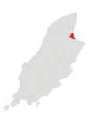
Ballaugh |
Parish | Michael | 1,042 | 54°18′36″N 4°32′43″W / 54.31000°N 4.54528°W / 54.31000; -4.54528 (Ballaugh) |
 |
 |
Braddan |
Parish | Middle | 3,151 | 54°9′29″N 4°30′19″W / 54.15806°N 4.50528°W / 54.15806; -4.50528 (Braddan) |
 |
 |
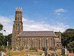
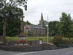
Bride |
Parish | Ayre | 418 | 54°23′6″N 4°23′45″W / 54.38500°N 4.39583°W / 54.38500; -4.39583 (Bride) |
 |
2.jpg) |
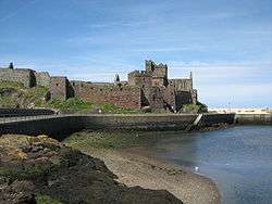
Castletown |
Town | Rushen | 3,109 | 54°4′27″N 4°39′14″W / 54.07417°N 4.65389°W / 54.07417; -4.65389 (Castletown) |
 |
 |
Douglas |
Town | Middle | 26,218 | 54°8′42″N 4°28′54″W / 54.14500°N 4.48167°W / 54.14500; -4.48167 (Douglas) |
 |
 |
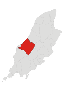
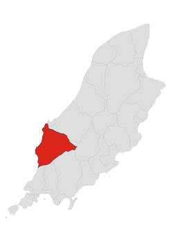
German |
Parish | Glenfaba | 995 | 54°13′18″N 4°41′28″W / 54.22167°N 4.69111°W / 54.22167; -4.69111 (German) |
 |
 |
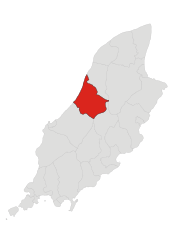
Jurby |
Parish | Michael | 659 | 54°21′18″N 4°32′53″W / 54.35500°N 4.54806°W / 54.35500; -4.54806 (Jurby) |
 |
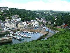 |
Laxey |
Village | Garff | 1,768 | 54°13′40″N 4°24′7″W / 54.22778°N 4.40194°W / 54.22778; -4.40194 (Laxey) |
 |
 |
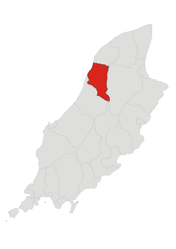
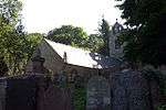
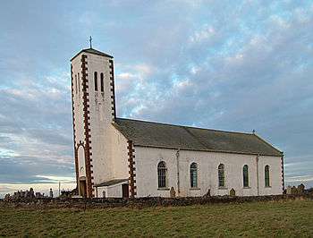
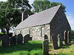
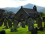
Lezayre |
Parish | Ayre | 1,237 | 54°19′18″N 4°25′23″W / 54.32167°N 4.42306°W / 54.32167; -4.42306 (Lezayre) |
 |
_church_-_geograph.org.uk_-_32559.jpg) |
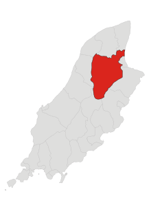
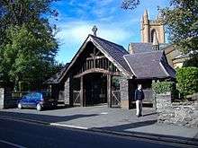
Lonan |
Parish | Garff | 1,563 | 54°11′13″N 4°24′54″W / 54.18694°N 4.41500°W / 54.18694; -4.41500 (Lonan) |
 |
 |
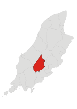
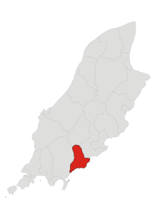
Malew |
Parish | Rushen | 2,304 | 54°5′31″N 4°39′15″W / 54.09194°N 4.65417°W / 54.09194; -4.65417 (Malew) |
 |
 |
Marown |
Parish | Middle | 2,086 | 54°10′34″N 4°34′24″W / 54.17611°N 4.57333°W / 54.17611; -4.57333 (Marown) |
 |
 |
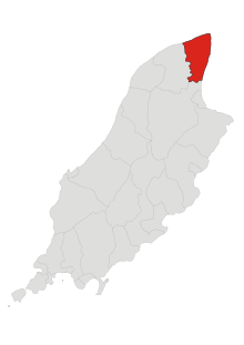
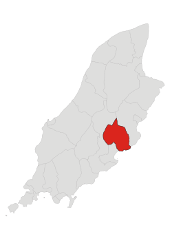
Maughold |
Parish | Garff | 950 | 54°17′55″N 4°19′2″W / 54.29861°N 4.31722°W / 54.29861; -4.31722 (Maughold) |
 |
 |
Michael |
Parish | Michael | 1,640 | 54°17′6″N 4°35′12″W / 54.28500°N 4.58667°W / 54.28500; -4.58667 (Michael) |
 |
 |
Onchan |
Village | Middle | 9,172 | 54°10′22″N 4°27′9″W / 54.17278°N 4.45250°W / 54.17278; -4.45250 (Onchan) |
 |
 |
Patrick |
Parish | Glenfaba | 1,294 | 54°12′29″N 4°41′33″W / 54.20806°N 4.69250°W / 54.20806; -4.69250 (Patrick) |
 |
 |
Peel |
Town | Glenfaba | 4,280 | 54°13′18″N 4°41′28″W / 54.22167°N 4.69111°W / 54.22167; -4.69111 (Peel) |
 |
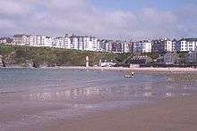 |
Port Erin |
Village | Rushen | 3,575 | 54°5′6″N 4°45′18″W / 54.08500°N 4.75500°W / 54.08500; -4.75500 (Port Erin) |
 |
 |
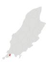
Port St Mary |
Village | Rushen | 1,913 | 54°4′29″N 4°44′20″W / 54.07472°N 4.73889°W / 54.07472; -4.73889 (Port St Mary) |
 |
 |
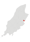
Ramsey |
Town | Garff | 7,309 | 54°19′16″N 4°23′4″W / 54.32111°N 4.38444°W / 54.32111; -4.38444 (Ramsey) |
 |
 |
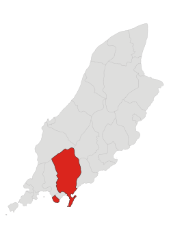
Rushen |
Parish | Rushen | 1,591 | 54°5′24″N 4°44′45″W / 54.09000°N 4.74583°W / 54.09000; -4.74583 (Rushen) |
 |
 |
Santon |
Parish | Middle | 680 | 54°7′15″N 4°34′51″W / 54.12083°N 4.58083°W / 54.12083; -4.58083 (Santon) |
 |
References