List of neighbourhoods in Calgary

Calgary, Alberta, Canada, as of 2013, has 198 neighbourhoods, which are referred to as "communities" by the City of Calgary, and 41 industrial areas.[1] The number of neighbourhoods increased to 198 in 2013 with the approvals of Cityscape and Hotchkiss.[2][3]
Centre City
The area collectively known as the Centre City comprises Downtown (including the Downtown West End and Downtown East Village) and the adjacent neighbourhoods of Eau Claire, Chinatown, and the Beltline (including Connaught and Victoria Park).[4]
Within Centre City, those neighbourhoods below that have an area redevelopment plan (ARP) in effect[5] are indicated with "ARP" in parentheses.
Downtown
Downtown Calgary is bordered by 11th Street W. on the west, 3rd Avenue S. and the Bow River on the north, the Elbow River on the east and the CPR mainline tracks on the south.
Downtown neighbourhoods:
- Downtown West End
- Downtown Commercial Core
- Downtown East Village (ARP)
Unofficial districts:[6]
- Stephen Avenue Retail Core
- Entertainment District
- Government District
Other
The remaining Centre City neighbourhoods are predominantly residential and mixed-use. These areas are often considered to be an extension of downtown. Other Centre City neighbourhoods include:
- Beltline - The Beltline is physically separated from downtown proper by the CPR mainline tracks, and is the densest and most populous neighbourhood in Calgary. It comprises the former neighbourhoods of Connaught on the west and Victoria Park on the east.
- Chinatown (ARP)
- Eau Claire
Inner city
The inner city includes Downtown Calgary and the adjoining communities, and overlays roughly the city limits before 1961. It is delimited by Sarcee Trail to the west; Glenmore Reservoir and Glenmore Trail to the south; Bow River and Deerfoot Trail to the east; and Bow River and 32 Avenue to the north.[7]
The inner city includes the following neighbourhoods (by city quadrant):
- NE: Bridgeland/Riverside, Crescent Heights, Mayland, Mayland Heights, Renfrew, Tuxedo, Winston Heights - Mountview
- NW: Banff Trail, Bowness, Capitol Hill, Hillhurst, Hounsfield Heights/Briar Hill, Montgomery, Mount Pleasant, Parkdale, Point Mckay, Rosedale, St. Andrews Heights, Sunnyside, University Heights, University of Calgary, West Hillhurst
- SW: Altadore, Bankview, Bel-Aire, Cliff Bungalow, Currie Barracks, Lincoln Park, Connaught (district in Beltline), Elbow Park, Elboya, Erlton, Garrison Green, Garrison Woods, Glamorgan, Glenbrook, Glendale, Killarney/Glengarry, Lower Mount Royal, Mayfair, Meadowlark Park, Mission, North Glenmore Park, Parkhill/Stanley Park, Richmond, Rideau Park, Rosscarrock, Roxboro, Rutland Park, Scarboro, Scarboro/Sunalta West, Shaganappi, South Calgary, Spruce Cliff, Sunalta, Upper Mount Royal, Westgate, Wildwood, Windsor Park
- SE: Albert Park/Radisson Heights, Alyth/Bonny Brook, Burns Industrial, Dover, Erin Woods, Forest Heights, Forest Lawn, Highfield Industrial, Inglewood, Manchester Industrial, Manchester, Ogden Shops, Ogden, Ramsay, Southview, Victoria Park (district in Beltline)
Quadrants
Calgary is divided into four geographic quadrants generally described below.[8]
- Northwest Calgary – west of a combination of Centre Street/Harvest Hills Boulevard and north of a combination of the Bow River, Sarcee Trail and Highway 1 (Trans-Canada Highway)
- Northeast Calgary – east of a combination of Centre Street//Harvest Hills Boulevard and north of a combination of the Bow River, a Canadian Pacific rail line, Centre Avenue and Memorial Drive
- Southwest Calgary – south of a combination of the Bow River, Sarcee Trail and Highway 1 (Trans-Canada Highway) and west of a combination of Centre Street, a Canadian Pacific rail line, Macleod Trail and Sheriff King Street
- Southeast Calgary – south of a combination of the Bow River, a Canadian Pacific rail line, Centre Avenue and Memorial Drive and east of a combination of Centre Street, a Canadian Pacific rail line, Macleod Trail and Sheriff King Street
List
The following is a list of all neighbourhoods within the City of Calgary including residential communities, industrial areas, major parks and residual areas by electoral ward.[9]
Business revitalization zones
The business revitalization zone (BRZ) program was established in 1983 to allow certain commercial areas of the city to administer and promote themselves internally. Many of the zones (or districts) that emerged from this have since acquired a virtual "neighbourhood" status by the people of Calgary. Most zones now offer a unique street shopping environment (many have restaurants and nightlife too) and have become popular destinations for both Calgarians and visitors to the city. None of these zones are officially designated as neighbourhoods unto themselves however. The City of Edmonton also uses BRZs, and other cities have equivalent systems such as Business improvement districts.
- Downtown (within the Downtown Commercial Core)
- Uptown 17th Avenue SW[10] (within the Beltline)
- International Avenue (within the neighbourhood of Forest Lawn)
- Victoria Crossing (within the Beltline)
- Fourth Street (within the Mission and Cliff Bungalow neighbourhoods)
- Kensington (within Hillhurst and Sunnyside)
- Inglewood (within the neighbourhood of Inglewood)
- Marda Loop (mostly within the neighbourhoods of Richmond and South Calgary)
- Bowness (within the neighbourhood of Bowness)
Industrial areas
Most industrial areas are located between Deerfoot Trail and 36 Street East in the northern half of the city; between Macleod Trail, Deerfoot Trail and Glenmore Trail in the south and east of Barlow Trail in the southeast.
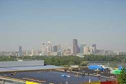
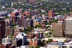
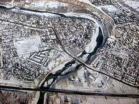
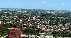
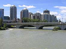
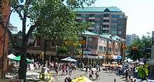
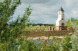
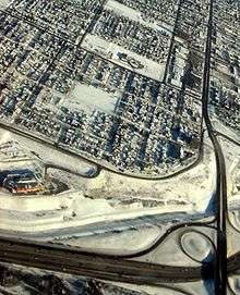
Gallery


See also
- Calgary (main article)
- List of neighbourhoods in Edmonton
References
- ↑ "City of Calgary Communities and Industrial Area Locations" (PDF). City of Calgary. September 2011. Retrieved 2012-05-02.
- ↑
- ↑
- ↑ "Calgary's Centre City". City of Calgary. 2011-06-15. Retrieved 2011-07-06.
- ↑ City of Calgary. "Community & Area Plans". Retrieved 2007-05-23.
- ↑ Downtown Calgary Association (2005). "Downtown Districts". Archived from the original on 6 October 2007. Retrieved 2007-05-07.
- ↑ Calgary MLS Zone Maps. "Calgary Inner City Communities Map". Retrieved 2007-05-22.
- ↑ https://maps.calgary.ca/CalgaryBoundaries/
- ↑ "2012 Civic Census Results" (PDF). City of Calgary. 2012. Retrieved 2012-07-03.
- ↑ 17 Avenue BRZ. "Uptown 17th". Retrieved 2007-05-09.
External links
- Calgary Official Community Map
- Calgary Area - List of Communities and Community Associations
- City of Calgary - Community profiles
| Features | |
|---|---|
| History | |
| Geography | |
| Economy | |
| Politics | |
| Public services | |
| Education |
|
| Culture | |
| Transportation | |
| |