List of localities and stopping places related to the Trans Australian railway line
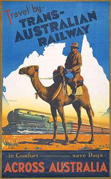
Poster for the Trans Australian railway
The Trans-Australian Railway line has a very ambiguous term, Nullarbor. This list is relative to the 1917 construction of railway line that went from Kalgoorlie to Port Augusta [1][2][3]
Western Australia
- Kalgoorlie
- Parkeston 1776.0 km
- Golden Ridge 1758.0 km
- Curtin 1722.5 km
- Blamey 1692.0 km
- Karonie 1670.5 km
- Chifley Siding 1642.0 km
- Coonana 1611.0 km
- Zanthus 1572.0 km
- Goddards 1551.0 km
- Kitchener 1512.5 km
- Boonderoo 1484.0 km
- 913 mile
- Naretha 1450.5 km
- Rawlinna 1403.0 km
- Wilban 1369.5 km
- Haig 1331.5 km
- Nurina 1287.0 km
- Loongana 1239.5 km
- Mundrabilla 1192.0 km
- Forrest 1137.5 km
- Reid 1106.5 km
- Deakin 1054.0 km
WA-SA Border 1050.910 km
South Australia
- Hughes 1002.0 km
- Denman 956.5 km
- Koonalda Block Point 936.0 km
- Cook 914.5 km
- Thomiar 889.0 km
- Fisher 861.5 km
- O'Malley Block Point 839.0 km
- Watson 809.0 km
- Ooldea 776.0 km
- Immarna Block Point 744.5 km
- Bates 725.5 km
- Barton (Barton Siding) 693.5 km
- Mungala 667.0 km
- Mount Christie siding 638.0 km
- Wynbring 606.5 km
- Lyons 565.0 km
- Malbooma 541.5 km
- Tarcoola 504.5 km
- 245 miles (now Ferguson) 469.0 km
- Kingoonya 426.5 km
- Kultanaby 394.0 km
- Coondambo 365.5 km
- Wirraminna 342.0 km
- Lake Hart (now Burando) 311.0 km
- Pimba 273.0 km
- Wirrappa 242.0 km
- Woocalla (now McLeay) 210.0 km
- Bookaloo 177.0 km
- Hesso 146.5 km
- Tent Hill 119.5 km
- Port Augusta 92.0 km
Access
Most of the locations along the railway line exist in reserves with limited or no access allowable, or are positioned next to a road that has been closed and has no access possible: the few locations that are accessible have either landing strips for access by plane and roads that run north from the Eyre Highway. Most of the identified locations in this list are ruins or have very few services or facilities.
See also
- Trans-Australian Railway - Names of stopping places for a cluster of related station names
- Indian Pacific
- Nullarbor Plain
Notes
- ↑ (1927 Travel in comfort across Australia on the Trans-Australian Railway. Melbourne : Commonwealth Railways. internal map titled Map shewing Connections between Capital Cities via Trans- Australian Railway
- ↑ Hema Maps (Firm) & Zell, Len & Glover, Ian (Ian Thomas), 1949 & Sakker, Elizabeth & Wild Discovery Guides (Firm) 2007, Australia's great desert tracks atlas & guide Hema Maps & Wild Discovery Guides, Eight Mile Plains, Qld ISBN 978-1-86500-382-5 (pbk.) pp.210-215, 238-239
- ↑ Updated to reflect the 2010 ARTC Network Diagram including Kilometreages from Coonamia.
| ||||||||||||||
This article is issued from Wikipedia - version of the 10/5/2015. The text is available under the Creative Commons Attribution/Share Alike but additional terms may apply for the media files.