List of highways in Brewster County, Texas
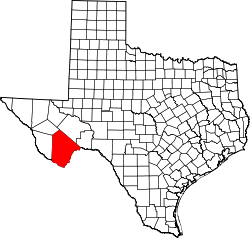
Location of Brewster County
The following is a list of all state highways in Brewster County, Texas maintained by the Texas Department of Transportation. All state highways in Texas are paved.
U.S. highways
| Route Name | Direction | Termini | Junctions | Length | Remarks |
|---|---|---|---|---|---|
| S/N | Presidio County to Presidio County |
1.3 miles (2.1 km)[2] | Overlays US 90 and briefly leaves county | ||
| S/N | Presidio County to Pecos County |
37.2 miles (59.9 km)[2] | Passes through Alpine | ||
| W/E | Presidio County to Presidio County |
1.3 miles (2.1 km)[2] | Overlays US 67 and briefly leaves county | ||
| W/E | Presidio County to Pecos County |
70.8 miles (113.9 km)[2] | Passes through Alpine, Marathon | ||
| S/N | Pecos County |
59.1 miles (95.1 km)[5][6][7] | Passes through Marathon |
State highways
| Route Name | Direction | Termini | Junctions | Length | Remarks |
|---|---|---|---|---|---|
| S/N | Jeff Davis County |
89.7 miles (144.4 km)[2] | Passes through Study Butte, Alpine | ||
| S/N | 1.6 miles (2.6 km)[9] | Partial loop around northeast quadrant of Alpine |
Farm and ranch to market roads
| Route Name | Direction | Termini | Junctions | Length | Remarks |
|---|---|---|---|---|---|
| W/E | Presidio County to |
18.0 miles (29.0 km)[2] | Passes through Lajitas, Terlingua to Study Butte | ||
| S/N | Wagon Road |
3.9 miles (6.3 km)[11] | Serves rural subdivision near Alpine | ||
| S/N | La Linda International Bridge to |
28.0 miles (45.1 km)[12] |
Historic roads
| Route Name | Direction | Termini | Remarks |
|---|---|---|---|
| W/E | Presidio County to |
Replaced by US 90 in 1939 | |
| S/N | Pecos County to |
Replaced by US 385 in 1959 | |
| S/N | Santa Elena Canyon |
Portion in Big Bend National Park dropped from description in 1946 Replaced by SH 51 in 1956 | |
| W/E | Terlingua |
Former Terlingua spur of SH 227 in Big Bend National Park before 1946 | |
| S/N | Pecos County to |
Replaced by SH 51 in 1956 |
Adjacent countries and counties
- Pecos County (northeast)
- Terrell County (east)
- Mexico (south)
- Presidio County (west)
- Jeff Davis County (northwest)
References
- 1 2 Transportation Planning and Programming Division (n.d.). "U.S. Highway No. 67". Highway Designation Files. Texas Department of Transportation.
- 1 2 3 4 5 6 Texas Department of Transportation, Statewide Planning Map using map's measurement utility
- 1 2 Transportation Planning and Programming Division (n.d.). "U.S. Highway No. 90". Highway Designation Files. Texas Department of Transportation.
- ↑ Transportation Planning and Programming Division (n.d.). "U.S. Highway No. 385". Highway Designation Files. Texas Department of Transportation.
- 1 2 Transportation Planning and Programming Division (n.d.). "Farm to Market Road No. 1214". Highway Designation Files. Texas Department of Transportation.
- ↑ Google Maps, Map of concurrent section of US 90 and US 385 at Marathon
- 1 2 Transportation Planning and Programming Division (n.d.). "State Highway No. 227". Highway Designation Files. Texas Department of Transportation.
- ↑ Transportation Planning and Programming Division (n.d.). "State Highway No. 118". Highway Designation Files. Texas Department of Transportation.
- 1 2 Transportation Planning and Programming Division (n.d.). "State Highway No. 223". Highway Designation Files. Texas Department of Transportation.
- ↑ Transportation Planning and Programming Division (n.d.). "Farm to Market Road No. 170". Highway Designation Files. Texas Department of Transportation.
- 1 2 Transportation Planning and Programming Division (n.d.). "Farm to Market Road No. 1703". Highway Designation Files. Texas Department of Transportation.
- 1 2 Transportation Planning and Programming Division (n.d.). "Ranch to Market Road No. 2627". Highway Designation Files. Texas Department of Transportation.
- ↑ Transportation Planning and Programming Division (n.d.). "State Highway No. 3". Highway Designation Files. Texas Department of Transportation.
- ↑ Transportation Planning and Programming Division (n.d.). "State Highway No. 51". Highway Designation Files. Texas Department of Transportation.
- ↑ Transportation Planning and Programming Division (n.d.). "State Highway Spur No. 121". Highway Designation Files. Texas Department of Transportation.
This article is issued from Wikipedia - version of the 11/9/2016. The text is available under the Creative Commons Attribution/Share Alike but additional terms may apply for the media files.