Ecoregions of Madagascar
The ecoregions of Madagascar, as defined by the World Wildlife Fund, include seven terrestrial, five freshwater, and two marine ecoregions. Madagascar's diverse natural habitats harbour a rich fauna and flora with high levels of endemism, but most ecoregions suffer from habitat loss.
Overview
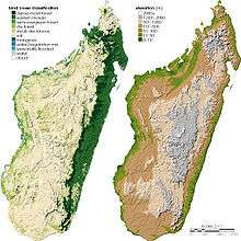
Madagascar belongs to the Afrotropical realm. With its neighboring Indian Ocean islands, it has been classified by botanist Armen Takhtajan as Madagascan Region, and in phytogeography it is the floristic phytochorion Madagascan Subkingdom in the Paleotropical Kingdom. Madagascar features very contrasting topography, climate, and geology. A mountain range on the east, rising to 2,876 m (9,436 ft) at its highest point, captures most rainfall brought in by trade winds from the Indian Ocean. Consequently, the eastern belt harbours most of the humid forests, while precipitation decreases to the west. The rain shadow region in the southwest has a sub-arid climate. Temperatures are highest on the west coast, with annual means of up to 30 °C (86 °F), while the high massifs have a cool climate, with a 5 °C (41 °F) annual mean locally. Geology features mainly igneous and metamorphic basement rocks, with some lava and quartzite in the central and eastern plateaus, while the western part has belts of sandstone, limestone (including the tsingy formations), and unconsolidated sand.[1]
Terrestrial ecoregions
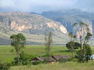
Seven terrestrial ecoregions are defined by the World Wildlife Fund for Madagascar. They range from the very humid eastern lowland forests to the sub-arid spiny thickets in the southwest.[2]
| Ecoregion | Biome | WWF code | Map | Image |
|---|---|---|---|---|
| Madagascar lowland forests or Madagascar humid forests | Tropical moist broadleaf forest: specifically seasonal (monsoon) tropical forest | AT0117 |  |
 |
| Madagascar subhumid forests | Tropical moist broadleaf forest | AT0118 |  |
 |
| Madagascar dry deciduous forests | Tropical dry forest | AT0202 | 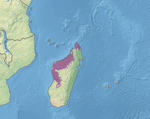 |
 |
| Madagascar ericoid thickets | Montane shrubland | AT1011 |  |
 |
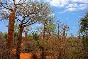
| Madagascar spiny thickets or Madagascar spiny forests | Xeric shrubland | AT1311 | 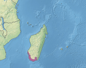 |
 |
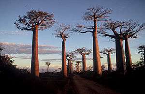
| Madagascar succulent woodlands | Xeric shrubland | AT1312 | 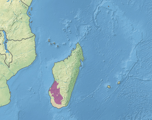 |
 |
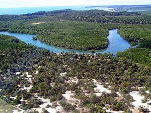
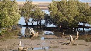
| Madagascar mangroves | Mangroves | AT1404 | 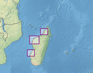 |
 |
Freshwater ecoregions
Freshwater ecoregions correspond to major catchment areas with a distinctive assemblage of species. In Madagascar, five regions are distinguished:
- Eastern Lowlands
- Eastern Highlands
- Northwestern Basins
- Southern Basins
- Western Basins
Marine ecoregions
The seas around Madagascar are part of the Western Indian Ocean province in the Western Indo-Pacific realm. They are divided into two marine ecoregions:
- Southeast Madagascar
- Western and Northern Madagascar
References
- ↑ Moat, J.; Smith, P. (2007). Atlas of the Vegetation of Madagascar/Atlas de la Végétation de Madagascar. Richmond, Surrey: Royal Botanic Gardens, Kew. (English/French)
- ↑ Burgess, N.; D'Amico Hales, J.; Underwood, E.; et al., eds. (2004). Terrestrial Ecoregions of Africa and Madagascar: A Conservation Assessment. World Wildlife Fund Ecoregion Assessments (2nd ed.). Washington D.C.: Island Press. ISBN 978-1559633642. Archived from the original (PDF) on 2016-11-01.