List of cities and towns in Jamaica
This is a list of settlements[1] in Jamaica.
Definitions
The following definitions have been used:
- City: Any settlement listed at [2] that had a 1991 or 2001 census population of 75,000 or more. These are believed to be cities by Charter or by Act of the Jamaican parliament but no source for this has been found.
- Town: As given at [2] plus any other settlements with a 1991 census population of between 750 and 75,000.
- Village Any settlement not listed at [2] and with a 1991 census population of less than 750.
- Hamlet: Any settlement not listed at [2] and which Google Maps satellite view shows is too small to be a village.
- Neighbourhood: Geographically obvious subdivisions of any of the above.
Cities and towns
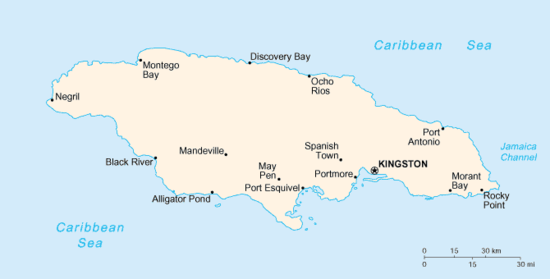
A map of Jamaica.
| Name | Pop. (1991) | Coordinates | Parish |
| Cities |
| Kingston | 587,798 | 17°59′00″N 76°48′00″W / 17.9833°N 76.8000°W / 17.9833; -76.8000 (Kingston) | Kingston / St. Andrew |
| Montego Bay | 96,488 | 18°28′00″N 77°55′00″W / 18.4666°N 77.9166°W / 18.4666; -77.9166 (Montego Bay) | Saint James |
| Towns |
| Above Rocks | 3,263 | 18°06′32″N 76°52′38″W / 18.1089°N 76.8772°W / 18.1089; -76.8772 (Above Rocks) | Saint Catherine |
| Albert Town | 3,389 | 18°17′45″N 77°32′29″W / 18.2958°N 77.5414°W / 18.2958; -77.5414 (Albert Town) | Trelawny |
| Alexandria | 1,672 | 18°17′54″N 77°21′27″W / 18.2983°N 77.3575°W / 18.2983; -77.3575 (Alexandria) | Saint Ann |
| Alligator Pond | 1,542 | 17°52′16″N 77°34′06″W / 17.8711°N 77.5683°W / 17.8711; -77.5683 (Alligator Pond) | Manchester |
| Anchovy | 3,633 | 18°24′35″N 77°56′02″W / 18.4097°N 77.9339°W / 18.4097; -77.9339 (Anchovy) | Saint James |
| Annotto Bay | 5,468 | 18°16′13″N 76°46′14″W / 18.2703°N 76.7706°W / 18.2703; -76.7706 (Annotto Bay) | Saint Mary |
| Balaclava | 2,837 | 18°10′14″N 77°38′54″W / 18.1705°N 77.6484°W / 18.1705; -77.6484 (Balaclava) | Saint Elizabeth |
| Bamboo | 3,732 | 18°23′06″N 77°15′58″W / 18.3851°N 77.2662°W / 18.3851; -77.2662 (Bamboo) | Saint Ann |
| Bath | 2,151 | 17°57′N 76°21′W / 17.95°N 76.35°W / 17.95; -76.35 (Bath) | Saint Thomas |
| Bethel Town | 2,768 | 18°18′N 77°57′W / 18.30°N 77.95°W / 18.30; -77.95 (Bethel Town) | Westmoreland |
| Black River | 3,675 | 18°02′N 77°52′W / 18.03°N 77.86°W / 18.03; -77.86 (Black River) | Saint Elizabeth |
| Bluefields | 2,564 | 18°10′N 78°02′W / 18.17°N 78.03°W / 18.17; -78.03 (Bluefields) | Westmoreland |
| Bog Walk | 8,794 | 18°06′N 77°01′W / 18.10°N 77.02°W / 18.10; -77.02 (Bog Walk) | Saint Catherine |
| Brompton | 1,457 | 18°04′N 77°54′W / 18.06°N 77.90°W / 18.06; -77.90 (Brompton) | Saint Elizabeth |
| Brown's Town | 6,762 | 18°24′N 77°22′W / 18.40°N 77.36°W / 18.40; -77.36 (Brown's Town) | Saint Ann |
| Buff Bay | 2,596 | 18°14′N 76°40′W / 18.23°N 76.67°W / 18.23; -76.67 (Buff Bay) | Portland |
| Bull Savanna | | 17°53′N 77°35′W / 17.88°N 77.59°W / 17.88; -77.59 (Bull Savanna) | Saint Elizabeth |
| Cambridge | 3,384 | 18°19′N 77°53′W / 18.32°N 77.89°W / 18.32; -77.89 (Cambridge) | Saint James |
| Cascade | 1,220 | 18°24′N 78°06′W / 18.40°N 78.10°W / 18.40; -78.10 (Cascade) | Hanover |
| Cave Valley | 1,777 | 18°16′N 77°22′W / 18.27°N 77.37°W / 18.27; -77.37 (Cave Valley) | Saint Ann |
| Chapelton | 3,930 | 18°05′N 77°16′W / 18.08°N 77.27°W / 18.08; -77.27 (Chapelton) | Clarendon |
| Sanguinetti | 3,900 | 18°06′N 77°20′W / 18.10°N 77.34°W / 18.10; -77.34 (Sanguinetti) | Clarendon |
| Christiana | 7,235 | 18°10′N 77°29′W / 18.17°N 77.49°W / 18.17; -77.49 (Christiana) | Manchester |
| Claremont | 2,154 | 18°23′N 77°10′W / 18.38°N 77.17°W / 18.38; -77.17 (Claremont) | Saint Ann |
| Clark's Town | 3,139 | 18°25′N 77°34′W / 18.42°N 77.57°W / 18.42; -77.57 (Clark's Town) | Trelawny |
| Coleyville | 3,320 | 18°13′N 77°30′W / 18.22°N 77.50°W / 18.22; -77.50 (Coleyville) | Manchester |
| Constant Spring | 12,369 | 18°03′N 76°47′W / 18.05°N 76.78°W / 18.05; -76.78 (Constant Spring) | Saint Andrew |
| Croft's Hill | 2,994 | 18°08′N 77°13′W / 18.13°N 77.22°W / 18.13; -77.22 (Croft's Hill) | Clarendon |
| Dalvey | 2,742 | 17°54′N 76°15′W / 17.90°N 76.25°W / 17.90; -76.25 (Dalvey) | Saint Thomas |
| Darliston | 1,435 | 18°14′N 77°58′W / 18.23°N 77.97°W / 18.23; -77.97 (Darliston) | Westmoreland |
| Discovery Bay (Dry Harbour) | 2,230 | 18°28′N 77°23′W / 18.47°N 77.39°W / 18.47; -77.39 (Discovery Bay) | Saint Ann |
| Duncans | 1,849 | 18°28′N 77°32′W / 18.47°N 77.53°W / 18.47; -77.53 (Duncans) | Trelawny |
| Easington | 2,378 | 17°55′N 76°36′W / 17.92°N 76.60°W / 17.92; -76.60 (Easington) | Saint Thomas |
| Ewarton | 8,742 | 18°11′N 77°05′W / 18.18°N 77.08°W / 18.18; -77.08 (Ewarton) | Saint Catherine |
| Falmouth | 7,245 | 18°29′N 77°40′W / 18.49°N 77.66°W / 18.49; -77.66 (Falmouth) | Trelawny |
| Frankfield | 2,865 | 18°09′N 77°21′W / 18.15°N 77.35°W / 18.15; -77.35 (Frankfield) | Clarendon |
| Frome | 900 | 18°18′N 78°09′W / 18.30°N 78.15°W / 18.30; -78.15 (Frome) | Westmoreland |
| Gayle | 3,205 | 18°20′N 77°00′W / 18.33°N 77.00°W / 18.33; -77.00 (Gayle) | Saint Mary |
| Seaford Town | 4,108 | 18°09′N 77°32′W / 18.15°N 77.54°W / 18.15; -77.54 (German Town) | Westmoreland |
| Golden Grove | 2,761 | 17°56′N 76°16′W / 17.93°N 76.27°W / 17.93; -76.27 (Golden Grove) | Saint Thomas |
| Gordon Town | 1,049 | 18°03′N 76°42′W / 18.05°N 76.70°W / 18.05; -76.70 (Gordon Town) | Saint Andrew |
| Grange Hill | 6,530 | 18°22′N 78°12′W / 18.37°N 78.20°W / 18.37; -78.20 (Grange Hill) | Westmoreland |
| Green Island | 1,591 | 18°23′N 78°35′W / 18.38°N 78.58°W / 18.38; -78.58 (Green Island) | Hanover |
| Guy's Hill | 3,165 | 18°15′N 77°00′W / 18.25°N 77.00°W / 18.25; -77.00 (Guy's Hill) | Saint Mary |
| Hayes | 8,447 | 17°53′N 77°15′W / 17.88°N 77.25°W / 17.88; -77.25 (Hayes) | Clarendon |
| Highgate | 5,418 | 18°19′N 76°52′W / 18.32°N 76.87°W / 18.32; -76.87 (Highgate) | Saint Mary |
| Hope Bay | 1,569 | 18°12′N 76°34′W / 18.20°N 76.57°W / 18.20; -76.57 (Hope Bay) | Portland |
| Hopewell | 4,268 | 18°15′N 78°18′W / 18.25°N 78.30°W / 18.25; -78.30 (Hopewell) | Hanover |
| Islington | 2,868 | 18°19′N 76°51′W / 18.32°N 76.85°W / 18.32; -76.85 (Islington) | Saint Mary |
| Kellits | 2,291 | 18°10′N 77°14′W / 18.17°N 77.23°W / 18.17; -77.23 (Kellits) | Clarendon |
| Lacovia | 3,159 | 18°04′N 77°45′W / 18.07°N 77.75°W / 18.07; -77.75 (Lacovia) | Saint Elizabeth |
| Linstead | 14,114 | 18°09′N 77°01′W / 18.15°N 77.02°W / 18.15; -77.02 (Linstead) | Saint Catherine |
| Lionel Town | 4,669 | 17°48′N 77°14′W / 17.80°N 77.23°W / 17.80; -77.23 (Lionel Town) | Clarendon |
| Little London | 1,848 | 18°18′N 78°12′W / 18.30°N 78.20°W / 18.30; -78.20 (Little London) | Westmoreland |
| Lluidas Vale | 2,161 | 18°07′N 77°09′W / 18.12°N 77.15°W / 18.12; -77.15 (Lluidas Vale) | Saint Catherine |
| Lucea | 6,002 | 18°26′N 78°11′W / 18.44°N 78.18°W / 18.44; -78.18 (Lucea) | Hanover |
| Lucky Hill | 750 | 18°18′N 77°01′W / 18.30°N 77.02°W / 18.30; -77.02 (Lucky Hill) | Saint Mary |
| Maggotty | 1,359 | 18°09′N 77°46′W / 18.15°N 77.77°W / 18.15; -77.77 (Maggotty) | Saint Elizabeth |
| Malvern | 3,262 | 17°58′N 77°43′W / 17.97°N 77.72°W / 17.97; -77.72 (Malvern) | Saint Elizabeth |
| Manchioneal | 2,185 | 18°03′N 76°17′W / 18.05°N 76.28°W / 18.05; -76.28 (Manchioneal) | Portland |
| Mandeville | 39,945 | 18°03′N 77°29′W / 18.05°N 77.48°W / 18.05; -77.48 (Mandeville) | Manchester |
| Maroon Town | 2,669 | 18°21′N 77°47′W / 18.35°N 77.79°W / 18.35; -77.79 (Maroon Town) | Saint James |
| Mavis Bank | 1,756 | 18°01′N 76°40′W / 18.02°N 76.67°W / 18.02; -76.67 (Mavis Bank) | Saint Andrew |
| May Pen | 45,903 | 17°58′N 77°14′W / 17.97°N 77.24°W / 17.97; -77.24 (May Pen) | Clarendon |
| Moneague | 2,880 | 18°17′N 77°06′W / 18.28°N 77.10°W / 18.28; -77.10 (Moneague) | Saint Ann |
| Moore Town | 1,054 | 18°04′N 76°26′W / 18.07°N 76.43°W / 18.07; -76.43 (Moore Town) | Portland |
| Morant Bay | 9,602 | 17°52′N 76°23′W / 17.87°N 76.39°W / 17.87; -76.39 (Morant Bay) | Saint Thomas |
| Nain | 2,373 | 17°58′N 77°36′W / 17.97°N 77.60°W / 17.97; -77.60 (Nain) | Saint Elizabeth |
| Negril | 4,184 | 18°19′N 78°20′W / 18.32°N 78.33°W / 18.32; -78.33 (Negril) | Westmoreland |
| Ocho Rios | 8,189 | 18°25′N 77°07′W / 18.42°N 77.11°W / 18.42; -77.11 (Ocho Rios) | Saint Ann |
| Old Harbour | 17,778 | 17°55′N 77°06′W / 17.92°N 77.10°W / 17.92; -77.10 (Old Harbour) | Saint Catherine |
| Old Harbour Bay | 5,405 | 17°54′N 77°06′W / 17.90°N 77.10°W / 17.90; -77.10 (Old Harbour Bay) | Saint Catherine |
| Oracabessa | 4,066 | 18°28′N 76°56′W / 18.47°N 76.93°W / 18.47; -76.93 (Oracabessa) | Saint Mary |
| Osbourne Store | 3,390 | 17°58′N 77°20′W / 17.97°N 77.33°W / 17.97; -77.33 (Osbourne Store) | Clarendon |
| Petersfield | 2,045 | 18°15′N 78°04′W / 18.25°N 78.07°W / 18.25; -78.07 (Petersfield) | Westmoreland |
| Point Hill | 3,651 | 18°05′N 77°06′W / 18.08°N 77.10°W / 18.08; -77.10 (Point Hill) | Saint Catherine |
| Port Antonio | 13,246 | 18°10′N 76°23′W / 18.16°N 76.38°W / 18.16; -76.38 (Port Antonio) | Portland |
| Port Maria | 7,651 | 18°22′N 76°53′W / 18.37°N 76.89°W / 18.37; -76.89 (Port Maria) | Saint Mary |
| Port Royal | 3,004 | 17°56′N 76°51′W / 17.93°N 76.85°W / 17.93; -76.85 (Port Royal) | Kingston |
| Portmore | 90,138 | 17°57′00″N 76°52′48″W / 17.9499°N 76.8799°W / 17.9499; -76.8799 (Portmore) | Saint Catherine |
| Porus | 5,095 | 18°02′N 77°25′W / 18.03°N 77.42°W / 18.03; -77.42 (Porus) | Manchester |
| Race Course | 2,589 | 17°50′N 77°17′W / 17.83°N 77.28°W / 17.83; -77.28 (Race Course) | Clarendon |
| Richmond | 1,984 | 18°14′N 76°54′W / 18.23°N 76.90°W / 18.23; -76.90 (Richmond) | Saint Mary |
| Rio Bueno | 1,108 | 18°34′N 77°27′W / 18.57°N 77.45°W / 18.57; -77.45 (Rio Bueno) | Trelawny |
| Riversdale | 2,791 | 18°09′N 76°58′W / 18.15°N 76.97°W / 18.15; -76.97 (Riversdale) | Saint Catherine |
| Rocky Point | 2,744 | 17°46′N 77°16′W / 17.77°N 77.27°W / 17.77; -77.27 (Rocky Point) | Clarendon |
| Runaway Bay | 5,655 | 18°27′N 77°20′W / 18.45°N 77.33°W / 18.45; -77.33 (Runaway Bay) | Saint Ann |
| Saint Ann's Bay | 10,961 | 18°26′N 77°13′W / 18.44°N 77.22°W / 18.44; -77.22 (Saint Ann's Bay) | Saint Ann |
| Sandy Bay | 4,476 | 18°27′N 78°06′W / 18.45°N 78.10°W / 18.45; -78.10 (Sandy Bay) | Hanover |
| Santa Cruz | 8,144 | 18°04′N 77°43′W / 18.07°N 77.72°W / 18.07; -77.72 (Santa Cruz) | Saint Elizabeth |
| Savanna-la-Mar | 16,553 | 18°10′N 77°57′W / 18.16°N 77.95°W / 18.16; -77.95 (Savanna-la-Mar) | Westmoreland |
| Seaforth | 4,108 | 17°56′N 76°27′W / 17.93°N 76.45°W / 17.93; -76.45 (Seaforth) | Saint Thomas |
| Siloah | 2,701 | 18°10′N 77°44′W / 18.17°N 77.73°W / 18.17; -77.73 (Siloah) | Saint Elizabeth |
| Southfield | 2,671 | 17°53′N 77°40′W / 17.88°N 77.67°W / 17.88; -77.67 (Southfield) | Saint Elizabeth |
| Spanish Town | 92,383 | 17°59′45″N 76°57′18″W / 17.9958°N 76.9551°W / 17.9958; -76.9551 (Spanish Town) | Saint Catherine |
| Stony Hill | 8,244 | 18°05′N 76°47′W / 18.08°N 76.78°W / 18.08; -76.78 (Stony Hill) | Saint Andrew |
| Trinity Ville | 2,614 | 17°57′N 76°32′W / 17.95°N 76.53°W / 17.95; -76.53 (Trinity Ville) | Saint Thomas |
| Ulster Spring | 1,391 | 18°19′N 77°31′W / 18.32°N 77.52°W / 18.32; -77.52 (Ulster Spring) | Trelawny |
| Wakefield | 2,724 | 18°25′N 77°43′W / 18.42°N 77.72°W / 18.42; -77.72 (Wakefield) | Trelawny |
| White House | 3,157 | 18°05′N 77°58′W / 18.08°N 77.97°W / 18.08; -77.97 (White House) | Westmoreland |
| Williamsfield | 2,800 | 18°04′N 77°29′W / 18.07°N 77.48°W / 18.07; -77.48 (Williamsfield) | Manchester |
| Yallahs | 6,902 | 17°52′N 76°34′W / 17.87°N 76.57°W / 17.87; -76.57 (Yallahs) | Saint Thomas |
Villages
Neighbourhoods
Kingston & St. Andrew
See also
References
- ↑ Cities, towns, villages and neighbourhoods
- 1 2 3 4 "World Gazetteer, Jamaica: Largest cities and towns with statistics of their population". Archived from the original on 2012-12-05.
External links
 Media related to Towns in Jamaica at Wikimedia Commons
Media related to Villages in Jamaica at Wikimedia Commons
Media related to Towns in Jamaica at Wikimedia Commons
Media related to Villages in Jamaica at Wikimedia Commons
|
|---|
|
|
|
| Cities | |
|---|
|
| Towns | |
|---|
|
| Villages | |
|---|
|
| Neighbourhoods | Kingston
and
St Andrew |
- Allman Town
- Arcadia
- Barbican
- Beverly Hills
- Bournemouth Gardens
- Camperdown
- Cassava Piece
- Cherry Gardens
- Cockburn Gardens
- Constant Spring
- Cooreville Gardens
- Cross Roads
- Delacree Park
- Denham Town
- Duhaney Park
- Eastwood Park
- Elleston Flats
- Fletcher's Land
- Forest Hills Garden
- Four Mile
- Grants Pen
- Greenwich Town
- Half Way Tree
- Hannah Town
- Harbour View
- Havendale
- Hope Pastures
- Hope Tavern
- Hughenden
- Jack's Hill
- Jones Town
- Kencot
- Kingston Gardens
- Kintyre
- Liguanea
- Manley Meadows
- Mannings Hill
- Maxfield
- Meadowbrook
- Meadowbrook Estate
- Molynes Gardens
- Mona
- Mona Heights
- Mountain View Gardens
- Nannyville Gardens
- New Haven
- New Kingston
- Newport West
- Newton Square
- Norbrook
- Norman Gardens
- Oaklands
- Olympic Gardens
- Papine
- Passmore Town
- Patrick City
- Pembroke Hall
- Perkins Estate
- Port Royal
- Queensborough
- Queensbury
- Rae Town
- Red Hills
- Richmond Park
- Rockfort/Rennock lodge
- Rollington Town
- Seaview Gardens
- Shooters Hill
- Six Miles
- South Side
- St Mary
- Stony Hill
- Three Mile
- Three Oaks Gardens
- Tivoli Gardens
- Trench Town
- Vineyard Town
- Washington Gardens
- Whitfield Town
- Wilton Gardens
- Woodford Park
- Ziadie Gardens
|
|---|
|
-
 Jamaica portal Jamaica portal
-
 Geography portal Geography portal
|
|
|---|
|
|---|
|
| History | | |
|---|
|
| Geography | |
|---|
|
| Politics | |
|---|
|
| Economy | |
|---|
|
| Society | |
|---|
|
|
List of cities in North America |
|---|
|
| Sovereign states | |
|---|
|
Dependencies and
other territories | |
|---|
List of towns in North America |
|---|
|
| Sovereign states | |
|---|
|
Dependencies and
other territories | |
|---|