List of caves of Maryland
The subject of this article and a reference book of the same name, Caves of Maryland was first released by the Maryland Geological Survey (MGS) in 1950. Information about Maryland caves was first gathered into a series of reports by Martin Muma in the mid-1940s, working under the MGS. After the release of these articles in 1946, a more comprehensive study was begun by William Davies, whose years of fieldwork led to the compilation of the premiere edition of Caves of Maryland in 1950.[1] Since its publication, this reference work has remained the principal source for information about Maryland caves, and has served as an outline for the work to follow.
Introduction
Following the release of the first edition of Caves of Maryland in 1950, several other attempts by various parties and interested groups have been made at expanding available information concerning Maryland's subterrain. In the late 1960s the MGS sponsored another statewide survey, undertaken by Richard Franz and Dennis Slifer, and a second, expanded edition of Caves of Maryland was released in 1971. It was not until the inception of this second project that areas west of Washington County were even thoroughly canvassed; even after the conclusion of the Franz/Slifer survey, it was speculated that even more, undiscovered caves could still remain in more remote portions of the western counties, prompting the need for an additional version, but since that time there have been no additional state sponsored reports or surveys released to the public.
In Maryland, a cave is defined as any subterranean cavity large enough for a human to enter.[2] This definition has led the authors to include several shelter caves, fissures, and mines that in states with larger, more complex cave systems, might otherwise go unlisted.
Locations
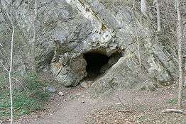
Cave locations are typically well-guarded secrets, as property owners are most-often fearful of liability issues and damage to their lands. Likewise, experienced spelunkers are also wary to guide novices to cave locations, fearing they might recklessly endanger the natural balance of these sanctuaries, making them inaccessible to all. While most find cave vandalism unimaginable, there are some who, whether out of carelessness, malice, or ignorance, have hopelessly destroyed beautiful caves forever. For this reason, precise locations of caves are seldom published. Rather than using a coordinate system, the MGS' "Caves of Maryland" provides approximate locations using a quadrangle system to be employed with the use of 7.5-minute topographic maps. Neither coordinates nor quadrangular data are posted on this page at present, only surrounding terrain and the condition/accessibility of said caves when known. While limited data and pictures about Maryland's caves can be found on the MGS’s website, the best sources of information are local speleological grottos and knowledgeable enthusiasts. To learn more about the caves of Maryland, their locations, and ethical caving practices in general, contact the Tri-state Grotto or Western Maryland Grotto, an internal organization of the National Speleological Society.
Maryland geology and caves
Most of Maryland's caves occur in its three westernmost counties (Washington, Allegany, and Garrett). While Maryland may be smaller than many of its neighboring states containing larger numbers of caves, its geology likewise allows for the formation of underground cavities, most of which are hollowed out by chemical processes—these caves are known as solutional caves. Non-solutional caves are carved out by weathering and are typically of smaller size and of little interest to spelunkers. Underlying layers of carbonate rocks form much of Maryland's bedrock; precipitation and groundwater react with such rocks as dolomite, limestone, and marble, dissolving the rock and forming small fissures and chambers that allow for the entry of more water and the dissolution of more of the carbonic rock. Being able to identify the different types of rock that caves are likely to form in can provide a great deal of background into a cave's likely history, and thus these rock formations will be further discussed moving east to west across the state.
Coastal Plain – this is the area of Maryland extending from just west of the Chesapeake Bay to the Atlantic Ocean: Precambrian rocks are mostly overlain by gravel, silts, marls, and sands, and consequently no solutional caves are known to exist in this region of Maryland.
Piedmont Plateau – an area of gently rolling hills and flatlands, the Piedmont is home to only a few of Maryland's caves, as most of its members are unsuitable for their development or are largely hidden from view beneath surface settlement. Exceptions in the uplands area include the Wakefield and Cockeystown marbles, which are known to include but a few caves. In the lowlands portion of the Piedmont (known as the Frederick Valley) caves are found in the Frederick Formation and Grove Limestone (upper Cambrian and lower Ordovician, respectively); while several other limestone members exist (Tomstown and New Oxford), no caves have been located within these members.
Blue Ridge & the Great Valley – the Blue Ridge rises up from the Piedmont just west of Frederick in the first of its two mountains, Braddock/Catoctin. Here older limestone and dolomites from the Cambrian/Ordovician make an appearance, offering up a few caves in the Frederick/Middletown Valley vicinity. On top of these, older, harder thrust sheets of metamorphic rocks from the Paleozoic give these mountains their well-defined crests and ridges. Wolf Rock, home to Maryland's best-known non-solutional cave, is an example of quartzite that has endured while Catoctin Mountain has weathered around it.
South Mountain, which serves as a natural border between Frederick and Washington counties, is the western edge of Maryland's Blue Ridge, giving way to an area of relatively little relief, known as the Great (or locally, Hagerstown/Cumberland) Valley. Here the harder metamorphosed rocks of the Blue Ridge are replaced by carbonates, sandstones, and shale that grow progressively younger moving west, entering the early Ordovician period. The highest concentration of Maryland caves lies within the Hagerstown Valley, where well-established waterways have cut into the underlying carbonate rocks.[3] Recent fieldwork, combined with the observations of Franz and Slifer, indicate that the most cavernous units exposed in the Great Valley are, from oldest to youngest, the Tomstown Dolomite, the Cavetown member of the Waynesboro Formation, the lower beds of the Elbrook Formation, the Rockdale Run Formation, and, especially cavernous, the Chambersburg Formation. The probability of cave development, however, is also very strongly influenced by the presence of structural features such as anticlinal axes, synclinal troughs, and faults. In contrast to the larger caves of neighboring West Virginia, caves in the Great Valley are generally quite shallow with little internal relief. In-cave relief rarely exceeds 50 feet (15 m) in Washington County. High deformation and faulting allows surface waters to penetrate rock vertically and reach the shallow underlying water table quickly without much lateral travel. This serves to limit cavern development considerably, and of the many caves in Washington County, only Crystal Grottoes is known to exceed 1,000 feet (300 m) in length, and it attains such length from having a maze pattern of passages, rather than a long continuous stream conduit.
Ridge & Valley Region – is the name of the physiological province extending west of the Great Valley to the western portion of Allegany County. This region is traditionally defined as starting at Fairview Mountain and is characterized by repeating southwest- to northeast-trending ridges and valleys. A thrust fault just east of Fairview indicates where younger rocks from the Ordovician through Devonian were overthrust by their Cambrian neighbors to the east. The region is built upon shale and sandstone from the upper Ordovician and lower Silurian periods, with little or no cave-bearing limestone seen until the lower Helderberg Group, Wills Creek Formation and Tonoloway Formation. Thicker formations of the upper Devonian consist of the Keyser Formation and New Creek Limestone, in which some of the largest caves in the state can be found.
Allegany Plateau – the Allegany is a rolling upland punctuated by deep, rounded valleys and ridges of distinct, broad anticlines. Shale and sandstone of the Ordovician and lower Silurian are replaced by limestone formations which continue into the lower Devonian. These younger rocks have settled to a depth equal to that of the much older rocks of the Ordovician; this change in depth occurs along a fault just east of Dans Mountain. Moving west from outcrops of early Devonian limestone, the Helderbergian limestones pinch out and the formation consists of clastic rocks that bear no caves. Synclines within this region have preserved remains from the younger Carboniferous Period—the period containing Maryland's only natural source of carbon fuels—within the Mississippian system lies the Greenbrier Formation, the next oldest limestone member known to contain caves. The Greenbrier is relatively thin but contains eight known large caves, including the largest cave in Maryland, Tanglefoot Cave. The youngest rocks to contain caves are in Garrett County: they are Pennsylvanian in age. All younger sediments have been removed from the landscape with the exception of the Dunkard Group, a small knob in Allegany County that is Permian in age.
List of caves
All caves given in the 1976 republication of Caves of Maryland will be listed below by county. The condition and status of many of these caves are unknown at this time; in an effort to establish an up-to-date record of these caves, editing of the list with any new information is encouraged!
Allegany County
After Washington County, Allegany County contains the second-highest concentration of caves in Maryland. The many ridges of the Appalachians' Ridge & Valley Province provide terrain well-suited to the formation of caves. While rocks here vary in age from Silurian to Mississippian, most caves are developed in the middle of this range in the Tonoloway and Helderberg formations. Like Washington County, distribution of caves within Allegany County often tend to run in patterns that parallel folds in local mountain chains.
- Allegany High School - about 150 feet (46 m) above the south side of Wills Creek is a crawlway about 20 feet (6.1 m) long, developed in the Wills Creek Shale at 770 feet (230 m) elevation.
- Atheys - Tonoloway Formation at 1,230 feet (370 m). Very little information could be found to indicate the cave's exact location: somewhere near the town of Rush on the property of an R. Bluebaker. The entrance is said to be inconspicuous. The cave contains four rooms and several pools of water. The cave entrance was filled in during the 1960s. The owner does not wish to be approached about the cave.
- Bins Fissure Cave - Located on a sandstone ridge overlooking the Potomac River between McKenzie and Cresaptown. Cave consists of two levels for a total of about 30 feet (9.1 m).
- Bowman's Addition Cave- Tonoloway Formation at 720 feet (220 m). Located in an old quarry on the east side of Valley Road, south of Bowmans Addition. The cave consists of one crawlway, a large room, and a chimney. A second cave is reported in the far end of the quarry.
- Corriganville Quarry Fissure - A fissure can be found at what now remains of Devil's Backbone. The extent of this fissure is unknown as it was unexplored at the time of the discovery, but it is estimated to be at least 40 feet (12 m) long.
- Cumberland Bone Cave - located within Andy's Ridge near the town of Corriganville, this cave was exposed in 1912 when the Western Maryland Railway cut through the mountain. After its discovery the cave yielded impressive quantities of Pleistocene vertebrate remains that were sent off to the Smithsonian Institution. Trent Spielman is currently the paleontologist associated with the cave. Although very little of the cave still exists, its remnants can sill be seen on the north and south walls of the railroad pass; it is developed in the Keyser Limestone at approximately 840 feet (260 m) elevation. Andy's Ridge still holds secrets to this day.
- Cumberland Quarry - Wills Creek Formation at 720 feet (220 m) elevation. On the south side of Wills Creek, opposite Valley Street in Cumberland. There are two crawlways here in a tightly folded section of the Wills Creek Formation, on the east face of an old quarry.
- Devil's Den - located south of Flintstone on the farm once owned by an H. Jackson. The entrance is on a wooded hillside and can be found by following the strike of the rocks northeast from a spring adjacent the house. Local tradition holds that children have played here for many years, though no dates are known to occur in the cave. The entrance is at 1,030 feet (310 m) elevation and can be easily deduced by the following means: the cave represents a lesser-used drainway of Flintstone Creek, where it plunges below the surface behind the school until its resurgence at the Jackson spring where it joins the other half of Flintstone Creek as a tributary of the Murley Branch. The cave is part of an upper level located around 1,030 feet (310 m), directly above the subterranean branch of the Flintstone, both of which occur in a thin band of the Tonoloway Formation adjacent to the Wills Creek Shale and Keyser Limestone. The present owner, Donald Jackson, reports the rear portion of the cave to be collapsing. He said the cave is considered to be closed.
- Devil's Hole - located at 1,250 feet (380 m) in the Helderberg Limestone's Keyser Member, the cave can be found northeast of Twiggtown on the property of R. Mullenax. The cave is one of the larger (1/4 mile of mapped passage), more interesting caves in the state. A liability waiver must be signed before entering the cave.
- Dressmans - part of the Tonoloway Limestone, located at 760 feet (230 m) on the northwest face of an old quarry. The cave is 60 feet (18 m) long, but the last 40 feet (12 m) is difficult to access due to a minor collapse or intentional fill. A few feet northeast and higher from the entrance is a small animal hole with slight airflow, indicating a possible continuation of the cave. Above the cave are several elongated depressions between the vertical bedding, underneath which are possibly the counterparts of Dressmans. Springs can also be found south of the quarry near Braddock Run by following the strike.
- Fort Hill Fissures - a series of three fissure caves have developed in the land owned by Potomac Edison on the northern end of Fort Hill (of Allegany Co.) that overlooks Rawlings. These fissures are all aligned in a southwest-northeast direction, are several hundred feet in length, and span over 50 feet (15 m) in the vertical.
- Goat - elevation 720 feet (220 m); located at the end of Paterson Street; the entrance faces southeast. The cave is developed in a narrow bed of folded limestone within the Wills Creek Formation. The cave is of very low ceiling (less than 4 feet (1 m) in most places), and is said to be a favorite spot of local children. The entrance currently has a mound of dirt in front of it, making entering difficult. This cave has "bad air" in the deepest part of it.
- Greises - developed in the Tonoloway Limestone at 1,020 feet (310 m); the cave has approximately 150 feet (46 m) of narrow passage and three observed rooms. The cave can be very wet, and was not fully explored at the time of the survey. Cavers have since explored the cave to its fullest extent. This cave is the first cave in Maryland to have recorded White Nose Syndrome. (Closed by private owner (Cumberland Bowhunters Club), 12/09)
- Gunning's Fissure Cave - Located just northeast of Bins Fissure Cave and likely related, this cave consists of one level with about the same length of passage as Bins.
- Haystack Mountain - a small shelter cave in the Tuscarora Sandstone south of Wills Creek; elevation 1,000 feet (300 m).
- Horse - can be found 1,000 yards (910 m) south of Twiggs Cave, near the Twiggtown-Spring Gap road. The cave is about 200 feet (61 m) long and accommodating in most regards. Developed in the Keyser Limestone at 1,440 feet (440 m) elevation, this cave is on the same property as Twigg's Cave. This cave is also considered to be closed.
- I-68 Caves - Two cave passages occur on the northwest side of Interstate 68 at the top of Martins Mountain. These were opened during construction of the highway in the late 1970s. One is a partially cement-filled passage and the other is a pit. Both could be opened easily but are on private property. There are neighbors who watch the property and immediately report trespassers to the State Police. These caves are to be considered closed. There was a cave, now filled, discovered also during construction, located between the east/westbound lanes. It was explored by Lawrence Cosgrove and friends prior to filling. It is reported to be extensive with several large rooms and highly decorated.
- Lovers Leap - Tuscarora Sandstone at 1,200 feet (370 m) elevation. Located on the north side of the Cumberland Narrows; 300 feet (91 m) west of the promenade known locally as "Lovers' Leap" atop Wills Mountain is a fissure which contains about 50 feet (15 m) of vertical passage and one side passage which returns to the surface. This fissure is opposite Haystack Cave, and the formation of the two fractures appears to be closely related. Accessing the cave is considered dangerous, as it means traversing an area alongside a sheer cliff face with a drop of some 600 feet (180 m). A 34-year-old man fell from this area on February 23, 2012, losing his life.
- Mt. Savage Road Quarry - Developed in the famous Greenbrier Limestone band that houses many of West Virginia's larger caves. Several caves have been discovered in quarries on opposite sides of Jennings Run along the Little Allegheny and Piney Mountains. All of these caves are on POSTED private property. These caves are to be considered closed to all.
- Murley Branch Spring - Tonoloway Limestone at 1,000 feet (300 m). The entrance to this cave faces north, out of which flows a large stream. The cave is developed in massive limestone near the base of the formation, where the bedding can be seen as horizontal at the crest of a subordinate anticline. Once inside the entrance and in the main room, the passage becomes impassable where the spring emerges from a siphon. The water here is said to be some 10 feet (3.0 m) deep and thus cannot be penetrated. Local residents report that during a particularly dry season in the 1940s, Frank Humbertson Sr. and several young men were able to pass beyond the siphon and found a passage extended further south for some 300 feet (91 m). The cave was recently dived and it was discovered a water filled passage exist to the east but is partially blocked by debris. Beyond that, it is clearly passable. Another passage was discovered 60 feet inside the cave. It is a dry passage that is clearly passable. This passage is accessible only through 60 feet of very cold water with no air space. Another cave was once reported to lie some 100 yards (91 m) south of the spring, but was not located in the Franz/Slifer survey. This could be the Wilsonian Cave reported in the area in the 1940s. This cave is closed to all.
- Piney Mountain shelter caves - These caves are located on the northeastern edge of Piney Mountain. Three are known to exist, there are probably more. They are all "walk-in" caves. They are relatively stable and range from 30 to 100 feet (9.1 to 30.5 m) in passage length. They are developed in sandstone. Words of caution: these are prime animal habitats, so caution should be taken when near them. Perhaps Native Americans may once have used them for shelter. They are on private property and permission will need to be obtained before going on the property.
- Pinto Mines - Keyser Limestone at 700 feet (210 m). Along the Potomac River near Pinto a series of disused limestone mines can be found in a cliff face. One of these mines was explored in 1966 using scuba gear, but the deeper passages were not fully explored. The cave was dived and mapped in 1976 to its fullest extent. Atop the cliff there are several active sinkholes indicating solutional activity; another cave was reported to be in the area, but was not located during Davies' exploration. Other caves have been found west of the mines in the same railroad cut, and can be easily seen in the winter high up in the cliff walls. Peculiarly, a large sandstone boulder blocks the passage of one. Please note: These mines are very unstable and there have been various roof collapses over the years. They should only be viewed from the entrance and not entered.
- Reynold's Gap Cave - A very accommodating shelter cave occurs on the opposite side of Reynold's Gap from Rhodes Cave. There are also many solutional tubes along this ridge as well as some possible filled in caves.
- Rhodes - a narrow passage developed in the Tuscarora Sandstone at 800 feet (240 m) elevation, east of U.S. Route 220 and south of Rawlings. The passage can be traversed through the cliff and is about 50 feet (15 m) in length.
- Rocky Gap - Tuscarora Sandstone at 1,300 feet (400 m) elevation. Located about 350 feet (110 m) above the Rock Gap Run along the Rocky Gap Gorge's southern lip, this fissure cave extends some 120 feet (37 m) to the southeast. The entrance can be found very close to the edge of the cliff, hidden in shrubs.
- Hole #19 Cave - Developed in Tonoloway limestone, this "cave" is a blowhole located in the side of a drainage ditch near Rocky Gap State Park. It has been plumbed to be at least 25 feet (7.6 m) in length. Also has a resident groundhog in it. It issues an impressive amount of air, and a room can be seen in the back of the entrance passage. It is not presently passable for exploration. The State of Maryland has denied permission to dig it open.
- Stegmaier Orchard Caves - Tonoloway Limestone at 1,000 feet (300 m) elevation. Three caves are known to exist along a line of similar elevation, on the west flank of Irons Mountain. They all occur within 550 feet (170 m) of each other and are of moderate interest. Permission may or may not be granted to enter these caves.
- Tanglefoot Cave- This cave is an ongoing project due to it just recently being discovered. No location information will be released at this time per the land owners request. At this time Tanglefoot cave is the largest cave in Maryland and has broken most state records concerning Maryland caves. It is also the deepest cave in the Northeast United States; listed at 470 feet on Bob Gulden's List of Deepest U.S. Caves. This cave is extreme in nature and only the best experienced cavers should enter.
- Tewell - Tonoloway Limestone at 1,440 feet (440 m) elevation. One quarter mile northeast of Devil's Hole Cave, on the east side of a ravine, three leads of interest can be found occurring within 200 feet (61 m) of each other. At least one of these leads needs more exploration to determine its size, while the other two appear of little interest. These caves require permission to view. Roger Mullenax owns these caves as well as Devil's Hole.
- Trash Pile Pit - Tonoloway Limestone at 1,080 feet (330 m). A pit used for waste disposal by local residents is known to have a couple of passages, mostly obstructed by garbage. Local reports have it that there were once several other caves in existence, said to have been filled during construction of a nearby golf course; these same sources have it that one of these caves was quite extensive. Another cave was opened in the 1930s on the same property. It was a pit, reportedly opening into a small underground pond or lake. A boat was lowered and it was viewed. It was decided that it was not feasible for commercial operation. The pit was capped and forgotten. This was reported by a Grabenstien before his death on the Grabenstien farm, owners of that property at that time. There was an insurgence 500 feet (150 m) southeast (prior to the building of the Mall) of Trash Pile Pit and watercourse resurged below an old quarry 1,800 feet (550 m) southwest in the Helderberg Limestone. This old quarry exhibits several small holes, some issuing air, but none passable.
- Twiggs - Helderberg Formation at 1,360 feet (410 m) elevation. Developed in the western side of an anticline, Twiggs Cave is formed by two parallel fissures connected by a subordinate joint. The cave is very muddy: high in clay content and containing an active stream. The cave was opened in 1898 by the Twigg Family, whose homestead lies approximately 1,500 feet (460 m) north of the cave's entrance on the east side of a limestone ridge. Notable formations include the "King's Chair" and a giant mud glacier; several large drops and chimneys have also been mapped. This cave is one of the largest in Allegany County. It is rumored that Twiggs Cave was to be permanently sealed, following an involved rescue due to low oxygen.
- Valley Road Quarry - Tonoloway Limestone at 720 feet (220 m) elevation. Two small caves occur on the west side of Shriver Ridge, opposite the Dry Run Dam near Valley Road in Cumberland. Both are said to be of little interest, but one does issue air.
Baltimore County
Formation of caves and sinkholes in Baltimore County is found within its Piedmont marble: the Cockeysville and throughout the limestone valleys. Note that there are also caves and sinkholes throughout the limestone valleys of Greenspring and Long Green. There are likely in excess of 20 caves of varying size in Baltimore County.
- Beaver Run Shelter - a small shelter cave that extends for about 20 feet (6.1 m). The entrance is 2 by 3 feet (0.61 by 0.91 m) and is located at an elevation of 600 feet (180 m) in the Cockeysville Marble (condition and location unknown).
- Greenpoint Road, Cockeysville - Small fissure cave near stream, said to extend 100 feet (30 m) or so. Note that there are several other small caves in the vicinity that can be seen from Padonia Road.
- Greenspring Valley - Multiple caves, generally small. One is near the Jones Falls and has (had) a small room. These caves are found in the limestone of this area.
- Lake Roland - Shallow cave popular with children-unknown size
- Loch Raven Caves - Mentioned in local literature as used by the Underground Railroad. Can be seen along the reservoir.
- Magers Landing Road, Monkton - a small cave that extends 11 feet (3.4 m), it is found close to a stream at an elevation of 350 feet (110 m).
- Meltons - a small fissure cave found in an enlarged joint above the parking lot adjacent to the Loch Raven Reservoir dam; it extends for about 20 feet (6.1 m) at an elevation of 260 feet (79 m) in the Cockeysville Marble (condition and location unknown).
- Monkton - Several small caves that extend no more than 15 feet (4.6 m); a few are found along the NCR Trail.
- Panther Cave - northern Baltimore County, unknown length
- Prettyboy Cave - Largest known cave in Baltimore County, located at 590 feet (180 m) elevation off a fire road near Gunpowder Road. Its entrance is 10 by 4 feet (3.0 by 1.2 m), extends for about 25 feet (7.6 m) and opens up to about 5 feet (1.5 m) tall inside.
- SW Road, Parkville - A fissure cave in Cockeysville marble, the entrance is about 6 by 3 feet (1.83 by 0.91 m). Located along a stream with several other small caves.
Carroll County
In Carroll County outcroppings of the Wakefield Marble provide the only known backdrop for the development of caves.
- Argo - the entrance is in the north wall of an abandoned quarry at 620 feet (190 m) elevation in the Wakefield Marble; locals reported the cave at one time to be much larger than its traversable 15 feet (4.6 m) of passage, suggesting that fallen material may now be blocking a hidden shoot-off; a strong draft was observed in this cave (condition and location unknown).
- Westminster - the entrance to this cave is said to be in an old quarry facing east; the cave was said to consist of a single room, previously having been much larger, with a concrete floor as it was previously used as a milk cooler. The only clues as to its location are that it was on the property of a William Hastings of Hollow Rock Avenue, and it is developed in the Wakefield Marble at an elevation of 700 feet (210 m) (condition unknown).
Frederick County
Lying along the western border of the Lower Piedmont and Blue Ridge, Frederick County is physically composed of two regions drawing their traits from the two physiographic provinces. Eastern Frederick County, with its gently rolling lowlands, is underlain by older Cambrian/Precambrian metamorphic rock and other intrusive rocks from the Paleozoic. Sand and silt from the Tertiary have been deposited against some of the older rocks approaching the Blue Ridge; few caves are found here. Western Frederick County, west of Catoctin Mountain, is founded upon older Precambrian rocks which were thrust to the surface over the course of the Taconic orogeny. Most of Frederick County's caves can be found in this area, where local limestone formations protrude from neighboring metamorphic rock.
- Buckeystown - a 25-foot (7.6 m) vertical shaft once gave access to a two-room cave in this area at around 300 feet (91 m) elevation. The entrance is described as "at the base of a small quarry along the eastern side of the woods midway between Buckeystown and Adamstown." While the quarry may no longer be evident, the only prevalent "woods" in the vicinity lie southwest of Buckeystown Station and are bisected by the railroad (condition unknown, March 2010).
- Catoctin Creek - a small shelter cave is developed in Precambrian mica schist, 75 feet (23 m) above the creek's east bank. The cave's elevation is approximately 360 feet (110 m); the entrance is 10 feet (3.0 m) wide and the cave trends southwest for 35 feet (11 m).
- Centerville - a four-room cave was once reported to exist in the Wakefield Marble in an old quarry one-half mile east of Centerville, along Coppermine Road. The cave was not located during fieldwork leading up to the 1976 publication.
- Friends Creek - one of the few of Maryland's non-solutional caves can be found in the Catoctin Metabasalt above the west side of the dirt road leading to the property of the Friends Creek Anglers Association, approximately one mile northeast of the Friends Creek Church. The cave exists at 560 feet (170 m) elevation and consists of one room.
- Grove Quarry - a large, single-room cave with measurements of approximately 50 by 50 feet (15 by 15 m) by 12 feet (3.7 m) and possessing a singly chimney was said to exist in the M.J. Grove Limestone quarry at 300 feet (91 m) elevation, but it is unknown if the cave still exists.
- LeGore Quarry/Powells - a series of cavernous openings were discovered in the north face of the LeGore quarry; one large room was encountered at the then-northwest margin of the quarry, and workers interviewed reported the openings appeared to circle to the east and then south. One hundred yards to the southeast of the quarry, on the west side of Israel Creek, a low passage extends some 100 feet (30 m) north towards the quarry. This is Powell Cave. Though the entrance to this latter cave has been closed with stones, it is thought to be of the same system as the features in the quarry; both are in the Grove Limestone at approximately 380 feet (120 m) elevation.
- Linganore Shelter - locals of this area report several small shelter caves said to contain Indian pictographs in the vicinity of Linganore, though they were unable to be located during fieldwork leading up to the publication.
- McKinstrys Mill - the largest cave in Maryland known to exist in the Wakefield Marble, McKinstrys Mill Cave can be found due west of the mill, with two entrances on the west side of Sam's Creek. The cave has about 200 feet (61 m) of passage and a third entrance in a small sink on the hillside above the cave at an elevation of approximately 440 feet (130 m).
- Monocacy River - can be found 20 feet (6.1 m) above the river's east bank in the vicinity of Hansonville; the entrance, measuring 4 by 2 feet (1.22 by 0.61 m), is at the base of a small cliff very near the power line. The cave is developed in the Frederick Limestone and extends for over 25 feet (7.6 m) towards the southeast; elevation approximately 260 feet (79 m).
- Wolf Rock Fissure - developed in an isolated outcrop of Weverton Quartzite, the fissure is one of the only non-solutional caves in Maryland. The Weverton Formation was once sedimentary rock, but extreme pressures produced by overlaying rocks and mountain-building periods have turned it into metamorphic rock, rendering the very durable and weather-resistant quartzite. While these younger rocks have since been eroded, the quartzite remains, and now forms the principal ridge-lines seen in the Catoctin area.[4] Millions of years of weathering have produced large fractures within this long-lived rock, and at Wolf Rock several large fissures can be entered.
Garrett County
Garrett County lies almost entirely within the Allegheny Plateau physiographic region. Here the oldest rocks exposed are Devonian in age, while most others are of the Mississippian or Pennsylvanian systems. These formations settle along locally occurring faults under strain so that they appear to coincide in the linear with the older rocks of the neighboring Ridge & Valley Region. Because limestone members occur only in the upper Devonian and Carboniferous, cavern formation has been limited to areas primarily above 1,500 feet (460 m). Garrett County is home to Maryland's largest cave, Crabtree, and also contains the youngest cave-bearing rocks in state, home to Sand Cave.
- Crabtree - This was the largest cave in Maryland but has now been surpassed by Tanglefoot Cave in Allegany County; elevation is 1,800 feet (550 m) in the Greenbrier Limestone, and location is west of the Savage River Dam. This cave has at least 4,200 feet (1,300 m) of mapped passage and should be considered difficult to explore. The cave can be navigated as a circuit, which can take an average of seven hours. This cave is gated and needs permission to enter. This cave, along with John Friend Cave, is currently protected by The Nature Conservancy.[5]
- Dead Man - located in the Greenbrier Limestone at 2,100 feet (640 m); the cave derives its name from a local legend about a mentally retarded child who was murdered by his brother and buried here in the 1860s. The cave was at one time filled and then reopened in the 1960s, but upon last reported visit (1970s?) was thought to be blocked by fallen earth.
- John Friend - located near Sang Run at 2,180 feet (660 m); the entrance can be found in a clump of woods 800 feet (240 m) north of the Ginseng Run Road. This cave has an extensive history dating back to as early as 1751. It contains a stream and about 700 feet (210 m) of passage. Bill Davies reports the existence of a second cave across the valley, though efforts to open what was thought to be this blocked cave ended abruptly in 1970. These caves are in the Greenbrier Limestone.
- Muddy Creek Falls Shelter - two small shelter caves lie at the base of Muddy Creek Falls in Swallow Falls State Forest; these caves belong to the Pottsville Formation and are at 2,260 feet (690 m).
- Old Salamander - located in the Greenbrier Limestone 1/4 mile east of the entrance to Crabtree Cave at an elevation of 1,380 feet (420 m). While not a very large cave, a population of salamanders and cave rats may make this cave worth checking out. (open, 1965)
- Sand Cave - southwest of Kelso Gap on the east flank of Backbone Mountain; this cave is in the Pottsville Formation, making it among the youngest caves of the state; it is also the largest shelter cave in Maryland, and in pre-colonial days, served as a habitat for Native Americans. A second cave is said to exist in this area, with over 1,000 feet (300 m) of walkable passage.
- Shelter - another shelter cave overlooking the Youghiogheny River; it is located at 2,000 feet (610 m) in the Greenbrier Limestone.
- Steep Run - an active cave in the Greenbrier Limestone, located at 2,200 feet (670 m); little is known except the entrance is located beyond an area where the stream sinks into the earth.
- Surveyors - discovered by Bob Corliss of Swanton. Mr. Corliss provided the only description known to exist, as recorded in the 1971 publication. A stream enters the entrance of the cave, and at one point, the surveyor must pass beneath a small waterfall to continue. Several hundred feet of passage was reported before the cave pinches down so as to be unpassable. Located in the Greenbrier Limestone at 2,100 feet (640 m).
- Weaver - located 250 feet (76 m) above Dead Man Cave in the same stream valley (elevation 2,300 feet (700 m)). A small stream flows downhill from an outcrop to enter the cave. It is developed in the Greenbrier Limestone.
- Woods Place - reportedly 4 miles (6 km) north of Oakland and east of the road leading to Swallow Falls. The cave was not located during the Franz/Slifer survey, and the only description is of the entrance passage, which leads downward in step-like terraces for 50 feet (15 m) where it meets a second passage.
Howard County
Like Baltimore and Carroll counties, formation of caves in Howard County can be found in outcroppings of Piedmont marbles—in this case, the Cockeysville formation. However, Howard County does have limestone which does contain caves, though not as extensive as in Frederick and western counties.
- Camels Den - located 20 feet (6.1 m) above the Patapsco River at an elevation of 240 feet (73 m) is a rock shelter measuring 15 by 6 feet (4.6 by 1.8 m) by 8 feet (2.4 m) high, developed in the Cockeysville Marble (location unknown).
Washington County
Washington County contains roughly sixty percent of all known caves in Maryland. Natural forces have exposed many of the older carbonate rocks underlying the Hagerstown Valley; one such member, the Tomstown Dolomite, found at the western foot of South Mountain, is home to the largest concentration of caves in Maryland, with over 30 known caves. Other areas of notable subterranean activity occur primarily along the county’s well-established stream and creek beds, where incisions into the surrounding rock faces have allowed for increased drainage and erosion. Caves are largely concentrated around these areas of high drainage, specifically the Mount Aetna, Beaver Creek, and Antietam/Little Antietam watersheds, as well as along the massive cliffs adjacent to the Potomac River. Notable members in this region include the Stones River Limestone, Conococheague Limestone, and the Beekmantown, Elbrook, and Tonoloway formations. Washington County is also home to Maryland's only show cave, Crystal Grottoes, which will not be discussed further in this article. Note: Due to the spread of WNS throughout Maryland, all caves on C&O Canal property are closed.
- Action-Hole - (closed by National Park Service, 11/09)
- Ankeney - several sources indicate the existence of a cave on the west side of "The Neck" south of the Four Locks area; the entrance is said to be small and obscure, the cave containing at least two rooms, though the property owner said it had never been completely explored. This cave was not located during fieldwork in 1969, but would be developed in the Conococheague Limestone at 400 feet (120 m) elevation (Lost).
- Antietam - a crawlway over 100 feet (30 m) long was reported to exist on the east side of a ravine east of the village of Antietam in the Tomstown Dolomite at 380 feet (120 m). The cave could not be located during fieldwork in 1969 and was suspected to be filled or covered; local residents interviewed insisted that this cave connected with an opening in a quarry near Burnside Bridge (almost 2 miles (3.2 km) to the north), though this seems highly unlikely; a more likely possibility would be that these reports referred to nearby Marker Cave (Lost, 11/09).
- Antietam Crack - (Open with landowner permission, 8/08)
- Antietam Creek - three small caves can be found along the west bank of the Antietam Creek between Funkstown and Roxbury, all found in the Beekmantown Limestone. Caves #1 & #2 are within relatively close proximity in a section of creek opposite Clagget Mill Lane; Cave #3 has two entrances and is about 2.5 miles (4.0 km) south of Cave #2; it can be found at the tip of the meander in the creek east of Roxbury Road.
- Antietam Quarry - a small cave is in the north wall of an old quarry south of Antietam in the vicinity of Limekiln Road; the quarry is in the Tomstown Dolomite and said to overlook the Potomac River, with the two-foot cave entrance 30 feet (9.1 m) above the quarry floor at 400 feet (120 m) elevation (Closed by private owner, 11/09).
- Artz - can be found in the tract of National Park Service land southeast of McMahon's Mill; the C&O Canal towpath has been closed in this area due to repeated flooding and erosion, but the cave is said to be at the top of a 40-foot (12 m) cliff overlooking the river (Closed by N.P.S., 11/09).
- Avey Hill - (Open with landowner permission, 11/09)
- Boonsboro Sinks - located on the property of the Boonsboro Livestock Exchange are several sinks discovered when the B.L.E. attempted to excavate a pond in the area north of their building. After completion, the pond lost all its water after several weeks, revealing several sinks—some 20 feet (6.1 m) deep—in the dry bed. Attempts at digging here yielded little results, but the authors of Caves of Maryland felt this area—underlain by the Tomstown Dolomite—had a high probability of containing caves.
- Bowman - the entrance to Bowman Cave, developed in the Tomstown Dolomite at 640 feet (200 m) elevation, is reported to be a tight slit under a low ledge on the property southeast of the LaForge quarry east of MD Route 66 and north of I-70. This tract of land lies on a small hill covered in forest and dense vegetation (could not be located, 3/10).
- Busheys Cavern & Cavetown Quarry Caves - three caves once existed in an old quarry in the Tomstown Dolomite just north of Cavetown. All three caves have been largely destroyed by blasting in the quarry, though the site remains of significant historic importance. Bushey's Cavern was mentioned in journals as early as 1748; in the 19th century the cave was showcased for a small admission fee; by 1925, quarry operations caused the cavern to collapse all but completely. Two other caves, Busheys Blasted Cave and Busheys Quarryside Cave, as well as the remnants of the cavern, can still be seen in the north part of the quarry today (destroyed, 1925).
- Cave-in-the-Field - found in a prominent sinkhole in a meadow southwest of Downsville and 750 yards (690 m) north of the McMahon's Mill cave system, the entrance is 4 feet (1.2 m) high and 15 feet (4.6 m) wide, trending down some 60 feet (18 m) to a cylindrical well; the cave is developed in the Stones River Limestone at 380 feet (120 m) elevation (Closed by private owner, 11/09).
- C&O Canal - east of Shepherdstown several old lime kilns exist on a farm; in the hillside beside an old barn are two deep quarries, one of which is filled with water and contains the large, 35-foot-wide (11 m) entrance to the cave, which is a single room extending east for 70 feet (21 m) where it ends in a clay bank. This cave is developed in the Elbrook Limestone close to its contact with the Conococheague Limestone and lies on the southeast flank of a minor anticlinal fold (Closed by private owner, 11/09).
- Column - this cave is the southernmost in a system of closely related caves consisting of King Quarry, Hogmaw, and Column (a fourth, Keedy Cave, may represent a small offshoot of this system). The entrance is 250 feet (76 m) south of Hogmaw Cave's entrance, and opens toward the northeast in the base of a former quarry 120 feet (37 m) east of Little Antietam Creek. Column Cave is dry and may represent a now defunct upper level of the much-wetter Hogmaw Cave, which is thought to overlap with Column Cave at its southern extent. The cave is relatively low and contains about 90 feet (27 m) of wide passage. Like all the caves in this system, it is developed in the Tomstown Dolomite (Closed by private landowner, 11/09).
- Cool Hollow Well - a low passage in the Elbrook Limestone was discovered at the bottom of a 35-foot-deep (11 m) well in front of the Cool Hollow House along Alternate U.S. Route 40 (unknown).
- Crystal Grottoes - Maryland's only show-cave, developed in the Tomstown Dolomite at 420 feet (130 m) elevation.
- Crystal Grotto Quarry - two small caves can be found on the south bank of the stream running from Crystal Grottoes towards Keedysville, adjacent to the remnants of an old limestone quarry approximately 300 yards (270 m) south-southwest of the neighboring show-cave; both are developed in the Tomstown Dolomite at 420 feet (130 m) elevation.
- Dam #4 Cave – with an easily discerned entrance located shortly after C&O Canal mile marker 83, this cave most often contains an active stream during the wet months that can be circumvented with little difficulty to access the rest of the cave. This cave is roomy enough, with adjoining levels and crossovers; it is in the Conococheague Limestone. (Closed due to WNS by the NPS)
- Dam #6 Mine - the entrance to this cave, which appears to have natural origins but was expanded as a mine, can be found at the crest of Tonoloway Ridge, overlooking Great Cacapon, West Virginia, across the Potomac River north of Deneen Road; it is developed in the Oriskany Sandstone at 540 feet (160 m) elevation.

- Darby - in a narrow band of Tonoloway Limestone, west of Indian Springs Road and south of Mooresville Road. Over time the waters wore through the limestone here, entering the sub-terrain and leaving behind a dry creek bed to the north where it once held domain. The underground waterway extends for some 120 feet (37 m) where it pools at a deep siphon and disappears. No specific resurgence of the run has been located, but its course is presumed to rejoin with the north branch of the run and Licking Creek, just a short distance to the north.
- Dargan Mountain
- Dargan Quarry - the quarry is southwest of Dargan along the C&O Canal. Two caves exist in the quarry wall proper: one at the northeast corner, and one another 100 feet (30 m) south of the first. A large opening 200 feet (61 m) south of the quarry is said to be the remnants of a manganese mine and contains two natural cave passages trending north and south. Elevation of said caves is approximately 300 feet (91 m). (Closed due to WNS by the NPS)
- Dellinger's - a popular cave developed in the Stones River Limestone, the cave contains over 200 feet (61 m) of passage. The entrance to this cave is small and faces south, about 100 feet (30 m) above the Potomac River at an elevation of 300 feet (91 m) (Closed due to WNS by the NPS).
- Dog House - a small cave in a hillside near Beaver Creek on the property of the Cushwa Brick Company; the cave trends southwest for 20 feet (6.1 m) and is near the contact of the Elbrook Limestone and the Waynesboro Formation at an elevation of 500 feet (150 m) (unknown).
- Drain Ditch - cave with one crawlway and room trending northwest once existed in a drainage ditch north of MD Route 34 north of Keedysville; like all caves in this area, it was in the Tomstown Dolomite at an elevation of 390 feet (120 m) (filled).
- Eby - a narrow pit emptying into a crevice that trends northwest is located near Pinesburg; the entrance shaft is said to be in the corner of an open meadow underlain by the Chambersburg Limestone at 470 feet (140 m) elevation; the cave is named after the former landowner who at one time resided west of the meadow (unknown).

- Fairview Caves – a prominent thrust sheet of limestone can be found along the west bank of Conococheague Creek, near the community of Fairview. Several openings are developed in the face of the rock, including a fissure approximately 3 by 5 feet (0.91 m × 1.52 m) tall out of which evidence of a spring can be observed year round. The largest cave in this cluster can be found at the rock's eastern extent. Here, 100 feet (30 m) of low, dry crawlway eventually leads to a large, muddy interior with high ceilings. These joint-controlled passages are home to a few formations and several flowstones, with several intermittent sections of higher and lower passage. Despite its extent, the furthest reaches appeared to have been visited by a raccoon and some inconsiderate party-goers. This was presumed to be Fairview Cave during the Franz/Slifer survey, though some discrepancy exists when compared to the initial report filed by Davies. (Open, but private owner will investigate trespassers, 01/10)
- Fake Fossil - (Open to visitation).
- Flook's Fissure - in 1955 Hurricane Hazel opened a 15-foot (4.6 m) fissure in the Tomstown Dolomite at 440 feet (130 m) elevation, half a mile north of Snively's Caves; the fissure has since been filled with debris (Filled).
- Gold Mine Cave - local residents report the existence of another cave in the area between Jugtown and Mount Aetna (information pending 3/10).
- Ground Hog - developed in the Tomstown Dolomite at 580 feet (180 m); this small cave contains one triangular shaped room and is located on the ridge east of Bowman's Cave.
- Grove - the entrance is at the mouth of a wooded ravine in an outcropping 25 feet (7.6 m) above Antietam Creek; it extends northeast for 15 feet (4.6 m) before tapering out. Just north of the cave on the same hillside are several springs; Grove Cave is developed in the Elbrook Limestone at 380 feet (120 m).
- Hepburn - developed in the Tonoloway Limestone at 510 feet (160 m), near a contact with the Wills Creek Shale. The cave is about a mile north of Hancock and is said to drain much of the valley to the west of Cove Ridge. In 1969 the water in this cave was said to be contaminated with organic pollution. The water siphons out of this cave via the floor; a possible resurgence is suspected 0.6 miles (0.97 km) southwest of the cave in a large spring that supplies water to Hancock. A lake situated in a line-of-travel connecting the cave and spring has trouble holding water and thus may be linked to the system.
- Hogmaw - the entrance to Hogmaw Cave is on the southeastern face of a sink approximately 550 feet (170 m) south of the King Quarry Cave. The cave contains over 250 feet (76 m) of wet passage, with water levels varying as much as 3 feet (0.91 m) depending on seasonal rainfall. Hogmaw, King Quarry, Keedy, and Column Caves are all presumed to be of a related system due to their common dip and a shared proximity to Little Antietam Creek, and are all developed in the Tomstown Dolomite (Closed by private owner, 11/09).
- Holmes - according to the 1976 publication of Caves of Maryland, the entrance to Holmes Cave is 0.3 miles (0.48 km) north of what is now Hagerstown Community College, on the west side of a low ridge. The entrance is 2 feet (0.61 m) square and extends northeast as a dry, dusty crawlway for approximately 30 feet (9.1 m) with one small room that doubles back under the entrance passage. The cave, however, has not been located due to a discrepancy between the publication's description of the location and the accompanying coordinates. The elevation is said to be at 600 feet (180 m) in the Beekmantown Limestone; the only other topographic clue as to its location is that it is 30 feet (9.1 m) north of a 6-foot-deep (1.8 m) sinkhole containing a small opening (lost, 3/10).
- Houpt - developed in the Elbrook Limestone at 520 feet (160 m); the cave has been closed and the water therein diverted for use at the fish hatchery (Closed by fish hatchery, 11/09).

- Howell Cave – located west of McMahon's Mill (not the cave) near mile marker 88 on the C&O Canal; during the wet months entrance to this cave is impeded by a small stream flowing from its low, gravel-lined mouth which sets back in a rocky alcove off the canal; located in the Stones River Limestone (Closed due to WNS by the NPS)

- Jugtown - can be found north of the Jugtown Road halfway up a wooded hillside. A stream that runs parallel to the road is now the principal source of drainage in the area, but at one point water levels were apparently sufficient to connect the stream and the cave (which contains its own stream). Following a dry stream bed from the current stream will reveal the cave's entrance, 6 feet (1.8 m) wide by 3 to 5 feet (0.91 to 1.52 m) high, which slopes downward in breakdown to the join the cave's only room. Beyond here the cave extends southeast, towards the mountain, along a narrow stream bed. Jugtown Cave is located in the Tomstown Dolomite at 740 feet (230 m) (open with landowner permission, 11/09).
- Keedy Cave - a small, dry cave in the Tomstown Dolomite, 330 feet (100 m) east of Hogmaw Cave; its entrance faces south, and the cave proper contains no more than 25 feet (7.6 m) of passage. This cave was likely once an offshoot of the King Quarry-Hogmaw-Column Cave system.
- Keedysville Caves - six small caves are located along Little Antietam Creek's east bank at around 400 feet (120 m) elevation just south of Keedysville. These caves are relatively small and developed along joints striking north; these caves are said to be dead (no confirmation)
- King Quarry - the history of this cave dates back to 1960, when it was exposed by quarrying operations during the construction of MD Route 67. This cave contains two levels and approximately 200 feet (61 m) of passage, though reports suggest that still more passage or even a third, lower level may exist to the south, trending off in the direction of Hogmaw Cave. King Quarry Cave has suffered damage from blasting during the quarrying operations that opened it, especially near its entrance. Like its neighbors (Hogmaw Cave, Keedy Cave, and Column Cave), King Quarry Cave is developed in the Tomstown Dolomite and is the northern most cave known in the King Quarry-Hogmaw-Column Cave system (Gated).
- Licking Creek - directly under the I-70 bridge where it crosses Licking Creek a cluster of openings can be found; these caves are developed in the Helderberg Limestone, though none can be followed for any great distance due to the narrowing of the passages.
- Limekiln Bend - (Open to visitation).
- Marker - located along Antietam Creek, this cave was once the site of an archeological investigation that produced Native American remains.[6] Tradition has it that the cave once served as both a dwelling and a burial place. The cave is at the base of a 40-foot (12 m) cliff (Closed by private owner, 11/09)

- McMahon's Mill Cave #1 - located on the northeast side of a wooded sink almost directly above Howell Cave; more exploration is needed, as this low cave was largely full of water when explored; located in the Stones River Limestone (Closed due to WNS by the NPS)

- McMahon's Mill Cave #2 – located in another sink a short distance northwest of Cave #1. The cave is very fragile and beautiful. For this reason, it is closed by the landowner. (Closed by private owner, 11/09)

- McMahon's Mill Cave #3 - The entrance levels are developed along vertical joints in the rock, while a lower level seems to be controlled by the flow of water along the horizontal beds of Stones River Limestone. Equipment recommended/upper-body strength a must for exiting; reports indicate that visitors are unwelcome by the property owner, who would most likely prosecute trespassers. (Closed by private owner, 11/09)
- Mega-hole
- Mt. Aetna - in August 1931 a cave was discovered in the vicinity of what is now MD Route 66 and Mt. Aetna Road. The following year the cave was opened commercially to the public by unknown parties, but the endeavor failed within six months due to lack of revenues. The property was later sold in the early 1960s; due to increasing vandalism the cave was enclosed by a wooden structure. The cave is on the property of the adjacent quarry, and was gated between 2005 and 2008 by the Tri-state grotto. The cave is developed in the Tomstown Formation at 540 feet (160 m) in particularly dense dolomite and is rich in formations. The cave is essentially one large passage nearly 400 feet (120 m) long, with one side passage near the entrance (Gated).
- Mt. Aetna Quarry - a cave was once reported to exist in the west wall of the quarry south of Mt. Aetna Cave along MD Route 66; elevation 540 feet (160 m), developed in the Tomstown Dolomite (unknown).
- Natural Well - one and a quarter miles west of Downsville, on the Scott farm, is a sinkhole enclosed in a wooden structure. A stream flows out of a nearby pool, across the sinkhole, and down into a siphon where it disappears. This siphon is thought to be the headwaters responsible for carving out a system of caves to the south, including Cave-in-the-Field, McMahon's Mill Caves, and Howell Cave; like its relatives, the sinkhole is developed in the Stones River Limestone at an elevation of 540 feet (160 m) (unknown).
- Neck - 400 yards (370 m) northwest of the farm at the tip of "the Neck" is a cave developed in nearly vertical beds of the Conococheague Limestone; the entrance is 5 by 3 feet (1.52 by 0.91 m) and faces the Potomac River, extending some 40 feet (12 m) north where a back entrance allows passage back to the surface. The cave appears to be non-solutional and is likely of tectonic origin, although several sinkholes exist in the bluffs north of Neck Cave, and the property owner indicated the existence of a second cave (Ankeney Cave) which could not be located. Elevation 400 feet (120 m) (Closed due to WNS by the NPS)
- Pine Hill - two caves were once said to exist in a sloping meadow 300 yards (270 m) east of Antietam Creek, due east of Breatheds Station. The caves would have been developed in the Elbrook Limestone at an elevation of about 500 feet (150 m), but the entrance shafts were filled with debris in the 1930s and likely remain so today (unknown).
- Pinesburg - located near the top of a cliff along the C&O Canal, the entrance is 3 feet (0.91 m) wide and 6 feet (1.8 m) high, extending north-northeast for about 75 feet (23 m); the cave is developed in the Stones River Limestone at 500 feet (150 m) elevation; a second cave is said to exist in the Pinesburg Quarry, 200 yards (180 m) west of Pinesburg Station (Closed due to WNS by the NPS).
- Red Hill - located south of Keedysville, the entrance is 4 by 4 feet (1.2 by 1.2 m) and has remnants of a stone wall on the left side; the cave trends north for 110 feet (34 m). A small sink exists above the cave, which is relatively shallow. The hill acquired its name from the iron-rich sediments beneath it, and the cave was apparently expanded as a result of a minor mining operation prior to the Civil War; it is developed in the Tomstown Dolomite at 420 feet (130 m) elevation (Closed by private owner, 11/09).
- Revells - a unique cave on the southern bank of a large oxbow carved out by Licking Creek in the vicinity of Pectonville. The main passage is at the crest of an anticline, with its subordinate forming a complex lattice of low passages trending to the south. The back-most passage is reported to have once extended some hundreds of feet further through the hill to open out on the other side, though this has not been confirmed. Revells Cave is developed in the thinly-bedded black limestone of the Tonoloway Formation at 450 feet (140 m) elevation (Open with landowner permission, 2/09).
- Rohrersville #5 - located in the vicinity of the King Quarry-Hogmaw-Column Cave system, #5 is a small hole on the west side of an outcrop, dropping 5 feet (1.5 m) into a fissure which divides into two crawlways, each extending about 20 feet (6.1 m) towards the east. The fissure is developed in the Tomstown Dolomite (condition unknown).
- Round Top Mines - at least eight mines are known to exist in the vicinity of the old cement kiln, below the Western Maryland Railroad near Round Top Hill. These mines are all triangular in shape and likely represent small, natural caves that were enlarged for mining purposes. Mine #1 is 130 feet (40 m) east of the mill and 40 feet (12 m) from the railroad tracks. Mine #2 is directly north of the mill, 35 feet (11 m) above the railroad. Mine #3 is 200 feet (61 m) west of the mill and level with the railroad tracks. Mine #4 is the largest, extending over 500 feet (150 m) and containing large amounts of water; it is 450 feet (140 m) west of the mill and 15 feet (4.6 m) above the railroad. Mine #5 is 1,100 feet (340 m) west of the mill and just 20 feet (6.1 m) above the C&O Canal towpath. Mine #6 is the best example of what these mines probably looked like prior to being enlarged; it is 20 feet (6.1 m) above the towpath and 800 feet (240 m) west of the mill. Mine #7 is 400 feet (120 m) west of the mill and 35 feet (11 m) above the towpath, and contains remnants of tracks used by mine-carts. Mine #8 is a large (50-by-20-foot (15.2 by 6.1 m)) shelter cave 900 feet (270 m) east of the mill and 25 feet (7.6 m) above the canal. All mines are gated and closed.
- Round Top Summit - one of the largest caves in Washington County, Round Top Summit consist of over 600 feet (180 m) of narrow and narrow, fissure-like passage. The cave is the highest of the Washington County caves, developed at 1,340 feet (410 m) above sea level in the knobby-black limestone of the Keyser Formation, and contains several large drops (the largest of which is 40 feet (12 m)). The entrance is 5 by 3 feet (1.52 by 0.91 m) and opens to the south, while the fissures trend southwest.
- Round Top #2 - during the 1950 expedition, Davies reported the existence of a Round Top Cave #2, which consisted of a straight passage extending some 400 feet (120 m). Repeated efforts were made by subsequent explorers to locate this cave, though nothing was found that matched Davies' description. Two passages were found in the general vicinity on an escarpment: one at the base extending 20 feet (6.1 m), and another 300 feet (91 m) east of this passage, extending 60 feet (18 m) towards the northeast. These two caves are developed in the Tonoloway Limestone at an elevation around 1,100 feet (340 m) (unknown).

- Sepentroph's Cave also known as Schetrompf's after Stanley Schetrompf who previously owned the property – can be easily found a short-distance north of Wilson above a watercress field bordering Conococheague Creek. A spring at the base of the road serves as an outlet for water draining from higher elevations; following the presumed path of drainage will reveal the cave's small entrance, halfway up the hillside. This cave can be very constraining, and a large degree of upper body strength is required to exit the cave or reach its upper level after having made the initial drop. This cave is in the Chambersburg Limestone near its contact with the Martinsburg Shale. During the winter months, this cave has been reported to have "bad air", and so caution is advised. In January 2012, a Baltimore-area college student became stuck in the cave's lower level while spelunking with others, prompting an extensive rescue operation. After hours of work, the student was safely extracted (Open with permission, 11/09).
- Sharman's Run Cave - (Open with landowner permission, 11/09).
- Shockeys Cave - during Prohibition a local man named Shockey was said to have run a bootlegging operation out of a small cave northeast of Falls Creek near Fort Ritchie. The cave was said to be in the base of a 40-foot (12 m) cliff in Weverton Quartzite; during the survey a local reported that the cave was sealed with rocks years prior (unknown).
- Snively Caves - located on a broken plateau east of Little Antietam Creek near Eakle's Mill and south of Dogstreet. There are two main caves and several smaller sinks and ravines of some interest. The caves are near the base of the Tomstown Dolomite at an elevation of 400 feet (120 m) (unknown).
- Snyder's Landing Cave #1 – located at the base of the C&O Canal near mile marker 76; located in the Conococheague Limestone (Closed due to WNS by the NPS).
- Snyder's Landing Cave #2 – located further downstream from Cave #1; the cave has two narrow entrances along the base of the canal and is in the Conococheague Limestone; easily distinguished from other caves by a third opening located above the right entrance, the two apparently being connected by a chimney (Closed due to WNS by the NPS).
- Snyder's Landing #3 - located atop cliff on the margin of a large sinkhole, almost directly above cave #1. (Open to visitation)

- Two Locks - along the C&O Canal between Dam #5 and mile marker 107 are several fissures and suspect openings, almost exclusively surrounding a rocky escarpment of Beakmantown Limestone. The northernmost of these caves can be seen as a large fissure on the cliff face looking up-river; at least two other caves exist on the cliff's adjacent face, where footing can be found to access the promontory. Remains at the top indicate this has been a vantage point of strategic importance over the past few centuries, and continues to provide scenic views upriver; remnants of a long-standing outpost or camp, several deep wells and chasms at this site suggest they may connect with the other caves located below the cliff, making this a relatively large system when considered as a whole. (Closed due to WNS by the NPS)
- Wheeler Road Crevice - an impressive crevice cave on the eastern flank of a ridge northeast of Keedysville. The fissure is 4 feet (1.2 m) wide and 20 feet (6.1 m) deep, trending northeast for 25 feet (7.6 m) before being reduced to a crawlway that extends for another 20 feet (6.1 m) with several minor side-passages (Closed by private landowner, 2007).

- Wilson - first opened in March 1968, the cave lies in a shallow sinkhole in a wooded area north of the Wilson General Store on U.S. Route 40. The cave is developed in a thin band of Chambersburg Limestone west of Conococheague Creek and east of its contact with the Beekmantown Group, at an elevation of 420 feet (130 m). The entrance is a 12-foot (3.7 m) vertical drop, and a second drop of 35 feet (11 m) must be overcome to gain access to the lower level. The cave is usually wet, with a well at the far end that should be considered dangerous to enter. In February 2009, this cave contained very little oxygen, and being difficult to exit, is extremely dangerous. (Open with landowner permission, 01/2010)
- Winder's Cave #1 - named after a Mr. Winders, who lived off Crystal Falls Drive, about a mile north of its intersection with Mt. Aetna Road; the land is now maintained by his kin. The cave is on his property which is somewhere southwest of Jugtown. Both caves are developed in the Tomstown Dolomite on the east flank of a wooded ridge at around 700 feet (210 m) elevation. This cave is said to contain several vertical drops and has two levels, and is likely hydrologically related to Jugtown Cave, one-half mile to the north and slightly to the east. Unfortunately, the Winder family does not want visitors in the cave (due to vandalism); they tell people the cave has been sealed off, but the actual condition is unknown (Closed by private landowner, 12/08).
- Winder's Cave #2 - located on the same ridge as #1, but hidden somewhere in a small, tree-filled sink 450 yards (410 m) to the south. The cave is reported to be of relatively little interest, but local reports suggest a third cave may/may have existed in another sink 50 yards (46 m) to the north (Closed by private landowner, 12/08).
Notes
- ↑ Maryland Geological Survey's Caves of Maryland, 1971
- ↑ Virginia Region of the NSS Maryland Cave Law
- ↑ MGS Online
- ↑ Catoctin National Park
- ↑ The Nature Conservancy Crabtree Cave
- ↑ A History of Western Maryland; Scharf, 1882