List of Pennsylvania state historical markers in Washington County
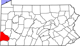
Location of Washington County in Pennsylvania
This is a list of the Pennsylvania state historical markers in Washington County.
This is intended to be a complete list of the official state historical markers placed in Washington County, Pennsylvania by the Pennsylvania Historical and Museum Commission (PHMC). The locations of the historical markers, as well as the latitude and longitude coordinates as provided by the PHMC's database, are included below when available. There are 53 historical markers located in Washington County.[1]
Historical markers
| Marker title | Image | Date dedicated | Location | Marker type | Topics |
|---|---|---|---|---|---|
| "Declaration and Address" | _1809.jpg) |
June 19, 1994 | 122 South Main Street, Washington 40°10′09″N 80°14′42″W / 40.16905°N 80.24487°W |
City | Religion |
| "S" Bridge | 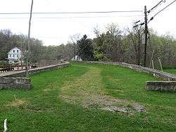 |
May 28, 1947 | National Road (US 40), at PA 221, 5 miles southwest of Washington 40°08′23″N 80°20′57″W / 40.1398°N 80.3491°W |
Roadside | Bridges, Roads, Transportation |
| 1948 Donora Smog | October 28, 1995 | Meldon Ave. (Pa. 837) at Fifth St., Donora 40°10′35″N 79°51′19″W / 40.1763°N 79.85538°W |
Roadside | Environment | |
| Augusta Town | May 28, 1947 | National Road (US 40), 3 miles southwest of Washington 40°09′06″N 80°18′58″W / 40.151533°N 80.316133°W |
Roadside | Government & Politics, Government & Politics 18th Century | |
| Bradford House | 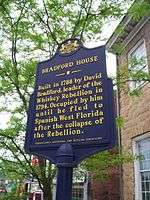 |
August 1, 1953 | 175 South Main Street, Washington 40°10′05″N 80°14′41″W / 40.16813°N 80.24475°W |
City | Buildings, Houses & Homesteads, Military, Whiskey Rebellion |
| Bradford House | 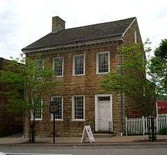 |
April 7, 1966 | At site, 175 South Main Street, Washington (retired) | Roadside | Buildings, Houses & Homesteads, Military, Whiskey Rebellion |
| California Boatyards | 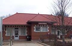 |
June 18, 1994 | Borough library (old railroad station), Wood Street, California 40°04′05″N 79°53′21″W / 40.06818°N 79.88927°W |
City | Business & Industry, Transportation |
| Capt. Philo McGiffin | 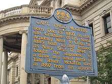 |
May 28, 1947 | County Courthouse, Main & Beau Streets, Washington 40°10′15″N 80°14′44″W / 40.1707°N 80.24558°W |
Roadside | Military, Military Post-Civil War |
| Cement City | October 4, 1997 | McKean Avenue (PA 837) & Chestnut Street, Donora 40°10′05″N 79°51′43″W / 40.16798°N 79.86203°W |
Roadside | Business & Industry, Labor | |
| Col. George Morgan | May 28, 1947 | Morganza Road and West McMurray Road, Canonsburg 40°16′25″N 80°09′30″W / 40.27352°N 80.15832°W |
Roadside | Government & Politics, Government & Politics 19th Century, Native American, Professions & Vocations | |
| Cross Creek Church | October 16, 1950 | Cross Creek Road & Vance Drive, east of PA 18, Cross Creek 40°19′47″N 80°24′45″W / 40.329600°N 80.412600°W |
Roadside | Ethnic & Immigration, Religion | |
| David Reed | May 9, 1950 | PA 50, 3 miles west of PA 980, near Venice 40°18′53″N 80°16′09″W / 40.31485°N 80.2692°W |
Roadside | Early Settlement, Ethnic & Immigration, George Washington | |
| Delvin G. Miller (1913-1996) | August 1, 2009 | Entrance to The Meadows Racetrack and Casino, 210 Racetrack Road, Washington 40°12′58″N 80°12′06″W / 40.21621°N 80.201794°W |
Roadside | Sports | |
| Doddridge's Fort | May 28, 1947 | Washington Pike (PA 844) at Sugar Run Road, 2.5 miles west of Middletown 40°14′54″N 80°28′20″W / 40.248467°N 80.472250°W |
Roadside | American Revolution, Military | |
| Edward Acheson | 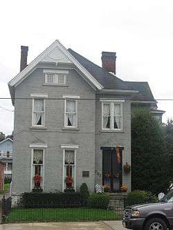 |
August 1, 1953 | Southwest corner of Main & Maiden Streets, Washington 40°10′04″N 80°14′42″W / 40.16773°N 80.24488°W |
City | Invention, Medicine & Science, Professions & Vocations |
| Elisha McCurdy | May 28, 1947 | SR 4004 (old US 22) near Pa. 18, Florence 40°25′55″N 80°26′09″W / 40.43207°N 80.4359°W |
Roadside | Religion | |
| Gantz Oil Well | 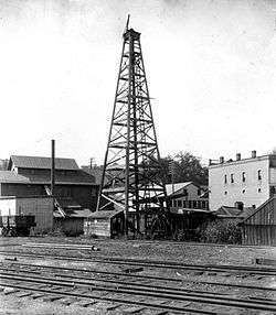 |
October 3, 1953 | West Chestnut Street at Brookside Avenue, Washington 40°10′16″N 80°15′20″W / 40.171117°N 80.255467°W |
City | Business & Industry, Oil & Gas |
| George Washington | 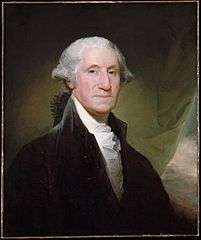 |
May 9, 1950 | Southview Road, north of PA 150, Venice 40°19′31″N 80°16′11″W / 40.3252°N 80.2697°W |
Roadside | Early Settlement, George Washington, Government & Politics, Government & Politics 18th Century |
| Globe Inn | 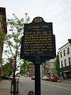 |
August 1, 1953 | 155 South Main Street, Washington 40°10′06″N 80°14′41″W / 40.168333°N 80.244717°W |
City | Buildings, Business & Industry, Roads, Inns & Taverns |
| Hill Church | 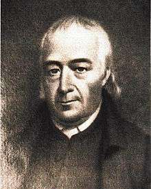 |
January 7, 1949 | US 19, 5 miles northeast of Washington (Missing) | Roadside | Buildings, Early Settlement, Religion |
| Hill's Tavern | June 1952 | US 40 and Fava Farm Road, Scenery Hill 40°05′10″N 80°04′13″W / 40.086067°N 80.070183°W |
Roadside | Buildings, Business & Industry, Roads, Inns & Taverns | |
| James G. Blaine | 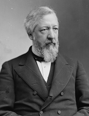 |
May 28, 1947 | 238 Main Street, West Brownsville 40°01′34″N 79°53′13″W / 40.026233°N 79.886967°W |
Roadside | Government & Politics, Government & Politics 19th Century |
| Jay Livingston (1915-2001) | October 7, 2004 | South McDonald Street (PA 980) and Panhandle Trail, McDonald 40°22′00″N 80°14′05″W / 40.36663°N 80.23478°W |
Roadside | Motion Pictures & Television, Music & Theater, Writers | |
| John K. Tener (1863-1946) | 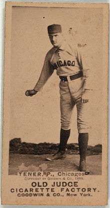 |
September 1, 1999 | 7th & Fallowfield Streets, Charleroi 40°08′24″N 80°14′05″W / 40.140096°N 80.23478°W |
Roadside | Baseball, Ethnic & Immigration, Government & Politics, Governors, Sports |
| John McMillan | |
January 7, 1949 | US 19 near PA 519, south of Canonsburg 40°14′31″N 80°10′41″W / 40.24192°N 80.17808°W |
Roadside | Education, Religion |
| Joseph A. "Jock" Yablonski (1910-1969) | November 4, 1995 | 3rd & Wood Streets, California 40°04′00″N 79°53′23″W / 40.06662°N 79.88982°W |
Roadside | Coal, Government & Politics 20th Century, Labor | |
| LeMoyne Crematory | 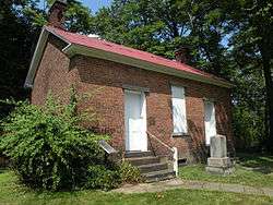 |
August 1, 1953 | Opposite 815 South Main Street, south end of Washington 40°09′38″N 80°14′16″W / 40.16057°N 80.23785°W |
City | Buildings, Business & Industry |
| LeMoyne House | 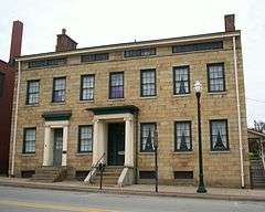 |
August 1, 1953 | 49 East Maiden Street, Washington 40°10′05″N 80°14′36″W / 40.16798°N 80.24327°W |
City | Buildings, Houses & Homesteads, Medicine & Science, Professions & Vocations |
| McDonald Oil Field | |
August 1, 1953 | At Heritage Park, PA 980 west of 6th Street, Washington 40°21′59″N 80°14′28″W / 40.366467°N 80.241067°W |
City | Buildings, Houses & Homesteads, Medicine & Science, Professions & Vocations |
| The McGugin Gas Well | January 6, 1967 | PA 18 northwest of Washington (MISSING) | Roadside | Business & Industry, Oil & Gas | |
| Meadowcroft Rockshelter | 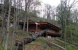 |
September 19, 1999 | 401 Meadowcroft Road, Avella 40°17′11″N 80°29′20″W / 40.28635°N 80.489°W |
Roadside | Native American |
| Miller's Blockhouse | May 28, 1947 | US 40, 3.5 miles west of Claysville 40°06′33″N 80°29′42″W / 40.109300°N 80.495000°W |
Roadside | American Revolution, Early Settlement, Forts, Military, Native American | |
| Mingo Creek Church | March 4, 1994 | PA 88 & Mingo Church Road, 2 miles south of Finleyville 40°13′49″N 79°59′45″W / 40.23015°N 79.99583°W |
Roadside | Military, Religion, Whiskey Rebellion | |
| Monongahela | May 28, 1947 | PA 136 at the Monogahela River Bridge (MISSING) | Roadside | Cities & Towns, Early Settlement, Transportation | |
| Monongahela |  |
May 28, 1947 | PA 136 at Chess Street, in small park 40°12′22″N 79°56′23″W / 40.20608°N 79.93975°W |
Roadside | Cities & Towns, Early Settlement, Transportation |
| Monongahela | May 28, 1947 | Main Street (PA 88) at 5th Street at Municipal Building, Monongahela 40°12′14″N 79°55′39″W / 40.2039°N 79.92763°W |
Roadside | Cities & Towns, Early Settlement, Transportation | |
| Monongahela | May 28, 1947 | PA 88 at 7th Street, in Monongahela's Chess Park 40°12′18″N 79°55′52″W / 40.2049°N 79.93118°W |
Roadside | Cities & Towns, Early Settlement, Transportation | |
| The Mounds | July 15, 1948 | Memorial Park, Mounds & Indiana Streets, Monongahela 40°11′55″N 79°55′57″W / 40.19855°N 79.93258°W |
City | Native American | |
| National Road |  |
April 1, 1949 | National Road (US 40), 3.6 miles southwest of Washington 40°09′00″N 80°19′41″W / 40.14998°N 80.32803°W |
Roadside | Government & Politics, Roads, Transportation |
| Ralston Thresher | May 28, 1947 | PA 844 at West Middletown 40°14′34″N 80°25′47″W / 40.242883°N 80.429733°W |
Roadside | Agriculture, Business & Industry, Invention | |
| Rebecca Harding Davis | 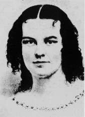 |
April 13, 2013 | Lincoln Street near Strawberry Alley, Washington & Jefferson College, Washington 40°10′10″N 80°14′27″W / 40.16931°N 80.24079°W |
City | Ethnic & Immigration, Labor, Women, Writers |
| Reverend John McMillan | |
n/a | Junction US 19 & PA 519, south of Canonsburg 40°14′31″N 80°10′41″W / 40.24202°N 80.17797°W |
Plaque | Education, Religion |
| Rice's Fort | 1973 | National Road (US 40) at Lake Road, 3.5 miles west of Claysville 40°07′16″N 80°28′27″W / 40.121000°N 80.474167°W |
Roadside | American Revolution, Forts, Military, Native American | |
| Toll House | March 14, 1947 | National Road (US 40), .8 mile west of Claysville (MISSING) | Roadside | Government & Politics 19th Century, Roads, Transportation | |
| Washington |  |
May 28, 1947 | Murtland Avenue (US 19) at North Avenue, northeast edge of Washington 40°10′50″N 80°14′09″W / 40.18047°N 80.23575°W |
Roadside | Cities & Towns, George Washington, Native American, Roads |
| Washington | 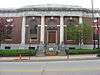 |
May 28, 1947 | US 40 W on ramp at junction of I-70 (MISSING) | Roadside | Cities & Towns, George Washington, Native American, Roads |
| Washington |  |
May 28, 1947 | National Road (US 40) near Coffey's Crossing Road (PA 526), west of Washington, near Finney 40°09′00″N 80°19′41″W / 40.15002°N 80.32797°W |
Roadside | Cities & Towns, George Washington, Native American, Roads |
| Washington |  |
May 28, 1947 | PA 136, East Beau Street @ Clare Drive, near Junction of I-70 and I-79 40°10′46″N 80°13′30″W / 40.179562°N 80.225137°W |
Roadside | Buildings, Cities & Towns, Early Settlement, George Washington, Native American, Transportation |
| Washington and Jefferson College | 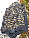 |
February 2, 1954 | At main building, opposite 27 College Avenue, and Beau Street between College and Lincoln, Washington 40°10′14″N 80°14′33″W / 40.1705°N 80.2426°W |
City | Education, George Washington |
| Washington and Jefferson College | |
February 2, 1954 | South College Street (US 19) south of East Beau Street (PA 136), Washington 40°10′15″N 80°14′34″W / 40.170717°N 80.242717°W |
City | Education, George Washington |
| Washington County | December 17, 1981 | County courthouse, Main Street & Cherry Way, Washington 40°10′13″N 80°14′43″W / 40.17015°N 80.24538°W |
City | George Washington, Government & Politics, Government & Politics 18th Century, Military, Roads, Whiskey Rebellion | |
| Whiskey Point | May 26, 1949 | Main Street (PA 136/88/837) between First Street & Park Avenue, Monongahela 40°12′01″N 79°55′21″W / 40.20015°N 79.92258°W |
Roadside | Government & Politics, Government & Politics 18th Century, Military, Whiskey Rebellion | |
| William Holmes McGuffey | 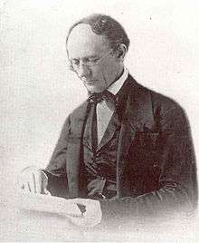 |
April 23, 1998 | National Road (US 40) at McGuffey High School/Middle School, just west of PA 221, east of Claysville 40°08′23″N 80°21′36″W / 40.139733°N 80.360133°W |
Roadside | Education, Professions & Vocations, Publishing, Writers |
| Wolff's Fort | May 28, 1947 | National Road (US 40), 3.3 miles southwest of Washington 40°09′02″N 80°19′24″W / 40.150558°N 80.323323°W |
Roadside | American Revolution, Early Settlement, Forts, Military |
See also
- List of Pennsylvania state historical markers
- National Register of Historic Places listings in Washington County, Pennsylvania
- Washington County History & Landmarks Foundation
References
- ↑ "PHMC Historical Markers Search" (Searchable database). Pennsylvania Historical and Museum Commission. Commonwealth of Pennsylvania. Retrieved 2010-07-19.
External links
| Counties |  Map of the Pittsburgh Tri-State with green counties in the metropolitan area and yellow counties in the combined area. | |
|---|---|---|
| Major cities | ||
| Cities and towns 15k-50k (in 2010) | ||
| Airports | ||
| Topics | ||
| ||

This article is issued from Wikipedia - version of the 4/23/2016. The text is available under the Creative Commons Attribution/Share Alike but additional terms may apply for the media files.