List of Pennsylvania state historical markers in Allegheny County
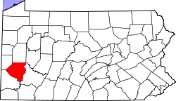
Location of Allegheny County in Pennsylvania
This is a list of the Pennsylvania state historical markers in Allegheny County.
This is intended to be a complete list of the official state historical markers placed in Allegheny County, Pennsylvania by the Pennsylvania Historical and Museum Commission (PHMC). The locations of the historical markers, as well as the latitude and longitude coordinates as provided by the PHMC's database, are included below when available. There are currently 148 historical markers located in Allegheny County.[1]
Historical markers
| Marker title | Image | Date dedicated | Location | Marker type | Topics |
|---|---|---|---|---|---|
| 1909 McKee's Rocks Strike | 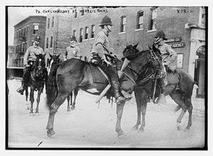 |
October 14, 2000 | 812 Island Avenue at McKees Rocks Bridge, Stowe Township 40°28′25″N 80°03′45″W / 40.47372°N 80.06258°W |
Roadside | Labor |
| 1st Drive-In Filling Station | 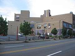 |
July 11, 2000 | Near intersection of Baum Boulevard & St. Clair Streets, East Liberty/Friendship (Pittsburgh) 40°27′34″N 79°55′50″W / 40.45934°N 79.93066°W |
City | Business & Industry, Oil & Gas, Transportation |
| Allegheny Arsenal | 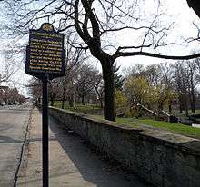 |
June 1, 1967 | 40th Street near Davidson at Arsenal Park, opposite #257, Lawrenceville 40°28′02″N 79°57′38″W / 40.46719°N 79.9605°W |
City | Civil War, French & Indian War, Military |
| Allegheny Cotton Mill Strikes | October 1, 2007 | Allegheny Landing, near Allegheny River between Roberto Clemente (6th Street) & Andy Warhol (7th Street) Bridges, North Shore (Pittsburgh) 40°26′49″N 80°00′09″W / 40.44706°N 80.00258°W |
City | Government & Politics 19th Century, Labor, Mills | |
| Allegheny County | 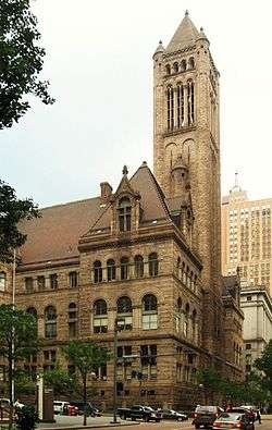 |
December 30, 1982 | County Courthouse (courtyard), Grant Street between 5th & Forbes Avenues, Pittsburgh 40°26′19″N 79°59′47″W / 40.438673°N 79.996396°W |
City | Business & Industry, Government & Politics, Government & Politics 18th Century, Iron, Steel |
| Allegheny Observatory | 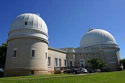 |
November 2, 1979 | Riverview Avenue in Riverview Park (off US 19) near Observatory, Observatory Hill, Pittsburgh 40°28′58″N 80°01′06″W / 40.48274°N 80.01831°W |
City | Education, Medicine & Science, Transportation |
| Andrew Carnegie (1835-1919) |  |
April 18, 1996 | Carnegie Museum of Natural History, 4400 Forbes Avenue (Schenley Drive Extension), Oakland (Pittsburgh) 40°26′34″N 79°57′06″W / 40.44277°N 79.95168°W |
City | Business & Industry, Education, Ethnic & Immigration, Professions & Vocations, Steel |
| Art Blakey (1919-1990) | 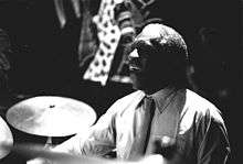 |
August 26, 2007 | 617 Chauncey Street, Hill District (Pittsburgh) 40°26′52″N 79°58′25″W / 40.4479°N 79.97358°W |
City | African American, Music & Theater, Performers |
| Arthur J. Rooney (1901-1988) | June 3, 2005 | Tourman Street & Coulterville Road, Coulter 40°17′45″N 79°47′57″W / 40.295967°N 79.799300°W |
Roadside | Ethnic & Immigration, Football, Sports | |
| August Wilson (1945-2005) | 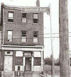 |
May 30, 2007 | 1727 Bedford Ave., Hill District (Pittsburgh) 40°26′43″N 79°59′08″W / 40.44521°N 79.98542°W |
Roadside | African American, Music & Theater, Writers |
| Avery College | January 1, 1968 | 621 East Ohio Street, North Side (Pittsburgh) 40°27′14″N 79°59′54″W / 40.453833°N 79.998363°W |
City | African American, Education, Religion | |
| Barney Dreyfuss (1865-1932) |  |
June 30, 2005 | Posvar Hall, Roberto Clemente & Schenley Drives, University of Pittsburgh, Oakland section 40°26′30″N 79°57′11″W / 40.4416°N 79.95296°W |
City | Baseball, Entrepreneurs, Sports |
| Bethel A.M.E. Church |  |
September 24, 1995 | 405 1st Avenue, at Smithfield Street, Pittsburgh 40°26′14″N 80°00′02″W / 40.43716°N 80.0005°W |
City | African American, Civil Rights, Education, Religion |
| Bethel Presbyterian Church |  |
August 21, 1951 | 2999 Bethel Church Road between PA 88 & US 19, Bethel Park 40°20′11″N 80°02′53″W / 40.336476°N 80.047926°W |
Roadside | Buildings, Education, Religion |
| Billy Eckstine (1914-1993) | July 31, 1994 | 5917 Bryant Street, Highland Park (Pittsburgh) 40°28′32″N 79°55′09″W / 40.475567°N 79.919250°W |
City | African American, Performers | |
| Bost Building |  |
July 7, 1992 | 617-623 East 8th Avenue near Heisel Street, Homestead 40°24′33″N 79°54′16″W / 40.409039°N 79.904394°W |
City | Buildings, Iron, Labor, Publishing, Steel |
| Bouquet Camp | December 21, 1946 | Saltsburg Road (PA 380) & Frankstown Avenue (Petermans Corner), Penn Hills Twp 40°29′03″N 79°49′09″W / 40.48414°N 79.81905°W |
Roadside | Forts, French & Indian War, Military, Roads | |
| Bower Hill | August 23, 1996 | 292 Kane Boulevard, Scott Twp., NE of Bridgeville 40°22′28″N 80°05′10″W / 40.37434°N 80.08614°W |
Roadside | African American, American Revolution, George Washington, Mansions & Manors, Military, Whiskey Rebellion | |
| Braddock's Crossing | August 24, 1964 | Hoffman & Kennywood (PA 837) Boulevards at Kennywood Park, West Mifflin 40°23′07″N 79°51′47″W / 40.38524°N 79.86292°W |
Roadside | French & Indian War, Military, Native American | |
| Braddock's Defeat |  |
February 28, 1948 | 549 Jones Avenue, Washington Statue Park, Braddock 40°24′11″N 79°51′48″W / 40.40296°N 79.86343°W |
Roadside | Forts, French & Indian War, Military, Native American |
| Braddock's Defeat | |
February 28, 1948 | US 30, north side, S of I-376 exit 10, Forest Hills (Missing) |
Roadside | French & Indian War, Military, Native American |
| Braddock's Field | September 12, 1994 | 549 Jones Avenue, Washington Statue Park, Braddock 40°24′11″N 79°51′48″W / 40.403006°N 79.863265°W |
Roadside | Government & Politics, Military, Whiskey Rebellion | |
| Carnegie Hero Fund Commission | 1995 | 301 Pittsburgh Street (SR 1001, old PA 28), across from Washington Street, Springdale 40°32′28″N 79°47′26″W / 40.54106°N 79.79061°W |
Roadside | Business & Industry | |
| Carnegie Library of Homestead Swim Team |  |
August 14, 2004 | Homestead Library, 510 East 10th Avenue, Munhall 40°24′26″N 79°54′11″W / 40.40733°N 79.90314°W |
City | Sports, Women |
| Charles Martin Hall (1863-1914) |  |
March 1, 1998 | 3200 Smallman St., Pittsburgh 40°27′42″N 79°58′15″W / 40.461581°N 79.9707°W |
City | Business & Industry, Electricity, Entrepreneurs, Invention |
| Charles Taze Russell (1852-1916) | 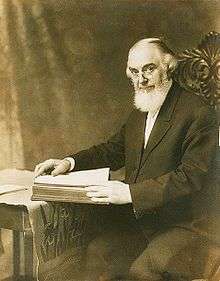 |
May 8, 2000 | Allegheny Center, East Commons, at New Hazlett Theater (formerly Carnegie Hall), Pittsburgh 40°27′10″N 80°00′18″W / 40.45274°N 80.00488°W |
City | Buildings, Houses & Homesteads, Religion |
| Chartier's Town | December 19, 1946 | PA 28 at Tarentum (Missing) |
City | Business & Industry, Cities & Towns, Early Settlement, Native American | |
| Clinton Furnace |  |
September 2, 2004 | Bessemer Court at Station Square, Pittsburgh 40°26′03″N 80°00′16″W / 40.434284°N 80.004582°W |
Roadside | Business & Industry, Furnaces, Iron |
| Crawford Grill | 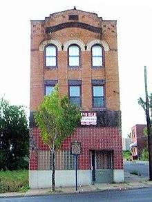 |
April 7, 2001 | Wylie Avenue at Elmore Street, Pittsburgh 40°26′44″N 79°58′41″W / 40.445503°N 79.977943°W |
City | African American, Music & Theater |
| Daisy E. Lampkin | August 8, 1993 | 2519 Webster Avenue at Watt Lane, Hill District (Pittsburgh) 40°27′00″N 79°58′19″W / 40.44991°N 79.97201°W |
City | African American, Government & Politics, Government & Politics 20th Century, Women | |
| David L. Lawrence | February 28, 1985 | Point State Park, Pittsburgh (Missing) |
City | Government & Politics, Government & Politics 19th Century, Governors | |
| Davis Island Lock & Dam | 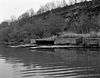 |
July 4, 1987 | 1050 Ohio River Blvd. (PA 65) at E borough line, at Eat 'n' Park, Avalon 40°29′38″N 80°03′51″W / 40.494°N 80.06416°W |
Roadside | Environment |
| Dravo Corporation Shipyard | 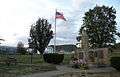 |
August 18, 1995 | 5500 Grand Avenue, at Memorial Park, beside fire station, Neville Island 40°30′43″N 80°07′47″W / 40.51182°N 80.12971°W |
Roadside | Business & Industry, Entrepreneurs |
| Duquesne Steel Works | October 12, 1997 | East Grant Avenue & Linden Street (PA 837), Duquesne 40°22′27″N 79°50′33″W / 40.37407°N 79.84241°W |
City | Business & Industry, Entrepreneurs | |
| Duquesne University | 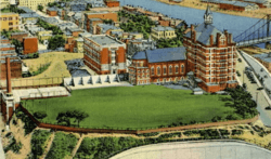 |
October 5, 1978 | Bluff Street at University Administration Building, Pittsburgh 40°26′08″N 79°59′34″W / 40.4355°N 79.99285°W |
City | Education, Ethnic & Immigration, Religion |
| Elizabeth | 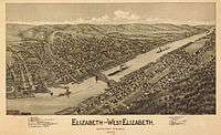 |
December 20, 1946 | Between exit ramp of PA 51 and Elizabeth Bridge, Elizabeth 40°16′21″N 79°53′06″W / 40.2724°N 79.88489°W |
Roadside | Business & Industry, Transportation |
| Ethelbert Nevin | 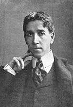 |
May 7, 1948 | Ohio River Boulevard (PA 65) at Edgeworth Lane, east side, Edgeworth 40°32′57″N 80°11′48″W / 40.54917°N 80.19664°W |
Roadside | Music & Theater, Writers |
| Ethelbert Nevin | 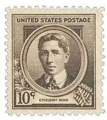 |
May 7, 1948 | Ohio River Boulevard (PA 65), west side, at Edgeworth Lane (MISSING) |
Roadside | Music & Theater |
| Ferris Wheel Inventor | 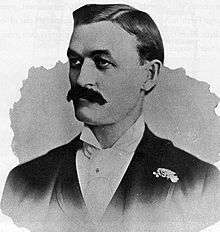 |
1967 | West Commons, Arch Street near South Diamond (MARKER NOT YET REINSTALLED) |
City | George Washington, Invention, Professions & Vocations, Sports |
| First Aluminum Observatory Dome | June 27, 1998 | Between West View Avenue & McKnight Road (Truck US 19), Ross Township 40°29′59″N 80°00′46″W / 40.499846°N 80.012819°W |
Roadside | Education, Environment, Invention, Medicine & Science | |
| First Mining of Pittsburgh Coal |  |
April 18, 1985 | Grandview Avenue between Ulysses & Bertha Streets, Mt. Washington (Pittsburgh) 40°26′04″N 80°00′41″W / 40.43438°N 80.01127°W |
City | Business & Industry, Coal |
| First Professional Football Game | 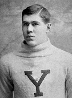 |
November 3, 1992 | North Shore Drive & Art Rooney Drive, near Heinz Field, North Shore (Pittsburgh) 40°26′44″N 80°00′49″W / 40.44546°N 80.0137°W |
Roadside | Football, Sports |
| First World Series |  |
September 18, 1998 | Riverwalk near PNC Park and the water steps, North Shore (Pittsburgh) 40°26′43″N 80°00′33″W / 40.445401°N 80.009171°W |
Roadside | Baseball, Sports |
| Forbes Field | 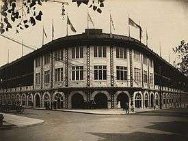 |
July 7, 2006 | 3950 Roberto Clemente Drive near South Bouquet Street, by remaining Forbes Field wall, Pitt campus, Oakland (Pittsburgh) 40°26′29″N 79°57′10″W / 40.44146°N 79.95282°W |
Roadside | Baseball, Football, Sports |
| Forbes Road (Bouquet's Breastworks) | July 9, 1952 | Old Frankstown Road, at Boyce Park Administration Building, Monroeville 40°27′36″N 79°45′10″W / 40.45997°N 79.7528°W |
Roadside | French & Indian War, Military | |
| Forbes Road, 1758, Fort Bedford to Fort Duquesne - Fort Duquesne End (PLAQUE) | 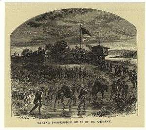 |
1930 | Point State Park, between Fort Pitt Museum & Blockhouse, Pittsburgh 40°26′28″N 80°00′35″W / 40.44109°N 80.00967°W |
Plaque | Forts, French & Indian War, Military, Roads |
| Forbes Road, 1758, Fort Bedford to Fort Duquesne - The Bouquet Encampment (PLAQUE) | 1930 | PA 380 (Saltsburg & Frankstown Roads), Petermans Corner, Penn Hills Township 40°29′03″N 79°49′09″W / 40.4842°N 79.81918°W |
Plaque | French & Indian War, Military, Roads | |
| Fort Duquesne | 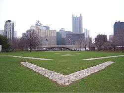 |
May 8, 1959 | Point State Park, main entrance at Commonwealth Place, Pittsburgh (MISSING) |
City | Forts, French & Indian War, Military |
| Fort Lafayette |  |
December 1, 1958 | 9th Street just north of Penn Avenue, Pittsburgh 40°26′37″N 79°59′54″W / 40.4437°N 79.99834°W |
City | Forts, Military, Native American, War of 1812 |
| Fort Pitt |  |
May 8, 1959 | Point State Park, main entrance Commonwealth Place, Pittsburgh (MISSING) |
City | Forts, French & Indian War, Military |
| Fort Pitt Blockhouse | 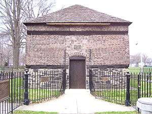 |
May 8, 1959 | Point State Park, main entrance Commonwealth Place, Pittsburgh (MISSING) |
City | Forts, French & Indian War, Military |
| Fort Prince George | May 8, 1959 | Point State Park, main entrance Commonwealth Place, Pittsburgh (MISSING) |
City | Forts, French & Indian War, George Washington, Military | |
| Founding Convention of the AFL |  |
September 24, 1997 | Northwest corner of Mellon Park, between 5th & 6th Streets, opposite William Penn Hotel, Pittsburgh 40°26′27″N 79°59′51″W / 40.4409°N 79.9975°W |
City | Labor |
| Founding Convention of the CIO | September 23, 1997 | North Commons Drive, at MLK Elementary, near Allegheny Center, Pittsburgh 40°27′16″N 80°00′16″W / 40.45433°N 80.00448°W |
City | Labor | |
| Founding of Ironworkers Union | May 22, 1999 | At Firstside Park, Grant Street, between Boulevard of the Allies and 1st Avenue, Pittsburgh 40°26′12″N 79°59′55″W / 40.43665°N 79.99854°W |
City | Iron, Labor | |
| Frances Perkins | 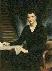 |
October 4, 2003 | Southwest corner of 9th Avenue & Amity Street, at police station, Homestead 40°24′23″N 79°54′37″W / 40.40628°N 79.91019°W |
City | Government & Politics 20th Century, Labor, Steel, Women |
| Frank Conrad (1874-1941) |  |
December 1, 1990 | PA 8 (Penn Avenue) & South Trenton Avenue, Wilkinsburg 40°26′45″N 79°53′29″W / 40.445818°N 79.891436°W |
City | Business & Industry, Entrepreneurs |
| Frank E. Bolden (1912-2003) | September 30, 2004 | 2621 Centre Avenue, across from YMCA, Hill District (Pittsburgh) 40°26′48″N 79°58′04″W / 40.4468°N 79.96774°W |
City | African American, Military Post-Civil War, Publishing, Writers | |
| Frank Vittor (1888-1968) |  |
October 12, 2008 | At Columbus statue in Schenley Park, Schenley Drive & Frew Street Extension, Oakland (Pittsburgh) 40°26′26″N 79°56′54″W / 40.440433°N 79.948300°W |
Roadside | Artists, Ethnic & Immigration |
| Gen. Matthew B. Ridgway (1895-1993) | 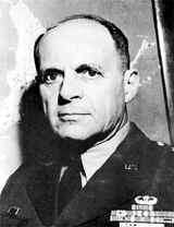 |
November 6, 1999 | Fox Chapel High School, 611 Field Club Road, Fox Chapel 40°31′04″N 79°52′03″W / 40.51775°N 79.86756°W |
Roadside | Military, Military Post-Civil War |
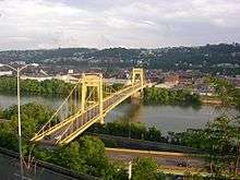
| George Westinghouse | 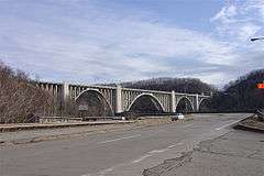 |
May 7, 1948 | US 30 at west end of George Westinghouse Bridge over Turtle Creek, Turtle Creek 40°23′42″N 79°50′20″W / 40.39487°N 79.83875°W |
Roadside | Business & Industry, Electricity, Entrepreneurs, Invention |
| George Westinghouse | 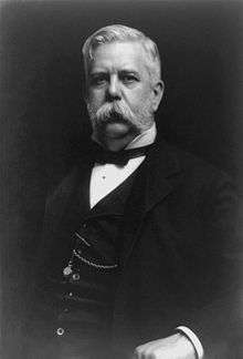 |
December 23, 1946 | US 30 at east end of George Westinghouse Bridge over Turtle Creek, Turtle Creek (MISSING) |
Roadside | Business & Industry, Electricity, Entrepreneurs, Invention |
| Great Steel Strike of 1919, The | 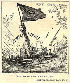 |
September 23, 1994 | Braddock Avenue at 14th Street, across from Edgar Thompson Works, Braddock 40°23′55″N 79°51′44″W / 40.39852°N 79.8622°W |
City | Government & Politics, Labor, Steel |
| Greenlee Field | July 17, 2009 | Bedford Avenue & Junilla Street, Hill District (Pittsburgh) 40°27′02″N 79°58′23″W / 40.4506°N 79.973°W |
City | African American, Football, Sports | |
| Hand's Hospital | December 24, 1946 | PA 60 (West Steuben Street) at Linden Street, across from Crafton Park, Crafton 40°26′21″N 80°04′24″W / 40.43913°N 80.07339°W |
Roadside | French & Indian War, Military | |
| Heidelberg Raceway and Sports Arena | July 15, 2012 | Washington Pike (PA 50), in front of King's Restaurant, Heidelberg 40°23′15″N 80°05′29″W / 40.387450°N 80.091450°W |
City | Performers, Railroads, Sports & Recreation | |
| Helen Richey (1909-1947) | 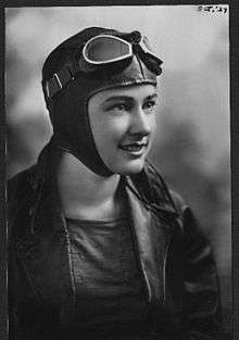 |
October 1, 2002 | Renzie Park, Eden Park Boulevard & Tulip Drive, McKeesport 40°20′26″N 79°49′38″W / 40.34063°N 79.82724°W |
Roadside | Education, Military, Military Post-Civil War, Professions & Vocations, Transportation, Women |
| Henry Clay Frick (1848-1919) | 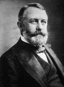 |
December 10, 1946 | Grant Street near 5th Avenue, in median at Frick Bldg., Pittsburgh 40°26′21″N 79°59′49″W / 40.43928°N 79.996884°W |
City | Business & Industry, Coal |
| Henry J. Heinz (1844-1919) |  |
September 14, 1994 | Chestnut & Progress Streets, North Side (Pittsburgh) 40°27′12″N 79°59′34″W / 40.453317°N 79.992673°W |
City | Business & Industry, Entrepreneurs |
| Homestead Grays, The |  |
September 27, 2000 | Amity Street at The Waterfront, at parking lot and railroad tracks, Homestead 40°24′33″N 79°54′44″W / 40.409218°N 79.912121°W |
Roadside | African American, Baseball, Sports |
| Homestead Strike |  |
July 1, 1992 | 880 East Waterfront Drive, Munhall 40°24′46″N 79°53′50″W / 40.41285°N 79.89711°W |
City | Government & Politics, Labor |
| Homestead Strike Victims | July 11, 1993 | At Cemetery, 102 East 22nd & Dewey Streets, Munhall 40°23′51″N 79°54′07″W / 40.39762°N 79.9019°W |
Roadside | Labor | |
| Honus Wagner (1874-1955) | .JPG) |
August 29, 1998 | Mansfield Boulevard & Chartiers Street, Carnegie 40°24′26″N 80°05′20″W / 40.407281°N 80.088843°W |
Roadside | Baseball, Ethnic & Immigration, Sports |
| James Hay Reed | December 1, 1958 | Carnegie Science Center (south of North Commons), North Side (Pittsburgh) 40°27′12″N 80°00′21″W / 40.45321°N 80.00587°W |
City | Business & Industry, Professions & Vocations | |
| Jane Grey Swisshelm | 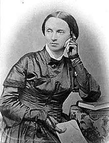 |
September 14, 1959 | South Braddock Avenue & New Street, Edgewood, just north of I-376 exit 77 40°25′43″N 79°53′29″W / 40.42867°N 79.89134°W |
Roadside | Civil Rights, Civil War, Medicine & Science, Women, Writers |
| Jane Holmes (1805-1885) | May 29, 2007 | Western PA School for Blind Children, Bayard Street at North Bellefield Avenue, Schenley Farms (Pittsburgh) 40°26′54″N 79°57′11″W / 40.44823°N 79.95295°W |
City | Women | |
| John A. Roebling (1806-1869) | 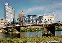 |
1996 | Smithfield Street Bridge, Station Square (Pittsburgh) 40°26′00″N 80°00′12″W / 40.43335°N 80.00328°W |
City | Bridges, Transportation |
| John M. Phillips (1861-1953) | October 31, 2009 | St. Pius X Byzantine Catholic Church, 2336 Brownsville Road, Pittsburgh 40°23′18″N 79°59′07″W / 40.3884°N 79.9852°W |
City | Government & Politics 19th Century, Government & Politics 20th Century, Professions & Vocations | |
| John Scull (1765-1828) | December 1, 1958 | Boulevard of the Allies, just west of Market Street, Pittsburgh 40°26′20″N 80°00′14″W / 40.43902°N 80.00376°W |
City | Business & Industry, Professions & Vocations, Publishing | |
| John T. Comès (1873-1922) | January 27, 2013 | St. Agnes Center at Carlow University, 3219 5th Avenue, Oakland (Pittsburgh) 40°21′02″N 79°52′04″W / 40.350572°N 79.86764°W |
City | Buildings & Architecture, Professions & Vocations, Religion, Writers | |
| Johnny Unitas (1933-2002) | 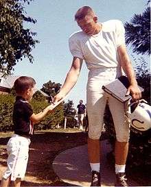 |
September 4, 2004 | Arsenal Middle School Field, Butler & 40th Streets, Lawrenceville 40°28′06″N 79°57′46″W / 40.46827°N 79.96268°W |
City | Football, Sports |
| Joshua (Josh) Gibson (1911-1947) | September 23, 1996 | 2217 Bedford Avenue, Hill District (Pittsburgh) 40°26′55″N 79°58′39″W / 40.44861°N 79.97754°W |
City | African American, Baseball, Sports | |
| Joshua Meeks (1731-1818) |  |
May 7, 2008 | Beaver Grade Road at entrance to Forest Glen Condos, Moon Township 40°30′35″N 80°12′44″W / 40.509622°N 80.212178°W |
Roadside | American Revolution, Early Settlement, Education, Government & Politics 18th Century, Military |
| K. Leroy Irvis (1916-2006) | April 3, 2008 | 2170 Centre Avenue, Hill District (Pittsburgh)(MISSING) |
Roadside | African American, Civil Rights, Education, Government & Politics 20th Century, Labor | |
| Kennedy-Nixon Taft-Hartley Debate | June 23, 2012 | 5th Avenue at Market Street (PA 148), McKeesport 40°21′02″N 79°52′04″W / 40.350572°N 79.86764°W |
City | Politics, Labor Unions | |
| Kennywood Park | 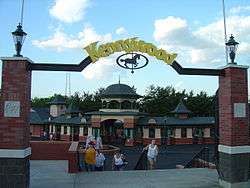 |
August 5, 1992 | Just outside North Gate Entrance from parking lot, West Mifflin 40°23′09″N 79°51′56″W / 40.3857°N 79.86564°W |
Roadside | Sports |
| Kier Refinery | March 16, 1959 | Small park near Chatham/Bigelow Square, between Bigelow Boulevard & 7th Avenue, Pittsburgh 40°26′29″N 79°59′39″W / 40.44145°N 79.99405°W |
City | Business & Industry, Entrepreneurs | |
| Kuskusky Path |  |
August 24, 2008 | 2500 Brandt School Road, at Trinity Lutheran Church, Wexford (Franklin Park) 40°36′07″N 80°04′49″W / 40.601906°N 80.080242°W |
Roadside | Early Settlement, Military, Native American, Paths & Trails, Transportation |
| Lewis and Clark Expedition | 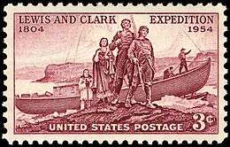 |
August 28, 2008 | 1 block north of 10th Street Bypass & Waterfront Drive intersection, Pittsburgh 40°26′49″N 79°59′43″W / 40.447°N 79.9952°W |
City | Exploration |
| Martha Graham (1894-1991) | 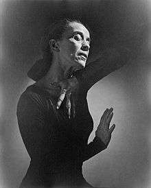 |
June 7, 2008 | California Avenue & Brighton Road North Side (Pittsburgh) (Pittsburgh) 40°27′34″N 80°01′01″W / 40.459427°N 80.016865°W |
City | Education, Music & Theater, Performers, Women |
| Martin R. Delany (1812-1885) |  |
May 11, 1995 | 5 PPG Place, 3rd Avenue & Market Street, Pittsburgh 40°26′22″N 80°00′12″W / 40.43948°N 80.00325°W |
City | African American, Civil War, Military, Professions & Vocations, Publishing |
| Mary Cassatt (1844-1926) | 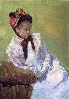 |
May 22, 2004 | Allegheny and Ridge Avenues, in park, Allegheny Avenue & I-376 on-ramp, North Side (Pittsburgh) 40°26′58″N 80°01′05″W / 40.44937°N 80.01809°W |
City | Artists, Women |
| Mary Harris "Mother" Jones | 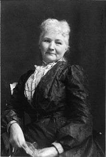 |
October 4, 2003 | Northeast corner of 9th and Amity Streets, (at former municipal building), Homestead 40°24′24″N 79°54′37″W / 40.40654°N 79.91016°W |
City | Government & Politics 20th Century, Labor, Steel, Women |
| Mary Lou Williams (1910-1981) |  |
November 30, 1996 | Lincoln Elementary School, Frankstown Road, Larimer (Pittsburgh) 40°27′36″N 79°54′44″W / 40.46°N 79.91209°W |
City | African American, Music & Theater, Performers, Women |
| McClurg Iron Foundry | May 16, 2016 | Fifth Avenue, just west of Smithfield Street (Pittsburgh) 40°26′25″N 79°59′56″W / 40.440252°N 79.998955°W |
City | Buildings, Business & Industry, Military, War of 1812 | |
| McKees Rocks Mound |  |
May 18, 2002 | Rangers Field, Shingiss & Sproul Streets. The Bottoms, McKees Rocks 40°28′23″N 80°03′06″W / 40.47301°N 80.05156°W |
City | Native American |
| Mercy Hospital |  |
May 27, 1994 | 1400 Locust Street, Pittsburgh 40°26′12″N 79°59′06″W / 40.43665°N 79.98489°W |
City | Education, Professions & Vocations, Religion, Women |
| Michael A. Musmanno (1897-1968) | October 11, 1993 | 1321 Island Avenue (PA 51), Stowe Township 40°28′57″N 80°04′12″W / 40.48241°N 80.06998°W |
Roadside | Government & Politics, Government & Politics 20th Century, Writers | |
| Monongahela River Navigation System | June 18, 2012 | Elizabeth Lock & Dam, Bunola River Road, Elizabeth 40°15′45″N 79°54′01″W / 40.262597°N 79.900161°W |
Roadside | Business & Industry, Coal, Government & Politics 19th Century, Iron & Steel, Navigation, Transportation | |
| Mooncrest |  |
April 15, 2004 | Mooncrest Drive at Old Thorn Run Road, Moon Twp. 40°31′18″N 80°11′28″W / 40.521625°N 80.191103°W |
City | Business & Industry, Government & Politics 20th Century, Labor, Military, Military Post-Civil War |
| National Negro Opera Company |  |
September 25, 1994 | 7101 Apple Street, Homewood (Pittsburgh) 40°27′51″N 79°53′45″W / 40.4642°N 79.89571°W |
City | African American, Music & Theater |
| National Tube Works | January 15, 1991 | 575 Lysle Boulevard (PA 148), at subway entrance to plant, McKeesport 40°21′08″N 79°51′37″W / 40.35215°N 79.8604°W |
City | Business & Industry, Oil & Gas | |
| Neville House |  |
August 12, 1947 | PA 50 just south of Woodville, Heidelberg 40°22′46″N 80°05′46″W / 40.37939°N 80.09621°W |
Roadside | American Revolution, Houses & Homesteads, Military, Whiskey Rebellion |
| Old St. Luke's Church |  |
July 14, 2001 | 330 Old Washington Pike & Church Street, Scott Township 40°23′04″N 80°05′26″W / 40.38449°N 80.09067°W |
Roadside | Buildings, Early Settlement, French & Indian War, Military, Religion, Whiskey Rebellion |
| Pennsylvania Canal | December 1, 1958 | Liberty Avenue at 11th Street (at the Pennsylvanian), Pittsburgh 40°26′38″N 79°59′34″W / 40.44398°N 79.99289°W |
City | Canals, Navigation, Transportation | |
| Pioneer Short-Wave Station | November 2, 1997 | Barclay Avenue, off Greensburg Pike, Forest Hills 40°25′06″N 79°50′29″W / 40.41831°N 79.84138°W |
City | Business & Industry | |
| Pittsburgh |  |
December 21, 1946 | PA 51 at south city line, near Stewart Avenue (MISSING) |
Roadside | Cities & Towns, Early Settlement, Forts, Government & Politics, Steel |
| Pittsburgh |  |
December 18, 1946 | 4675 Steubenville Pike (PA 60) at West Steuben Street, at bridge and Sharp Edge Creekhouse restaurant, Thornburg 40°26′25″N 80°04′50″W / 40.44041°N 80.08066°W |
Roadside | Cities & Towns, Early Settlement, Forts, Government & Politics, Steel |
| Pittsburgh |  |
December 23, 1946 | PA 65 (Ohio River Boulevard), north city line (MISSING) |
Roadside | Cities & Towns, Early Settlement, Forts, Government & Politics, Steel |
| Pittsburgh |  |
December 18, 1946 | US 30 (Ardmore Boulevard) westbound at park, Forest Hills 40°25′26″N 79°51′27″W / 40.423907°N 79.857575°W --> |
Roadside | Cities & Towns, Early Settlement, Forts, Government & Politics, Steel |
| Pittsburgh |  |
December 18, 1946 | PA 8 & PA 28, Millvale (MISSING) |
Roadside | Cities & Towns, Early Settlement, Forts, Government & Politics, Steel |
| Pittsburgh |  |
December 21, 1946 | Perrysville Road (US 19), near St. Benedict's Academy, north of city line (MISSING) |
Roadside | Cities & Towns |
| Pittsburgh |  |
December 18, 1946 | PA 65 at north city line (MISSING) |
Roadside | Cities & Towns |
| Pittsburgh | December 18, 1946 | US 19 north of city line (MISSING) |
Roadside | Cities & Towns | |
| Pittsburgh Agreement (The) | May 31, 2001 | Penn Avenue & 7th Street, Pittsburgh 40°26′35″N 80°00′01″W / 40.44312°N 80.000314°W |
City | Ethnic & Immigration, Government & Politics 20th Century | |
| Pittsburgh Glass Works | October 2, 1997 | Foot of Duquesne Incline, West Carson Street, Pittsburgh 40°26′23″N 80°01′03″W / 40.43986°N 80.0174°W |
City | Business & Industry, Glass | |
| Pittsburgh Grease Plant | September 18, 2000 | 33rd Street & Smallman Street, Strip District (Pittsburgh) 40°27′45″N 79°58′09″W / 40.46258°N 79.96909°W |
City | Business & Industry, Military, Military Post-Civil War, Oil & Gas, Transportation | |
| Pittsburgh Plate Glass Company |  |
October 19, 1983 | Plaza of PPG Place, between 4th Avenue & Market Square, Pittsburgh 40°26′25″N 80°00′10″W / 40.44017°N 80.00288°W |
City | Business & Industry, Glass |
| Pittsburgh Platform | October 10, 2007 | Stockton Avenue at Concordia Club, East Park (North Side), Pittsburgh 40°27′03″N 80°00′07″W / 40.4509°N 80.0019°W |
City | Religion | |
| Polish Army |  |
April 3, 1960 | Polish Falcons, 97 South 18th Street, South Side Flats (Pittsburgh) 40°25′41″N 79°58′49″W / 40.428158°N 79.980289°W |
City | Ethnic & Immigration, Military, Military Post-Civil War |
| Presston | August 22, 2009 | Ohio & Center Streets, Presston, Stowe Township 40°28′58″N 80°03′46″W / 40.482711°N 80.062904°W |
Roadside | Ethnic & Immigration, Government & Politics 20th Century, Labor, Steel | |
| Queen Aliquippa | October 26, 2003 | 2928 Highland Avenue, Highland Grove Park, near 2918 Bowman Avenue, McKeesport 40°21′35″N 79°50′00″W / 40.35983°N 79.83326°W |
Roadside | French & Indian War, George Washington, Government & Politics 18th Century, Military, Native American, Women | |
| Rachel Carson |  |
May 20, 1988 | Pittsburgh Street at Colfax Street, Springdale 40°32′28″N 79°47′02″W / 40.54105°N 79.78399°W |
City | Environment, Medicine & Science, Women, Writers |
| Radio Station KDKA | 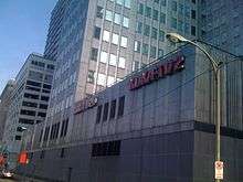 |
November 30, 1990 | KDKA Headquarters, 1 Gateway Center, Pittsburgh 40°26′33″N 80°00′20″W / 40.44255°N 80.00543°W |
City | Business & Industry |
| Railroad Strike of 1877 | 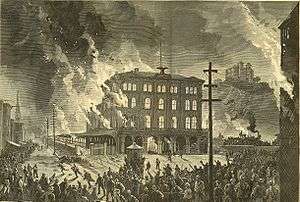 |
September 23, 1997 | Liberty Avenue at 28th Street (on traffic island), Strip District (Pittsburgh) 40°27′22″N 79°58′30″W / 40.45618°N 79.97491°W |
City | Labor, Railroads, Transportation |
| Robert Lee Vann (1879-1940) | July 13, 1997 | Center Avenue, at Francis Street, Hill District (Pittsburgh) 40°26′49″N 79°58′03″W / 40.447057°N 79.967413°W |
City | African American, Government & Politics, Government & Politics 20th Century, Professions & Vocations, Publishing | |
| Salk Polio Vaccine |  |
April 12, 2005 | Salk Hall, University of Pittsburgh, Terrace Street at Sutherland Drive (across from Peterson Events Ctr.), Oakland (Pittsburgh) 40°26′34″N 79°57′44″W / 40.442763°N 79.96209°W |
Roadside | Invention, Medicine & Science |
| Shadyside Iron Furnace | December 1, 1958 | Southeast corner of Bayard Street & Amberson Avenue, at Winchester-Thurston High School field, Shadyside (Pittsburgh) 40°27′08″N 79°56′30″W / 40.4521°N 79.94173°W |
City | Business & Industry, Furnaces, Iron | |
| Shannopin Town | December 1, 1958 | 40th Street Bridge (west side), Lawrenceville (Pittsburgh) 40°28′10″N 79°57′49″W / 40.46953°N 79.96358°W |
City | Early Settlement, Native American | |
| Shousetown Boatyard | June 14, 1987 | McGovern Boulevard (PA 51) near Spring Run Road, Honor Roll Park, across from fire department, Glenwillard/Crescent Township 40°33′26″N 80°13′15″W / 40.55716°N 80.22081°W |
City | Business & Industry, Transportation | |
| Sisters of Mercy | December 21, 1993 | 800 Penn Avenue, Cultural District, (Pittsburgh) 40°26′36″N 79°59′57″W / 40.443448°N 79.999158°W |
City | Ethnic & Immigration, Religion, Women | |
| Site of the Western Penitentiary - PLAQUE |  |
1931 | Eagle enclosure at the National Aviary, North Side (Pittsburgh) 40°27′12″N 80°00′37″W / 40.4532°N 80.01015°W |
Plaque | Civil War, Military, Police and Safety |
| Station WQED | August 20, 1964 | 4802 5th Avenue, Oakland (Pittsburgh) 40°26′50″N 79°56′40″W / 40.44717°N 79.94453°W |
City | Business & Industry, Education, Motion Pictures & Television | |
| Steamboat "New Orleans" | October 15, 2011 | First Avenue at Try Street, Pittsburgh 40°26′08″N 79°59′47″W / 40.435567°N 79.996250°W |
City | Business & Industry, Exploration, Navigation, Transportation | |
| Stephen C. Foster | 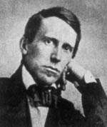 |
July 4, 1976 | 3600 Penn Avenue, at homestead (behind fence), Lawrenceville (Pittsburgh) 40°27′51″N 79°57′49″W / 40.46415°N 79.96374°W |
Roadside | Music & Theater |
| Stephen C. Foster Memorial |  |
December 1, 1958 | Forbes Avenue just east of Bigelow Boulevard, Oakland (Pittsburgh) 40°26′37″N 79°57′09″W / 40.44354°N 79.95256°W |
City | Music & Theater, Writers |
| Three Rivers Stadium | 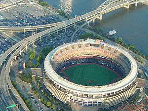 |
November 26, 2007 | Art Rooney Avenue, near North Shore Drive, Heinz Field, North Shore (Pittsburgh) 40°26′46″N 80°00′50″W / 40.44602°N 80.01387°W |
Roadside | Baseball, Football, Sports |
| Union Local 471 American Federation of Musicians | June 23, 2012 | Crawford Avenue at Webster Avenue, Hill District (Pittsburgh) 40°26′35″N 79°59′15″W / 40.443100°N 79.987400°W |
Roadside | African American, Labor, Music & Theater, Performers | |
| United Steelworkers of America | 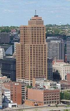 |
June 17, 1986 | 4th Avenue & Grant Street, Pittsburgh 40°26′17″N 79°59′51″W / 40.437941°N 79.997501°W |
City | Government & Politics 20th Century, Labor, Steel |
| University of Pittsburgh | 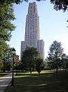 |
November 2, 1979 | Southeast corner, 5th Avenue & Bigelow Boulevard, Oakland (Pittsburgh) 40°26′40″N 79°57′16″W / 40.44444°N 79.95452°W |
City | Education |
| V.F.W. |  |
September 16, 1967 | 5th Avenue & Bigelow Boulevard, at Wm. Pitt Union by bus stop, Oakland, Pittsburgh 40°26′39″N 79°57′16″W / 40.44416°N 79.95458°W |
City | Military, Military Post-Civil War |
| Victor Herbert (1859-1924) |  |
August 28, 2010 | 4400 Forbes Avenue, at Carnegie Mus. near Shakespeare statue, Oakland (Pittsburgh) 40°26′37″N 79°57′05″W / 40.443587°N 79.951356°W |
City | Ethnic & Immigration, Performers |
| Westinghouse Atom Smasher | June 3, 2005 | North Avenue at F Avenue, Forest Hills 40°24′38″N 79°50′32″W / 40.410474°N 79.842308°W |
City | Environment, Invention, Science & Medicine | |
| Westinghouse Electric Corporation | .jpg) |
October 1, 1986 | Westinghouse Plaza by First Niagara Building, Pittsburgh 40°26′22″N 80°00′22″W / 40.439350°N 80.006217°W |
City | Business & Industry, Electricity |
| Westinghouse Railroad Air Brake | July 23, 2011 | Liberty Avenue at 25th Street at Opera House, Strip District (Pittsburgh) 40°27′12″N 79°58′45″W / 40.45334°N 79.979277°W |
City | Invention, Railroads, Transportation | |
| William "Billy" Strayhorn (1915-1967) | 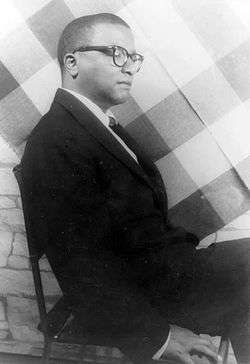 |
May 27, 1995 | 1101 North Murtland Street, at Westinghouse High School, Homewood (Pittsburgh) 40°27′38″N 79°54′01″W / 40.4606°N 79.9003°W |
City | African American, Music & Theater |
| William D. Boyce (1858-1929) |  |
June 11, 1960 | 595 Beatty Road, Boyce Campus of Community College of Allegheny County, Monroeville 40°27′15″N 79°45′13″W / 40.45407°N 79.75371°W |
Roadside | Education |
| William T. Kerr (1868-1953) | June 12, 1992 | 4 Columbia Avenue at Noblestown Road, at bus stop, Rennersdale 40°23′53″N 80°08′24″W / 40.39809°N 80.14012°W |
Roadside | Government & Politics, Government & Politics 20th Century | |
| Work Accidents and the Law (1910) |  |
April 28, 2008 | Market Square, Pittsburgh 40°26′26″N 80°00′10″W / 40.440488°N 80.002669°W |
City | Business & Industry, Government & Politics 20th Century, Labor, Women, Writers |
| Yohogania Courthouse | 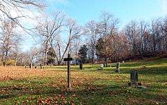 |
June 10, 1948 | PA 837 southwest of West Elizabeth 40°15′41″N 79°54′42″W / 40.261517°N 79.911650°W |
Roadside | Government & Politics, Government & Politics 18th Century |
See also
- List of Pennsylvania state historical markers
- National Register of Historic Places listings in Allegheny County, Pennsylvania
- National Register of Historic Places listings in Pittsburgh, Pennsylvania
- List of City of Pittsburgh historic designations
- List of Pittsburgh History and Landmarks Foundation Historic Landmarks
References
- ↑ "PHMC Historical Markers Search" (Searchable database). Pennsylvania Historical and Museum Commission. Commonwealth of Pennsylvania. Retrieved 2010-07-19.
External links
| Counties |  Map of the Pittsburgh Tri-State with green counties in the metropolitan area and yellow counties in the combined area. | |
|---|---|---|
| Major cities | ||
| Cities and towns 15k-50k (in 2010) | ||
| Airports | ||
| Topics | ||
| ||
Harrisburg (capital) | |
| Topics |
|
| Society | |
| Metro areas | |
| Largest cities | |
| Largest municipalities |
|
| Regions |
|
| Counties |
|
| Museums and Archives |
|  |
|---|---|---|
This article is issued from Wikipedia - version of the 10/10/2016. The text is available under the Creative Commons Attribution/Share Alike but additional terms may apply for the media files.