Lindale, Georgia
| Lindale, Georgia | |
|---|---|
| Census-designated place | |
 Location in Floyd County and the state of Georgia | |
| Coordinates: 34°11′37″N 85°10′25″W / 34.19361°N 85.17361°WCoordinates: 34°11′37″N 85°10′25″W / 34.19361°N 85.17361°W | |
| Country | United States |
| State | Georgia |
| County | Floyd |
| Area | |
| • Total | 5.5 sq mi (14.3 km2) |
| • Land | 5.4 sq mi (14.0 km2) |
| • Water | 0.1 sq mi (0.3 km2) |
| Elevation | 666 ft (203 m) |
| Population (2010) | |
| • Total | 4,191 |
| • Density | 775/sq mi (299.2/km2) |
| Time zone | Eastern (EST) (UTC-5) |
| • Summer (DST) | EDT (UTC-4) |
| ZIP code | 30147 |
| Area code(s) | 706/762 |
| FIPS code | 13-46580[1] |
| GNIS feature ID | 0332220[2] |
Lindale is an unincorporated community and census-designated place (CDP) in Floyd County, Georgia, United States. It is part of the Rome, Georgia Metropolitan Statistical Area. The population was 4,191 at the 2010 census.[3]
History
A post office called Lindale has been in operation since 1883.[4] The name Lindale may have been selected from a novel a resident had read.[5]
Geography
Lindale is located in southeastern Floyd County at 34°11′37″N 85°10′25″W / 34.19361°N 85.17361°W (34.193495, -85.173713).[6] It is bordered to the north by the city of Rome, the county seat.
According to the United States Census Bureau, the Lindale CDP has a total area of 5.5 square miles (14.3 km2), of which 5.4 square miles (14.0 km2) is land and 0.1 square miles (0.3 km2), or 2.20%, is water.[3]
Demographics
As of the census[1] of 2000, there were 4,088 people, 1,682 households, and 1,165 families residing in the CDP. The population density was 741.6 people per square mile (286.5/km²). There were 1,796 housing units at an average density of 325.8/sq mi (125.9/km²). The racial makeup of the CDP was 95.01% White, 1.79% African American, 0.17% Native American, 0.27% Asian, 1.32% from other races, and 1.44% from two or more races. Hispanic or Latino of any race were 2.74% of the population.
There were 1,682 households out of which 29.4% had children under the age of 18 living with them, 52.5% were married couples living together, 12.4% had a female householder with no husband present, and 30.7% were non-families. 26.5% of all households were made up of individuals and 12.9% had someone living alone who was 65 years of age or older. The average household size was 2.42 and the average family size was 2.91.
In the CDP the population was spread out with 23.8% under the age of 18, 8.3% from 18 to 24, 28.6% from 25 to 44, 21.7% from 45 to 64, and 17.6% who were 65 years of age or older. The median age was 38 years. For every 100 females there were 94.1 males. For every 100 females age 18 and over, there were 85.8 males.
The median income for a household in the CDP was $28,486, and the median income for a family was $31,563. Males had a median income of $26,657 versus $21,910 for females. The per capita income for the CDP was $15,844. About 10.8% of families and 16.0% of the population were below the poverty line, including 26.0% of those under age 18 and 11.2% of those age 65 or over.
Notable people
- Eric L. Haney, former soldier and writer
- Randy Johnson, football player
- Willard Nixon, former major league baseball player, Pitcher for Boston Red Sox
References
- 1 2 "American FactFinder". United States Census Bureau. Retrieved 2008-01-31.
- ↑ "US Board on Geographic Names". United States Geological Survey. 2007-10-25. Retrieved 2008-01-31.
- 1 2 "Geographic Identifiers: 2010 Census Summary File 1 (G001), Lindale CDP, Georgia". American FactFinder. U.S. Census Bureau. Retrieved April 28, 2016.
- ↑ "Floyd County". Jim Forte Postal History. Retrieved 25 April 2015.
- ↑ "Floyd County". Calhoun Times. September 1, 2004. p. 69. Retrieved 24 April 2015.
- ↑ "US Gazetteer files: 2010, 2000, and 1990". United States Census Bureau. 2011-02-12. Retrieved 2011-04-23.
Municipalities and communities of Floyd County, Georgia, United States | ||
|---|---|---|
| Cities | 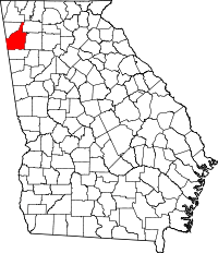 | |
| CDPs | ||
| Unincorporated communities | ||