Lincoln Avenue (Chicago)
 | |
|---|---|
| Little Fort Road | |
 Lincoln was once an Indian trail and called Little Fort Road | |
| Length | 13 mi (21 km) |
| Location | Chicago |
| South end | Clark Street (1800 N/164 W)[1] in Chicago |
| North end | Dempster Street (8800 N/6450 W)[2] in Morton Grove |
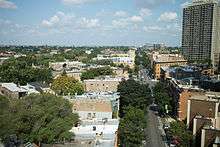
Lincoln Avenue is a street of the north side of city of Chicago. It runs from Clark Street (itself a diagonal) on the western border of Lincoln Park largely to the northwest, ending in Morton Grove, Illinois. It leaves the city limits of Chicago at Devon Avenue, through the village of Lincolnwood, curves through the village of Skokie and ends at Dempster Street in Morton Grove. In total distance it is about 13 miles (21 km) long, although it is not completely continuous. Between Foster Avenue and Skokie Boulevard U.S. Route 41 runs on Lincoln Avenue.
Most of Lincoln Avenue is zoned commercial, and is lined by shops, restaurants and other establishments. It is the site of the yearly Taste of Lincoln Avenue,[3] held between Fullerton Avenue and Wrightwood Avenue.
History
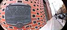
Originally it was an Indian trail running along a slight ridge in the usually soggy ground of pre-settlement Chicago. Prior to the assassination of Abraham Lincoln, the street was known as Little Fort Road, and it led to the town of Little Fort, now known as Waukegan, Illinois. In Morton Grove it was known as Miller's Mill Road.
See also
References
- ↑ Lincoln Avenue at Chicago Neighborhood & City Guide
- ↑ Lincoln Avenue at Google Maps
- ↑ Taste of Lincoln Avenue