Limkheda
| Limkheda | |
|---|---|
| Town | |
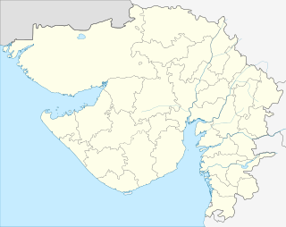 Limkheda  Limkheda Location in Gujarat, India | |
| Coordinates: 22°49′0″N 73°59′0″E / 22.81667°N 73.98333°ECoordinates: 22°49′0″N 73°59′0″E / 22.81667°N 73.98333°E | |
| Country |
|
| State | Gujarat |
| District | Dahod |
| Elevation | 207 m (679 ft) |
| Languages | |
| • Official | Gujarati, Hindi |
| Time zone | IST (UTC+5:30) |
| Vehicle registration | GJ |
| Website |
gujaratindia |
Limkheda is a village in Dahod district, Gujarat, India.
Geography
It is located at 22°49′0″N 73°59′0″E / 22.81667°N 73.98333°E at an elevation of 207 metres (680 ft)[1] Limkheda is the heart of Dahod district, it is situated on the river bank of Hadaf, the River HADAF is Passing between Limkheda@ palli. Limkheda is famous for its chandras kachori, Limkheda has very good old Hasteshwar mahadev temple, it is good place for picnic, in Limkheda deshi bazaar is known as HAT, its arranging at every Sunday.
Location
Limkheda is 25 kilometres (16 mi) west of Dahod. Nearest airport is Harni Airport at Vadodara.
National Highway 59 passes through Limkheda.
References
External links
This article is issued from Wikipedia - version of the 10/3/2016. The text is available under the Creative Commons Attribution/Share Alike but additional terms may apply for the media files.