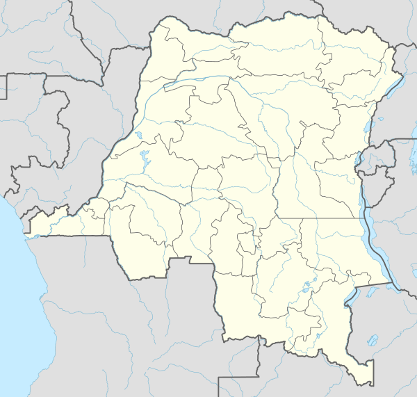
Likasi
| Likasi Jadotville | ||
|---|---|---|
| ||
 Likasi Location in the Democratic Republic of the Congo | ||
| Coordinates: 10°58′53″S 26°44′00″E / 10.98139°S 26.73333°E | ||
| Country |
| |
| Province | Haut-Katanga Province | |
| Area | ||
| • Total | 235 km2 (91 sq mi) | |
| Elevation | 1,318 m (4,324 ft) | |
| Population (2012) | ||
| • Total | 447,449 | |
| • Density | 1,900/km2 (4,900/sq mi) | |
| Time zone | Lubumbashi Time (UTC+2) | |
| Climate | Cwa | |

Likasi (formerly official names: Jadotville (French) and Jadotstad (Dutch)) is a city in Haut-Katanga Province, in the south-east of the Democratic Republic of Congo.
Climate
Likasi has a humid subtropical climate (Köppen: Cwa).
| Climate data for Likasi | |||||||||||||
|---|---|---|---|---|---|---|---|---|---|---|---|---|---|
| Month | Jan | Feb | Mar | Apr | May | Jun | Jul | Aug | Sep | Oct | Nov | Dec | Year |
| Daily mean °C (°F) | 21.4 (70.5) |
21.5 (70.7) |
21.5 (70.7) |
20.9 (69.6) |
18.6 (65.5) |
16.2 (61.2) |
15.9 (60.6) |
18.1 (64.6) |
21.3 (70.3) |
22.8 (73) |
22.3 (72.1) |
21.7 (71.1) |
20.2 (68.4) |
| Average precipitation mm (inches) | 212 (8.35) |
205 (8.07) |
214 (8.43) |
62 (2.44) |
6 (0.24) |
0 (0) |
0 (0) |
0 (0) |
8 (0.31) |
65 (2.56) |
177 (6.97) |
226 (8.9) |
1,175 (46.27) |
| Source: Climate-Data.org[1] | |||||||||||||
Demographics
Likasi has a population of around 447,500 (2012).[2] During the 1990s the United Nations set up feeding centres and refugee centres in and around Likasi to assist with the refugees fleeing ethnic violence in Shaba,[3] whose arrival had increased the population of the town some 41,000.[4]
History
In 1961, during the United Nations intervention in the Katanga conflict, a company of Irish UN troops deployed to Jadotville was forced to surrender to troops loyal to the Katangese Prime Minister Moise Tshombe (see Siege of Jadotville).
Economy

Likasi remains a centre for industry, especially mining,[5] and is a transport hub for the surrounding region. There are mines and refineries supplied by nearby deposits of copper and cobalt.[6] There is also an abandoned gold mine in Likasi, which has been drained of its gold but is still dug by artisanal miners.
Transport
Likasi is served by a station on the national railway system. The trains are mostly cargo trains and not passenger trains.
Notes
- ↑ "Climate:Likasi". Climate-Data.org. Retrieved 10 April 2014.
- ↑ "DWW bought a building for RADEM maternity in Congo" Doctors Worldwide, 28 September 2005, from ReliefWeb, accessed 28 March 2009
- ↑ ACC/SCN Secretariat with Shoham, Jeremy (8 December 1993) "Current Situation: 11. Shaba Region, Zaire" Refugee Nutrition Information System (RNIS), No. 2 - Report on the Nutrition Situation of Refugee and Displaced Populations United Nations Administrative Committee on Coordination, Sub-committee on Nutrition, Geneva
- ↑ ACC/SCN Secretariat with Shoham, Jeremy (17 October 1994) "Current Situation: 11. Shaba/Kasai Regions, Zaire" Refugee Nutrition Information System (RNIS), No. 7 - Report on the Nutrition Situation of Refugee and Displaced Populations United Nations Administrative Committee on Coordination, Sub-committee on Nutrition, Geneva
- ↑ Harding, Andrew (27 March 2009)"Slowdown blights DR Congo economy" BBC News, accessed 27 March 2009
- ↑ Rorison, Sean (2008) "Likasi" Congo: Democratic Republic and Republic Bradt Travel Guides, Chalfont St. Peter, England, pp. 143-145 ISBN 1-84162-233-8
See also
External links
| Wikimedia Commons has media related to Likasi. |
Coordinates: 10°59′S 26°44′E / 10.983°S 26.733°E
