List of lighthouses in the United States

This is a list of lighthouses in the United States. The United States has had approximately a thousand lights as well as light towers, range lights, and pier head lights. Michigan has the most lights of any state with over 150 past and present lights.
Most of the lights in the United States have been built and maintained by the Coast Guard (since 1939) and its predecessors, the United States Lighthouse Service (1910–1939) and the United States Lighthouse Board (1852–1910). Before the Lighthouse Board was established, local collectors of customs were responsible for lighthouses under Stephen Pleasonton. As their importance to navigation has declined and as public interest in them has increased, the Coast Guard has been handing over ownership and in some cases responsibility for running them to other parties, the chief of them being the National Park Service under the National Historic Lighthouse Preservation Act of 2000.
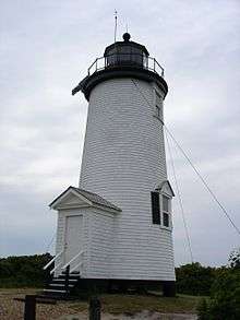
New England
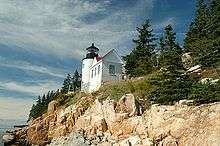
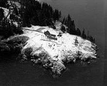
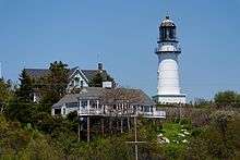
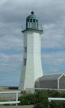
Maine
- "Historic Light Station Information and Photography: Maine". United States Coast Guard Historian's Office.
If not otherwise noted, focal height and coordinates are taken from the United States Coast Guard Light List,[1] while location and dates of activation, automation, and deactivation are taken from the United States Coast Guard Historical information site for lighthouses.[2]

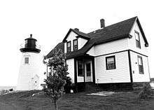
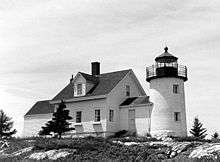
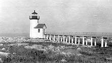
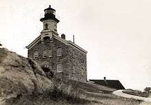
.jpg)


_Lighthouse_(1892_version)_Maine.JPG)


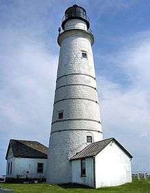
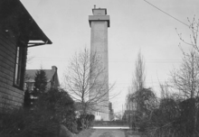
Massachusetts
- "Historic Light Station Information and Photography: Massachusetts". United States Coast Guard Historian's Office.

.jpg)


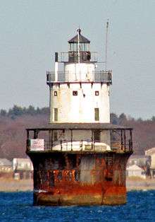
_MA.JPG)


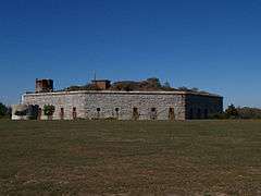


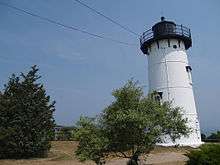


_Light_MA.JPG)

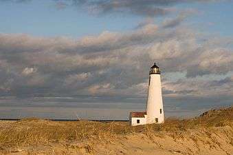

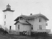


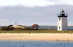


.JPG)
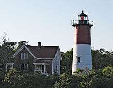
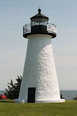
.jpg)
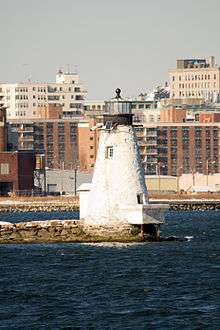

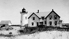
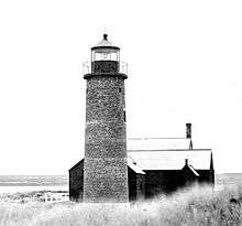


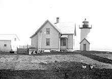


.jpg)
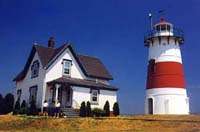
New Hampshire
"Historic Light Station Information and Photography: New Hampshire". United States Coast Guard Historian's Office.
| Name | Image | Location | Coordinates | Year first lit | Automated | Year deactivated | Current Lens |
|---|---|---|---|---|---|---|---|
| Isles of Shoals Light |  |
Isles of Shoals | 42°58′02″N 70°37′23″W / 42.96722°N 70.62306°W | 1865 | 1987 | Active | VLB-44 LED unit |
| Portsmouth Harbor Light |  |
New Castle | 43°04′15″N 70°42′30″W / 43.07083°N 70.70833°W | 1878 | 1960 | Active | Fourth order Fresnel |
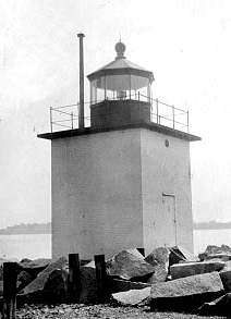
Rhode Island
Connecticut
- See also "Historic Light Station Information and Photography: Connecticut". United States Coast Guard Historian's Office.
- Note: All entries here show the current tower's status, for a more detailed list see the main article


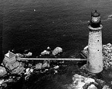
.jpg)


_Light_(New_Haven_County%2C_Connecticut).jpg)

.jpg)
_Light_(Fairfield_County%2C_Connecticut).jpg)
Vermont
"Historic Light Station Information and Photography: Vermont". United States Coast Guard Historian's Office.
- Note: All entries here show the current tower's status, more details can be found in the lighthouse articles
| Name | Image | Location | Coordinates | Year first lit | Automated | Year deactivated | Current Lens |
|---|---|---|---|---|---|---|---|
| Burlington Breakwater Lights | Burlington | 2003 | 2003 | Active | Unknown | ||
| Colchester Reef Light |  |
Shelburne | 1871 | Never automated | 1933 | Solar-powered beacon | |
| Isle La Motte Light |  |
Isle La Motte | 1881 | Unknown | 1970s | Unknown | |
| Juniper Island Light |  |
South Burlington | 1846 | Never automated | 1954 | None | |
| Maxfield Point Light | Orleans | N/A | 1879 | Unknown | Unknown | None | |
| Newport Wharf Light | Orleans | N/A | 1879 | Unknown | Unknown | None | |
| Windmill Point Light |  |
Isle La Motte | 1858 | Unknown | Active | 300 mm | |
| Whipple Point Light | Orleans | N/A | 1879 | Unknown | 1906 | None |
Mid-Atlantic
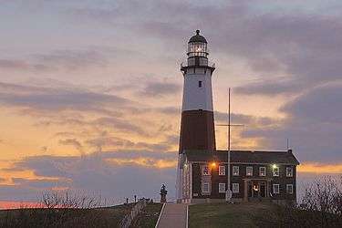
New York
"Historic Light Station Information and Photography: New York". United States Coast Guard Historian's Office.
- Ambrose Light, Lower New York Bay
- Barber's Point Light, Lake Champlain
- Barcelona (Portland Harbor) Light, Portland Harbor, Lake Erie
- Blackwell Island Light, New York City
- Bluff Point Light, Valcour Island/Lake Champlain
- Braddock Point Light, Bogus Point, Lake Ontario
- Brewerton Range Rear, Oneida Lake
- Buffalo (main) Light, mouth of Buffalo River/Erie Canal, under skyway in downtown Buffalo
- Buffalo Harbor North and South entrance Lights
- Buffalo Intake Crib Light
- Buffalo North breakwater East end Light
- Buffalo North breakwater West end Light
- Cape Vincent breakwater East end Light
- Cayuga Inlet Light, Cayuga Lake
- Cayuga Inlet Breakwater Light, Cayuga Lake
- Cedar Island Light, East Hampton
- Clayton Light, Town of Clayton
- Cold Spring Harbor Light, north shore of Long Island
- Coney Island (Nortons Point) Light, New York Harbor main channel
- Cooperstown Marina, Cooperstown, Otsego Lake
- Coxsackie Light, Hudson River
- Crossover Island Light, St. Lawrence River
- Crown Point Light, Lake Champlain
- Cumberland Head Light, Cumberland Bay, Lake Champlain
- Dunkirk Light, Point Gratiot, Lake Erie
- Dunkirk Pierhead Light, Dunkirk harbor, Lake Erie
- Eatons Neck Light, Long Island
- East Charity Shoal Light, Cape Vincent
- Elm Tree Beacon Light
- Esopus Meadows (middle Hudson River) Light
- Execution Rocks Light, Long Island Sound
- Fairhaven Range Lights
- Fire Island Light, Fire Island
- Fort Niagara Light, Niagara River south shore, Lake Ontario
- Fort Tompkins Light, Staten Island
- Fort Wadsworth Light, East bank of The Narrows
- Frenchman's Island, Oneida Lake
- Galloo Island Light, SW end of island in Lake Ontario
- Genesee (Charlotte-Genesee/Rochester) Light
- Genesee East Pier Light, Rochester Harbor
- Genesee North Pier Light, Rochester Harbor
- Grand Island Range Front Light
- Grand Island Range Rear Light
- Horseshoe Reef Light
- Horton Point Light, Long Island
- Hudson-Athens (Hudson city) Light, Middle Ground Flats, Hudson River
- Huntington Harbor Light, Huntington Bay, Long Island
- Kings Point Light
- Kingsborough Community College Light, Brooklyn
- Latimer Reef Light, Fishers Island Sound
- Little Gull Island Light, Long Island Sound
- Little Red Lighthouse (Jeffrey's Hook Lighthouse), Manhattan
- Orient Long Beach Bar Light, Orient Harbor
- Myers Point Light, Cayuga Lake
- Montauk Point Light, Montauk Point State Park
- Montauk Yacht Club Light
- New Dorp Light, Staten Island Swash Channel rear range
- North Brother Island Light
- North Dumpling Light, Fishers Island Sound
- Oak Orchard Light
- Ogdensburg Harbor Light, Light Point, St. Lawrence River
- Olcott Light, on Lake Ontario
- Old Field Point Light
- Old Orchard Shoal Light, Gedney Channel, Lower New York Bay
- Orient Point Light ("Coffee Pot"), Oyster Pond Reef, Plum Gut, Long Island
- Oswego Harbor West Pierhead Lighthouse, mouth of Oswego River, Lake Ontario
- Plattsburg Beacon
- Plum Island Light
- Point Aux Roches Light, Lake Champlain
- Port of Genesee (Charlotte-Genesee) Light, Genesee River/Lake Ontario
- Barcelona (Portland Harbor) Light, south shore of Lake Erie
- Princes Bay Light, Staten Island
- Race Rock Light, Fishers Island
- Robbins Reef Light, west side main channel, Upper New York Bay
- Rock Island Light, St. Lawrence River/Lake Ontario
- Romer Shoal Light, actually in New Jersey, but the Coast Guard lists it in New York
- Rondout Creek (Kingston) light, Kingston Point, Hudson River
- Horse Island Light, Lake Ontario
- Sands Point Light
- Saugerties Light, Hudson River at Esopus Creek
- Selkirk (Salmon River) Light, Salmon River entrance, Lake Ontario
- Shinnecock Light, Ponquogue, Great West Bay
- Shoal Point Light, Fourth Lake, Adirondacks
- Sodus Outer Light, north end of west pier, entrance to Great Sodus Bay
- Sodus Point Light, Sodus Bay, Lake Ontario
- South Buffalo South Side Light, breakwater, south side of main south entrance to Buffalo harbor
- Split Rock Point Light, Whallon Bay, Lake Champlain
- Staten Island Light
- Statue of Liberty, Upper New York Bay
- Stepping Stones Light
- Stony Point (Henderson) Light, Henderson Bay, Lake Ontario
- Stony Point light, Hudson River
- Stuyvesant Light, Hudson River
- Sunken Rock Light, Bush Island, St. Lawrence River
- Tarrytown (Sleepy Hollow) Light, Hudson River, south of Kingsland
- Thirty Mile Point Light, Lake Ontario
- (Three) Sisters Island Light, St. Lawrence River
- Throgs Neck Light, New York City
- Tibbetts Point Light, St. Lawrence River, Lake Ontario
- Titanic Memorial, South Street Seaport, New York City
- Verona Beach (Sylvan Beach) Light, Oneida Lake
- West Bank Light, Ambrose Channel, Lower New York Bay (range front)
- Whitestone Point Light, Whitestone Point, southerly side of East River

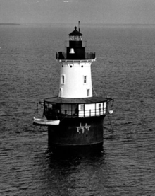
New Jersey
- "Historic Light Station Information and Photography: New Jersey". United States Coast Guard Historian's Office.
- List
| Name | Image | Location | Coordinates | Year first lit | Automated | Year deactivated | Current Lens |
|---|---|---|---|---|---|---|---|
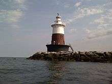
| Absecon Light |  |
Atlantic City | 39°21′58″N 74°24′51″W / 39.36611°N 74.41417°W | 1857 | Never automated | 1933 | Decorative light |
| Barnegat Lighthouse | 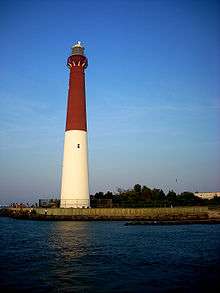 |
Barnegat Light | 1857 | 1927 | Active | VRB-25 | |
| Brandywine Shoal Light | |||||||
| Brigantine Lighthouse | |||||||
| Cape May Light | |||||||
| Chapel Hill Rear Range Light | |||||||
| Conover Beacon | |||||||
| Cross Ledge Light | |||||||
| East Point (Maurice River) Light | |||||||
| Elbow of Cross Ledge Light | |||||||
| Finns Point Range Light | |||||||
| Hereford Inlet Light | |||||||
| Ludlam's Beach Light | |||||||
| Miah Maull Shoal Light | |||||||
| Navesink Twin Lights | |||||||
| Robbins Reef Light | |||||||
| Romer Shoal Light | |||||||
| Sandy Hook Light | |||||||
| Sea Girt Light | |||||||
| Ship John Shoal Light | |||||||
| Tinicum Island Rear Range Light | |||||||
| Waackaack Rear Range Light |
Pennsylvania
"Historic Light Station Information and Photography: Pennsylvania". United States Coast Guard Historian's Office.
- Erie Harbor North Pier Light, Presque Isle
- Erie Land Light, Erie
- Presque Isle Light, Presque Isle
- Turtle Rock Lighthouse, Philadelphia
In addition, Rowlett, Russ. "Lighthouses of the United States: Northwestern Pennsylvania". The Lighthouse Directory. University of North Carolina at Chapel Hill. lists:
- Erie Yacht Club
- Erie Harbor Pierhead (Presque Isle North Pier) (2)
- Erie Pierhead Light
Southeastern Pennsylvania Lighthouses
Schuylkill River Lighthouse
- Turtle Rock Light
- Delaware River Lighthouse
- Chester (Schooner Ledge) Range Rear (3)
- Chester (Schooner Ledge) Range Front (3)
Notable faux lighthouses:
- Sherman Memorial (Tionesta)
Lost lighthouses:
- Fort Mifflin Blockhouse
- Horseshoe Lower Range Front (1881-?), Horseshoe Upper Range Front (1881–1931), and Horseshoe Rear (1881–1920), Delaware River. ARLHS USA-384, 1132, and 385, respectively.
- Schooner Ledge Range Front (1880-about 1915), Delaware River. ARLHS USA-169.
- Schuylkill River Range Front and Schuylkill River Range Rear (1875-about 1912), mouth of Schuylkill River. ARLHS USA-1206 and 1207.
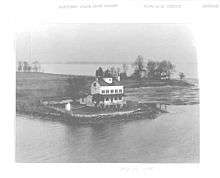
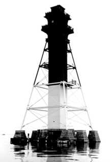
Delaware
- "Historic Light Station Information and Photography: Delaware". United States Coast Guard Historian's Office.

.jpg)


_2.jpg)

.jpg)

.jpg)


.jpg)
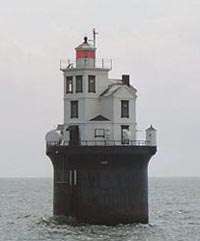
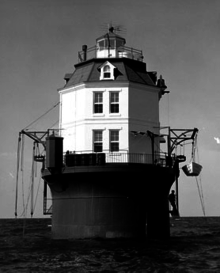
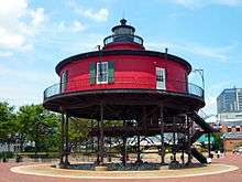
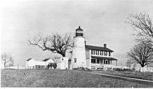
Maryland
- "Historic Light Station Information and Photography: Maryland". United States Coast Guard Historian's Office.


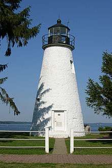
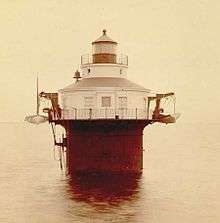

.jpg)


Mid-West
Illinois
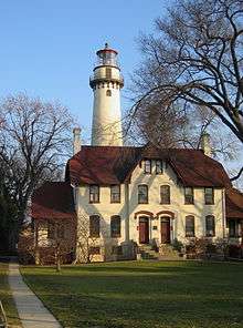
"Historic Light Station Information and Photography: Illinois". United States Coast Guard Historian's Office.
- Chicago Harbor Light (1893), Chicago (still in use)
- Grosse Point Light (1873), Evanston (currently a private navigation aid) (museum)
- Waukegan Harbor Light , Waukegan (currently an aid to navigation)
Indiana
"Historic Light Station Information and Photography: Indiana". United States Coast Guard Historian's Office.
- Buffington Harbor Breakwater Light
- Calumet Harbor Light
- Calumet Harbor Breakwater South End
- Calumet Pierhead
- Gary Harbor Breakwater Light, Gary
- Gary West Breakwater
- Indiana Harbor East Breakwater Light
- Michigan City Breakwater
- Michigan City East Light (1858 and 1904), Michigan City, pierhead; Light still in use, old tower is a museum
- Michigan City East Pierhead
- Michigan City West Pierhead
- Old Michigan City Light, Michigan City
Notable faux lighthouses:
- Cooper Memorial (1997), on the Prairie Creek Reservoir near Muncie, is an active light but does not meet the Directory's size standard for a lighthouse.
- Gloryland Lighthouse, near New Castle, is not on navigable water.
Michigan
"Historic Light Station Information and Photography: Michigan". United States Coast Guard Historian's Office. The Michigan.gov website has a Map of Michigan Lighthouses in PDF format.
- Alpena Light, Alpena
- Au Sable Light
- Au Sable North Pierhead Light
- Beaver Island (Beaver Head) Light, southern tip of Beaver Island
- Beaver Island Harbor Light, northern end of Beaver Island
- Belanger Park (Mariners Memorial) Light
- Bete Grise (Mendota) Light
- Big Bay Point Light
- Big Sable Point (Grande Point au Sable) Light, north of Ludington
 Big Sable Light
 - Bois Blanc Island Light
- Cedar River Light
- Charity Island Light
- Charlevoix South Pier Light, Charlevoix
- Cheboygan Crib Light
- Cheboygan River Light
- Clinton River Light
- Copper Harbor Front Range Light, Copper Harbor
- Copper Harbor Light, Copper Harbor
- Copper Harbor Rear Range Light, Copper Harbor
- Crisp Point Light
- De Tour Reef Light
- Detroit Light
- Detroit River (Bar Point Shoal) Light
- Eagle Harbor Light, Eagle Harbor
- Eagle Harbor Rear Range Light, Eagle Harbor
- Eagle River Light, Eagle River
- Ecorse Light
- Ecorse Range Rear Light
- Fort Gratiot Light, Port Huron
- Forty Mile Point Light
- Fourteen Foot Shoal Light
- Fourteen Mile Light
- Frankfort North Breakwater Light, Frankfort
- Frying Pan Island Light relocated to Sault Ste. Marie
- Gibraltar Light
- Grand Haven South Pierhead Entrance Light, Grand Haven
- Grand Haven South Pierhead Inner Light, Grand Haven
- Grand Island East Channel Light
- Grand Island Harbor Rear Range Light
- Grand Island North Light
- Grand Marais Inner Range Light
- Grand Marais Outer Range Light
- Grand Traverse Light, Northport
- Granite Island Light, 12 miles northwest of Marquette
- Grassy Island North Channel Range Light
- Grassy Island South Channel Range Light
- Gravelly Shoal Light
- Gray's Reef Light, offshore, east of Beaver Island
- Grosse Ile North Channel Front Range Light
- Grosse Isle South Channel Range Light
- Gull Rock Light Station
- Harwood Point East Range Front Light
- Harbor Beach Light
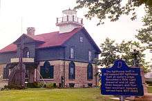
- Holland Harbor Light (Big Red), near Holland
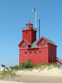 Holland Harbor Light, also called Big Red near Holland, Michigan
 - Huron Island Light
- Huron Lightship, Port Huron, Michigan
- Ile aux Galets Light, see Skillagalee Island (Ile aux Galets) Light
- Isle Royale (Menagerie Island) Light, Isle Royale National Park
- Keweenaw Waterway Upper Entrance Light
- Keweenaw Waterway Lower Entrance Light
- Lake St. Clair Light
- Lansing Shoals Light
- Little Sable Point (Petite Point au Sable) Light, south of Pentwater
- Little Traverse Light
 Waugoshance Light
 - Ludington Light, Ludington
- Mackinac Point Light, Mackinaw City
- Mama Juda Light, destroyed, Detroit River, Detroit
- Mama Juda Range Front Light
- Manistee Light, Manistee
- Manistee North Pierhead Light, Manistee
- Manistique East Breakwater Light, Manistique
- Manitou Island Light Station
- Manning Memorial Light
- Mariners Memorial (River Rouge) Light
- Marquette Breakwater Outer Light
- Marquette Harbor Light
- Martin Reef Light
- McGulpin's Point Light
- Menagerie Island Light, see Isle Royale (Menagerie Island) Light
- Mendota Light, see Bete Grise (Mendota) Light
- Menominee North Pier Light
- Middle Island Light
- Middle Lake George
- Minneapolis Shoal Light
- Mission Point Light, deactivated, replaced by offshore light tower
- Monroe Pier Light
- Munising Front Range Light, Munising
- Munising Rear Range Light, Munising
- Muskegon Pier Light, Muskegon
- Muskegon Breakwater Light, Muskegon
- Naubinway Island Light
- New Buffalo Light
- Ninth District Light
- North Manitou Island Light
- North Manitou Shoal Light, offshore east of North Manitou Island
- Old Mackinac Point Light
- Old Mission Point Light, alternate name for Mission Point Light
- Ontonagon Harbor West Pierhead Light, Ontonagon
- Ontonagon Light, Ontonagon
- Passage Island Light, Isle Royale National Park
- Peche Island Light, relocated from Peche Island to Marine City
- Peninsula Point Light
- Pipe Island Light
- Poe Reef Light
- Point Betsie (Point aux Becs Scies) Light, Frankfort
- Point Iroquois Light
- Pointe aux Barques Light
- Port Austin Light
- Port Sanilac Light
- Portage River (Jacobsville Light)
- Poverty Island Light, Poverty Island south of Fairport
- Presque Isle Front Range Light
- Presque Isle Harbor Breakwater Light
- Presque Isle Light (New), Presque Isle
- Presque Isle Light (Old), Presque Isle
- Presque Isle Rear Range Light
- Rock Harbor Light, Isle Royale National Park
- Rock of Ages Light, Isle Royale National Park
- Rouleau Point Range Front and Rear Lights
- Round Island Light, Round Island
 Round Island Lighthouse
 - Round Island Light, St. Mary's River
- Round Island Passage Light
- Round Island Rear Light
- Saginaw Bay Light
- Saginaw River Rear Range Light
- Sand Beach North Entrance East Light
- Sand Hills Light
- Sand Point Light, Escanaba
- Sand Point Light, Baraga
- Saugatuck Light, Saugatuck
- Seul Choix Point Light, Gulliver
- Six Mile Point Range Rear Light
- Skillagalee Island (Ile aux Galets) Light, Ile Aux Galets
- South Fox Island Light, South Fox Island
- South Haven South Pier Light, South Haven
- South Manitou Island Light, part of Sleeping Bear Dunes National Lakeshore
- Spectacle Reef Light
- Squaw Point Light
- Squaw Island Light, Squaw Island
- St. Clair Flats South Channel Front Range Light
- St. Clair Flats South Channel Rear Range Light
- St. Helena Island Light, west of the Straits of Mackinac
- St. James Light, see Beaver Island Harbor Light
- St. Joseph North Pier Inner Light
 White Shoal Light
 - St. Joseph North Pier Outer Light
- St. Martin Island Light
- St. Mary's River Lower Range Front Light
- Stannard Rock Light
- Sturgeon Point Light
- Tawas Point Light
- Thunder Bay Island Light
- Tri-Centennial Light of Detroit
- Vidal Shoals Channel Range Front and Rear Lights
- Waugoshance Light
- White River Light, Whitehall
- White Shoal Light, west of Mackinaw City
- Whitefish Point Light
- William Livingstone Memorial Light[67]
- Windmill Point Light
- Windmill Point Range Front and Rear Lights
- Winter Point Range Front Light
Minnesota
- Duluth North Pier Light, Duluth
- Duluth South Breakwater Outer Light, Duluth
- Duluth South Breakwater Inner Light, Duluth
- Grand Marais Light, Grand Marais
- Minnesota Point Light, Duluth
- Split Rock Light, Beaver Bay
- Two Harbors Light, Two Harbors
Nebraska
- Linoma Lighthouse, near Gretna
- Lake Minatare Lighthouse, near Scottsbluff
Ohio
"Historic Light Station Information and Photography: Ohio". United States Coast Guard Historian's Office.
- Ashtabula Harbor Light, Ashtabula
- Cedar Point Light, Sandusky
- Cleveland west breakwater/East pierhead Lights, Cleveland
- Cleveland east entrance Light, Cleveland
- Conneaut west Light, Conneaut
- Grand Lake St. Marys Lighthouse, Celina
- Grand River (Fairport Harbor) Light, Fairport Harbor
- Fairport Harbor West Breakwater Light, Fairport Harbor
- Green Island Light, Green Island
- Huron Harbor Light, Huron
- Lorain West Breakwater Light, Lorain
- Marblehead Light, Marblehead
- Port Clinton Light, Port Clinton
- Sandusky Harbor Light, Sandusky
- South Bass Island Light, South Bass Island
- Toledo Harbor Light, Toledo Harbor
- Turtle Island Light
- Vermilion Light, Vermilion
- West Sister Island Light
Wisconsin
"Historic Light Station Information and Photography: Wisconsin". United States Coast Guard Historian's Office.
- Algoma Light, Algoma, Kewaunee County
- Apostle Islands Lighthouses
- Ashland Harbor Breakwater Lighthouse, Ashland, Ashland County
- Baileys Harbor Lighthouse, Baileys Harbor, Door County
- Baileys Harbor Range Lights, Baileys Harbor, Door County
- Boyer Bluff Light, Door County
- Cana Island Lighthouse, near Baileys Harbor, Door County
- Chambers Island Lighthouse, Chambers Island, Door County
- Chequamegon Point Lighthouse, Long Island, Apostle Islands, Ashland County
- Devils Island Lighthouse, Devils Island, Apostle Islands, Ashland County
- Eagle Bluff Lighthouse, Ephraim, Door County
- Fond du Lac Lighthouse, Fond du Lac, Fond du Lac County
- Grassy Island Range Lights, relocated to Green Bay Yacht Club
- Green Bay Harbor Entrance Light
- Green Island Light
- Gull Island Light, Gull Island, Ashland County
- Kenosha North Pier Lighthouse, Kenosha, Kenosha County
- Kenosha Light, Kenosha, Kenosha County
- Kevich Light, Ozaukee County
- Kewaunee Pierhead Lighthouse, Kewaunee, Kewaunee County
- La Pointe Lighthouse, Apostle Islands, Ashland County
- Long Tail Point Light, Green Bay, Brown County
- Manitowoc Breakwater Lighthouse, Manitowoc, Manitowoc County
- Michigan Island Lighthouse, Apostle Islands, Ashland County
- Milwaukee Pierhead Light, Milwaukee, Wisconsin
- Milwaukee Breakwater Lighthouse, Milwaukee, Wisconsin
- Neenah Light, Neenah, Winnebago County
- North Point Lighthouse, Milwaukee, Milwaukee County
- Outer Island Lighthouse, Apostle Islands, Ashland County
- Peshtigo Reef Light, Green Bay east of Peshtigo Point, Marinette County
- Pilot Island Lighthouse, near Gills Rock, Door County
- Plum Island Range Lights, near Gills Rock, Door County
- Port Washington Light, Port Washington, Ozaukee County
- Potawatomi Lighthouse aka Rock Island Light, Rock Island State Park, Door County
- Racine Harbor Light, Racine
- Racine North Breakwater Light, Racine
- Raspberry Island Lighthouse, Apostle Islands, Bayfield County
- Rawley Point Lighthouse, Manitowoc County
- Rockwell Light, Oshkosh, Winnebago County
- Sand Island Lighthouse, Apostle Islands, Bayfield County
- Sheboygan Breakwater Light, Sheboygan, Sheboygan County
- Sherwood Point Lighthouse, near Sturgeon Bay, Door County
- Sturgeon Bay Canal Lighthouse, Sturgeon Bay, Door County
- Sturgeon Bay Canal North Pierhead Light, Sturgeon Bay, Door County
- Tail Point Light: see Long Tail Point Light
- Two Rivers Light, Two Rivers, Manitowoc County
- Wind Point Lighthouse, Racine, Racine County
- Wisconsin Point Lighthouse, Superior, Douglas County
Pacific
Alaska
Listed here are 18 lights. The article List of lighthouses in Alaska includes 16 Alaskan lighthouses listed by the US Coast Guard (at "Historic Light Station Information and Photography: Alaska". United States Coast Guard Historian's Office.). There are 14 Alaska lighthouses (counting a lightship and a minor light not listed by the USCG) listed at Lighthouse Friends. None are located north of the Aleutian Islands.
- Aleutian Islands up to Anchorage
- Cape Sarichef Light, Unimak pass through Aleutian islands
- Scotch Cap Light, Unimak Island
- South Alaska east of Anchorage
- Minor light of Alaska - Odiak Pharos[68]
- Cape Hinchinbrook Light, Prince William Sound
- Cape St. Elias Light, Kayak Island[69]
- Alaska panhandle, southeast Alaska
- Cape Spencer Light, Cross Sound
- Point Retreat Light, Admiralty Island
- Eldred Rock Light, Lynn Canal
- Fairway Island Light, Peril Strait
- Point Sherman Light, Lynn Canal[70]
- Sentinel Island Light, Lynn Canal
- Five Finger Islands Light, Frederick Sound
- Tree Point Light, Revillagigedo Channel
- Guard Island Light, Clarence Strait[71]
- Lincoln Rocks Light, Clarence Strait
- Lightship Umatilla WLV-196, located near Ketchikan[72]
- Cape Decision Light, Kuiu Island
- Mary Island Light, Mary Island[73]
Washington

"Historic Light Station Information and Photography: Washington". United States Coast Guard Historian's Office.
- Admiralty Head Light, Whidbey Island
- Alki Point Light, West Seattle
- Browns Point Light, Browns Point
- Burrows Island Light, Anacortes
- Cape Disappointment Light
- Cape Flattery Light, Neah Bay
- Cattle Point Light, San Juan Island
- Clover Island Light, Kennewick
- Destruction Island Light
- Dofflemyer Point Light
- Ediz Hook Light
- Grays Harbor Light, Westport
- Lime Kiln Light, San Juan Island
- Marrowstone Point Light, Fort Flagler
- Mukilteo Light, Mukilteo
- New Dungeness Light, Sequim
- North Head Light, Ilwaco
- Patos Island Light, San Juan Islands
- Point No Point Light, Hansville
- Point Roberts Light, Point Roberts
- Point Robinson Light, Vashon Island
- Point Wilson Light, Port Townsend
- Semiahmoo Harbor Light, Port Blaine
- Slip Point Light, Clallam Bay
- Turn Point Light, Stuart Island
- West Point Light, Seattle
Oregon

- Cape Arago Light, Coos County
- Cape Blanco Light, Curry County
- Cape Meares Light, Tillamook County
- Cleft of the Rock Light, private
- Coquille River Light, Coos County
- Desdemona Sands Light, Clatsop County
- Heceta Head Light, Lane County
- Lightship Columbia, Clatsop County (now a museum ship, previously anchored outside three mile zone)
- Point Adams Light, demolished
- Port of Brookings Light, private
- Tillamook Rock Light, Clatsop County
- Umpqua River Light, Douglas County
- Warrior Rock Light, on Sauvie Island in the Columbia River
- Willamette River Light, mouth of the Willamette River at the Columbia River
- Yaquina Bay Light, Newport
- Yaquina Head Light, Lincoln County
California
"Historic Light Station Information and Photography: California". United States Coast Guard Historian's Office.

- Alcatraz Island Light, San Francisco
- Anacapa Island Light, entrance to Santa Barbara Channel
- Angel Island Light, see Point Blunt Light or Point Stuart Light
- Año Nuevo Island Light
- Ballast Point Light, Point Loma, San Diego Harbor entrance
- Battery Point Light, Crescent City
- Cape Mendocino Light
- Carquinez Strait Light, near Vallejo
- East Brother Island Light, Richmond, off Point San Pablo
- Farallon Island Light, Southeast Farallon Island
- Fort Point Light, entrance to San Francisco Harbor, directly beneath the south anchorage of the Golden Gate Bridge
- Humboldt Harbor Light
- Lime Point Light, entrance of San Francisco Bay, adjacent to the north end of the Golden Gate Bridge, Sausalito
- Long Beach Light
- Los Angeles Harbor Light, San Pedro Breakwater, Angels Gate
- Mare Island Light, north shore of San Pablo Bay at the entrance to Carquinez Strait; nearest town or city is Vallejo
- Mark Abbott Memorial Light, Santa Cruz
- Mile Rocks Light, southwest of the Golden Gate Bridge
- Oakland Harbor Light, Embarcadero Cove, Oakland
- Piedras Blancas Light Station, northern entrance to San Simeon bay
- Pigeon Point Light, Pescadero, southern approach to San Francisco Bay
- Point Arena Light, two miles north of Point Arena
- Point Arguello Light, Santa Barbara Channel
- Point Blunt Light, Angel Island, San Francisco Bay
- Point Bonita Light, Marin Headlands, San Francisco Bay entrance near Sausalito
- Point Cabrillo Light, Mendocino, between Point Arena and Cape Mendocino
- Point Conception Light, Point Conception
- Point Diablo Light, west of the Golden Gate Bridge
- Point Fermin Light, San Pedro
- Point Hueneme Light, Santa Barbara Channel
- Point Knox Light
- Point Loma Light (old), San Diego
- Point Loma Light (new), San Diego
- Point Montara Light
- Point Pinos Light, Pacific Grove
- Point Reyes Light, Point Reyes
- Point San Luis Light, near San Luis Obispo, Avila Beach, and Diablo Canyon Power Plant
- Point Stuart Light Angel Island San Francisco California
- Point Sur Light
- Point Vicente Light, Palos Verdes
- Punta Gorda Light, south of Cape Mendocino
- Roe Island Light, Suisun Bay
- Rubicon Point Light, Lake Tahoe; highest elevation American lighthouse
- Santa Barbara Light
- Santa Cruz Breakwater Light
- Santa Cruz Harbor Light (see Walton Light)
- Southampton Shoal Light, in San Francisco Bay
- St. George Reef Light, near Crescent City
- Sugar Pine Point Light, Lake Tahoe
- Table Bluff Light, Humboldt Bay
- Trinidad Head Light
- Walton Light (also known as Santa Cruz Harbor Light), Santa Cruz
- Yerba Buena Light, in San Francisco Bay
Hawaii

Fifteen lighthouses in Hawaii are associated with the U.S. Coast Guard.[74] Including minor lights, there are 43 lights in total, listed at LighthouseFriends.Com's list of Hawaii lighthouses.
(intended to be ordered from northwest to southeast, partially so ordered):
- Kuaui
- Kilauea Point Light, Kilauea, Hawaii (northern-most point in state of Hawaii)
- Nawiliwili Harbor Light (Ninini Point)
- Minor light at Hanapepe[75]
- Minor light at Kahala Point[76]
- Minor light at Kokole[77]
- Kuki'i Point Light, a minor light[78]
- Minor light at Makahu'ena Point[79]
- Minor light at Nohili Point[80]
- Molokai
- Moloka'i Light (Kalaupapa)
- Lae O Ha La'au Point Light, also known as Kalaeokala’au and La’au Point
- Lanai
- Minor light at Kaumalapau[81]
- Minor light at Manele Bay[82]
- Palaoa Point Light (Cape Ka'ea), a minor light at Palaoa Point[83]
- Pohakuloa Light (Shipwreck Beach), a minor light[84]
- Maui
- Lahaina Light
- Pauwela Point Light on Maui
- Hanamanioa Point Light, a minor light[85]
- Minor light at Hawea Point[86]
- Ka'uiki Head Light, a minor light[87]
- McGregor Point Light, a minor light at McGregor Point[88]
- Minor light at Nakalele[89]
- Minor light at Pa'uwela Point[90]
- Minor light at Kahului Harbor[91]
- Minor light at Molokini[92]
- Oahu
- Aloha Tower, Honolulu Harbor, Oahu
- Honolulu Range Front Light ("Historic Light Station Information and Photography: Hawaii". United States Coast Guard Historian's Office.)
- Barbers Point Light, Oahu
- Diamond Head Light
- Makapuu Point Light, Makap'uu Point, Oahu[93]
- Ka'ena Point Light, a minor light[94]
- Pyramid Rock Light, a minor light[95]
- Kaho'olawe
- Kaho'olawe southwest point light[96]
- Hawaii (Big Island)
- Pepeekeo Point Light, about 6 mi north of Hilo, also known as Aila Point Light or Makahanaloa Light
- Coconut Point Light[97]
- Kailua Point Light (in Kailua, Hawaii County, Hawaii[98]
- Napo'opo'o Light, at Captain Cook Monument[99]
- Cape Kumukahi Light[100]
- Kauhola Point Light, near Kapa'au, Hawaii
- Minor light at Laupahoehoe Point[101]
- Kawaihae Light, a minor light[102]
- Keahole Point Light, a minor light at Keahole Point[103]
- Mahukona Light, a minor light[104]
- Minor light at Pepe'ekeo[105]
- Kukuihaele Light[106]
- Ka Lae Light (at southernmost point of the 50 United States)
- to be sorted
- Kaunakakai Range Front Light
- Pauka'a Point Light
South Pacific insular areas and associated states
- Howland Island Light
- Japanese Lighthouse on Saipan, Northern Mariana Islands
- Japanese Lighthouse (Poluwat, Chuuk), in Federated States of Micronesia
South
Alabama
| Name | Image | Location | Coordinates | Year first lit | Year deactivated | Current Lens |
|---|---|---|---|---|---|---|
| Battery Gladden Light | Mobile Bay | 30°40′3″N 88°1′22″W / 30.66750°N 88.02278°W | 1872 | 1913 | - | |
| Choctaw Point Light | Mobile | 30°40′N 87°59′W / 30.667°N 87.983°W | 1831 | 1862 | - | |
| Middle Bay Light |  |
Mobile Bay | 30°26′N 88°40′W / 30.433°N 88.667°W | 1885 | 1967 | - |
| Mobile Point Range Lights | Fort Morgan | 30°22′N 88°02′W / 30.367°N 88.033°W | 1822 | 1966 | - | |
| Sand Island Light |  |
Mobile Bay | 30°11′16″N 88°03′02″W / 30.18778°N 88.05056°W | 1864 (Current tower) | 1933 | None |
Florida


- Alligator Reef Light, near Indian Key (1873) (still in use)
- Amelia Island Light, Fernandina Beach (1820) (still in use) (U.S. Coast Guard housing)
- Amelia Island North Range Light, Amelia Island
- American Shoal Light, near Florida Keys (1880) (still in use)
- Anclote Keys Light, near Tarpon Springs (1887)
- Boca Grande Light - please see Gasparilla Island Light
- Cape Canaveral Light, Cape Canaveral (1868) (still in use)
- Cape Florida Light, Key Biscayne (1846) (museum)
- Cape San Blas Light (1885)
- Carysfort Reef Light, near Key Largo (1852) (still in use)
- Cape St. George Light, St. George Island (1852)
- Cedar Key Light, Seahorse Key, near Cedar Key (1854) (marine laboratory)
- Charlotte Harbor Light
- Cosgrove Shoal Light - please see Unmanned reef lights of the Florida Keys
- Crooked River Light, near Carrabelle (1895)
- Dames Point Light, St. Johns River
- Dog Island Light
- Dry Tortugas Light, Loggerhead Key, Dry Tortugas (1858) (still in use)
- Egmont Key Light, Tampa Bay (1858) (still in use)
- Fowey Rocks Light, off Key Biscayne (1878) (still in use)
- Garden Key Light, Fort Jefferson (1876)
- Gasparilla Island Lights, Boca Grande (1890) (still in use) (museum)
- Hen and Chickens Shoal Light - please see Unmanned reef lights of the Florida Keys
- Hillsboro Inlet Light, Pompano Beach (1907) (still in use) (Coast Guard housing)
- Jupiter Inlet Light, Jupiter (1860) (still in use) (museum)
- Key West Light, Key West (1846) (museum)
- Loggerhead Key Light - please see Dry Tortugas Light
- Molasses Reef Light - please see Unmanned reef lights of the Florida Keys
- Northwest Passage Light, near Key West
- Pacific Reef Light - please see Unmanned reef lights of the Florida Keys
- Pensacola Light, Pensacola Bay (1859) (still in use)
- Pensacola Bar Beacon - please see Pensacola Light
- Ponce de Leon Inlet Light, town of Ponce Inlet (1887) (still in use) (museum)
- Port Boca Grande Light - please see Gasparilla Island Light
- Pulaski Shoal Light - please see Unmanned reef lights of the Florida Keys
- Rebecca Shoal Light
- Sand Key Light, near Key West (1853) (still in use)
- Sanibel Island Light (1884) (still in use)
- Seahorse Key Light - please see Cedar Key Light
- Smith Shoal Light - please see Unmanned reef lights of the Florida Keys
- Sombrero Key Light, south of Key Vaca in Marathon, Florida (1858) (still in use)
- St. Augustine Light, Anastasia Island (1874) (museum)
- St. George Island Light - please see Cape St. George Light
- St. Johns Light Station
- St. Johns River Light (1859)
- St. Joseph Bay Light - please see St. Joseph Point Light
- St. Joseph Point Light, near Port St. Joe (1902) (private residence)
- St. Marks Light, Apalachee Bay (1842) (still in use)
- Tennessee Reef Light - please see Unmanned reef lights of the Florida Keys
- Tortugas Harbor Light - please see Garden Key Light
- Unmanned reef lights of the Florida Keys
- Volusia Bar Light, near DeLand, Florida
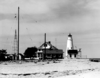
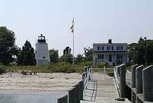
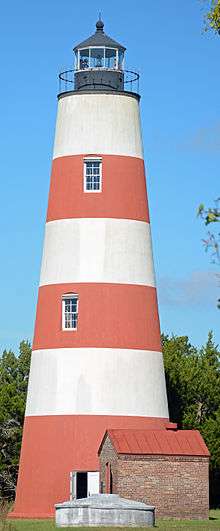
Georgia
"Historic Light Station Information and Photography: Georgia". United States Coast Guard Historian's Office.

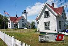
%2C_GA%2C_US.jpg)

.jpg)

.jpg)

Kentucky
Lighthouses in Kentucky and Tennessee
- Lighthouse Landing (Grand Rivers), at Kentucky Lake
- Notable faux lighthouses
- Louisville Waterfront Plaza, lighthouses on top of building
Louisiana
"Historic Light Station Information and Photography: Louisiana". United States Coast Guard Historian's Office.
- Barataria Bay Light
- Bayou St. John Light, Canal de Carondolet
- Bonfouca (Bayou Bonfouca) Light, northern Lake Pontchartrain
- Calcasieu River Range Lights, Calcasieu River
- Chandeleur Island Light, outer rim of Chandeleur Sound
- Cubits Gap Light, Cubits Gap
- East Rigolets Light, Rigolets Waterway
- Franks Island Light, Franks Island
- Head of the Passes Light, Deer Island
- Madisonville Light, Madisonville
- New Canal Light, Lake Pontchartrain canal entrance
- Oyster Bay (Bayou) Light, easternmost entrance to Atchafalaya Bay
- Pass A L'Outre Light, Head of Passes, Mississippi River delta
- Pass Manchac Light, west shore of Lake Pontchartrain
- Point Au Fer Reef Light, entrance to Atchafalaya River
- Pointe Aux Herbes Light, south side of east end of Lake Pontchartrain
- Port Pontchartrain Light, Lake Pontchartrain
- Pontchartrain Beach Light, New Orleans
- Sabine Pass Lighthouse, located at the entrance to Sabine Lake in Cameron Parish
- Sabine Pass East Jetty Light
- Ship Shoal Light, 10 miles south of Grand Isle
- South Pass Range Front Light, Mississippi River
- South Pass Range Lights
- Southwest Pass Entrance Light
- Southwest Reef Light, old entrance to Atchafalaya River
- Tchefuncte River Range Lights, north side of Lake Pontchartrain
- Timbalier Bay (Little Pass) Light, Timbalier Bay
- Trinity Shoal Light
- West Rigolets Light, Rigolets Channel, Lake Pontchartrain
Mississippi
- Biloxi Light, Biloxi
- Cat Island Light, Cat Island
- East Pascagoula River Light, Pascagoula
- Horn Island Light
- Lake Borgne Light
- Merrill Shell Bank Light, Mississippi Sound
- Natchez Light
- Pass Christian Light
- Petit Bois Island Light, see Horn Island Light
- Round Island Light (Mississippi), Pascagoula
- Ship Island Light, Ship Island
- St. Joseph Island Light, near Lake Borgne
North Carolina
"Historic Light Station Information and Photography: North Carolina". United States Coast Guard Historian's Office.

- Bald Head Light, Cape Fear River Inlet
- Bodie Island Light, Bodie Island, Outer Banks
- Cape Fear Light, Cape Fear River Inlet
- Cape Hatteras Light, Hatteras Island, Outer Banks
- Cape Lookout Light, Cape Lookout, Outer Banks
- Croatan Shoal Light
- Currituck Beach Light, Corolla, Outer Banks
- Federal Point Light, Pleasure Island
- Hatteras Beacon, near Cape Hatteras
- Diamond Shoal Light
- Frying Pan Shoals Light
- Laurel Point Light
- Long Point Beacon Light
- Neuse River Light
- Oak Island Light, Oak Island
- Ocracoke Island Light, Ocracoke Island, Outer Banks
- Pamlico Point Shoal Light
- Price Creek Light, Southport
- Roanoke Marshes Light
- Roanoke River Light
- Wade Point Light
Oklahoma
Rowlett, Russ. "Lighthouses of Oklahoma". The Lighthouse Directory. University of North Carolina at Chapel Hill.
- Lake Hefner Lighthouse, Oklahoma City, Oklahoma
- Notable faux lighthouses
- Centennial Lighthouse, Elk City, Oklahoma
South Carolina

"Historic Light Station Information and Photography: South Carolina". United States Coast Guard Historian's Office.
- Bloody Point Light on Daufuskie Island, Beaufort County
- Bulls Bay Light, Charleston County
- Combahee Bank Light formerly in St. Helena Sound
- Cape Romain Lighthouses near McClellanville, Charleston County
- Castle Pinckney Light in Charleston Harbor, Charleston County
- Charleston Light in Sullivan's Island, Charleston County
- Fort Ripley Shoal (Middle Ground) Light in Charleston Harbor, Charleston County
- Fort Sumter Range Lights, Charleston County
- Georgetown Light
- Haig Point Range Lights on Daufuskie Island, Beaufort County
- Harbour Town Light on Hilton Head Island, Beaufort County
- Hilton Head Range Rear (Leamington)
- Hunting Island Light on Hunting Island, Beaufort County
- Morris Island Light on Morris Island, Charleston County
- Parris Island Range Lights on Parris Island, formerly in Beaufort County
- Sullivan's Island Range Lights, Charleston County
Tennessee
- Lighthouses in Kentucky and Tennessee
- Omohundo Waterworks Intake Crib, Nashville, Tennessee
- Notable faux lighthouse
- Carthage Light, on the Cumberland River near Carthage, Tennessee
Texas
"Historic Light Station Information and Photography: Texas". United States Coast Guard Historian's Office.
- Aransas Pass Light
- Brazos River Light
- Brazos Santiago Light
- Clopper's Bar Light
- Fort Point Light, Galveston Bay
- Galveston Jetty Light
- Half Moon Reef Light
- Matagorda Island Lighthouse, located at entrance to Matagorda Bay (more information)
- Point Bolivar Light, located at entrance to Galveston Bay
- Port Isabel Light, across the causeway from South Padre Island in Port Isabel (more information)
- Redfish Bar Light
- Redfish Bar Cut Light
- Sabine Bank Light
Virginia

"Historic Light Station Information and Photography: Virginia". United States Coast Guard Historian's Office.
- Assateague Light, Assateague Island
- Back River Light, Chesapeake Bay near Hampton
- Bells Rock Light, York River
- Bowlers Rock Light, Rappahannock River
- Cape Charles Light, Cape Charles
- Cape Henry Light (old), Cape Henry, Virginia Beach
- Cape Henry Light (new), Cape Henry, Virginia Beach
- Cherrystone Bar Light, Cape Charles
- Chesapeake Light, entrance to Chesapeake Bay
- Craney Island Light, mouth of Elizabeth River
- Deepwater Shoals Light, James River
- Dutch Gap Canal Lights, James River
- Great Wicomico River Light, Chesapeake Bay
- Hog Island Light
- Jones Point Light, Alexandria
- Jordan Point Light, James River
- Killock Shoal Light
- Lambert Point Light, Norfolk
- Nansemond River Light, Nansemond and James rivers
- New Point Comfort Light, Chesapeake Bay
- Newport News Middle Ground Light, Newport News
- Old Plantation Flats Light, Cape Charles
- Old Point Comfort Light, Hampton
- Pages Rock Light, York River
- Point of Shoals Light, James River
- Pungoteague Creek Light, Chesapeake Bay
- Smith Point Light, mouth of Potomac River
- Stingray Point Light, mouth of Rappahannock River
- Tangier Sound Light, Chesapeake Bay
- Thimble Shoal Light, Chesapeake Bay, north of Hampton Roads
- Tue Marshes Light, mouth of York River
- Watts Island Light, Chesapeake Bay
- White Shoal Light, James River
- Windmill Point Light, mouth of Rappahannock River
- Wolf Trap Light, Chesapeake Bay
- York Spit Light, mouth of York River
Other United States territories and minor islands
American Samoa
Caribbean Sea
- Cape Mala Light Station in the Canal Zone
- Fort Louisa Augusta Light in the Virgin Islands
- Windward Point Light in Guantanamo Bay, Cuba
Guam
Northern Mariana Islands
Puerto Rico
United States Minor Outlying Islands
United States Virgin Islands
See also
- List of lighthouses in the United States by height
- National Historic Preservation Act of 1966
- National Historic Lighthouse Preservation Act
- United States Lighthouse Society
- Lightvessels in the United States
- Lightvessel
- List of lighthouses and lightvessels
Further reading
- Crompton, Samuel Willard & Michael J. Rhein, The Ultimate Book of Lighthouses (2002) ISBN 1-59223-102-0; ISBN 978-1-59223-102-7.
- Hyde, Charles K., and Ann and John Mahan. The Northern Lights: Lighthouses of the Upper Great Lakes. Detroit: Wayne State University Press, 1995. ISBN 0-8143-2554-8 ISBN 9780814325544.
- Jones, Ray & Bruce Roberts, American Lighthouses (Globe Pequot, September 1, 1998, 1st Ed.) ISBN 0-7627-0324-5; ISBN 978-0-7627-0324-1.
- Jones, Ray,The Lighthouse Encyclopedia, The Definitive Reference (Globe Pequot, January 1, 2004, 1st ed.) ISBN 0-7627-2735-7; ISBN 978-0-7627-2735-3.
- Noble, Dennis, Lighthouses & Keepers: U. S. Lighthouse Service and Its Legacy Annapolis: U. S. Naval Institute Press, 1997. ISBN 1-55750-638-8; ISBN 978-1-55750-638-2.
- Oleszewski, Wes, Great Lakes Lighthouses, American and Canadian: A Comprehensive Directory/Guide to Great Lakes Lighthouses, (Gwinn, Michigan: Avery Color Studios, Inc., 1998) ISBN 0-932212-98-0.
- Penrod, John, Lighthouses of Michigan, (Berrien Center, Michigan: Penrod/Hiawatha, 1998) ISBN 978-0-942618-78-5 ISBN 9781893624238.
- Penrose, Laurie and Bill, A Traveler’s Guide to 116 Michigan Lighthouses (Petoskey, Michigan: Friede Publications, 1999). ISBN 0-923756-03-5 ISBN 9780923756031
- Pepper, Terry. "Seeing the Light: Lighthouses on the western Great Lakes".
- Putnam, George R., Lighthouses and Lightships of the United States, (Boston: Houghton Mifflin Co., 1933).
- Roach, Jerry, Ultimate Guide to Great Lakes Lighthouses, (2003).
- Thurston, Harry,Against Darkness and Storm: Lighthouses of the Northeast (Halifax: Nimbus, 1993).
- United States Coast Guard, Aids to Navigation, (Washington, DC: U. S. Government Printing Office, 1945).
- Scott T. Price. "U. S. Coast Guard Aids to Navigation: A Historical Bibliography". United States Coast Guard Historian's Office.
- U.S. Coast Guard, Historically Famous Lighthouses (Washington, D.C.: Government Printing Office, 1957).
- Wagner, John L. "Beacons Shining in the Night: The Lighthouses of Michigan". Clarke Historical Library, Central Michigan University.
- Wagner, John L., Michigan Lighthouses: An Aerial Photographic Perspective, (East Lansing, Michigan: John L. Wagner, 1998) ISBN 1-880311-01-1 ISBN 9781880311011.
- Weiss, George, The Lighthouse Service, Its History, Activities and Organization (Baltimore: Johns Hopkins Press, 1926).
- Wright, Larry and Wright, Patricia, Great Lakes Lighthouses Encyclopedia Hardback (Erin: Boston Mills Press, 2006) ISBN 1-55046-399-3.
Notes
- ↑ If there is a second date, it represents the date the most recent tower was lit.
- 1 2 Inactive 1981-1989.
- ↑ estimated from Google Maps
- ↑ Inactive 1937-2007; during this period the light was displayed on a skeleton tower.
- ↑ Inactive 1934-1987; during this period the light was displayed on a skeleton tower.
- ↑ Inactive 1934-1951.
- ↑ Inactive 1975-2001; during this period the light was displayed on a skeleton tower.
- 1 2 Inactive 1942-2002.
- ↑ If there is a second date, it represents the date the most recent tower was lit.
- ↑ Briefly lit in 1976
- ↑ current location; this light has been moved several times
- ↑ surviving tower
- ↑ inactive 1898-2001
- ↑ location of modern bridge
- ↑ previously named Cape Cod Light
- ↑ estimated from pier location
- ↑ also known as the Hyannis Harbor Light
- ↑ became Ipswich Light after removal of front light in range
- 1 2 1858 location; light was frequently moved.
- 1 2 see discussion at Nantucket Beacon
- ↑ current location; original location was slightly to the west.
- ↑ light displayed on adjacent skeleton tower 1931-1952
- ↑ currently designated "Thacher Island North Light" in the light list
- ↑ current location; originally they were at Nauset Light
- ↑ These towers were sold off piecemeal to private owners and were acquired by the park service in 1965-1975, and were reassembled at their current location in 1990.
- ↑ formerly known as Bass River Light
- ↑ Also briefly deactivated 1880-1881
- ↑ If there is a second date, it represents the date the most recent tower was lit.
- ↑ Charts show the light up to 1930 but the light appears in listings to the end of the decade.
- ↑ current tower
- ↑ current tower
- ↑ A second set of coordinates indicate the structure has been moved since deactivation.
- ↑ If there is a second date, it represents the date the most recent tower was lit.
- ↑ Gutted by fire in 1960
- ↑ also known as Cobb Island Bar Light
- ↑ The skeleton tower was erected in 1925, supplanting the old beacon, but the keepers continued to live in the original house until the light was automated in 1939. The original house is now in ruins.
- ↑ The current tower was constructed for a fog bell in 1882 but was converted to a light in 1901.
- 1 2 There were two Greenbury Point lights, the first on land and the second offshore.
- ↑ front light of the Brewerton Channel Range
- ↑ rear light of the Brewerton Channel Range
- ↑ A second story was added to the house in 1883.
- ↑ The tower leans about 15° due to ice damage in 1977.
- ↑ The brick tower bearing the lamp remains but the attached house has been removed.
- ↑ Relit as a private aid to navigation in 2002.
- ↑ Inactive 1876-1882.
References
- 1 2 Light List, Volume I, Atlantic Coast, St. Croix River, Maine to Shrewsbury River, New Jersey (PDF). Light List. United States Coast Guard. 2012.
- 1 2 3 4 5 6 7 "Historic Light Station Information and Photography: Maine". United States Coast Guard Historian's Office.
- 1 2 "Avery Rock Light". Jeremy D'Entremont.
- ↑ Taken from NOAA chart 13316
- ↑ "Crabtree Ledge Light". Jeremy D'Entremont.
- 1 2 "Crabtree Ledge Light: History". Jeremy D'Entremont.
- ↑ "Dice Head Light: History". Jeremy D'Entremont.
- ↑ "Grindel Point Light". LighthouseFriends.
- ↑ "Hendricks Head Light". LighthouseFriends.
- ↑ "Indian Island Light". LighthouseFriends.
- ↑ "Narraguagus (Pond Island) Light". Lighthouse Friends.
- ↑ "Narraguagus (Pond Island) Light: History". Jeremy D'Entremont.
- ↑ "Nash Island Light". Lighthouse Friends.
- ↑ "Nash Island Light". Jeremy D'Entremont.
- ↑ "Pumpkin Island Light". Lighthouse Friends.
- ↑ "St. Croix River Light". Jeremy D'Entremont.
- ↑ "Tenants Harbor, ME". LighthouseFriends.
- ↑ "Tenants Harbor Light". Jeremy D'Entremont.
- 1 2 "Winter Harbor, ME". Lighthouse Friends.
- ↑ "Billingsgate Island Light". Jeremy D'Entremont.
- ↑ "Bird Island Light". Jeremy D'Entremont.
- ↑ "Brant Point (old), MA". Lighthouse Friends.
- 1 2 3 4 Report of the Secretary of the Treasury on the State of the Finances. Washington, DC: William A. Harris. December 6, 1858. pp. 446–447. Retrieved 2012-09-28.
- 1 2 3 4 5 6 7 8 List of Lights and Fog Signals on the Atlantic and Gulf Coasts of the United States. Washington, DC: US Government Printing Office. 1900. p. 38.
- 1 2 3 4 5 6 "Broad Sound Channel Inner Range Lights: History". Jeremy D'Entremont.
- ↑ Marthas Vineyard to Block Island (Map). 1:80,000. NOAA. 1980. Chart 13218.
- ↑ "Section VIII: Light List Corrections". Local Notice to Mariners, District 1. United States Coast Guard: 20. 2005 week 40. Check date values in:
|date=(help) - ↑ Boston Harbor (Map). 1:25,000. NOAA. 1969. Chart 13270.
- ↑ "Derby Wharf Light: History". Jeremy D'Entremont.
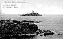
- 1 2 "Egg Rock Light". Jeremy D'Entremont.
- ↑ "Egg Rock Light: History". Jeremy D'Entremont.
- 1 2 "Cape Cod (Highland), MA". Lighthouse Friends.
- 1 2 "Hyannis Harbor Light: History". Jeremy d'Entremont.
- ↑ "Hyannis Harbor Light". Jeremy d'Entremont.
- 1 2 3 Ipswich Bay to Gloucester, Massachusetts (Map). 1:20,000. Department of Commerce. 1930. Chart 243.
- 1 2 3 "Long Island Head Light: History". Jeremy D'Entremont.
- 1 2 Boston Harbor (Map). 1:20,000. US Dept. of Commerce. 1928. Chart 246.
- 1 2 "Section VIII: Light List Corrections" (PDF). Local Notice to Mariners, District 1. United States Coast Guard: 22. 2012 week 3. Check date values in:
|date=(help) - 1 2 "Mayo's Beach, MA". Lighthouse Friends.
- 1 2 "Monomoy Point Light". Jeremy E'Entremont.
- 1 2 3 "Nantucket Cliff Range, MA". Lighthouse Friends.
- ↑ "Newburyport Harbor Range Front, MA". Lighthouse Friends.
- 1 2 Newburyport Harbor and Plum Island Sound (Map). 1:20,000. US Dept. of Commerce. 1958. Chart 213.
- ↑ "Newburyport Harbor Range Rear, MA". Lighthouse Friends.
- ↑ "Scituate Light". Jeremy D'Entremont.
- 1 2 "Palmer's Island Light". Jeremy D'Entremont.
- ↑ "Point Gammon, MA". Lighthouse Friends.
- 1 2 3 "Point Gammon Light". Jeremy D'Entremont.
- ↑ "Sandy Neck, MA". Lighthouse Friends.
- ↑ "Stage harbor, MA". Lighthouse Friends.
- ↑ "Three Sisters, MA". Lighthouse Friends.
- ↑ "Baker Rear Range, DE". LighthouseFriends.
- 1 2 3 "Bellevue Rear Range, DE". LighthouseFriends.
- ↑ "Inventory of Historic Light Stations: Bellevue Range Rear Light". National Park Service.
- 1 2 List of Light-houses, Lighted Beacons, and Floating Lights of the Atlantic, Gulf, and Pacific Coasts of the United States. Treasury Department. January 1, 1868. pp. 24–25. Retrieved 2014-01-23.
- 1 2 3 "Delaware Breakwater Light". LighthouseFriends. Retrieved 2014-01-23.
- 1 2 "Cherry Island Range, DE". LighthouseFriends.
- 1 2 3 4 5 6 7 List of Lights and Fog Signals on the Atlantic and Gulf Coasts of the United States. Government Printing Office. March 1, 1907. p. 124. Retrieved 2014-01-15.
- 1 2 3 Trapani, Bob (2007). "Christiana River Light Station". Delaware Lights: A History of Lighthouses in the First State. History Press. pp. 46–49. Retrieved 2014-01-21.
- 1 2 List of Lights and Fog Signals on the Atlantic and Gulf Coasts of the United States. Government Printing Office. June 30, 1900. p. 94. Retrieved 2014-01-23.
- 1 2 3 "Delaware Breakwater Rear Range (Green Hill) Light". LighthouseFriends. Retrieved 2014-01-23.
- ↑ "Fenwick Island, DE". LighthouseFriends.
- ↑ "Liston rear Range, DE". Lighthouse Friends.
- ↑ "Inventory of Historic Light Stations: Delaware Lighthouses: Reedy Island Range Rear Light". National Park Service. Retrieved 2013-12-20.
- ↑ "Sharps Island, MD". LighthouseFriends.
- ↑ "Local Notice to Mariners District 5 Week 02/10" (PDF). United States Coast Guard. 12 January 2010. p. 24. Retrieved 2010-12-05.
- ↑ William Livingstone Memorial Light
- ↑ Minor light of Alaska - Odiak Pharos
- ↑
- ↑
- ↑ Guard Island, AK, at LighthouseFriends.com
- ↑
- ↑
- ↑ "Historic Light Station Information and Photography: Hawaii". United States Coast Guard Historian's Office.
- ↑ Minor light of Kaua'i - Hanapepe, HI, at LighthouseFriends.com
- ↑ Minor light of Kaua'i - Kahala Point, HI, at LighthouseFriends.com
- ↑ Minor light of Kaua'i - Kokole, HI, at LighthouseFriends.com
- ↑ Minor light of Kaua'i - Kuki'i Point, HI, at LighthouseFriends.com
- ↑ Minor light of Kaua'i - Makahu'ena Point, HI, at LighthouseFriends.com
- ↑ Minor light of Kaua'i - Nohili Point, HI, at LighthouseFriends.com
- ↑ Minor light of Lana'i - Kaumalapau, HI, at LighthouseFriends.com
- ↑ Minor light of Lana'i - Manele Bay, HI
- ↑ Minor light of Lana'i - Palaoa Point , HI, at LighthouseFriends.Com
- ↑ Minor light of Lana'i - Pohakuloa Point, HI
- ↑ Minor light of Maui - Hanamanioa , HI
- ↑ Minor light of Maui - Hawea Point, HI
- ↑ Minor light of Maui - Ka'uiki Head, HI, at LighthouseFriends.com
- ↑ Minor light of Maui - McGregor Point, HI, at LighthouseFriends.com
- ↑ Minor light of Maui - Nakalele, HI
- ↑ Minor light of Maui - Pa'uwela Point, HI, at LighthouseFriends.com
- ↑ Minor light of Maui - Kahului Harbor Range, HI, at LighthouseFriends.com
- ↑ Minor light of Maui - Molokini, HI, at LighthouseFriends.com
- ↑
- ↑ Minor light of Oahu - Ka'ena Point, HI
- ↑ Minor light of Oahu - Pyramid Rock, HI
- ↑ Minor light of Kaho'olawe - Kaho'olawe Southwest Point, HI
- ↑ Minor light of Hawai'i - Coconut Point, HI, at LighthouseFriends.Com
- ↑ Minor light of Hawai'i - Kailua, HI, at LighthouseFriends.Com
- ↑ Minor light of Hawai'i - Napo'opo'o, HI
- ↑ Cape Kumukahi, HI
- ↑ Minor light of Hawai'i - Laupahoehoe Point, HI, at LighthouseFriends.com
- ↑ Minor light of Hawai'i - Kawaihae, HI
- ↑ Minor light of Hawai'i - Keahole Point, HI, at LighthouseFriends.Com
- ↑ Minor light of Hawai'i - Mahukona, HI, at LighthouseFriends.com
- ↑ Minor light of Hawai'i - Pepe'ekeo Point, HI, at LighthouseFriends.com
- ↑ Minor light of Hawai'i - Kukuihaele, HI , at LighthouseFriends.Com
External links
General
- Lighthouses in the National Park System.
- Light List, Volumes 1-7. United States Coast Guard.
- Lighthouse Friends
- Rowlett, Russ. "The Lighthouse Directory". University of North Carolina at Chapel Hill. a comprehensive international listing maintained by Russ Rowlett
- Inventory of Historic Light Stations from the National Park Service
- Interactive map of lighthouses all over the country.
- Lighthouses in the National Park System.
- Amateur Radio Lighthouse Society (ARLHS) U.S. LIGHTHOUSES BY STATE
- Lighthouses: An Administrative History
Great Lakes
- Wisconsin Historical Society, antique photographs of Wisconsin lighthouses.
- Terry Pepper on lighthouses of the Western Great Lakes.
- Bibliography on Michigan and other lighthouses.
- A more comprehensive (and interactive with geographic locations) listing of Michigan lighthouses and museums, complete with pictures and descriptions
- Detroit News, Interactive map on Michigan lighthouses.
- Map of Michigan Lighthouse in PDF Format.
- Wagner, John L. Beacons Shining in the Night, Michigan Lighthouse Bibliography, Chronology, History, Keepers Lives, and Photographs, Clarke Historical Library, Central, Michigan University.
| Types |
| _-_cropped.jpg) | ||||||||||
|---|---|---|---|---|---|---|---|---|---|---|---|---|
| Fixtures | ||||||||||||
| Maintenance |
| |||||||||||
| Individual lighthouses |
| |||||||||||
| Museums |
| |||||||||||
| Other organizations | ||||||||||||
| ||||||||||||