Light List
A Light List is a detailed list of navigational aids including lighthouses and other lighted navigation aids, unlighted buoys, radiobeacons, daybeacons, and racons. Light lists are published by most of the major maritime nations. Some nations, including the United Kingdom and the United States, publish lists that cover the whole world in many volumes. Other nations publish lists that cover only their own coasts.
Canada
The Canadian Coast Guard publishes the List of Lights,Buoys and Fog Signals in four volumes which are updated periodically
- Newfoundland and Labrador
- Inland Waters
- Atlantic Coast
- Pacific Coast
The books are available in paper from dealers and in PDF form for free download.[1]
Chile
The Chilean official list of lighthouses is the Lista de Faros de la costa de Chile, Costa Oriental de Tierra del Fuego y Territorio Antártico published (as Nr. 3007) by the Hydrographic and Oceanographic Service of the Chilean Navy (SHOA)[2]
Navigational aids in Chile are provided by the Servicio de Señalización Marítima [Maritime Signalling Service], a department of the Dirección de Seguridad y Operaciones Marítimas (Dirsomar) [Directorate of Maritime Security and Operations], of the Dirección General del Territorio Marítimo y de Marina Mercante (Directemar) [Directorate General of the Maritime Territory and the Merchant Marine] of the Chilean Navy.
France
SHOM, the French Naval Hydrographic and Oceanographic Service, publishes Les livres des feux et signaux de brume (Books of Lights and Fog Signals) in four volumes, updated periodically:[3]
- LA - The northeast Atlantic from Gibraltar to Ireland and the southern North Sea
- LB - The Mediterranean from Gibraltar to Sicily; and Syria and Lebanon
- LC - Atlantic Islands, west coast of Africa south to the Equator; Madagascar, Mauritius, Kerguelen; French Possessions in the Pacific Ocean
- LD - Saint Pierre and Miquelon - Lesser Antilles - Guyana
United Kingdom

The United Kingdom Hydrographic Office, generally known as "The Admiralty", publishes the Admiralty List of Lights and Fog Signals covering the whole world in 12 volumes. The information is also available in digital form.[4]
United States
The United States Coast Guard Light List is published annually in 7 volumes. It covers the entire coastline of the United States and its possessions.[5]
- I, Atlantic Coast, St. Croix River, Maine to Shrewsbury River, New Jersey
- II, Atlantic Coast, Shrewsbury River, New Jersey to Little River, South Carolina
- III, Atlantic Coast, Little River, South Carolina to Econfina River, Florida
- IV, Gulf of Mexico
- V, Mississippi River System
- VI, Pacific Coast and Pacific Islands
- VII, Great Lakes
Each volume of the Light List contains aids to navigation in geographic order from north to south along the Atlantic coast, from east to west along the Gulf coast, and from south to north along the Pacific coast. It lists seacoast aids first, followed by entrance and harbor aids listed from seaward.
Intracoastal Waterway aids are listed last in geographic order in the direction from New Jersey to Florida to the border of Texas and Mexico.
The listings are preceded by a description of the aids to navigation system in the United States, luminous range diagram, geographic range tables, and other information.
NGA publishes NGA List of Lights Radio Aids & Fog Signals covering the rest of the world:[6]
- PUB. 110 - Greenland, the East Coasts of North and South America (excluding Continental U.S.A. except the East Coast of Florida) and the West Indies
- PUB. 111 - The West Coasts of North and South America (Excluding Continental U.S.A. and Hawaii), Australia, Tasmania, New Zealand, and the Islands of the North and South Pacific Oceans
- PUB. 112 - Western Pacific and Indian Oceans Including the Persian Gulf and Red Sea
- PUB. 113 - The West Coasts of Europe and Africa, the Mediterranean Sea, Black Sea and Azovskoye More (Sea of Azov)
- PUB. 114 - British Isles, English Channel and North Sea
- PUB. 115 - Norway, Iceland and Arctic Ocean
- PUB. 116 - Baltic Sea with Kattegat, Belts and Sound and Gulf of Bothnia
Both the Coast Guard and the NGA lists are available in book form from a range of dealers and in PDF form, without charge.
References
- ↑ "Lists of Lights, Buoys and Fog Signals". Canadian Coast Guard.
- ↑ "Catálogo de cartas y publicaciones náuticas" (PDF) (in Spanish). Armada de Chile. 16 October 2011. Retrieved 22 January 2012.
- ↑ "Les ouvrages nautiques".
- ↑ "Admiralty Nautical Paper Publications". UK Hydrographic Office.
- ↑ "USCG Light Lists".
- ↑ "NGA List of Lights". NGA.
| General References | 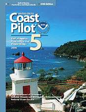 | |
|---|---|---|
| Nautical charts | ||
| Lights and Buoys | ||
| Geographic Information | ||
| Celestial Navigation | ||
| Tidal Information | ||
| Radio Information | ||
| Periodicals | ||
| See also | ||