Liergues
| Liergues | |
|---|---|
|
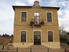
The town hall in Liergues | |
 Liergues | |
|
Location within Auvergne-Rhône-Alpes region  Liergues | |
| Coordinates: 45°58′01″N 4°40′01″E / 45.967°N 4.667°ECoordinates: 45°58′01″N 4°40′01″E / 45.967°N 4.667°E | |
| Country | France |
| Region | Auvergne-Rhône-Alpes |
| Department | Rhône |
| Arrondissement | Villefranche-sur-Saône |
| Canton | Le Bois-d'Oingt |
| Intercommunality | Communauté de communes Beaujolais-Saône-Pierres-Dorées |
| Government | |
| • Mayor (2008–2014) | René Bataillon |
| Area1 | 5.32 km2 (2.05 sq mi) |
| Population (2004)2 | 1,477 |
| • Density | 280/km2 (720/sq mi) |
| Time zone | CET (UTC+1) |
| • Summer (DST) | CEST (UTC+2) |
| INSEE/Postal code | 69114 / 69400 |
| Elevation |
201–308 m (659–1,010 ft) (avg. 210 m or 690 ft) |
|
1 French Land Register data, which excludes lakes, ponds, glaciers > 1 km² (0.386 sq mi or 247 acres) and river estuaries. 2 Population without double counting: residents of multiple communes (e.g., students and military personnel) only counted once. | |
Liergues is a commune in the Rhône department in eastern France.
See also
References
| Wikimedia Commons has media related to Liergues. |
This article is issued from Wikipedia - version of the 10/28/2016. The text is available under the Creative Commons Attribution/Share Alike but additional terms may apply for the media files.