Licq-Athérey
| Licq-Athérey | |
|---|---|
|
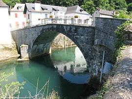
Bridge on the river Saison | |
 Licq-Athérey | |
|
Location within Nouvelle-Aquitaine region  Licq-Athérey | |
| Coordinates: 43°04′05″N 0°52′32″W / 43.0681°N 0.8756°WCoordinates: 43°04′05″N 0°52′32″W / 43.0681°N 0.8756°W | |
| Country | France |
| Region | Nouvelle-Aquitaine |
| Department | Pyrénées-Atlantiques |
| Arrondissement | Oloron-Sainte-Marie |
| Canton | Tardets-Sorholus |
| Intercommunality | Communauté de communes de Soule-Xiberoa |
| Government | |
| • Mayor (2008–2014) | Jean-Marc Peillen |
| Area1 | 17.87 km2 (6.90 sq mi) |
| Population (2006)2 | 232 |
| • Density | 13/km2 (34/sq mi) |
| Time zone | CET (UTC+1) |
| • Summer (DST) | CEST (UTC+2) |
| INSEE/Postal code | 64342 / 64560 |
| Elevation |
242–1,097 m (794–3,599 ft) (avg. 497 m or 1,631 ft) |
|
1 French Land Register data, which excludes lakes, ponds, glaciers > 1 km² (0.386 sq mi or 247 acres) and river estuaries. 2 Population without double counting: residents of multiple communes (e.g., students and military personnel) only counted once. | |
Licq-Athérey (Basque: Ligi-Atherei) is a commune in the Pyrénées-Atlantiques department in south-western France.
It is located in the former province of Soule.
Sights
Licq has a church (Church of St. Julien) whose origins date back to the Middle Ages and was substantially revised in the nineteenth century.
See also
References
External links
| Wikimedia Commons has media related to Licq-Athérey. |
- LIGI-ATHEREI in the Bernardo Estornés Lasa - Auñamendi Encyclopedia (Euskomedia Fundazioa) (Spanish)

This article is issued from Wikipedia - version of the 7/21/2016. The text is available under the Creative Commons Attribution/Share Alike but additional terms may apply for the media files.