Lexington, Massachusetts
| Lexington, Massachusetts | |||
|---|---|---|---|
| Town | |||
|
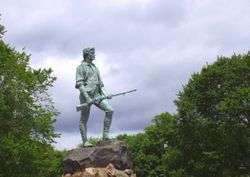
Statue of Captain John Parker and Hayes Memorial Fountain on Lexington Common, by H. H. Kitson | |||
| |||
| Etymology: Likely from Laxton, Nottinghamshire | |||
| Nickname(s): Birthplace of American Liberty | |||
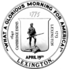
| Motto: "What a Glorious Morning for America!" | |||
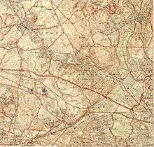
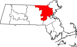
 Location in Middlesex County in Massachusetts | |||
| Coordinates: 42°26′50″N 71°13′30″W / 42.44722°N 71.22500°WCoordinates: 42°26′50″N 71°13′30″W / 42.44722°N 71.22500°W | |||
| Country | United States | ||
| State | Massachusetts | ||
| County | Middlesex | ||
| Settled | 1642 | ||
| Incorporated | 1713 | ||
| Government | |||
| • Type | Representative town meeting | ||
| Area | |||
| • Total | 16.5 sq mi (42.8 km2) | ||
| • Land | 16.4 sq mi (42.5 km2) | ||
| • Water | 0.1 sq mi (0.4 km2) | ||
| Elevation | 210 ft (64 m) | ||
| Population (2010) | |||
| • Total | 31,394 | ||
| • Density | 1,900/sq mi (730/km2) | ||
| Demonym(s) | Lexingtonian | ||
| Time zone | Eastern (UTC-5) | ||
| • Summer (DST) | Eastern (UTC-4) | ||
| ZIP code | 02420 / 02421 | ||
| Area code(s) | 339 / 781 | ||
| FIPS code | 25-35215 | ||
| GNIS feature ID | 0619401 | ||
| Website | www.lexingtonma.gov | ||

Lexington is a town in Middlesex County, Massachusetts, US. The population was 31,394 at the 2010 census,[1] in nearly 11,100 households. Settled in 1641, it is celebrated as the site of the first shots of the American Revolutionary War, in the Battle of Lexington on April 19, 1775. It is part of the Greater Boston Area and is the sixth wealthiest small city in the United States.[2]
History
Lexington was first settled circa 1642[3] as part of Cambridge, Massachusetts.[3] What is now Lexington was then incorporated as a parish, called Cambridge Farms, in 1691. This allowed them to have a separate church and minister, but were still under jurisdiction of the Town of Cambridge. Lexington was incorporated as a separate town in 1713. It was then that it got the name Lexington.[4] How it received its name is the subject of some controversy. Some people believe that it was named in honor of Lord Lexington, an English peer.[5] Some, on the other hand, believe that it was named after Lexington (which was pronounced and is today spelled Laxton) in Nottinghamshire, England.[6]
In the early colonial days, Vine Brook, which runs through Lexington, Burlington, and Bedford, and then empties into the Shawsheen River, was a focal point of the farming and industry of the town. It provided for many types of mills, and in the 20th Century, for farm irrigation.
For decades, Lexington grew modestly while remaining largely a farming community, providing Boston with much of its produce. It always had a bustling downtown area, which remains to this day. Lexington began to prosper, helped by its proximity to Boston, and having a rail line (originally the Lexington and West Cambridge Railroad, later the Boston and Maine Railroad) service its citizens and businesses, beginning in 1846. (As of 2015, the Minuteman Bikeway occupies the site of the former rail line.) For many years, East Lexington was considered a separate village from the rest of the town, though it still had the same officers and Town Hall. Most of the farms of Lexington became housing developments by the end of the 1960s.
Lexington, as well as many of the towns along the Route 128 corridor, experienced a jump in population in the 1960s and 70s, due to the high-tech boom. Property values in the town soared, and the school system became nationally recognized for its excellence.[7] The town participates in the METCO program, which buses minority students from Boston to suburban towns to receive better educational opportunities than those available to them in the Boston Public Schools.[8]
On April 19, 1775, what many regard as the first battle of the American Revolutionary War was a battle at Lexington. After the rout, the British march on toward Concord where the militia had been allowed time to organize at the Old North Bridge and turn back the British and prevent them from capturing and destroying the militia's arms stores.[9]
Lexington was the Cold War location of the USAF "Experimental SAGE Subsector"[10] for testing a prototype IBM computer that arrived in July 1955[11] for development of a computerized "national air defense network"[12] (the namesake "Lexington Discrimination System" for incoming ICBM warheads was developed in the late 1960s.)[13]
Geography
Lexington is located at 42°26′39″N 71°13′36″W / 42.44417°N 71.22667°W (42.444345, -71.226928).[14]
According to the United States Census Bureau, the town has a total area of 16.5 square miles (42.8 km²), of which 16.4 square miles (42.5 km²) is land and 0.1 square miles (0.4 km²), or 0.85%, is water.
Lexington borders the following towns: Burlington, Woburn, Winchester, Arlington, Belmont, Waltham, Lincoln, and Bedford. It has more area than all other municipalities that it borders.
Demographics
| Historical population | ||
|---|---|---|
| Year | Pop. | ±% |
| 1850 | 1,893 | — |
| 1860 | 2,329 | +23.0% |
| 1870 | 2,277 | −2.2% |
| 1880 | 2,460 | +8.0% |
| 1890 | 3,197 | +30.0% |
| 1900 | 3,831 | +19.8% |
| 1910 | 4,918 | +28.4% |
| 1920 | 6,350 | +29.1% |
| 1930 | 9,467 | +49.1% |
| 1940 | 13,187 | +39.3% |
| 1950 | 17,335 | +31.5% |
| 1960 | 27,691 | +59.7% |
| 1970 | 31,886 | +15.1% |
| 1980 | 29,479 | −7.5% |
| 1990 | 28,974 | −1.7% |
| 2000 | 30,355 | +4.8% |
| 2010 | 31,394 | +3.4% |
Source: United States Census records and Population Estimates Program data.[15][16][17][18][19][20][21][22][23][24] | ||
By the 2010 census, the population had reached 31,394.
As of the census[25] of 2010, there had been 31,394 people, 11,530 households, and 8,807 families residing in the town. The population density was 1,851.0 people per square mile (714.6/km²). There were 12,019 housing units at an average density of 691.1 per square mile (266.8/km²). The racial makeup of the town was 75.5% White, 19.9% Asian (8.6% Chinese, 4.8% Asian Indian, 3.2% Korean[26]), 1.5% Black or African American, 0.1% Native American, 0.0% Pacific Islander, 0.5% from other races, and 2.6% from two or more races. Hispanic or Latino of any race were 2.3% of the population.
There were 11,530 households out of which 38.6% had children under the age of 18 living with them, 66.0% were married couples living together, 7.7% had a female householder with no husband present, and 24.1% were non-families. 20.8% of all households were made up of individuals and 12.3% had someone living alone who was 65 years of age or older. The average household size was 2.66 and the average family size was 3.10.
In the town the population was spread out with 26.4% under the age of 18, 3.5% from 18 to 24, 22.7% from 25 to 44, 28.5% from 45 to 64, and 19.0% who were 65 years of age or older. The median age was 44 years. For every 100 females there were 88.7 males. For every 100 females age 18 and over, there were 83.5 males.
In 2013,[27] the mean home price for detached houses was $852,953, and the median price of a house or condo was $718,300. According to a 2012 estimate,[28] the median income for a household in the town was $191,350, and the median income for a family was $218,890. Males had a median income of $101,334 versus $77,923 for females. The per capita income for the town was $70,132. About 1.8% of families and 3.4% of the population were below the poverty line, including 3.2% of those under age 18 and 3.4% of those age 65 or over.
By race, the median household income was highest for mixed race households, at $263,321. Hispanic households had a median income of $233,875. Asian households had a median income of $178,988. White households had a median income of $154,533. Black households had a median income of $139,398. American Indian or Alaskan Native households had a median income of $125,139.[28]
Foreign-born population
In 2010, 20% of the residents of Lexington were born outside of the United States.[29]
Education
Public schools
Lexington's public education system includes six elementary schools, two middle schools, and one high school. Overall the Lexington school district is among the top ranked in the state and nationally.
Bridge Elementary School and Jonas Clarke Middle School were High Performing National Blue Ribbon Schools in 2010 and 2013 respectively.[30][31] They have been ranked as top schools based on Massachusetts Comprehensive Assessment System (MCAS) test scores. Lexington High School was ranked in 2014 as the 19th best high school in the nation by USNews.[32] In 2012, Lexington High School won the U.S. Department of Energy (DOE) National Science Bowl competition.[33] In addition to Lexington High School, students may attend Minuteman Regional High School.
Supplementary education
The Lexington Chinese School (LCS; 勒星頓中文學校) holds its classes at Belmont High School in Belmont.[34] In 2003 over 400 students attended classes at LCS, held on Sundays.[35]

Points of interest
- Lexington is most well known for its history and is home to many historical buildings, parks, and monuments, most dating from Colonial and Revolutionary times.
- One of the most prominent historical landmarks, located in Lexington Centre, is the Common, or as it later became known, the Battle Green, where the battle was fought, and a statue of John Parker, captain of the Lexington militia stands.
- Another important historical monument is the Revolutionary Monument, the nation's oldest standing war memorial (completed on July 4, 1799) and the gravesite of those colonists slain in the Battle of Lexington.
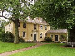
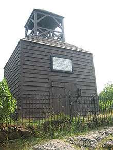
- Other landmarks of historical importance include the Old Burying Ground (with gravestones dating back to 1690), the Old Belfry, Buckman Tavern (circa 1704-1710), Munroe Tavern (circa 1695), the Hancock-Clarke House (1737), the U.S.S. Lexington Memorial, the Centre Depot (old Boston and Maine train station, today the headquarters of the town Historical Society), Follen Church (the oldest standing church building in Lexington, built in 1839), and the Mullikan White Oak (one of Lexington's most distinguished and oldest trees).[36]
- Lexington is also home, along with neighboring Lincoln and nearby Concord to the 900-acre (3.6 km2) Minute Man National Historical Park.
- The Scottish Rite Masonic Museum & Library showcases exhibits on American history and Freemasonry.
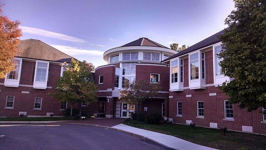
- Lexington's town center is home to numerous dining opportunities, fine art galleries, retail shopping, a small cinema, the Cary Memorial Library, the Minuteman Bikeway, Depot Square, and many of the aforementioned historical landmarks.
- The Great Meadow a.k.a. Arlington's Great Meadows, is a sprawling meadow and marshland located in East Lexington, but owned by the town of Arlington, Lexington's neighbor to the east.
- Willards Woods Conservation Area, a small forest of conservation land donated years ago by the Willard Sisters.[37] Willards Woods is referenced in the classic Saturday Night Live skit "Donnie's Party".
- Wilson Farm, a farm and farm stand in operation since 1884.
- The Lexington Community Center, a meeting place for Lexington residents
- Notable Lexington neighborhoods include Lexington Centre, Meriam Hill (and Granny Hill), Irish Village, Loring Hill, Belfry Hill, Munroe Hill, Countryside (sometimes referred to as "Scotland"), the Munroe District, the Manor Section, Four Corners, Grapevine Corner, Woodhaven, and East Lexington (fondly "East Village", or "The East End").
- Marrett Square, at the intersection of Marrett Road and Waltham Street, is the location of some light shopping and dining.
- The "Old Reservoir," sometimes referred to by locals as "The Res," used to provide drinking water to Lexington residents and surrounding areas. Now it offers a place to swim and picnic in the summer time. In the winter, when it freezes over, it is used as an ice skating area.
- Book publisher D.C. Heath was founded in 1885 at 125 Spring Street in Lexington, near the present day intersection of Route 128 and MA Route 2, and was headquartered on that spot until its 1995 sale to Houghton Mifflin.
- Lexington is home to several historically significant modernist communities built by notable architects. These neighborhoods include Six Moon Hill, Peacock Farm, and Five Fields.[38]
Notable people
- Henry David Abraham, M.D., psychiatrist[39]
- Orny Adams, comedian
- Charles Bachman, computer scientist and early developer of database management systems.[40]
- Nariman Behravesh, economic forecaster[41]
- Tim Berners-Lee, computer scientist and creator of the World Wide Web[42]
- Konrad Bloch, Nobel Prize in Medicine
- Nicolaas Bloembergen, Nobel Prize in Physics.
- Harold Dow Bugbee, Western artist [43]
- Sidney Burbank, officer in the U.S. Army during the American Civil War[44]
- Noam Chomsky, professor of linguistics at MIT, creator of the theory of generative grammar, noted political activist, commentator, and author.[45]
- Francis Judd Cooke, composer
- Mary Dailey (1928–1965), All-American Girls Professional Baseball League player.
- Alan Dawson (1929-1996), famous jazz drummer and percussion teacher
- Dave DeGuglielmo, Football coach
- Joseph Dennie, writer
- John M. Deutch, Deputy Secretary of Defense (1994–1995), Director of Central Intelligence (DCI) (1995–1996) and professor of chemistry at MIT
- Peter A. Diamond, 2010 Nobel Prize in Economics, Professor of Economics at MIT.
- Rachel Dratch, cast member of Saturday Night Live
- David Elkind, child psychologist, author
- Brad Ellis, composer and pianist appearing on the television show Glee (TV Series)
- Philip Elmer-DeWitt, science editor for Time Magazine
- Pavel Etingof, mathematician, fellow of the American Mathematics Society, and professor at MIT.
- Carlton Fisk, Hall of Fame catcher for Boston Red Sox and Chicago White Sox
- Jean B. Fletcher, Norman C. Fletcher (see John & Sarah Harkness below)
- Henry Louis Gates, Jr., African-American Studies scholar, co-editor of Encarta Africana encyclopedia
- Peter Glaser, pioneer in solar energy engineering
- Dana Greeley, last president of the American Unitarian Association and first president of the Unitarian Universalist Association
- Jonathan Gruber, professor of Economics at MIT and former Deputy Assistant Secretary of the U. S. Treasury
- Cyrus Hamlin, co-founder of Robert College in Istanbul
- G. Hannelius, child actress
- John C. Harkness and Sarah P. Harkness, founders of The Architects Collaborative in Cambridge, Massachusetts with Bauhaus veteran Walter Gropius
- Oliver Hart, 2016 Nobel Prize in Economics, Professor of Economics at Harvard
- Yu-Chi Ho, mathematician
- Pete Holmes, comedian
- Bill Janovitz, lead singer and guitarist of the rock and roll band Buffalo Tom
- Tama Janowitz, author, Slaves of New York (1986)[46]
- Dennis Johnson, guard for the Boston Celtics
- Claude Julien, current head coach for the Boston Bruins
- Jon Kabat-Zinn, creator of Mindfulness-based stress reduction [47]
- X. J. Kennedy, noted poet and writer
- Joyce Kulhawik, arts and entertainment anchor for WBZ-TV news
- Steve Leach, former NHL player
- Gerald S. Lesser (1926–2010), psychologist who played a major role in developing the educational programming included in Sesame Street.[48]
- Bill Lichtenstein, Peabody Award-winning journalist, filmmaker, radio producer
- Abraham Loeb, chair of Astronomy department and director of the Institute for Theory & Computation, Harvard University
- Salvador Luria, Nobel Prize in Medicine
- Rollie Massimino, led Villanova Wildcats to basketball national championship in 1985, former Lexington High School teacher and coach
- Scott McCloud, cartoonist
- Bill McKibben, environmentalist
- Andrew McMahon, musician, lead vocalist and songwriter of Jack's Mannequin and Something Corporate
- Douglas Melton, pioneer of stem cell research
- Eugene Mirman, comedian
- Mario Molina, Nobel Prize in Chemistry
- Russell Morash, pioneer of 'how-to' television, creator and producer of the PBS shows "The Victory Garden," "This Old House," and "New Yankee Workshop"
- Robbie Mustoe, former English Footballer, current ESPN analyst
- Matt Nathanson, musician
- Marjorie Newell Robb, (1889-1992), one of the last survivors of the sinking of RMS Titanic in 1912.
- Ryan Jude Novelline, contemporary artist and fashion designer[49]
- Joseph Nye, political analyst, author of Soft power
- Cathy O'Neil, Data Scientist, Occupier and blogger at mathbabe. LHS Grad.[50]
- Peter Orszag, economist, Director of the Office of Management and Budget
- Amanda Palmer, songwriter, vocalist, pianist of the duo The Dresden Dolls[51]
- John Parker, captain of the Lexington militia at the Battle of Lexington & Concord[52]
- Theodore Parker, Unitarian minister and Transcendentalist[53][54]
- Cecilia Payne-Gaposchkin, astronomer known for her work on spectral analysis of stars. Awarded the Henry Norris Russell Lectureship by the American Astronomical Society in 1976.[55]
- Charles Ponzi, con man, bought mansion in Lexington during 1920 (see Ponzi scheme)
- Dionne Quan, voice actress
- John Rawls, philosopher; known for his theory of justice
- Ruth Sawyer, author, winner of the Newbery Medal
- Clifford Shull, Nobel Prize in Physics
- Aafia Siddiqui, neuroscientist convicted of assaulting with a deadly weapon and attempting to kill U.S. soldiers and FBI agents (alleged Al-Qaeda operative)
- Tom Silva, building contractor and co-host of the PBS show This Old House
- Clarence Skinner, Dean of Crane School of Theology at Tufts and influential 20th-century American Universalist
- Robert Solow, Nobel Prize–winning economist
- Jill Stein, 2012 and 2016 Green Party presidential candidate
- Samuel Ting, Nobel Prize in Physics
- Bradford Washburn (1910-2007), mountaineer and Barbara Washburn (1914-2014), first woman to summit Denali.
- Sheila E. Widnall, aerospace researcher and educator at MIT, former Secretary of the Air Force
- Edward Osborne Wilson, entomologist and two-time Pulitzer Prize-winning author
- Ethan Zohn, winner of Survivor: Africa[56]
Sister cities
Lexington is a sister city of
-
 Antony, France [57]
 -
 Dolores Hidalgo, Guanajuato, Mexico [57]
 -
 Dnipropetrovsk, Ukraine
 -
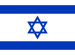 Haifa, Israel
 -
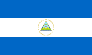 Waspam, Nicaragua[57]
 -
 Pavlovsk, Russia[57]
 - Gatchina, Russia[57]
References
- ↑ "Profile of General Population and Housing Characteristics: 2010 Demographic Profile Data (DP-1): Lexington town, Middlesex County, Massachusetts". U.S. Census Bureau, American Factfinder. Archived from the original on September 11, 2013. Retrieved April 6, 2012.
- ↑ "These Are The 10 Richest Small Cities In America". Movoto Real Estate. Retrieved January 9, 2015.
- 1 2 Tracing the Past in Lexington, Massachusetts. Edwin B. Worthen.
- ↑ Lexington, MA Chamber of Commerce Home Page
- ↑
- ↑ Lexington - Britannica Online Encyclopedia
- ↑ "America's Top Schools - Lexington High School #19 in 2014".
- ↑ "METCO FAQ". Massachusetts Department of Education.
- ↑ Fischer, David Hackett. Paul Revere's Ride, pp. 184-232, Oxford University Press, New York, NY, 1994. ISBN 0-19-508847-6.
- ↑ http://www.dtic.mil/cgi-bin/GetTRDoc?AD=AD0419183
- ↑ Biweekly Report for 29 July 1955 (PDF) (minutes). Memorandum 6M-3797. Lincoln Laboratory Division 6. Retrieved 2013-07-25.
All XD-1 frames have now been delivered. The LRI and output frame3 arrived 29 July.
- ↑ "Overview". SAGE: The First [computerized]National Air Defense Network. IBM.com. Retrieved 2013-05-08.
the AN/FSQ-7…was developed, built and maintained by IBM. … In June 1956, IBM delivered the prototype of the computer to be used in SAGE.
- ↑ Lemnios, William Z.; Grometstein, Alan A. (November 1, 2002). "Overview of the Lincoln Laboratory Ballistic Missile Defense Program". Lincoln Laboratory journal. 13.
- ↑ "US Gazetteer files: 2010, 2000, and 1990". United States Census Bureau. 2011-02-12. Retrieved 2011-04-23.
- ↑ "TOTAL POPULATION (P1), 2010 Census Summary File 1". American FactFinder, All County Subdivisions within Massachusetts. United States Census Bureau. 2010.
- ↑ "Massachusetts by Place and County Subdivision - GCT-T1. Population Estimates". United States Census Bureau. Retrieved July 12, 2011.
- ↑ "1990 Census of Population, General Population Characteristics: Massachusetts" (PDF). US Census Bureau. December 1990. Table 76: General Characteristics of Persons, Households, and Families: 1990. 1990 CP-1-23. Retrieved July 12, 2011.
- ↑ "1980 Census of the Population, Number of Inhabitants: Massachusetts" (PDF). US Census Bureau. December 1981. Table 4. Populations of County Subdivisions: 1960 to 1980. PC80-1-A23. Retrieved July 12, 2011.
- ↑ "1950 Census of Population" (PDF). Bureau of the Census. 1952. Section 6, Pages 21-10 and 21-11, Massachusetts Table 6. Population of Counties by Minor Civil Divisions: 1930 to 1950. Retrieved July 12, 2011.
- ↑ "1920 Census of Population" (PDF). Bureau of the Census. Number of Inhabitants, by Counties and Minor Civil Divisions. Pages 21-5 through 21-7. Massachusetts Table 2. Population of Counties by Minor Civil Divisions: 1920, 1910, and 1920. Retrieved July 12, 2011.
- ↑ "1890 Census of the Population" (PDF). Department of the Interior, Census Office. Pages 179 through 182. Massachusetts Table 5. Population of States and Territories by Minor Civil Divisions: 1880 and 1890. Retrieved July 12, 2011.
- ↑ "1870 Census of the Population" (PDF). Department of the Interior, Census Office. 1872. Pages 217 through 220. Table IX. Population of Minor Civil Divisions, &c. Massachusetts. Retrieved July 12, 2011.
- ↑ "1860 Census" (PDF). Department of the Interior, Census Office. 1864. Pages 220 through 226. State of Massachusetts Table No. 3. Populations of Cities, Towns, &c. Retrieved July 12, 2011.
- ↑ "1850 Census" (PDF). Department of the Interior, Census Office. 1854. Pages 338 through 393. Populations of Cities, Towns, &c. Retrieved July 12, 2011.
- ↑ "American FactFinder". United States Census Bureau. Archived from the original on September 11, 2013. Retrieved 2008-01-31.
- ↑ "QT-P8: Race Reporting for the Asian Population by Selected Categories: 2010". factfinder2.census.gov. 2010 Census. Retrieved 1 June 2014.
- ↑ "Lexington, MA 02421 Zip Code Detailed Profile". City-data.com. Retrieved 2016-04-09.
- 1 2 "Lexington, MA Income and Careers". Usa.com. Retrieved 2015-02-10.
- ↑ Sacchetti, Maria. "A melting pot stretches out to the suburbs." Boston Globe. September 15, 2010. p. 2 (Archived November 11, 2014, at the Wayback Machine.). Retrieved on September 23, 2014.
- ↑ "2010 National Blue Ribbon Exemplary High Performing Schools" (PDF). U.S. Department of Education.
- ↑ "2013 National Blue Ribbon Exemplary High Performing Schools" (PDF). U.S. Department of Education.
- ↑ .
- ↑ Past High School National Science Bowl Winners (1991 - 2012) | U.S. DOE Office of Science (SC). Science.energy.gov (2013-05-17). Retrieved on 2013-08-16.
- ↑ "關於我們 About Us." Lexington Chinese School. Retrieved on September 8, 2015. "Lexington Chinese School 221 Concord Ave. Belmont, MA 02478, USA (at Belmont High School)" Directions
- ↑ Hsiao, Teresa. "WEEKEND TRAINING" (Archived 2015-09-07 at WebCite). The Patriot Ledger. July 2, 2003 (from the summary page(Archive). Retrieved on September 8, 2015.
- ↑ We Are Lexington, MA - Celebrating 300 Years, "The Oldest Tree in Lexington" by Nell Walker.
- ↑ Willards Woods Conservation Area
- ↑ Kathleen Burge, Boston Globe, Out to save the modern home, 2011 Feb 24
- ↑ "Directions to Dr. A's Office". drabraham.com. Retrieved 2 September 2015.
- ↑ Andrew L. Russell (April 9, 2011). "Oral-History:Charles Bachman". IEEE Oral History Network. Retrieved September 1, 2015.
- ↑ "MIT Alumni". Retrieved January 27, 2014.
- ↑ "29 Are Chosen for Fellowships From the MacArthur Foundation", The New York Times, June 2, 1998, retrieved January 29, 2012
- ↑ Wishart, David J., ed. (2004), Encyclopedia of the Great Plains, Center for Great Plains Studies, p. 112, retrieved January 29, 2012
- ↑ Hudson, Charles (1913), History of the town of Lexington, Middlesex County, Massachusetts, from its first settlement to 1868, Houghton Mifflin, p. 80, retrieved January 31, 2012
- ↑ Famous folks from Lexington, Boston.com, retrieved July 31, 2012
- ↑ "She'll Take Manhattan", New York Magazine, July 14, 1986
- ↑ Simon, Cecilia Capuzzi (12 July 2005). "Mr. Mindfulness". Washington Post. Retrieved 31 August 2015.
- ↑ Fox, Margalit. "Gerald S. Lesser, Shaper of 'Sesame Street,' Dies at 84", The New York Times, October 4, 2010. Accessed October 4, 2010.
- ↑ Campbell, Ami (October 2, 2014), Lexington's Novellines 'A Power House' of Creativity, 149 (50), Lexington, MA: Lexington Minuteman, p. C1, archived from the original (Print & Web) on October 2014, retrieved October 7, 2014
- ↑ "Catherine O'Neil". LinkedIn.com. Retrieved November 19, 2014.
- ↑ "Famous folks from Lexington". Boston.com. Retrieved July 31, 2012.
- ↑ Fischer, David Hackett. Paul Revere's Ride, pp. 149-51, 158, 160, 180, 182, 188, 191, 193, 197, 201, 203, 210, 228, 229, 285, 319, 395, Oxford University Press, New York, NY, 1994. ISBN 0-19-508847-6.
- ↑ Commager, Henry Steele. Theodore Parker: An Anthology, Beacon Press, Boston, MA, 1960.
- ↑ Commager, Henry Steele. Theodore Parker, Beacon Press, Boston, MA, 1947.
- ↑ "Henry Norris Russell Lectureship". Retrieved March 20, 2015.
- ↑ "Famous folks from Lexington". Boston.com. Retrieved July 31, 2012.
- 1 2 3 4 5 Lexington's Sister Cities
Further reading
- 1871 Atlas of Massachusetts. by Wall & Gray.Map of Massachusetts. Map of Middlesex County.
- History of Middlesex County, Massachusetts, Volume 1 (A-H), Volume 2 (L-W) compiled by Samuel Adams Drake, published 1879 and 1880. 572 and 505 pages. Lexington section by Charles Hudson in volume 2 pages 9–33 (note page 9 missing).
- History of the Town of Lexington, Middlesex County, Massachusetts,Volume 1 - History, Volume2 - Genealogies, by Charles Hudson, published 1913.
- Paul Revere's Ride, by David Hackett Fischer, Oxford University Press, New York, NY, 1994. ISBN 0-19-508847-6.
External links
| Wikimedia Commons has media related to Lexington, Massachusetts. |
-
 Lexington (Massachusetts) travel guide from Wikivoyage
 - Town of Lexington official website
- Lexington Historical Society
-
 "Lexington, a township of Middlesex county, Massachusetts, U.S.A.". Encyclopædia Britannica (11th ed.). 1911.