Lentvaris
| Lentvaris | |||
|---|---|---|---|
| City | |||
| |||
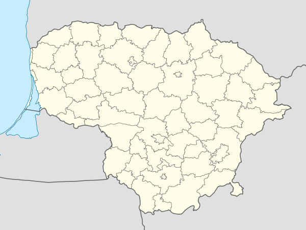 Lentvaris Location of Lentvaris | |||
| Coordinates: 54°39′0″N 25°4′0″E / 54.65000°N 25.06667°ECoordinates: 54°39′0″N 25°4′0″E / 54.65000°N 25.06667°E | |||
| Country |
| ||
| Ethnographic region | Dzūkija | ||
| County | Vilnius County | ||
| Municipality | Trakai district municipality | ||
| Eldership | Lentvaris eldership | ||
| Capital of | Lentvaris eldership | ||
| First mentioned | 17th century | ||
| Granted city rights | 1946 | ||
| Population (2005) | |||
| • Total | 11,832 | ||
| Time zone | EET (UTC+2) | ||
| • Summer (DST) | EEST (UTC+3) | ||


Lentvaris (![]() pronunciation , is a town, (formerly known as 'Landwarów' in Polish), in eastern Lithuania, 9 km east of Trakai. It is a transportation hub, as several road and rail routes cross here.
Lake Lentvaris is nearby.
pronunciation , is a town, (formerly known as 'Landwarów' in Polish), in eastern Lithuania, 9 km east of Trakai. It is a transportation hub, as several road and rail routes cross here.
Lake Lentvaris is nearby.
History
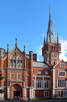
In the 18th Century, the town of Lentvaris, was within the Polish–Lithuanian Commonwealth. It was populated by Poles, Lithuanians and Jews and belonged to the estate of the Polish-Lithuanian House of Sapieha. Following the partitions of Polish-Lithuanian Commonwealth the town became part of the Russian Empire. In 1850 the town was owned by Izdebski and then sold on to another Polish-Lithuanian magnate clan, the Tyszkiewicz (Tiškevičius) family.[1] In 1885 they had a Tudor-style palace built with a park, designed by Édouard André.[2] In 1869 an industrial nail factory was established in the town.
After the Polish-Bolshevik War, from 1922, Lentvaris was part of Poland in the Wilno–Troki District of the Wilno Voivodeship,.[3][4]
In September 1939, Nazi Germany attacked Poland simultaneously with the Soviet Union. The town was taken over by the Soviets on September 19, 1939. Local Polish soldiers, who had fought in the September Campaign, were attacked and interned by Lithuanians in the town of Kretinga.[5] Between 1942 and 1943, a Jewish partisan unit headed by Abba Kovner operated in the area. They blew up a train bound from Warsaw to Vilnius, near Lentvaris station, on the stretch between Vilnius and Grodno. Twenty one carriages carrying German troops and supplies were derailed.[6]
Famous people
- Stefan Tyszkiewicz (1894-1976), last heir to the Tyszkiewicz estate of Landwarów, was a noted engineer and inventor. In the 1920s he was an early pioneer of the Polish automotive industry through his firm, Stetysz. His life was much interrupted by wars, but he never ceased to apply his technical skills. After his arrest in Lithuania by the Soviets during World War II, he was imprisoned in Lubianka Prison, then released to join Anders' Army and its great exodus through the Middle East to Italy. After the war he remained an exile until his death in London.
- In 1932, a wedding between Rebbetzin Shaina, daughter of Lubavitcher Rebbe, Rabbi Yosef Yitzchok Schneersohn and Rabbi Menachem Mendel Horenstein, the Rebbe's cousin, was held in the town.
- Teresa Żylis-Gara, the 20th century soprano singer was born in Lentvaris. In 2004 she founded a Pipe organ in the Polish Roman-Catholic church pw. Zwiastowania NMP in the town.[7]
References
- ↑ (Polish) http://dir.icm.edu.pl/pl/Slownik_geograficzny/Tom_V/75, Estreicher's standard text on the geography of Poland.
- ↑ (Polish) Aftanazy, Roman. DZIEJE REZYDENCJI NA DAWNYCH KRESACH RZECZYPOSPOLITEJ. TOM 3 WOJEWÓDZTWO TROCKIE, KSIĘSTWO ŻMUDZKIE, INFLANTY POLSKIE, KSIĘSTWO KURLANDZKIE, Wrocław: Ossolineum, 1992.
- ↑ (Polish) Orneta.net - serwis miasta; informator
- ↑ Michael Tobias, JewishGen Communities Database
- ↑ (Polish) Mieczysław Potocki "Węgielny", Okres od 1 września 1939 r. do kwietnia 1940 r.
- ↑ Operations Diary of a Jewish Partisan Unit in Rūdnikai Forest (1943-1944). Source: Yad Vashem
- ↑ (Polish) Teresa Żylis-Gara in Landwarów, including photographs
- (Polish) Parafianie kościoła pw. Zwiastowania NMP w Landwarowie, i Teresa Żylis-Gara
- (Polish) Alwida Antonina Bajor, Spotkanie z hrabiostwem Hanną i Adamem Tyszkiewiczami
See also
| Municipalities |  | |
|---|---|---|
| Cities | ||
| Towns | ||
| Villages | ||