Lenox Hill
Coordinates: 40°46′08″N 73°57′43″W / 40.769°N 73.962°W


Lenox Hill is a neighborhood on Manhattan's Upper East Side. It forms the lower section of the Upper East Side, closest to Midtown. The neighborhood ranges from East 60th Street to East 77th Street south to north, by East River to the east, and by Park Avenue to the west.[1] A significant portion of the neighborhood lies within the Upper East Side Historic District designated by the New York Landmarks Preservation Commission in 2013 and expanded in 2010.[2] The neighborhood is part of Manhattan Community Board 8.
History
The neighborhood is named for the hill that "stood at what became 70th Street and Park Avenue."[1] The name "Lenox" is that of the immigrant Scottish merchant Robert Lenox (1759-1839),[3] who owned about 30 acres (120,000 m2) of land "at the five-mile (8 km) stone", reaching from 5th Avenue to 4th Avenue and from East 74th Street to 68th Street.[4] For the sum of $6,420 ($99,000 in current dollar terms)[5] or $6,920 ($107,000)[4] he had purchased a first set of three parcels in 1818, at an auction held at the Tontine Coffee House of mortgaged premises of Archibald Gracie, in order to protect Gracie's heirs from foreclosure, as he was executor of Gracie's estate.[4] Several months later he purchased three further parcels, extending his property north to 74th Street.[6] According to one source, "Thereafter these two tracts were known as the 'Lenox Farm.'"[7] The tenant farmhouse stood on the rise of ground between Fifth and Madison avenues and 70th and 71st Streets, which would have been the hill, if the property had ever been called "Lenox Hill." The railroad right-of-way of the New York & Harlem Railroad passed along the east boundary of the property.
Robert Lenox's son James Lenox divided most of the farm into blocks of building lots and sold them during the 1860s and 1870s;[8] he also donated land for the Union Theological Seminary along the railroad right-of-way, between 69th and 70th Streets, and just north of it a full square block between Madison and Fourth Avenue, 70th and 71st streets, for the Presbyterian Hospital, which occupied seven somewhat austere structures on the plot;[9] He built the Lenox Library on a full block-front of Fifth Avenue, now the site of the Frick Collection.
Structures
Lenox Hill Hospital, the former German Hospital, is located in this area, on East 77th Street.
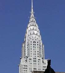
Luxury residences built in the 1910s and '20s are now very expensive. Park Avenue and Lexington Avenue both pass through Lenox Hill, and along these avenues, there are many boutiques, art galleries and five-star hotels. Museums in the area include the Frick Collection.[10]
Demographics
As of 2009, the population of the area was 67,122. The population density was approximately 35,960 people per square kilometer. Over 75% of residents were white. The median income for a household living in Lenox Hill was $92,219.[11]
Transportation
Lenox Hill is serviced by the 68th Street–Hunter College station on the 4 6 <6> trains of the New York City Subway.[12] Bus routes include M1, M2, M3, M4, M15, M66, M72, M98, M101, M102, M103.[13]
Lenox Hill is expected to be served by the Citywide Ferry Service[14] starting in 2018.[15][16]
References
Notes
- 1 2 Jackson, Kenneth T., ed. (1995). The Encyclopedia of New York City. Yale University Press. p. 663. ISBN 978-0300055368.
...bounded to the north by East 77th Street, to the east by East River, to the south by East 60th Street, and to the west by Park Avenue.
- ↑ White, Norval; Willensky, Elliot; Leadon, Fran (2010), AIA Guide to New York City (5th ed.), New York: Oxford University Press, ISBN 9780195383867, p.419
- ↑ (New York Public Library) Guide to the James Lenox Papers; James Trager, The New York Chronology. s.v. "1840" [sic]. Archived December 10, 2006, at the Wayback Machine.
- 1 2 3 "Miss Lenox's Heirs". The New York Times. 14 September 1886. Retrieved February 22, 2013.
- ↑ Morrison (1906), p. 85f
- ↑ Wilson, James Grant. The Memorial History of the City of New-York from Its First Settlement... 1893, p. 10
- ↑ Morrison (1906)
- ↑ "Realty Romance in Old Lenox Farm", The New York Times (December 15, 1918); the occasion was the auction of the auction sale an 1874 map of the section of Robert Lenox's farm that lay between 71st and 74th Streets.
- ↑ "Founded by James Lenox, the chief features of the Presbyterian Hospital..., The New York Times (July 3, 1892)
- ↑ Jackson, Kenneth T., ed. (2010), The Encyclopedia of New York City (2nd ed.), New Haven: Yale University Press, ISBN 978-0-300-11465-2, p.732
- ↑ "Lenox Hill neighborhood in New York, New York (NY)". city-data.com. Retrieved 2012-12-22.
- ↑ "Subway Map" (PDF). Metropolitan Transportation Authority. November 2016. Retrieved 2016-11-07.
- ↑ "Manhattan Bus Map" (PDF). Metropolitan Transportation Authority (New York). 2016. Retrieved 2016-09-23.
- ↑ DNAinfoNewYork. "Proposed Routes for NYC's Expanded Ferry Service". Scribd. Retrieved September 22, 2016.
- ↑ "Citywide Ferry Service to Launch in June 2017, Official Says". DNAinfo New York. 2016-03-03. Retrieved 2016-09-22.
- ↑ "New York City's Ferry Service Set to Launch in 2017". NBC New York. Retrieved 9 May 2016.
Bibliography
- Morrison, George Austin. History of Saint Andrew's Society of the State of New York, 1756-1906 (1906)
External links
 Media related to Lenox Hill at Wikimedia Commons