Leilani Estates, Hawaii
| Leilani Estates, Hawaii | |
|---|---|
| Census-designated place | |
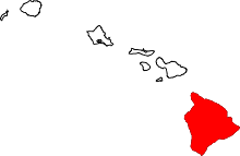
 Location in Hawaii County and the state of Hawaii | |
| Coordinates: 19°28′25″N 154°55′13″W / 19.47361°N 154.92028°WCoordinates: 19°28′25″N 154°55′13″W / 19.47361°N 154.92028°W | |
| Country | United States |
| State | Hawaii |
| County | Hawaii |
| Area | |
| • Total | 4.2 sq mi (10.8 km2) |
| • Land | 4.2 sq mi (10.8 km2) |
| • Water | 0.0 sq mi (0.0 km2) |
| Elevation | 771 ft (235 m) |
| Population (2010) | |
| • Total | 1,046 |
| • Density | 251.5/sq mi (97.1/km2) |
| Time zone | Hawaii-Aleutian (UTC-10) |
| Area code(s) | 808 |
| FIPS code | 15-44562 |
| GNIS feature ID | 1852580 |
Leilani Estates is a census-designated place (CDP) in Hawaiʻi County, Hawaiʻi, United States located in the District of Puna. The population was 1,046 at the 2000 census. The population increased by 49.1% to 1,560 at the 2010 census.[1]
Geography
Leilani Estates is located at 19°28′25″N 154°55′13″W / 19.47361°N 154.92028°W (19.473546, -154.920268).[2]
According to the United States Census Bureau, the CDP has a total area of 4.2 square miles (11 km2), all of it land.
Leilani Estates is located directly on a stretch of the east rift zone of Kīlauea volcano, in lava flow hazard zone 1.[3] Zone 1 includes the summit and rift zones of active volcanoes—new eruptive vents can spawn anywhere inside this zone. However, despite this apparent dire possibility no lava has come close to affecting Leilani Estates for over 55 years. Only approximately 10% or 50 square miles (100 km2) out of the 500 square miles (1,000 km2) of Puna have been covered by lava flows since 1790 when George Washington was still President of the US.[4]
Demographics
As of the census of 2010, there were 1,560 people in 696 households residing in the CDP. The population density was 371.4 people per square mile (144.4/km²). There were 807 housing units at an average density of 192.1 per square mile (74.7/km²). The racial makeup of the CDP was 63.40% White, 1.35% African American, 1.79% American Indian & Alaska Native, 6.09% Asian, 6.15% Native Hawaiian & Pacific Islander, 1.22% from other races, and 20.00% from two or more races. Hispanic or Latino of any race were 9.81% of the population.[1]
There were 696 households out of which 18.1% had children under the age of 18 living with them. The average household size was 2.24.[1]
In the Leilani Estates CDP the population was spread out with 17.4% under the age of 18, 6.9% from 18 to 24, 11.7% from 25 to 34, 17.6% from 35 to 49, 32.9% from 50 to 64, and 13.4% who were 65 years of age or older. For every 100 females there were 113.1 males. For every 100 males there were 88.4 females.[1]
The median income for a household in the CDP at the 2000 census was $31,541, and the median income for a family in 2000 was $32,692. Males had a median income of $30,500 versus $22,875 for females in 2000. The per capita income for the CDP in 2000 was $15,522. About 13.7% of families and 21.9% of the population were below the poverty line in 2000, including 16.4% of those under age 18 and 25.5% of those age 65 or over.
References
- 1 2 3 4 US Census Bureau - 2010 Population Finder - Leilani Estates CDP
- ↑ "US Gazetteer files: 2010, 2000, and 1990". United States Census Bureau. 2011-02-12. Retrieved 2011-04-23.
- ↑ Volcanic and Seismic Hazards on the Island of Hawaii: Lava Flow Hazard Zone Maps
- ↑ USGS Summary of the Pu`u `Ō `ō-Kupaianaha Eruption, 1983-present