Lee, London

Coordinates: 51°27′08″N 0°00′31″E / 51.4522°N 0.0086°E
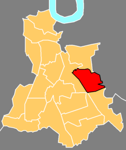
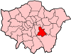
Lee (also Lee Green) is a suburban district of south east London, within the London Borough of Lewisham. It is located west of Eltham and east of Lewisham town centre. Until 1889 the district was in the county of Kent.
St Margaret's Church (built 1839–41, architect: John Brown) is the burial place of three Astronomers Royal: Edmond Halley, Nathaniel Bliss and John Pond.
History

The Manor of Lee was a historic parish of the Blackheath hundred and existed up to 1900 when it was merged with the parish of Lewisham to create the Metropolitan Borough of Lewisham. While modern Lee is centred on Lee railway station and the road of Burnt Ash Hill, the parish was based around Lee High Road which today stretches into the town centre of Lewisham. The River Quaggy formed much of the boundary between the two parishes, though at Lee Bridge (at the western end of Lee High Road) it is now almost completely hidden.
The Lee Manor Society have produced a comprehensive history of the area.[2] The Domesday Book describes Lee as a small area of cultivation set in extensive woodland. The earliest map available (Rocque's of 1740) shows a cluster of about a dozen houses around a triangular village green. This hamlet was surrounded by fields. Lee Green Farm occupied the south-east quadrant from the 1660s (roughly on the site of the present Leegate shopping centre). The farm was demolished in the 1840s and rebuilt as Tudor House further east.
The Old Tiger's Head and the New Tiger's Head pubs are important and striking features of the crossroads. Confusingly, the original (Old) Tiger's Head is thought to have been built on the site currently occupied by the New Tiger's Head. The original pub is thought to have been built before 1730. It was rebuilt on its present site, the north-west quadrant, in 1750–1770 and then rebuilt (in its third incarnation) in 1896 – the date carried on its frontage. It became an important mail and coaching inn. The New Tiger's Head started life as a beer shop known as the Tiger Tavern in the 1830s. It was situated in the end of four cottages known as Prospect Terrace built around the same time. Three of these cottages remain, housing a post office/newsagent and a hairdresser. In 1868 it is referred to as the Tiger's Head Inn. The present building is thought to have replaced the original cottage a few years after 1896 – the date of the rebuilding of the Old Tiger's Head. The New Tiger's Head has now closed down.
In 1815 cavalry and foot regiments passed through Lee Green on their way to the Battle of Waterloo:
- "The space in front of the Tiger's Head and the Green were very commodious for the transfer of baggage to the waggons of the farmers from the other side of London to those of the farmers in this neighbourhood which were pressed for that purpose, to convey them 15 miles further on the journey to Dover." (FH Hart History of Lee, 1892)
In the early nineteenth century boxing matches took place at the Old Tiger's Head. Horse racing and (human) foot racing took place in the 1840s but the police put a stop to these events, probably under pressure from local citizens. At that time the green was the centre of village life with cricket matches, bare knuckle boxing and other entertainments. In the 1850s further house-building prompted the installation of proper sewers and the Lee Green horse pond was filled in. In the 1860s John Pound, a developer, erected houses in the south-east quadrant, Orchard Terrace on Eltham Road and Crown Terrace on Burnt Ash Lane (now Road).
The opening of Lee station in 1866 prompted more house-building at the crossroads. The site of Lee Green Farm was built on as Carston Mews. In the same year Charles Henry Reed, a linen draper, moves into 1 Orchard Terrace and established a department store. Reed died in 1895 and in 1903 the business was taken over by Griffith & Co.
In the south-west quadrant the Prince Arthur pub was built at 422 Lee High Road in 1870 (closed 2005). It was originally one of a row of early nineteenth century cottages of which three – nos 424–428 – survived behind modern shop fronts. In 1898 No 345 Lee High Road was built in front of the former Old Tiger's Head stables. It incorporated a fire station but the London County Council built a replacement in 1906 in Eltham Road. It is still in use. A police station was built at 418 Lee High Road in 1904, replacing one built before 1860. It was converted to apartments in 2003.
In the early 1960s the south-east quadrant, including Carston Mews, was demolished to make way for Leegate shopping centre which went into decline following the opening of Sainsbury's on the opposite side of Burnt Ash Road in the late 1980s. Owners of the centre, St. Modwen Properties have recently proposed a £40m regeneration plan for the centre, including the demolition of the current shopping precinct to be replaced with an Asda supermarket as well as the conversion of the existing office block into a hotel.[3]
Famous residents
- Sir Francis Baring, founder of Baring Brothers Bank, bought the Manor House (attributed to architect Richard Jupp) in Manor Lane (now a library and its grounds a public park, Manor House Gardens) in 1796.
- Henry Thomas Buckle, English historian and author of A History of Civilization was born in Lee.
- Poet Ernest Dowson was also born in Lee.
- Actor James Robertson Justice was born in Lee in 1907.
- Actor Jude Law
- Musician Manfred Mann lived in Southbrook Road in Lee.
- Philosopher, sociologist and economic historian Karl Marx lived at Lee for a short period during the 19th century
- John Mayall lived in Lee Green. Eric Clapton stayed with him during the recording sessions of the album Blues Breakers with Eric Clapton
- Sir Gregory Page built a large mansion house (demolished in 1787) at Wricklemarsh in Lee.
- Mechanical engineer John Penn died at his home, The Cedars, Lee on 23 September 1878, and was subsequently buried at nearby St Margaret's Church.
- Reggie Schwarz, South African cricketer, was born in Lee.
- Comedian Arthur Smith briefly lived in Lee while he attended Roan Boys' Grammar School
- Stanley Unwin, publisher, lived in Handen Road.
- Max Wall, actor and comedian
- Estelle Winwood, English stage and screen actress who later lived in the USA and, at the time of her death at 101, she was the oldest member in the history of the Screen Actors Guild.
Transport
Lee High Road is the major road through the area and forms part of the A20 road.
Lee station serves the area with services to London Charing Cross, London Cannon Street both via Lewisham and via Sidcup and Woolwich Arsenal as part of a loop service. There are also services to Gravesend. Lee is served by many Transport for London buses linking it with areas including Bromley, Blackheath, Catford, Crystal Palace, Eltham, Kidbrooke, Lewisham, New Cross, Sidcup, Sydenham and Woolwich.
Nearby areas
 |
Lewisham | Blackheath | Kidbrooke | |
| Hither Green | |
Eltham | ||
| ||||
| | ||||
| Catford | Grove Park | Mottingham |
External links
References
- ↑ "Lewisham Ward population 2011". Neighbourhood Statistics. Office for National Statistics. Retrieved 13 October 2016.
- ↑ http://www.leemanorsociety.org/Design/LeeGreenDesignBrief_June2007.pdf leemanorsociety.org
- ↑ Chandler, Mark. "St Modwen's £40m plans for the Leegate Shopping Centre feature Asda supermarket". News Shopper. Retrieved 18 July 2012.
| Districts |
|  |
|---|---|---|
| Attractions | ||
| Parks and open spaces |
| |
| Constituencies | ||
| Rail stations | ||
| Other topics | ||