Lecelles
| Lecelles | ||
|---|---|---|
|
Lecelles, church: église Saint-Denis | ||
| ||
 Lecelles | ||
|
Location within Hauts-de-France region  Lecelles | ||
| Coordinates: 50°28′17″N 3°23′43″E / 50.4714°N 3.3953°ECoordinates: 50°28′17″N 3°23′43″E / 50.4714°N 3.3953°E | ||
| Country | France | |
| Region | Hauts-de-France | |
| Department | Nord | |
| Arrondissement | Valenciennes | |
| Canton | Saint-Amand-les-Eaux-Rive gauche | |
| Intercommunality | Vallée de la Scarpe | |
| Government | ||
| • Mayor (2008–2014) | Edith Hourdeau | |
| Area1 | 16.24 km2 (6.27 sq mi) | |
| Population (1999)2 | 2,662 | |
| • Density | 160/km2 (420/sq mi) | |
| Time zone | CET (UTC+1) | |
| • Summer (DST) | CEST (UTC+2) | |
| INSEE/Postal code | 59335 / 59226 | |
| Elevation |
15–26 m (49–85 ft) (avg. 17 m or 56 ft) | |
|
1 French Land Register data, which excludes lakes, ponds, glaciers > 1 km² (0.386 sq mi or 247 acres) and river estuaries. 2 Population without double counting: residents of multiple communes (e.g., students and military personnel) only counted once. | ||

Lecelles is a commune in the Nord department in northern France.
Gallery
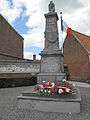 Lecelles, war memorial
 Lecelles, view to a street
 Lecelles, view to a street
Heraldry
_Nord-France.svg.png) |
The arms of Lecelles are blazoned : Azure, semy de lys Or. = France Ancient (Ansacq, Brillon, Escaudain, Escautpont, Hélesmes, Hérin, Lecelles, Lieu-Saint-Amand, Lourches, Neuville-sur-Escaut, Rosult, Rumegies and Wignehies use the same arms.) |
See also
References
| Wikimedia Commons has media related to Lecelles. |
This article is issued from Wikipedia - version of the 11/22/2016. The text is available under the Creative Commons Attribution/Share Alike but additional terms may apply for the media files.