Lebanon-Warren County Airport
Coordinates: 39°27′44″N 084°15′07″W / 39.46222°N 84.25194°W
| Lebanon-Warren County Airport | |||||||||||
|---|---|---|---|---|---|---|---|---|---|---|---|
|
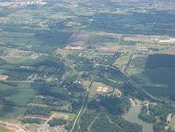
The Lebanon-Warren County Airport and surrounding countryside, seen from the west | |||||||||||
| IATA: none – ICAO: none – FAA LID: I68 | |||||||||||
| Summary | |||||||||||
| Airport type | Public | ||||||||||
| Owner | Warren County Airport Authority | ||||||||||
| Operator | Warren County Airport, Ltd. | ||||||||||
| Serves | Warren County, Ohio | ||||||||||
| Location | Lebanon, Ohio | ||||||||||
| Elevation AMSL | 898 ft / 274 m | ||||||||||
| Map | |||||||||||
 I68  I68 Location of airport in Ohio/United States | |||||||||||
| Runways | |||||||||||
| |||||||||||
| Statistics (2006) | |||||||||||
| |||||||||||
Lebanon-Warren County Airport (FAA LID: I68) is a public airport located three miles (5 km) northwest of the central business district of Lebanon, on Greentree Road, in Warren County, Ohio, United States.[1]
It is a county owned public airport operated by the Warren County Airport Authority, a board of 9 members appointed by the County Commissioners. The runway, taxiway, and communication and navigation aids are County owned. The Airport Authority leases a terminal for public use on adjacent private property. The hangars, and other airport buildings are privately owned and operated. Daily airport management is handled under contract by fixed-base operator (FBO), Warren County Airport, Ltd.
Facilities
Runway
There is one North-South Runway (01/19). The runway is 4502' x 65' asphalt paved with lighting for night operation. The runway has displaced thresholds on both ends to clear obstructions. Airport elevation is 898'. There is a taxiway parallel to the runway.[1]
Navigation and Communications aids
- MIRL Runway & Taxiway lights
- PCL Pilot Controlled Lighting - Frequency 123.075
- REIL - Runway End Identification Lights
- Rotating beacon - White-Green
- Wind sock near center of runway, between runway and taxiway
- Segmented Circle - Near Windsock
- Tower with obstruction light mid-field east of runway
- 4 light PAPI
- AWOS Automated Weather Observation System - Frequency 120.550, By Phone 513-934-5500
- UNICOM - Frequency 123.075
- Online weather information service in terminal building
Privately operated airport services
- Aviation Fuel
- Hangar Rental
- Pilot training
- Aircraft Rental
- Aircraft Charters
- Warren County Career Center - Aerospace Academy[2]
- Miami Valley Hospital Careflight[3] helicopter base and helipad
- Home of the USU Wright Flyer replica built for the 100th anniversary of aviation held in 2003 [4]
- Skydiving
- Helicopter Training, rides, photo flights, and other helicopter services [5]
- Hot air ballooning[6]
Aircraft
For the 12-month period ending December 19, 2006, the airport had 24,951 aircraft operations, an average of 68 per day: 99% general aviation, 1% air taxi and <1% military. There are 104 aircraft based at this airport: 72% single-engine, 26% multi-engine (27) and 2% jet.[1]
See also
References
- 1 2 3 4 FAA Airport Master Record for I68 (Form 5010 PDF), effective 2007-07-05
- ↑ http://www.wccareercenter.com/SecondaryEducation_course.aspx?clid=66&cgid=28&id=6
- ↑ http://www.miamivalleyhospital.org/mvhservices.aspx?id=10900&terms=careflight
- ↑ http://www.usuwrightflyer.org
- ↑ http://vaheli.com/site/index.php?option=com_frontpage&Itemid=1
- ↑ http://www.gentlebreeze.com/
External links
- Airport FBO website
- Ohio Department of Transportation - Aviation Division
- Online AWOS display
- Resources for this airport:
- FAA airport information for I68
- AirNav airport information for I68
- FlightAware airport information and live flight tracker
- SkyVector aeronautical chart for I68